Your Chile Argentina border crossing Patagonia guide: the main passes, documents, hours, SAG food rules and rental-car permits, with official sources.
By Patagonia Tourism Guide · First published 21 Sep 2026 · Updated 20 Oct 2026
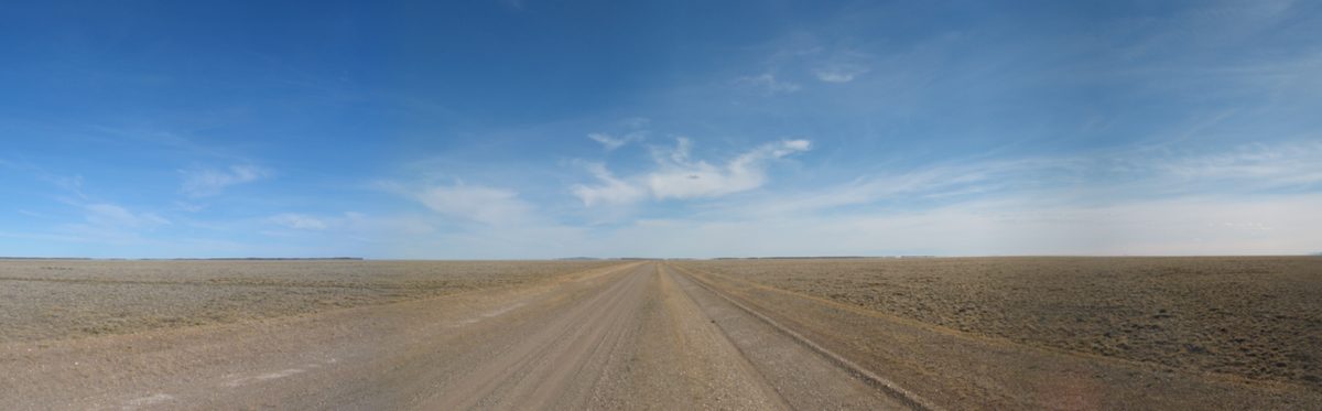
0 — 2 km Fig. 1 · Photo: Esemono / Public domain via Wikimedia Commons
The first time I crossed from Chile into Argentina in Patagonia, I almost lost a bag of apples and a small wheel of cheese to a very patient SAG inspector at Cerro Castillo. I had carried them up from a supermarket in Puerto Natales without thinking. She wasn’t angry. She’d clearly seen a thousand tourists do exactly the same thing. She just held out a bin, pointed at the apples, and waited. That two-minute lesson taught me more about a Chile Argentina border crossing Patagonia traveler should plan for than any blog I’d read beforehand.
Here is the short version.
Crossing between Chile and Argentina in Patagonia is routine and usually straightforward, but it is not a formality. You exit one country, drive a short no-man’s-land, and enter the other at a separate post. You need a valid passport, possibly a rental-car permit, and you must not carry fresh fruit, meat, dairy, or seeds into Chile. Hours are limited; verify everything before you go.
This guide is for the traveler who has a route that touches both countries: El Calafate to Torres del Paine, Bariloche to the Chilean lake district, Río Gallegos to Punta Arenas, or a Carretera Austral loop that dips into Argentina. I’ll walk you through the main Patagonian passes, the documents, the food rules, the rental-car paperwork, the hours, and what actually happens at each window. I’ll hedge hard, because border rules and hours change with the season and the year, and I’ll point you at official sources you should check close to your travel date. This is one of those topics where last year’s blog post, including this one, can quietly go stale.
One promise up front: I will never tell you a crossing “always takes 20 minutes” or “they never check.” Sometimes it’s ten minutes and a wave-through. Sometimes a tour bus arrives just before you and you’re standing in line for an hour while forty people get stamped. Plan for the slow version and be pleasantly surprised.
Chile Argentina border crossing Patagonia: the essentials
Before the pass-by-pass detail, here’s the shape of the whole thing, because the single most common mistake is imagining one border “gate” you walk through. There isn’t one. Patagonia has many crossings, scattered along more than a thousand kilometers of Andes, and they differ in hours, surface, remoteness, and how busy they get.
A few principles hold almost everywhere:
The two countries run separate posts. You complete Chilean formalities at the Chilean complex and Argentine formalities at the Argentine complex. Between them sits a stretch of road, anything from a few kilometers to nearly forty, that belongs to neither.
You get stamped into the country you’re entering and cleared out of the one you’re leaving. In practice, Argentina often doesn’t stamp passports on this route while Chile does, but don’t rely on that; carry the passport and let officers do whatever they do.
Chile takes agriculture seriously. Its agricultural service, SAG, inspects bags, and there are real fines for carrying or failing to declare restricted food. More on that below, because it trips up more travelers than passports ever do.
Hours are limited and seasonal. Most Patagonian passes are not 24-hour borders. Winter hours shrink, and weather can close a high pass entirely.
A rental car needs paperwork to cross. You cannot decide at the border. The permit is arranged in advance with the rental company.
Here’s the at-a-glance table. Treat every time and note as “verify before you travel,” because these are exactly the details that drift.
Crossing (Chile / Argentina side)
Connects
Notes
Cardenal Samoré (Pajaritos / Cardenal Samoré)
Osorno & Chilean lakes ↔ Bariloche / Villa La Angostura
Busiest northern pass; posts ~39 km apart; paved; SAG digital declaration
Cerro Castillo / Río Don Guillermo (Cerro Castillo / Cancha Carrera)
Torres del Paine / Puerto Natales ↔ El Calafate
Classic TdP–Calafate route; posts ~7 km apart; not 24h
Main far-south pass; Ruta 3 / CH-255; long summer hours
Dorotea (Dorotea / La Laurita-style local)
Puerto Natales ↔ Río Turbio
Smaller local crossing near Puerto Natales
Jeinimeni (Chile Chico / Los Antiguos)
Carretera Austral (Aysén) ↔ Ruta 40 / Los Antiguos
Busiest Carretera Austral pass; lake-shore route
Roballos (Cochrane area / Bajo Caracoles)
Southern Carretera Austral ↔ Ruta 40
Remote gravel; needs online police clearance
Huemules (Balmaceda / Lago Verde area)
Coyhaique / Balmaceda ↔ Futaleufú corridor
Aysén crossing; check status and hours
Swipe to see all columns
Table 1
For the bigger picture of how these crossings fit into moving around the whole region, this article sits under our pillar on how to get to Patagonia, and you’ll want it alongside the practical route guides I link throughout.
Why there isn’t one “Patagonia border”
It helps to understand the geography, because it explains the rules.
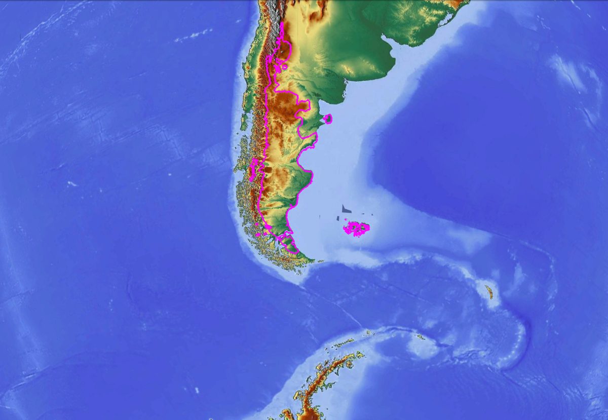
Patagonia is split down the spine of the Andes. Argentina holds the dry, wind-scoured steppe and the eastern flanks; Chile holds the wet, fjord-cut western side. The mountains are a genuine barrier, so road crossings exist only where there’s a usable pass or a low corridor. That’s why the crossings are far apart and why each one serves a specific pair of towns rather than a general “go to the other country” function.
It also explains a quirk that surprises people: two places that look close on a map can be a long way apart by road. Torres del Paine and Los Glaciares National Park are only about 47 km apart as the crow flies, but the Andes and a lack of roads mean the actual driving route between them runs well over 300 km, as the road-trippers at Trans-Americas Journey document from their own crossing. You don’t choose a crossing in the abstract. You choose the one your route forces on you.
So the right question isn’t “where’s the border?” It’s “which pass does my specific journey use, and what are its rules today?” Let’s go pass by pass.
Cardenal Samoré: Bariloche to the Chilean lakes
If your trip links Bariloche or Villa La Angostura with Osorno, Puyehue, and the Chilean lake district, this is your crossing. The Cardenal Samoré pass (long known as Paso Puyehue) is the second-busiest land crossing between the two countries and the main one in the northern Patagonian lakes, according to regional sources like InterPatagonia.
A few things to know specifically about Samoré:
It is not an integrated border. You clear Argentina at one complex and Chile at another, and there’s a meaningful drive between them, around 39 km through forest, so don’t expect the two posts to be side by side. Build in time for the road itself, not just the queues.
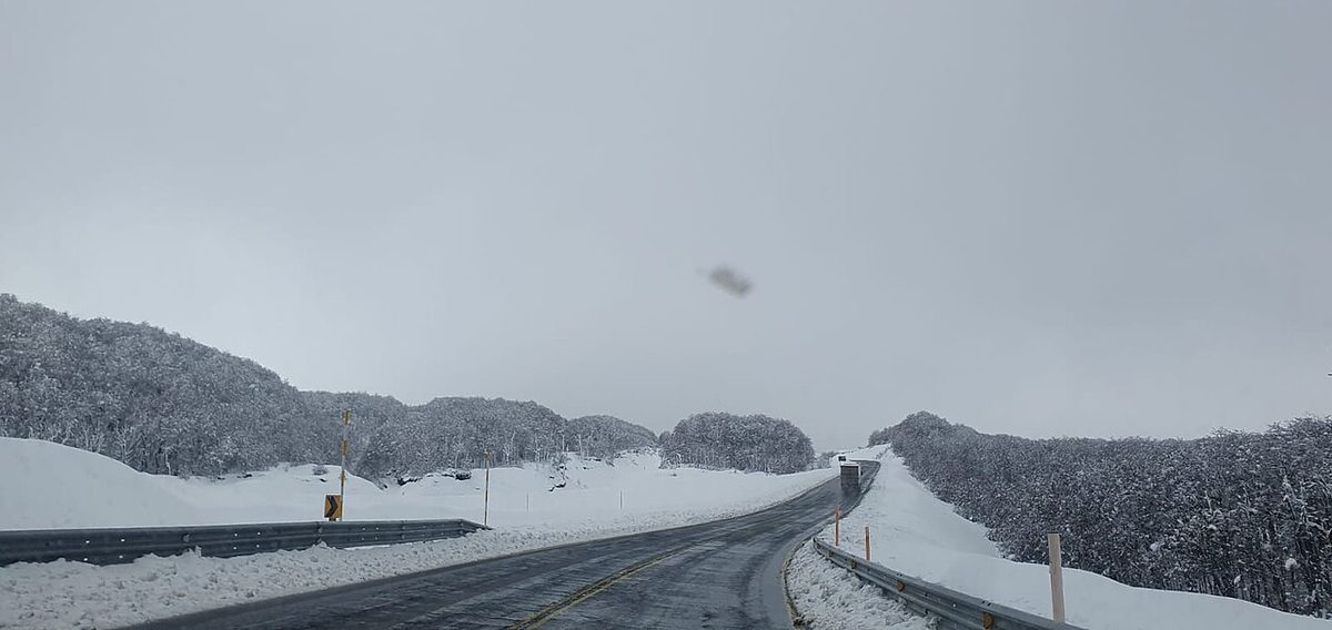
The road is paved and scenic but climbs over the Andes, so winter weather matters. Snow can slow or temporarily close the pass. Check conditions before you commit to a same-day plan.
Hours are limited. Reported opening times sit roughly in the 8 a.m. to 8 or 9 p.m. range, with seasonal variation, and pedestrians and cyclists are often required to cross earlier in the day than vehicles. I won’t pin an exact number here because it shifts; confirm current hours on the official sources below before you go.
Crucially, Cardenal Samoré is one of the crossings where Chile offers the SAG digital sworn declaration (more on that shortly), so you can fill in your food declaration online before you arrive. The official SAG trámite page lists Cardenal Samoré among the controls with online declaration, alongside Integración Austral and a handful of others.
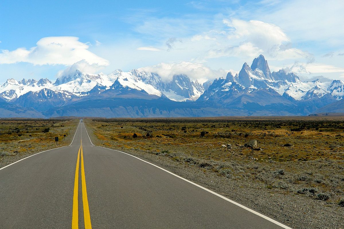
Fig. 2 · Photo: Mariajoaraya / CC BY-SA 4.0 via Wikimedia Commons
Cerro Castillo / Río Don Guillermo: Torres del Paine to El Calafate
This is the one most first-time Patagonia travelers actually use, because it’s the direct link between Torres del Paine / Puerto Natales and El Calafate. On the Chilean side it’s the Cerro Castillo complex, sitting right on the edge of the village of Cerro Castillo near the southern entrance to Torres del Paine; on the Argentine side it’s Cancha Carrera, leading onto Ruta 40 toward El Calafate. The pass itself is often called Río Don Guillermo.
What makes this crossing relatively painless is that the two posts are close together, roughly 7 km apart, about ten minutes of driving, per multiple crossing reports. That’s a world away from Samoré’s 39 km. Trans-Americas Journey clocked their formalities at around 10 minutes on each side, calling it one of their fastest crossings ever, though they crossed in summer with light traffic. Your mileage will vary with the season and whether a tour bus beats you to the window.
A few specifics worth holding onto:
It is not a 24-hour border. Reports and operators put the hours at roughly 8 a.m. to around 9 or 10 p.m., with reduced winter hours. If you’re on a bus from Puerto Natales or El Calafate, the schedule is built around these windows, but if you’re self-driving, don’t roll up at 11 p.m. expecting to cross.
There’s a road-surface gotcha on the Argentine side. Right after the Argentine post the pavement can disappear into washboard gravel if you take the most direct stretch of Ruta 40. Trans-Americas Journey describes that direct route as one of the roughest dirt roads they’d driven, and recommends the longer, mostly paved alternative via Ruta 7 toward El Calafate instead, even though it adds distance. If you’re in a rental, your tires will thank you.
Fuel is sparse. There’s no fuel right at the border on the Chilean side; the nearest is Puerto Natales, roughly 65 km south. On the Argentine side, the first reliable station is a fair drive in. Leave Chile with enough fuel to reach your destination in Argentina.
If your route runs through the deep south, between Punta Arenas in Chile and Río Gallegos in Argentina, you’ll use the Integración Austral complex, the main crossing at the bottom of the continent. On the Chilean side the post is at Monte Aymond; the Argentine complex sits on Ruta Nacional 3, with Chile’s Ruta CH-255 on the other side.
The official Argentine government page for Integración Austral gives the cleanest current picture of how it operates. It lists the resident agencies, Migraciones (immigration), Aduana (customs), Gendarmería Nacional, and SENASA (Argentina’s agricultural control), and at the time of writing posts hours of opening at 08:00, with exit from both countries closing at 21:45 and entry closing at 22:00. Those are long hours by Patagonian standards, and in peak summer this crossing has historically run even longer, but verify the current schedule on that official page before you rely on it.
This is also the crossing that feeds onward to Tierra del Fuego. If you’re heading to Ushuaia overland, you typically pass through here and then take the ferry across the Strait of Magellan, which is its own piece of logistics. It’s one reason I’d treat an overland Ushuaia leg as a deliberate plan rather than a casual add-on.
Because Integración Austral is one of the high-traffic crossings, it’s also one where the SAG digital declaration is available online, so do your food declaration before you arrive rather than filling in a paper form in the wind.
If you’re connecting these far-south cities, the broader logic of getting down here from the Chilean capital is covered in Santiago to Patagonia, and bus travelers should read getting around Patagonia by bus for how cross-border services handle the stop.
The smaller and remote crossings
Beyond the big three, several other Patagonian passes matter depending on your route, especially if you’re on the Carretera Austral or taking a back road.
Dorotea (Puerto Natales to Río Turbio)
A smaller, quieter crossing near Puerto Natales, used mainly for the short hop between Puerto Natales and the Argentine mining town of Río Turbio. It’s an alternative to Cerro Castillo for some routes, but most Torres del Paine–El Calafate traffic uses Río Don Guillermo. Check hours locally.
Jeinimeni (Chile Chico to Los Antiguos)
The busiest crossing along the Carretera Austral, on the shore of General Carrera lake, linking Chile Chico in Aysén with Los Antiguos in Argentina, from where Ruta 40 carries on. Sources put its hours at roughly 08:00 to 20:00 for entry to Chile and until about 19:45 for exit. It’s the natural crossing if you’re combining the Marble Caves and central Aysén with an Argentine Ruta 40 leg.
Roballos (Cochrane area to Bajo Caracoles)
A remote, mostly gravel crossing in the far south of the Carretera Austral, near Patagonia National Park. The important catch: this border does not have a permanent Chilean immigration police (PDI) presence on site, so travelers are generally required to complete an online police clearance (salvoconducto) in advance before they’re allowed to exit Chile here. Do not show up to Roballos without sorting that out first.
Huemules (Balmaceda / Coyhaique area to Futaleufú corridor)
Another Aysén-region crossing, enabled for buses, private vehicles, and cargo, with hours commonly reported around 08:00 to 20:00. As with all of these, confirm before you travel.
For all of these Carretera Austral passes, our Patagonia road trips, Ruta 40 and border crossings guide goes deeper into sequencing them into a real road trip, and the official Chilean status page (below) is the place to confirm any of them is actually open on your date.
Fig. 3 · Photo: Z3lvs / CC0 via Wikimedia Commons
Documents you need to cross
Let’s get concrete about paperwork. For most travelers it’s simpler than the internet makes it sound, but the details matter.
For you as a person:
A valid passport. This is the universal document. Watch the expiry date; a passport in poor condition or close to expiring can cause problems. The official Argentine border pages are explicit that you cannot travel on a “renewal in progress” receipt, you need the actual valid document.
Onward/return travel and accommodation details, sometimes. It’s not always asked, but officers can request proof of where you’re going and that you’ll leave. Have your bookings reachable.
For minors, expect extra requirements. Argentina in particular asks for proof of the parental relationship and, when a child travels with only one parent or alone, a notarized travel authorization. The Integración Austral page spells out the Argentine documentation for minors in detail; if you’re traveling with kids, read it carefully well ahead of time.
Visa note: many nationalities don’t need a visa for tourism in either country, but the rules depend entirely on your passport, and this is precisely the kind of thing that changes. Confirm your own situation against official immigration sources rather than assuming. Our entry requirements guide guide is the companion piece for the entry-requirements side of all this.
I won’t list specific countries’ visa rules here on purpose, because getting that wrong helps no one. Check your government’s travel advice and the destination country’s immigration site for your nationality, close to your travel date.
SAG Chile restrictions: the food rules that catch everyone
This is the section I most want you to read, because it’s where ordinary, well-meaning travelers get fined.
Chile runs strict agricultural border controls through SAG (Servicio Agrícola y Ganadero). The reason is real: Chile has worked hard to keep out pests and animal diseases like fruit fly and foot-and-mouth, and a single bag of fruit or a sandwich with the wrong filling is a genuine biosecurity risk. So when you enter Chile, you must complete a sworn declaration (declaración jurada) stating whether you’re carrying any products of plant or animal origin, no matter the quantity.
According to the official SAG declaration page, the list of things you must declare is long. In plain terms, do not casually carry into Chile:
Fresh fruit and vegetables of any kind, plus dried, dehydrated, and frozen versions.
Meat and meat products (fresh, cured, sausages, ham, etc.).
Dairy (milk, cheese, yogurt, butter).
Seeds and grains, including legumes and anything that could be planted.
Honey and other bee products (royal jelly, propolis).
Plants, flowers, soil, and wood, plus seeds, cuttings, and bulbs.
Spices, herbs, and dried plant material.
Animal products and crafts made from horn, hide, feathers, and the like.
Some processed, sealed, fully labeled products are allowed, and that’s exactly the kind of nuance you should check rather than guess. The safe rule for a casual traveler is simple: eat or bin fresh food before the border, and declare anything you’re unsure about. Declaring isn’t a confession; it just sends you to an inspector who decides. Failing to declare is what gets you fined, and the fines are not trivial.
The good news is you can do most of this in advance. SAG runs a digital declaration you fill in online, valid for your arrival date, through the official portal (ingresoachile.cl, linked from the SAG page above). At the major crossings, Cardenal Samoré, Integración Austral, and several others, you can complete it digitally before you arrive. You’ll show it on your phone when asked. At smaller crossings you may still fill in a paper form handed out at the post.
One more honest note: Argentina has its own agricultural control too, SENASA, on the other direction of travel. It’s generally less aggressive about tourist luggage than SAG, but the principle is the same, don’t carry fresh produce across borders and assume it’s fine. When in doubt, finish your snacks before you reach the post.
Crossing in a rental car: the permit you must arrange first
If you’re driving a rental across the border, this is the part you cannot improvise. I’ll say it plainly: you cannot decide at the border to take a rental car into the other country. The authorization is arranged ahead of time with the rental company, and without it you’ll be turned back.
Here’s what’s typically involved, based on what rental companies and experienced drivers report:
A cross-border permit from the rental company, often called a permiso de cruce de frontera or an authorization to leave the country with the vehicle. This usually carries an extra fee and must be requested in advance, frequently at least a week before pickup, because the company has to process paperwork. Some companies also require a minimum rental length.
The vehicle’s registration document (in Argentina, the cédula verde or its current equivalent), or the equivalent ownership/authorization document the company provides.
International insurance that covers the neighboring country. Argentina requires third-party insurance to drive legally, and you want coverage valid across the MERCOSUR countries; confirm the policy explicitly covers Chile (or Argentina, depending on direction).
Named, allowed crossings. Some companies only permit specific passes. Ask which crossings your permit covers.
One-way and gravel caveats. Cross-country one-way drop-offs are often restricted or expensive, and some companies limit gravel roads, which matters a lot on the Carretera Austral.
The practical move is to tell the rental company your cross-border intentions the moment you book, in writing, and get the list of required documents from them directly. Our Patagonia rental car guide has the full checklist of questions to ask, and it’s worth working through before you pay a deposit. A border officer will not care that the rental desk forgot to mention the permit.
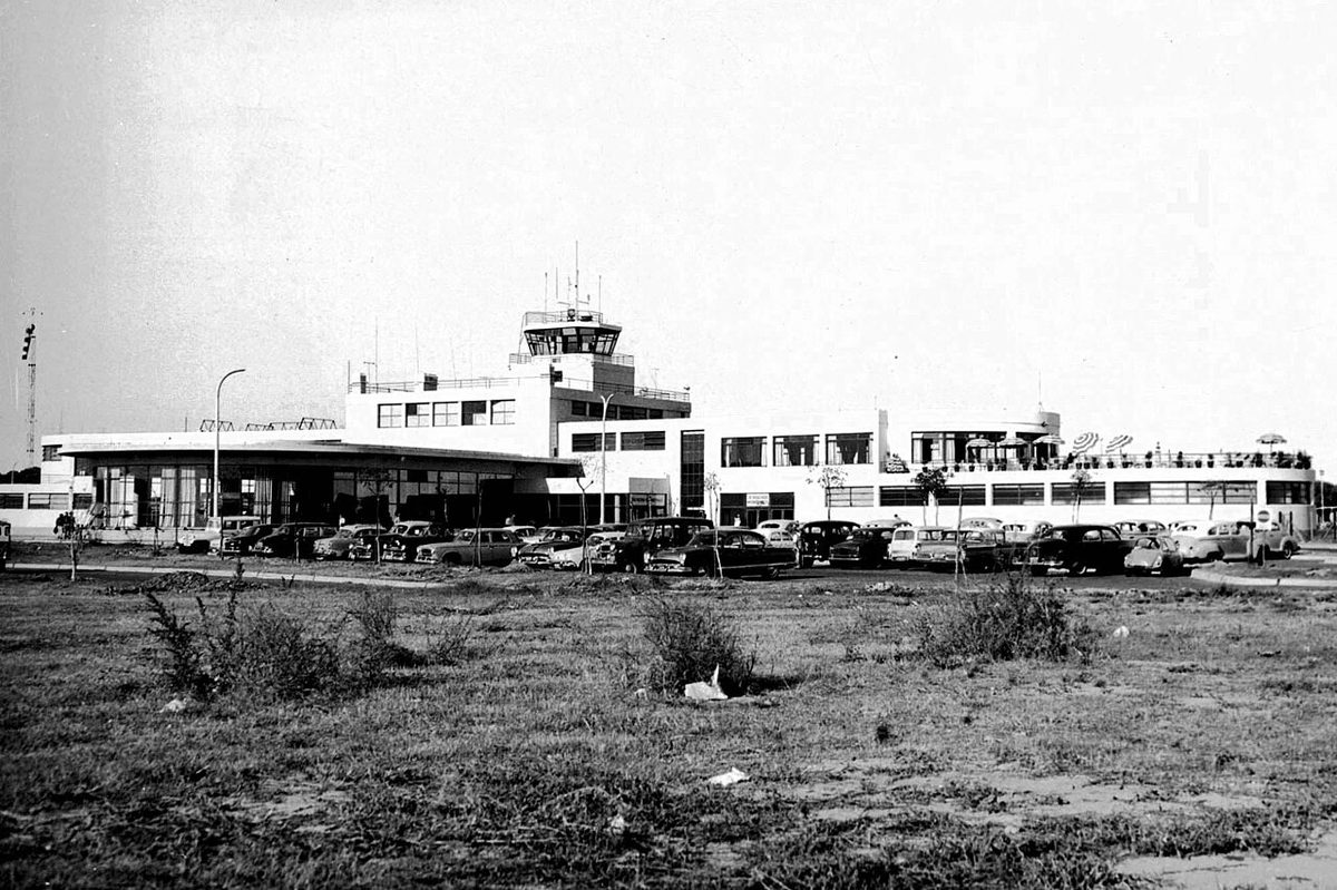
Fig. 4 · Photo: Maximilian Reininghaus / CC BY-SA 4.0 via Wikimedia Commons
Hours, waits, and timing your crossing
Timing is where good plans quietly fall apart, so a few rules I’d follow:
Treat most crossings as daytime-only. With the exception of the long-hours far-south pass, assume the border closes in the evening and plan to cross with daylight to spare. Winter hours are shorter. A high pass can close entirely in bad weather.
Build a buffer after the crossing, not a tight connection. My firm rule, the same one in our how to get to Patagonia pillar, is to never schedule a trek start, an expensive booked tour, or a same-day flight immediately after an important border crossing. If the queue is long or the weather turns, you want slack, not a missed flight out of El Calafate.
Expect bus crossings to take longer than the schedule suggests. On a cross-border bus the process is handled for you, everyone files off, gets stamped, and bags go through inspection, but it can still eat an hour or more, especially if another coach arrives at the same time. The ticket’s arrival time is optimistic, not guaranteed.
Mind the time-zone wrinkle. Most of Chile changes its clocks and Argentina does not, but Aysén and Magallanes keep UTC-3 all year, the same as Argentina. On the southern crossings there is no time difference; further north, in the Lakes District, you can gain or lose an hour depending on the season. Trans-Americas Journey flags exactly this at Río Don Guillermo. Check what time it actually is on the far side, because border hours are local.
Carry some cash in both currencies. Not usually for the crossing itself, which is typically free, but for the first fuel station, a toll, or a snack on the other side where cards may not work and prices run high.
Common mistakes I see at Patagonian borders
A short, honest list, because most border trouble is avoidable:
Carrying fresh food into Chile. The number-one slip. Eat it or bin it first, and declare anything borderline.
Assuming the rental can cross without a permit. Arrange it a week ahead, in writing.
Booking a tight onward connection. A trek, tour, or flight right after a crossing is asking for trouble.
Showing up after hours. Most passes aren’t 24/7. Cross in daylight.
Traveling on a passport that’s nearly expired or a “renewal in progress” receipt. Carry the valid document.
Forgetting minors’ paperwork. Notarized authorizations and proof of relationship can be required; sort them early.
Trusting map drive times on gravel, in wind, or in winter, including the distance between the two border posts.
Ignoring the time change, then arriving at a closed post because the clock jumped an hour.
None of this is hard. It just rewards doing the boring preparation before you leave town instead of improvising at the window.
Fig. 5 · Photo: Giacomo Miceli / Public domain via Wikimedia Commons
Final thoughts
A Patagonian border crossing is, most of the time, a pleasant non-event: a passport stamp, a quick bag check, a short drive through a gap in the Andes, and then you’re in a different country with a different landscape on the other side. The mountains make these crossings feel momentous, and in a quiet way they are. But the friction is almost entirely administrative, and almost entirely preventable.
So do the three things that matter. Carry a valid passport and, if you’re driving, the rental permit you arranged in advance. Don’t bring fresh food into Chile, declare what you must, and use the digital SAG form where you can. And give yourself time, with daylight hours, a buffer after the crossing, and no heroic same-day connections.
Then verify the specifics, hours, status, your own visa situation, close to your travel date, because this is a high-friction topic where the details genuinely change. The official sources below are where I’d start. Get those right and the border becomes what it should be: a line on a map you barely notice crossing.
Do I need a passport to cross between Chile and Argentina in Patagonia?
Yes. A valid passport is the standard document for tourists at every Patagonian crossing. Make sure it’s in good condition and not close to expiring, and don’t travel on a “renewal in progress” receipt. Whether you also need a visa depends entirely on your nationality, so check your own country’s situation against official immigration sources before you travel.
What food can’t I bring into Chile across the border?
Chile’s agricultural service, SAG, prohibits or restricts a long list: fresh fruit and vegetables, meat and meat products, dairy, seeds and grains, honey and bee products, plants, soil, wood, and more. You must complete a sworn declaration on entry, and failing to declare restricted items can mean a significant fine. The safest approach is to eat or bin fresh food before the border and declare anything you’re unsure about.
Can I take a rental car from Argentina to Chile, or the other way?
Yes, but only with a cross-border permit arranged in advance with the rental company, plus the vehicle registration and international insurance covering the neighboring country. The permit usually has an extra fee and needs several days, often at least a week, to process. Tell the rental company your plans in writing when you book. You cannot arrange this at the border.
Which border crossing connects Torres del Paine and El Calafate?
The Cerro Castillo / Río Don Guillermo crossing (Cancha Carrera on the Argentine side) is the direct link between Puerto Natales and Torres del Paine in Chile and El Calafate in Argentina. The two border posts are only about 7 km apart, so formalities are usually quick, though it’s not a 24-hour border and winter hours are shorter. Most buses on this route are timed around the crossing.
Are the Patagonia border crossings open 24 hours?
Mostly no. Most Patagonian passes operate daytime hours, often roughly 8 a.m. to somewhere between 8 and 10 p.m., with shorter winter hours, and high passes can close in bad weather. The far-south Integración Austral crossing between Punta Arenas and Río Gallegos has the longest hours and has historically run extended schedules in summer. Always confirm current hours on official sources before you travel.
How long does a Patagonia border crossing take?
It varies a lot. In a private vehicle with no traffic, formalities can take as little as 10 minutes on each side, plus the drive between posts. On a cross-border bus, or when a tour coach arrives just ahead of you, it can stretch to an hour or more because everyone is processed and bags are inspected. Plan for the slow version and don’t book a tight connection afterward.
Does my passport get stamped crossing between Chile and Argentina?
Usually you get stamped into the country you’re entering and cleared from the one you’re leaving, though in practice Argentina often doesn’t stamp passports on these routes while Chile does. Don’t rely on the absence of a stamp as proof of anything; keep any entry slips you’re given, and let the officers handle the paperwork their way.