Plan a Carretera Austral road trip with Route 7 sections, ferries, gravel roads, fuel, Marble Caves, Queulat, Pumalin, and route tips.
By Patagonia Tourism Guide · First published 11 Jun 2026 · Updated 27 Sep 2026
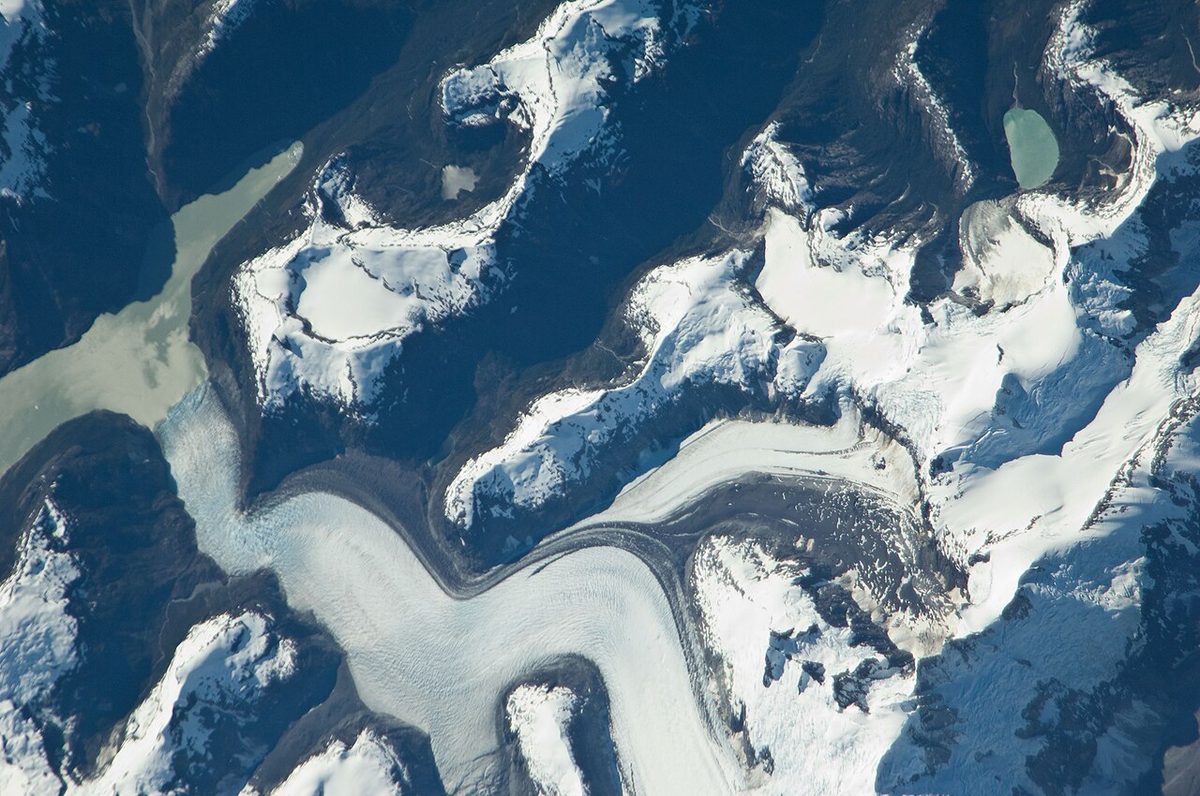
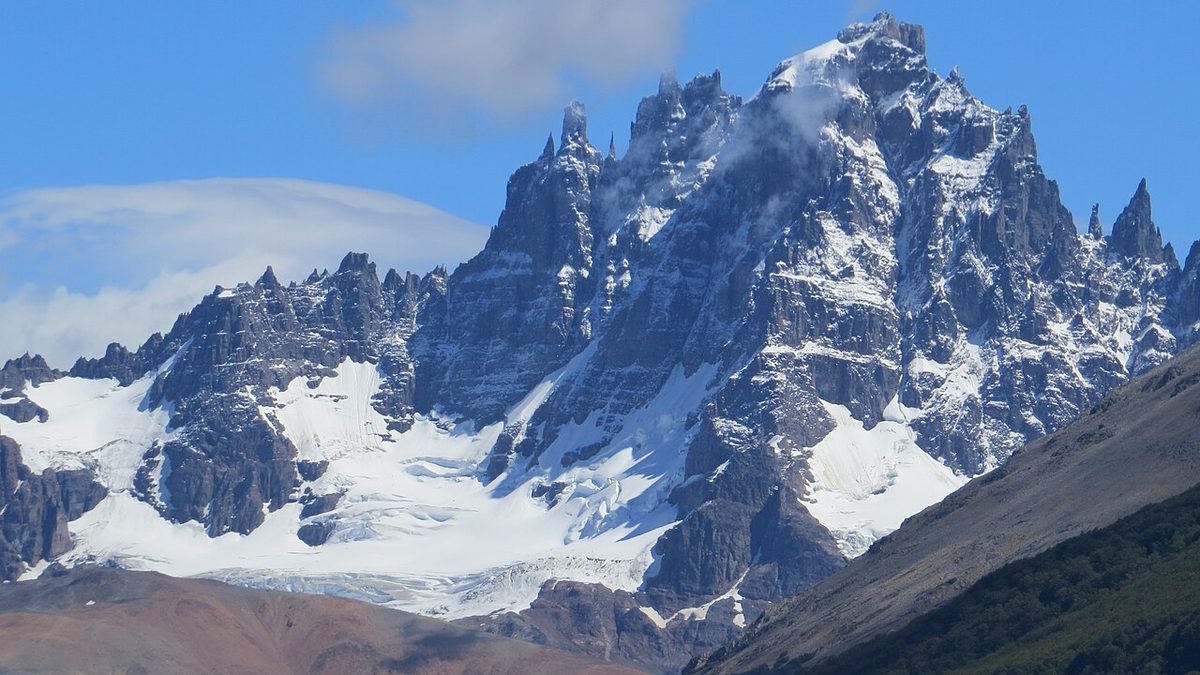
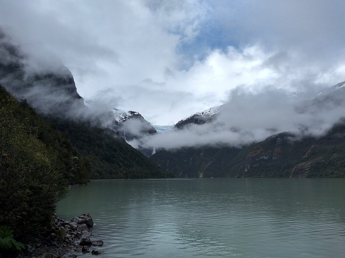
0 — 2 km Fig. 1 · Glacier and rugged Aysen landscape in Chilean Patagonia · Photo: Earth Science and Remote Sensing Unit, Lyndon B. Johnson Space Center / Public domain via Wikimedia Commons
The Carretera Austral is the Patagonia road trip that looks simple only before you start planning it.
On a map, it is one line: Chile’s Route 7 running south from Puerto Montt through forests, fjords, glaciers, rivers, tiny towns, hanging ice, turquoise lakes, gravel, ferries, and finally the road-end feeling of Villa O’Higgins. It sounds clean. Start at the top. Drive south. Stop at beautiful places. Take photos. Keep going.
Then the questions arrive.
Which ferry do you have to reserve? Is the Hornopiren to Caleta Gonzalo crossing the same as the Caleta La Arena ferry? Can you do the Marble Caves in a 7-day trip? Is Coyhaique a starting point or just a supply stop? Do you need a 4×4, or is a regular rental car fine? Should you go all the way to Villa O’Higgins, or is that mostly for the satisfaction of finishing the road? How much fuel should you carry? Can you combine the Carretera Austral with El Chalten or Torres del Paine? Why does a 240 km drive sometimes eat most of a day? And why do so many travelers who “only had a week” come home talking more about logistics than landscapes?
That is the real Carretera Austral planning problem. The scenery is not hard to sell. The route is gorgeous. The hard part is building a trip that respects how remote, weather-shaped, ferry-dependent, and slow this road can be.
This guide is for that stage of planning.
It will help you decide whether the Carretera Austral belongs in your Patagonia trip, how many days you need, whether to drive the full route or only a section, where to start, which towns make useful bases, what to know about ferries, fuel, gravel, rental cars, border crossings, and how to choose between Pumalin, Queulat, Cerro Castillo, the Marble Caves, Patagonia National Park, Caleta Tortel, and Villa O’Higgins.
For most travelers, the best Carretera Austral plan is not the full road. It is the section that fits the time you actually have.
If you have 7 days, do a focused section, usually from Balmaceda/Coyhaique toward Cerro Castillo, Puerto Rio Tranquilo, the Marble Caves, and maybe Patagonia National Park or Queulat. Do not pretend you can meaningfully drive from Puerto Montt to Villa O’Higgins and enjoy the route in one week.
If you have 10 days, choose either a northern route from Puerto Montt/Hornopiren to Coyhaique or a central-southern Aysen route from Balmaceda/Coyhaique to Puerto Rio Tranquilo, Cochrane, Patagonia National Park, Caleta Tortel, and maybe Villa O’Higgins if you accept long driving days.
If you have 14 days, you can attempt the full Puerto Montt to Villa O’Higgins road trip, but it will still be a driving-first itinerary. You need ferry planning, early starts, route discipline, and weather buffers.
If you have 3 weeks, the Carretera Austral becomes much better. You can slow down, hike, wait out rain, stay two nights in key towns, visit parks properly, and stop treating every ferry as a threat to the schedule.
Here is the practical version:
Time available
Best route style
Main tradeoff
5-6 days
Coyhaique/Balmaceda loop to Cerro Castillo and Puerto Rio Tranquilo
Good taste, not the full road
7 days
Central Aysen route or Chile Travel-style Hornopiren to Marble Caves route
Beautiful, but very selective
10 days
Northern route to Coyhaique or southern Aysen to Tortel/Villa O’Higgins
Still a road trip more than a hiking trip
14 days
Full Puerto Montt to Villa O’Higgins if logistics line up
Little margin for bad ferries/weather
18-21 days
Full route with park time and buffers
Best balance for serious road-trippers
3-4 weeks
Deep Carretera Austral plus Argentina or Torres del Paine extension
Requires budget, rental terms, and patience
Swipe to see all columns
Table 1
The best first-time road-trip logic is:
Fly to Puerto Montt if you want the northern forests, fjords, Pumalin, Chaiten, Futaleufu, and the full Route 7 feeling.
Fly to Balmaceda if you want a shorter, more efficient Aysen trip with Coyhaique, Cerro Castillo, Puerto Rio Tranquilo, the Marble Caves, Patagonia National Park, and the southern route.
Book or verify ferries before locking nonrefundable lodging.
Fill fuel whenever you can.
Do not trust map drive times on gravel.
Build at least one buffer day into any route with important ferries, long gravel, or boat trips.
If you remember only one thing, make it this: the Carretera Austral is not a normal road trip with scenery. It is a logistics route through remote Chilean Patagonia. That is exactly why it is special, and exactly why you should not rush it.
Yes, the Carretera Austral is worth it if the road trip itself is the trip.
That qualifier matters.
Some Patagonia destinations give you one obvious reward. El Calafate gives you Perito Moreno Glacier. El Chalten gives you Fitz Roy hiking. Torres del Paine gives you the towers, the W Trek, the O Circuit, and a compact concentration of famous scenery. Bariloche gives you lakes, food, viewpoints, and easy infrastructure. Ushuaia gives you Tierra del Fuego and the Beagle Channel.
The Carretera Austral gives you movement.
It is forests one day and open Aysen steppe the next. It is a ferry ramp in the rain, then a road curling above a river the color of crushed turquoise. It is a tiny cabin, a gravel road, a town with one fuel station, a boat that may or may not go to the Marble Caves because of wind, a glacier viewpoint, a bakery, a washed-out schedule, and a mountain that looks better because you had to work around it.
That is wonderful if you enjoy road trips. It is frustrating if you only want guaranteed highlights.
You Should Drive the Carretera Austral If
You like self-driving and remote logistics.
You want Chilean Patagonia beyond Torres del Paine.
You enjoy small towns and changing landscapes.
You are comfortable with gravel, ferries, weather, and uncertainty.
You have at least 10 days for a section or 2-3 weeks for the full route.
You want parks such as Pumalin, Queulat, Cerro Castillo, and Patagonia National Park.
You are drawn to the Marble Caves, Rio Baker, Caleta Tortel, or Villa O’Higgins.
You would rather go deep into one region than collect famous stops across all Patagonia.
You Should Skip or Shorten It If
You have only 10 days and also want El Chalten, Perito Moreno, and Torres del Paine.
You dislike gravel roads and long driving days.
You need every booking to behave exactly as scheduled.
You do not want to manage ferries.
You are traveling in winter without a route-specific reason.
You prefer one comfortable base and day trips.
You are choosing it only because it appears on “best road trips in the world” lists.
This route rewards people who can tolerate uncertainty. If that is you, it can be the best part of Patagonia. If it is not, you may be happier with a more compact route from the trip-planning walkthrough for Patagonia.
Where Is the Carretera Austral?
The Carretera Austral is Chile’s Route 7, the road that runs through northern and central Chilean Patagonia from Puerto Montt toward Villa O’Higgins.
Chile Travel describes it as more than 1,200 km of Route 7 crossing forests, glaciers, crystalline rivers, fjords, towns, national parks, and barge crossings. The official page places the route through Puerto Montt, Hornopiren, Pumalin National Park, Chaiten, La Junta, Coyhaique, Puerto Rio Tranquilo, Puyuhuapi, Queulat, Futaleufu, the Palena River, Caleta Tortel, and Villa O’Higgins.
Chile Travel’s broader Patagonia page places the Carretera Austral in the larger Chilean Patagonia story: fjords, forests, rivers, ice fields, Torres del Paine, Punta Arenas, Puerto Williams, and southern adventure.
There are a few different ways people describe the route length:
The important planning point is not whether you call it 1,200 or 1,247 km. The important point is that the road is long, discontinuous in places because of ferries, and slower than a normal paved highway.
The Route in Plain English
North to south, the Carretera Austral roughly works like this:
La Junta, Futaleufu side trip, Puyuhuapi, Queulat.
Coyhaique and Puerto Aysen/Puerto Chacabuco side routes.
Villa Cerro Castillo.
Puerto Rio Tranquilo and the Marble Caves.
Puerto Guadal, Chile Chico side route, Rio Baker, Cochrane.
Patagonia National Park.
Caleta Tortel side route.
Puerto Yungay ferry to Rio Bravo.
Villa O’Higgins and the southern road end.
That is the full journey. Most travelers should not start by asking whether they can do all of it. Start by asking which part gives you the trip you want.
How Many Days for the Carretera Austral?
The Carretera Austral is possible in fewer days than it deserves. That is the planning trap.
You can drive a lot in a week. You can also spend that week staring at a windshield, worrying about ferry times, and skipping the hikes and side roads that made the route worth choosing in the first place.
Here is how I would think about trip length.
5 to 6 Days
Do not attempt the full route. Use Balmaceda/Coyhaique as your gateway and build a focused Aysen trip.
Good choices:
Coyhaique -> Cerro Castillo -> Puerto Rio Tranquilo -> Marble Caves -> return.
Coyhaique -> Puerto Rio Tranquilo -> Patagonia National Park/Cochrane -> return if you accept longer drives.
This is best for travelers who want a taste of the Carretera Austral without pretending they have time for the full road.
7 Days
Seven days is enough for one strong section. It is not enough for a relaxed full route.
Chile Travel’s official 7-day itinerary runs through a spring-summer route from Hornopiren to the Marble Caves, with 1,089 km and highlights including Pumalin, Queulat, and General Carrera Lake/Marble Caves. That is a useful model, but notice what it implies: even an official 7-day version is selective and driving-heavy.
For independent travelers, I often prefer a 7-day Balmaceda/Coyhaique loop because it reduces ferry risk and puts you close to the Aysen highlights.
10 Days
Ten days gives you more room, but still not enough to treat the whole road gently.
Central/southern route: Balmaceda/Coyhaique -> Cerro Castillo -> Puerto Rio Tranquilo -> Cochrane/Patagonia National Park -> Caleta Tortel -> maybe Villa O’Higgins -> return.
Partial full route: Puerto Montt to Puerto Rio Tranquilo or Balmaceda, with a one-way rental or flight strategy.
The main problem with 10 days is not distance alone. It is what happens when a ferry, rain day, boat cancellation, or gravel slowdown eats your margin.
14 Days
Two weeks is the shortest time I would consider for the full Puerto Montt to Villa O’Higgins route.
It can work if:
Ferries are booked or verified.
You keep the route disciplined.
You do not expect major hikes everywhere.
You accept some one-night stops.
You are comfortable driving gravel.
You have a plan for ending the trip: return to Balmaceda, cross to Argentina, or take a longer ferry connection.
It is still fast. You will see a lot. You will skip a lot.
18 to 21 Days
This is where the Carretera Austral becomes a better trip.
With 3 weeks, you can:
Spend 2 nights in Pumalin/Chaiten.
Add Futaleufu without destroying the schedule.
Stay in Puyuhuapi for Queulat.
Use Coyhaique as a real resupply stop.
Hike or at least properly visit Cerro Castillo.
Spend 2 nights around Puerto Rio Tranquilo.
Visit Patagonia National Park without rushing.
Add Caleta Tortel.
Go to Villa O’Higgins for the road-end feeling.
Keep a buffer day for ferries, weather, or a boat trip.
If a friend asked me for the best Carretera Austral trip length, I would say 18 to 21 days.
One Month or More
With a month, you can treat the Carretera Austral as a region, not a route. You can add Chiloe, cross into Argentina via Futaleufu or Chile Chico, connect to El Chalten, or continue toward Torres del Paine with enough time to breathe.
That is the dream version. Most travelers do not have it. If you do, protect it from overplanning.
Best Time to Drive the Carretera Austral
The best time to drive the Carretera Austral is usually December through March.
Chile Travel says summer, December to March, is the best time because of more favorable climate and longer days. It also advises cold/humidity clothing and provisions because some sections have limited services.
That is the practical answer. Longer days matter here. You do not want to be dealing with gravel, ferries, rain, and unknown lodging in short daylight if you can avoid it.
November can be good if you want shoulder-season travel and can handle uncertainty. Services ramp up, weather improves, and crowds are lower than peak summer. Some high or remote activities may still be conditional.
April
April can be beautiful, especially with autumn color. It is also late. Days shorten, weather becomes more fragile, ferries and lodging can reduce, and some services begin to taper.
April is best for flexible travelers, photographers, and people not trying to force the full road on a rigid schedule.
May to September
Winter and late shoulder-season trips are possible but not the best default for first-time road-trippers. Snow, ice, short days, reduced services, and road conditions matter. If you want winter Patagonia, Bariloche or Ushuaia may be cleaner choices unless you have a specific Carretera Austral plan.
The easiest way to plan the Carretera Austral is to break it into sections. This keeps you from treating a very long, varied route like one continuous sightseeing day.
Section 1: Puerto Montt to Hornopiren
This is the northern gateway.
Puerto Montt is the practical start for the full Carretera Austral. It has El Tepual Airport, rental cars, supermarkets, outdoor gear, and ferry connections. From there, Route 7 heads toward Caleta La Arena, crosses by ferry to Caleta Puelche, and continues to Hornopiren.
This section is useful but not the main reason most travelers dream about the route. Its job is to get you into the rhythm: drive, ferry, small town, weather, road, repeat.
Do not leave Puerto Montt late and assume the day will sort itself out. The first ferry is frequent, but once you add rental pickup, groceries, navigation, weather, and daylight, the day can still stretch.
Section 2: Hornopiren to Caleta Gonzalo, Pumalin and Chaiten
This is where ferry planning becomes serious.
To continue south from Hornopiren toward Caleta Gonzalo and Pumalin, you use the bimodal route, which combines ferry and road segments through fjord country.
Chile Travel’s Pumalin page says access from Puerto Montt via the bimodal route requires ferry crossings including Hornopiren-Leptepu and Fiordo Largo-Caleta Gonzalo, and that these should be booked in advance. It also places Caleta Gonzalo as the northern entrance and Chaiten, 60 km south, as the southern entrance with more services.
This is one of the most important planning points on the whole route. A missed or unavailable ferry can reshape the northern Carretera Austral.
Pumalin itself deserves time. Chile Travel says it protects 402,000 hectares, including fjords and Valdivian forest, and highlights trails such as Cascadas Escondidas, Lago Blanco, and Ventisquero El Amarillo.
If you rush this section, you reduce Pumalin to “the place after the ferry.” That is a waste.
Section 3: Chaiten, Futaleufu, La Junta and Puyuhuapi
South of Chaiten, the route begins to stretch into classic northern Aysen road-trip country.
Chaiten is useful for services, Pumalin access, and the volcano story. Futaleufu is a side trip rather than directly on Route 7, but it is a major adventure stop.
Chile Travel describes Futaleufu as a rafting and kayaking capital, with the turquoise Futaleufu River, fly fishing, viewpoints, and outdoor activities. It places Futaleufu about 150 km from Chaiten by Route 235, and about 422 km north of Coyhaique if approaching from the south.
Add Futaleufu if whitewater, rivers, or the town itself interest you. Skip it if you are already short on time and mainly trying to connect Pumalin, Queulat, and Aysen.
Puyuhuapi is one of the more useful overnight stops in this section because it sets you up for Queulat National Park.
Section 4: Queulat, Coyhaique and Puerto Aysen
Queulat National Park is one of the headline stops on the northern half of the Carretera Austral.
Chile Travel says its main landmark is the Ventisquero Colgante, or Hanging Glacier, with waterfalls dropping above a turquoise lagoon. It describes a 3 km walk to the glacier viewpoint, and gives Coyhaique to the park as about 165 km north, around 4 hours, with gravel sections.
That 165 km and 4 hours is exactly the kind of Carretera Austral timing travelers need to internalize. Distances that look small can be slow.
Coyhaique is the main service city of Aysen. It is where you reset:
Fuel.
Groceries.
Cash.
Rental-car help.
Laundry.
Repairs.
Restaurants.
Lodging.
Weather checks.
Side trips.
Do not treat Coyhaique as a failure of wilderness. It is the place that keeps the road trip functional.
Section 5: Coyhaique to Villa Cerro Castillo
This is a shorter section, but it matters because Cerro Castillo is one of the strongest mountain stops on the route.
Chile Travel says Villa Cerro Castillo is about 100 km south of Coyhaique, around 1 hour 30 minutes by road. The park is known for the Las Horquetas circuit, which can last up to four days and requires self-sufficiency, along with views toward Cerro Castillo Lagoon and the El Penon Glacier.
You can treat Cerro Castillo as:
A scenic stop.
A one-night hiking base.
A multi-day trekking destination.
A break between Coyhaique and Puerto Rio Tranquilo.
If you are not doing a major hike, still consider stopping. The mountain profile is one of the route’s great visual moments.
Section 6: Villa Cerro Castillo to Puerto Rio Tranquilo and the Marble Caves
Puerto Rio Tranquilo is the gateway to the Marble Caves on Lago General Carrera.
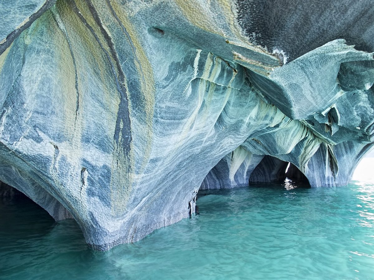
Chile Travel says Lago General Carrera is 1,850 sq km, making it Chile’s largest lake, and that the Marble Caves are reached from Puerto Rio Tranquilo by boat or kayak. It gives Coyhaique to Puerto Rio Tranquilo as about 240 km and approximately 5 hours by road.
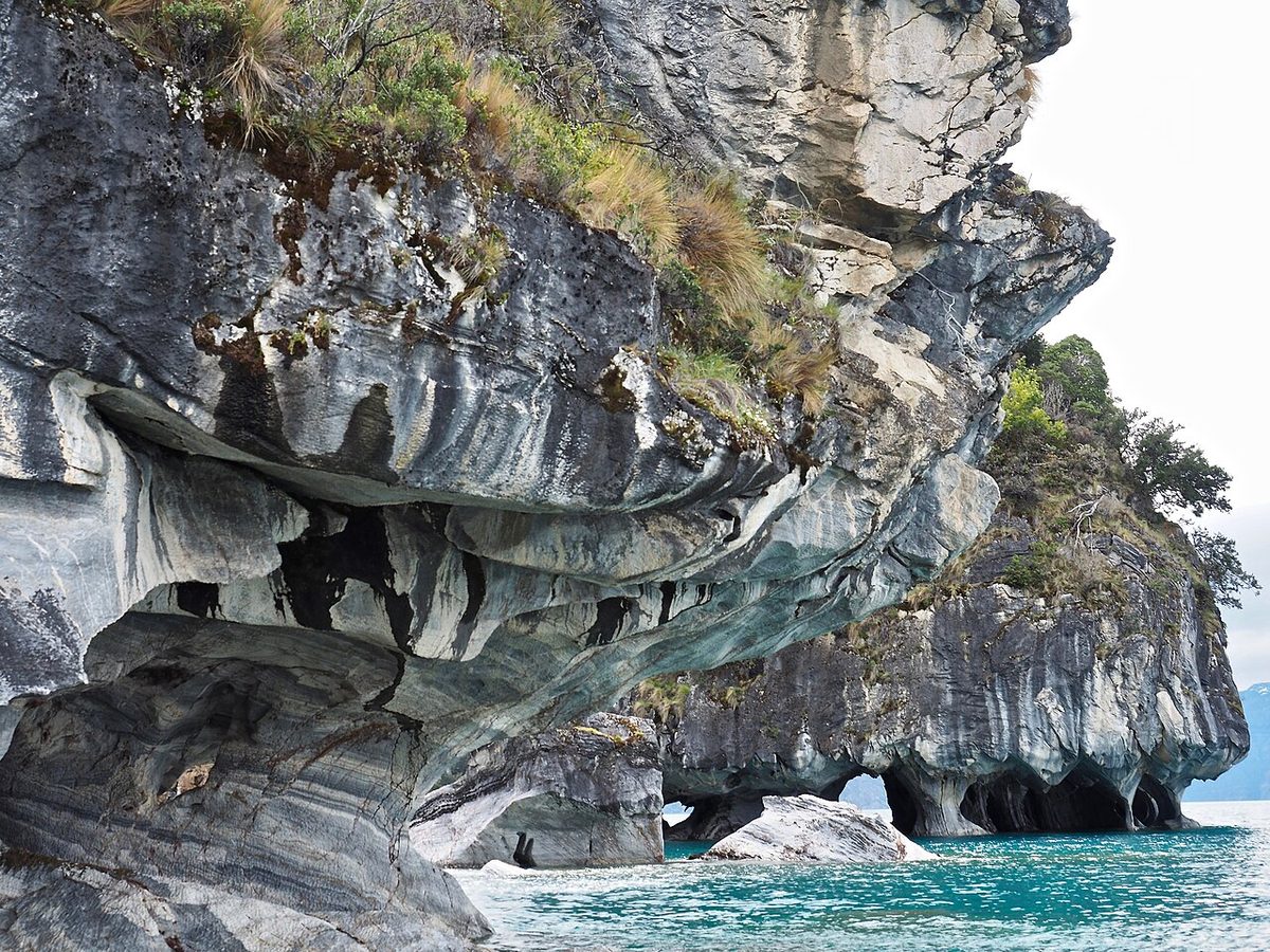
The Marble Caves are iconic. They are also weather-dependent. Wind on the lake can cancel or delay boat trips. That is why I prefer spending at least 2 nights around Puerto Rio Tranquilo if the caves are a priority.
Do not build a one-night arrival-late, depart-early plan and assume the lake will cooperate.
Section 7: Puerto Rio Tranquilo to Cochrane and Patagonia National Park
South of Puerto Rio Tranquilo, the route becomes drier in places and the landscape changes again. Rio Baker, Puerto Bertrand, Cochrane, and Patagonia National Park become the focus.
Cochrane is a useful base and supply point. Patagonia National Park is one of the most important stops in the southern half of the route.
Chile Travel says Patagonia National Park covers more than 300,000 hectares in Aysen, with steppe, mountains, wetlands, guanacos, birdlife, and areas such as the Chacabuco Valley and Jeinimeni sector. It notes that from Balmaceda/Coyhaique, the Chacabuco Valley is about 9 hours south by road with gravel sections, and recommends a high-traction/4×4-style vehicle or operator because of gravel, narrow roads, and sharp curves.
This is not a quick add-on if you want to do it well. Give it at least one full day, more if hiking or wildlife matters. If animals are shaping the whole trip, use the Patagonia wildlife and whale watching guide to compare Aysen steppe wildlife with Torres del Paine pumas and Peninsula Valdes whales.
Section 8: Cochrane, Caleta Tortel and Villa O’Higgins
The far south of the Carretera Austral is where the route becomes more psychological.
Caleta Tortel is famous for wooden walkways and a water-based town layout. Villa O’Higgins is the end of the road. The last section requires the Puerto Yungay to Rio Bravo ferry before continuing toward Villa O’Higgins.
Is Villa O’Higgins worth it? Yes, if finishing the road matters to you, if you like remote-endpoint travel, or if you have enough time to go south without resenting the return.
It may not be worth it if:
You are short on time.
You must backtrack immediately.
You are skipping Patagonia National Park or Tortel just to say you reached the end.
Weather and ferry timing are already tight.
The road-end feeling is real. It is also expensive in time.
There are too many possible stops to treat every one as mandatory. The better question is which stops match your route style.
Pumalin Douglas Tompkins National Park
Best for: rainforest, conservation, camping, short trails, volcano and fjord landscapes, northern route travelers.
Pumalin is one of the best reasons to start in Puerto Montt rather than flying directly to Balmaceda. It gives the northern Carretera Austral a lush, wet, ancient-forest feel that is very different from the drier Aysen steppe farther south.
Give it at least one full day if possible. For the trails, the Hornopiren ferry timing and how to base yourself around Chaiten, see the full Pumalin National Park guide.
Chaiten
Best for: services, Pumalin access, volcano context, a practical overnight.
Chaiten is useful rather than polished. That is not a criticism. On the Carretera Austral, useful towns matter.
Futaleufu
Best for: rafting, kayaking, river scenery, adventure travelers, Argentina border connections.
Futaleufu is not directly on the main Route 7 spine, so it costs time. Add it for a reason. If whitewater does not interest you, you may prefer to keep moving toward Queulat.
Puyuhuapi and Queulat National Park
Best for: hanging glacier, wet forest, hot springs, northern Aysen base.
Queulat is one of the easiest “yes” stops if you are driving the northern/central route. Bring waterproof layers. This is not dry Patagonia. The dedicated Queulat Hanging Glacier guide covers the viewpoint trail, the boat-to-the-lagoon option and using Puyuhuapi as a base.
Coyhaique
Best for: resupply, airport access, rental-car logistics, reset night.
Coyhaique will not be the most romantic stop in your itinerary, but it may be one of the most important. Use it well.
Cerro Castillo
Best for: mountain views, day hikes, multi-day trek, photography, breaking up the drive.
Cerro Castillo is where many travelers realize the Carretera Austral can compete visually with more famous southern Patagonia landscapes. If you hike, give it time. If you do not, at least stop and look properly.
Best for: iconic photos, boat/kayak tour, Lago General Carrera, short stays, first-time Aysen trips.
The Marble Caves are one of the most searched Carretera Austral experiences. They deserve that attention, but do not let them swallow the whole route. They are a weather-dependent boat or kayak experience, not a guaranteed drive-up viewpoint. My full Marble Caves Chile guide breaks down the boat versus kayak tours, the best time of day, and how wind and lake level affect the color.
Puerto Guadal and Chile Chico
Best for: lake scenery, quieter stays, border crossing to Argentina, Jeinimeni/Patagonia National Park access.
Chile Chico is a practical and scenic option if you plan to cross into Argentina via Los Antiguos. It can also be part of a Lago General Carrera loop, but roads and ferry timing need attention.
Cochrane and Patagonia National Park
Best for: wildlife, steppe, hiking, Chacabuco Valley, southern Aysen depth.
Patagonia National Park is not just another stop. It is one of the route’s biggest conservation and landscape stories. If you have time, treat Cochrane or the Chacabuco area as a real base. The Patagonia National Park Chile guide walks through the Chacabuco, Jeinimeni and Tamango sectors and their best trails.
Caleta Tortel
Best for: boardwalk town, atmosphere, photography, slow travel.
Tortel is not efficient. That is part of the point. It rewards travelers who like unusual places and do not need every stop to be about a hike or tour.
Go if you want the end. Skip if reaching the end would force you to sacrifice the places you actually care about.
Carretera Austral Ferries: What to Book and What Can Change
Ferries are not a side detail on the Carretera Austral. They are part of the road.
Some crossings are frequent and first-come, first-served. Some need advance booking. Some change by season. Some depend on weather, demand, tides, or operator schedules. Before travel, verify every ferry directly with the operator or current local source. For a crossing-by-crossing breakdown of what to book ahead and what can change, see the dedicated Carretera Austral ferries guide.
Caleta La Arena to Caleta Puelche
This is the gateway crossing south of Puerto Montt.
Transportes del Estuario says tickets are not purchased online, purchase is made on arrival, there are no prior reservations, service operates 24 hours, and passengers board in order of arrival. The same page lists pedestrian passengers as free and vehicle prices by category.
This is usually less stressful than the Hornopiren-Caleta Gonzalo connection, but do not ignore wait times in peak season.
Hornopiren to Caleta Gonzalo / Ruta Bimodal
This is the big northern planning piece.
The route involves ferry and road segments between Hornopiren, Leptepu, Fiordo Largo, and Caleta Gonzalo. Chile Travel’s Pumalin page says these crossings should be booked in advance.
If you are starting in Puerto Montt and driving south, sort this before you lock the next several days of lodging.
Puerto Ibanez to Chile Chico
This ferry crosses Lago General Carrera and can be useful for routes involving Chile Chico, Jeinimeni, Argentina via Los Antiguos, or a loop around the lake.
Carretera-Austral.cl’s May 2026 ferry update lists Puerto Ibanez-Chile Chico schedules and notes that the crossing is about 2 hours, with certain departures reserved for dangerous cargo and no passengers. Treat that as a reminder to check current schedules, not as a permanent timetable.
Puerto Yungay to Rio Bravo
This ferry is required for the final approach toward Villa O’Higgins.
Carretera-Austral.cl’s May 2026 update lists Puerto Yungay-Rio Bravo as subsidized/free, first-come boarding, and connecting toward Villa O’Higgins. Schedules vary by season, and the article’s listed times were for low season April to September 2026.
If Villa O’Higgins is in your route, this ferry matters. Do not arrive casually at the wrong time and expect the day to remain intact.
Long Ferry Options
Longer ferry options may connect places such as Puerto Montt, Chaiten, Chiloe, Puerto Cisnes, Puerto Chacabuco, Puerto Yungay, Caleta Tortel, Puerto Eden, and Puerto Natales depending on operator and season.
These can create creative routes, but they can also complicate everything. Use them if they solve a route problem, not because they sound romantic in the abstract.
Ferry Planning Rules
Verify schedules close to travel.
Book the Hornopiren/Caleta Gonzalo route early when possible.
Arrive early with a vehicle.
Ask whether tickets are online, advance-reserved, or first-come.
Check whether your rental car can board ferries.
Keep snacks, water, warm layers, and patience in the vehicle.
Do not book a fragile chain of lodging around one ferry with no buffer.
Driving the Carretera Austral: Gravel, Vehicle, Fuel and Safety
The Carretera Austral is not an off-road expedition for every traveler, but it is also not a normal paved highway. For the full operational picture, including road surfaces, the ferries the road depends on, fuel gaps and gravel technique, see how to drive the Carretera Austral.
Do You Need a 4×4?
Not always.
This is where advice gets noisy. Some people say you need a 4×4. Others say they drove it in a small city car. Both can be true depending on section, season, weather, driver, road works, side routes, and tolerance for discomfort.
Carretera-Austral.cl’s road guidance says the route is largely gravel but not exclusive to 4×4 vehicles; a 4×2 can generally do it with care. It also says a higher-clearance vehicle with good suspension is recommended for comfort and vehicle protection.
That matches the practical middle ground:
A 4×4 is useful for side routes, rough conditions, winter, remote park access, and peace of mind.
A high-clearance 2WD can be enough for many summer travelers on the main route.
A small low-clearance car can work in good conditions if you drive carefully, but I would not choose it if better options are available.
The rental contract matters. Insurance exclusions, gravel-road rules, ferry permission, border permission, tire coverage, and one-way fees matter more than the badge on the car.
Gravel and Speed
Do not use normal highway math.
Carretera-Austral.cl says gravel travel times often work out around 40-50 km/h because of ripio, curves, and road conditions. That is before you add photos, roadworks, animals, cyclists, ferries, rain, and wrong turns.
Plan driving days with humility.
Fuel Strategy
Fill up whenever you can.
Carretera-Austral.cl says there is generally some fuel option in most localities, but recommends keeping the tank full because stations can occasionally lack supply and distances between them can exceed 200 km.
That is the correct rule: fuel stops are not just about the number on the gauge. They are about uncertainty.
Tires and Flats
Sharp gravel, potholes, and rough surfaces can cause flats. Before leaving a rental office, check:
Spare tire.
Jack.
Tools.
Tire condition.
What insurance covers.
What to do after a flat.
Emergency numbers.
Whether driving on gravel affects coverage.
If the rental company shrugs at those questions, keep asking.
Driving Etiquette
On gravel:
Slow down when passing cyclists, motorcyclists, walkers, and local vehicles.
Stay right on curves.
Give uphill vehicles priority on steep narrow sections.
Avoid hard braking.
Watch for animals.
Use headlights when visibility is poor.
Pull over only where safe.
Do not drive tired just because the itinerary says you should arrive tonight.
This route is shared by locals, workers, cyclists, overlanders, buses, trucks, and travelers. Drive like you are a guest on a working road, because you are.
Where to Start: Puerto Montt, Balmaceda, Coyhaique or Argentina?
Your starting point changes the whole trip.
Puerto Montt
Start in Puerto Montt if:
You want the full Carretera Austral.
You want Pumalin and Chaiten.
You want the classic north-to-south route.
You can handle ferry planning early.
You have 14 days or more, ideally 3 weeks.
Chile Travel says El Tepual Airport (PMC) in Puerto Montt is the northern air gateway, with direct flights from Santiago.
Balmaceda and Coyhaique
Start in Balmaceda/Coyhaique if:
You have 5-10 days.
You want the most efficient Aysen highlights.
You care about Cerro Castillo, Puerto Rio Tranquilo, Marble Caves, Patagonia National Park, or Queulat.
You want fewer northern ferry complications.
You need a loop or shorter rental.
Chile Travel says Balmaceda Aerodrome (BBA) near Coyhaique provides access to the center of the Carretera Austral, with direct flights from Santiago.
For many travelers with limited time, Balmaceda is the smarter answer.
From Argentina
You can enter or exit Chile through border crossings such as Futaleufu, Huemules/Balmaceda, Coyhaique Alto, Jeinimeni/Chile Chico-Los Antiguos, Roballos, and others depending on season and status.
But do not build this around vibes. Check border hours and status with Pasos Fronterizos and Argentina sources close to travel. Also confirm rental-car cross-border permission before booking.
Carretera Austral Itineraries: 7, 10, 14 and 21 Days
Use these as route shapes, not commandments. Ferries, weather, rentals, and lodging can change the order. For detailed day-by-day plans, see the dedicated Carretera Austral itinerary guide with 7, 10 and 14-day route options.
7 Days: Central Aysen Highlights
Best for: first-time travelers with limited time, Marble Caves priority, less ferry complexity.
Day 1: Fly to Balmaceda, pick up car, sleep in Coyhaique or Villa Cerro Castillo.
Day 2: Cerro Castillo area, short hike or scenic day, sleep Villa Cerro Castillo.
Day 3: Drive to Puerto Rio Tranquilo, stop along the way, sleep there.
Day 4: Marble Caves boat/kayak tour, buffer for wind, sleep Puerto Rio Tranquilo.
Day 5: Rio Baker, Puerto Bertrand, Cochrane, or Patagonia National Park direction.
Day 6: Return north or continue park visit depending route.
Day 7: Return to Balmaceda/Coyhaique and depart.
This is the route I would choose for travelers who say, “We have one week and want the Carretera Austral.” It does not pretend to be the full road.
7 Days: Northern Chile Travel-Style Route
Best for: travelers starting in Puerto Montt who want Pumalin, Queulat, and Marble Caves.
Day 1: Puerto Montt to Hornopiren.
Day 2: Bimodal ferry to Caleta Gonzalo, Pumalin, sleep Caleta Gonzalo/Chaiten.
Day 3: Pumalin and Chaiten.
Day 4: Chaiten to Puyuhuapi.
Day 5: Queulat National Park.
Day 6: Drive toward Coyhaique or Cerro Castillo.
Day 7: Puerto Rio Tranquilo / Marble Caves or exit strategy depending rental.
This resembles the official Chile Travel idea in spirit, but you must solve the rental and endpoint logistics. A one-way rental may be expensive or unavailable. Returning to Puerto Montt in 7 days would make this too rushed.
10 Days: Southern Aysen to Tortel
Best for: Marble Caves, Rio Baker, Patagonia National Park, Caleta Tortel.
Day 1: Fly to Balmaceda, sleep Coyhaique.
Day 2: Coyhaique to Cerro Castillo.
Day 3: Cerro Castillo to Puerto Rio Tranquilo.
Day 4: Marble Caves and lake buffer.
Day 5: Rio Baker, Puerto Bertrand, Cochrane.
Day 6: Patagonia National Park / Chacabuco Valley.
Day 7: Cochrane to Caleta Tortel.
Day 8: Tortel, return toward Cochrane or continue south if aiming Villa O’Higgins.
Day 9: Return north toward Puerto Rio Tranquilo/Cerro Castillo.
Day 10: Return to Balmaceda and depart.
This is a strong Aysen route. If you add Villa O’Higgins, you may need to cut time elsewhere.
14 Days: Full Route Fast Version
Best for: road-trip focused travelers who want the whole route and can handle pace.
Day 1: Puerto Montt, supplies, Caleta La Arena ferry, Hornopiren.
Day 2: Hornopiren to Caleta Gonzalo via bimodal route, sleep Pumalin/Chaiten.
Day 3: Pumalin and Chaiten.
Day 4: Chaiten to Futaleufu or La Junta.
Day 5: Futaleufu/La Junta to Puyuhuapi.
Day 6: Queulat National Park.
Day 7: Puyuhuapi to Coyhaique.
Day 8: Coyhaique to Cerro Castillo.
Day 9: Cerro Castillo to Puerto Rio Tranquilo.
Day 10: Marble Caves, sleep Puerto Rio Tranquilo or Puerto Guadal.
Day 11: Rio Baker, Cochrane, Patagonia National Park.
Day 12: Caleta Tortel or Cochrane/park day.
Day 13: Puerto Yungay ferry and Villa O’Higgins, if conditions fit.
Day 14: Begin exit strategy.
Notice the problem: Day 14 is not enough if you need to return a car in Puerto Montt or Balmaceda. A full route requires an exit plan, not just an itinerary.
21 Days: Full Route With Breathing Room
Best for: the trip this road deserves.
Days 1-2: Puerto Montt, Hornopiren, ferry planning.
Days 3-4: Pumalin and Chaiten.
Days 5-6: Futaleufu or La Junta.
Days 7-8: Puyuhuapi and Queulat.
Days 9-10: Coyhaique reset and side trips.
Days 11-12: Cerro Castillo.
Days 13-14: Puerto Rio Tranquilo and Marble Caves.
Days 15-16: Rio Baker, Puerto Bertrand, Cochrane.
Days 17-18: Patagonia National Park.
Day 19: Caleta Tortel.
Day 20: Villa O’Higgins or buffer.
Day 21: Exit route begins.
Even here, you still need an exit plan. You may backtrack to Balmaceda, cross into Argentina, or use a longer ferry connection. Build that into the actual trip length.
Border Crossings and Combining With Argentina
The Carretera Austral pairs naturally with Argentina on a map, but the logistics are not automatic.
Common ideas include:
Futaleufu to Esquel/Bariloche.
Balmaceda/Huemules to Argentina routes.
Chile Chico to Los Antiguos for Ruta 40, El Chalten, or El Calafate.
Roballos for a more remote Patagonia National Park/Argentina connection.
The Chile Chico/Los Antiguos crossing is popular because it connects Lago General Carrera with Argentine Patagonia and can eventually lead toward El Chalten and El Calafate.
The Carretera Austral can be budget-friendly if you camp, cook, and move slowly. It can also become expensive quickly if you rent a car, book cabins, take boat tours, pay one-way fees, and travel in high season. For a town-by-town look at the best bases and the lodging types you will actually find, see where to stay on the Carretera Austral.
Main cost drivers:
Rental car or camper.
One-way rental fees.
Ferry tickets.
Fuel.
Lodging in small towns.
Marble Caves and boat tours.
Rafting in Futaleufu.
Guided hikes or park transport.
Food and groceries in remote areas.
Repairs or tire problems.
Extra nights caused by weather or ferries.
What to Book First
Book or verify in this order:
International and domestic flights.
Rental car or camper, including gravel-road and ferry permission.
Cross-border permission if needed.
Hornopiren-Caleta Gonzalo/Ruta Bimodal ferry.
High-demand lodging in small towns during January/February.
Marble Caves tour if you have limited flexibility.
The Carretera Austral is not an empty scenic corridor built for visitors. It is a road through communities, parks, working landscapes, fragile forests, rivers, and places where services are limited because people live with that isolation all year.
Travel accordingly.
Do not leave trash.
Do not feed wildlife.
Use established campsites where required.
Respect park rules.
Do not make illegal fires.
Slow down around cyclists, walkers, animals, and homes.
Buy locally when possible.
Do not block ferry ramps or narrow roads for photos.
Be patient with delays.
Remember that local people are not props in your adventure.
The Route of Parks framing is powerful because it connects travel with conservation. But that only works if travelers behave as if the place is worth protecting when nobody is watching.
How the Carretera Austral Fits With Other Patagonia Routes
The Carretera Austral is one of Patagonia’s best trips, but it does not combine easily with everything.
Carretera Austral + Torres del Paine
Possible, but time-hungry.
If you want the full Carretera Austral and Torres del Paine, think 3 weeks minimum and preferably more. The route between them is not just a simple drive south. You need a connection strategy through ferries, Argentina, or flights.
This can be excellent if you cross through Chile Chico/Los Antiguos or another appropriate border and continue toward Argentine Patagonia. The route pairs the road-trip feel of Chile with the hiking and glacier power of Argentina.
But again, give it time. El Chalten needs weather buffers. Perito Moreno Glacier deserves a full day. Do not steal all your flexibility with long drives.
This can work through northern border connections such as Futaleufu/Esquel or other lake district routing. It is best for travelers building a broader northern Patagonia and Aysen trip.
This is a big route. It belongs to long trips, overlanders, or travelers using flights strategically. If you only have 2 weeks, choose sharper priorities.
The Carretera Austral is Chile’s Route 7, a remote road through Chilean Patagonia from Puerto Montt toward Villa O’Higgins. It runs through forests, fjords, rivers, glaciers, towns, national parks, gravel sections, and ferry crossings.
How long is the Carretera Austral?
Chile Travel describes the Carretera Austral as more than 1,200 km. MOP/Direccion de Vialidad’s scenic-route declaration describes 1,240 km of Ruta 7 from Puerto Montt to the Ruta X-91 junction, plus 7 km to Puerto Bahamondes.
How many days do you need for the Carretera Austral?
You need at least 7 days for a focused section, 10 days for a stronger Aysen or northern route, 14 days for a fast full-route attempt, and 18 to 21 days for a better full Carretera Austral road trip.
Is 7 days enough for the Carretera Austral?
Seven days is enough for one section, not the full route. A good 7-day plan is a Balmaceda/Coyhaique loop to Cerro Castillo, Puerto Rio Tranquilo, and the Marble Caves, or a selective northern route with Pumalin and Queulat.
Do you need a 4×4 for the Carretera Austral?
Not always. A 4×2 can generally drive many parts of the route in good conditions, but a higher-clearance vehicle with good suspension is more comfortable. A 4×4 is useful for rough side roads, winter, remote park access, and extra margin.
Is the Carretera Austral paved?
Parts are paved and parts are gravel. Conditions change as roadworks continue. South of Villa Cerro Castillo, gravel dominates much of the route toward Villa O’Higgins. Always check current road guidance before travel.
What is the best month to drive the Carretera Austral?
The best broad period is December through March, when days are longer and travel conditions are generally more favorable. November and April can work for flexible travelers, while winter requires much more caution and route-specific planning.
Where should I start the Carretera Austral?
Start in Puerto Montt if you want the full north-to-south route and Pumalin. Start in Balmaceda/Coyhaique if you have less time and want efficient access to Cerro Castillo, Puerto Rio Tranquilo, Marble Caves, Queulat, and Patagonia National Park.
What ferries do you need for the Carretera Austral?
Important ferries can include Caleta La Arena-Puelche, Hornopiren-Leptepu/Fiordo Largo-Caleta Gonzalo, Puerto Ibanez-Chile Chico, and Puerto Yungay-Rio Bravo. Optional longer ferries may connect Chiloe, Chaiten, Puerto Cisnes, Puerto Chacabuco, Puerto Natales, or other points depending on route and season.
Are the Marble Caves worth it?
Yes, the Marble Caves are worth it if you are already in the Lago General Carrera area and can allow for wind or weather delays. They are reached by guided boat or kayak from Puerto Rio Tranquilo and should not be treated as a guaranteed quick roadside stop.
Can you drive the Carretera Austral by bus?
You can travel parts of the Carretera Austral by bus, but buses reduce flexibility and can make side trips, hikes, and ferries harder to coordinate. For most short trips, a rental car or camper gives a much better road-trip experience.
Can you combine the Carretera Austral with Torres del Paine?
Yes, but it requires time. The full Carretera Austral plus Torres del Paine is better with 3 weeks or more. With 2 weeks, choose either a selective Carretera Austral section or a Torres del Paine-focused itinerary.
Can you combine the Carretera Austral with El Chalten?
Yes. A common logic is to drive the Carretera Austral, cross into Argentina around Chile Chico/Los Antiguos or another suitable crossing, and continue toward El Chalten and El Calafate. Rental-car paperwork and border status must be checked in advance.
Is the Carretera Austral safe?
The Carretera Austral is generally safe for prepared travelers, but the risks are environmental and logistical: gravel, weather, ferries, limited services, tire damage, fuel gaps, and remote roads. Drive slowly, keep fuel topped up, carry supplies, and check current conditions.
Is the Carretera Austral better than Torres del Paine?
Neither is better for every traveler. The Carretera Austral is better for remote road trips, ferries, forests, rivers, small towns, and route-based travel. Torres del Paine is better for iconic compact scenery, W Trek/O Circuit planning, and travelers with less time.
Official Sources and Image License Notes
This article uses official destination, route, ferry, road-condition, park, and border-status sources for planning facts: