Queulat Hanging Glacier & Puyuhuapi: A Visit Guide
Plan a Queulat Hanging Glacier visit: the CONAF viewpoint hike, boat option, fees, hours, weather and Puyuhuapi base, with 2026 reopening details and tips.
By Patagonia Tourism Guide · First published 3 Sep 2026 · Updated 1 Aug 2026
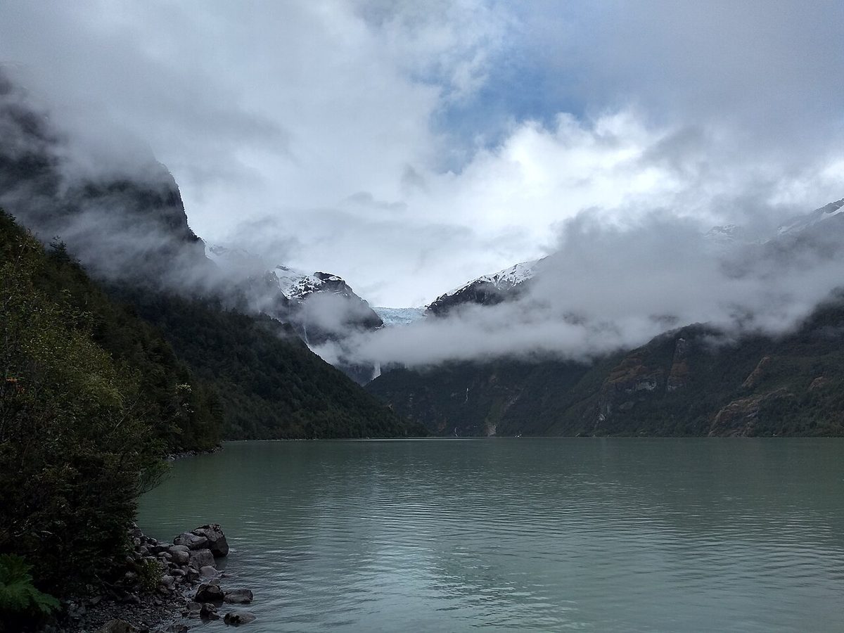
0 — 2 km Fig. 1 · The Queulat Hanging Glacier (Ventisquero Colgante) spilling waterfalls into a turquoise lagoon in Parque Nacional Queulat · Photo: Kenov66 / CC BY-SA 4.0 via Wikimedia Commons
The first time I drove south out of Puyuhuapi, the road hugged a fjord, the rain came in sideways, and I genuinely could not tell where the cloud ended and the mountains began. Then the highway pulled away from the water, climbed a little, and there it was through a gap in the trees: a wall of ice hanging off a cliff with two waterfalls pouring off its lip into nothing.
I pulled over like everyone else does. That is the effect this place has.
The Queulat Hanging Glacier is the headline act of one of the wettest, greenest, most theatrical stretches of the whole Carretera Austral, and it rewards a little planning more than almost any other roadside stop in northern Aysén.
Short answer: the Queulat Hanging Glacier (Ventisquero Colgante) is a glacier that spills off a mountain shelf inside Parque Nacional Queulat and pours waterfalls into a turquoise lagoon without quite reaching it. You see it on a roughly 3-km CONAF viewpoint trail, a short lagoon walk, or a small boat.
This guide is for road-trippers sequencing the northern Carretera Austral who want the honest version: which trail to walk, what it costs, when to come, and whether to sleep in Puyuhuapi.
If you are still piecing together the bigger drive, anchor this stop inside the Carretera Austral road trip guide, which is the pillar this article hangs off. Queulat is one of its most reliable highlights.
At a glance: the Queulat trails
Here is the quick version of what you can do at the park, so you can match a trail to your time and energy before we get into detail. Treat every figure as “around” and confirm at the gate, because Queulat reopened key trails in January 2026 after a big infrastructure overhaul and details are still settling.
Trail / activity
Distance & time (approx.)
Difficulty
Payoff
Sendero Ventisquero Colgante (now “La Morrena”)
~3.3 km signed, up to ~7 km round trip; 1.5 hr each way
Moderate, steep & muddy
The classic close-up glacier viewpoint
Sendero Laguna Témpanos
~600 m; 15–30 min
Easy
Lagoon shore + boat dock, glacier from below
Boat trip on Laguna Témpanos
~20–30 min on the water
Easy (you sit)
Closest you get without the climb
Sendero Laguna los Pumas
~5.8 km; half day
Moderate
Quiet forest lagoon, fewer people
Salto del Padre García (free sector)
~320 m; 25 min
Easy
A 30-m waterfall, quick leg-stretch
Sendero Río Guillermo (free sector)
~4 km+; half day
Harder
Deep rainforest, almost no crowds
Swipe to see all columns
Table 1
What the Queulat Hanging Glacier actually is
Let me clear up the names first, because they trip people up.
“Ventisquero Colgante” is Spanish for “hanging glacier,” and that is exactly what this is. A hanging glacier flows off a high mountain shelf but stops short of the valley or water below it, so it appears to dangle. English-speaking visitors often just call it the Queulat Hanging Glacier, and you will see both names used interchangeably on signs and maps.
The ice you are looking at is part of the larger Queulat ice cap. Meltwater spills off the glacier’s lip in tall waterfalls and feeds Laguna Témpanos, the milky, glacier-fed lagoon directly below. The glacier once reached that lagoon. Like most glaciers, it has retreated, so today there is a gap of bare rock between the ice and the water, which is part of why the waterfalls are so dramatic.
The word “Queulat” is thought to mean “sound of waterfalls” in the language of the Chono, the seafaring people who once moved through these channels. Stand at the viewpoint for two minutes and the name makes complete sense.
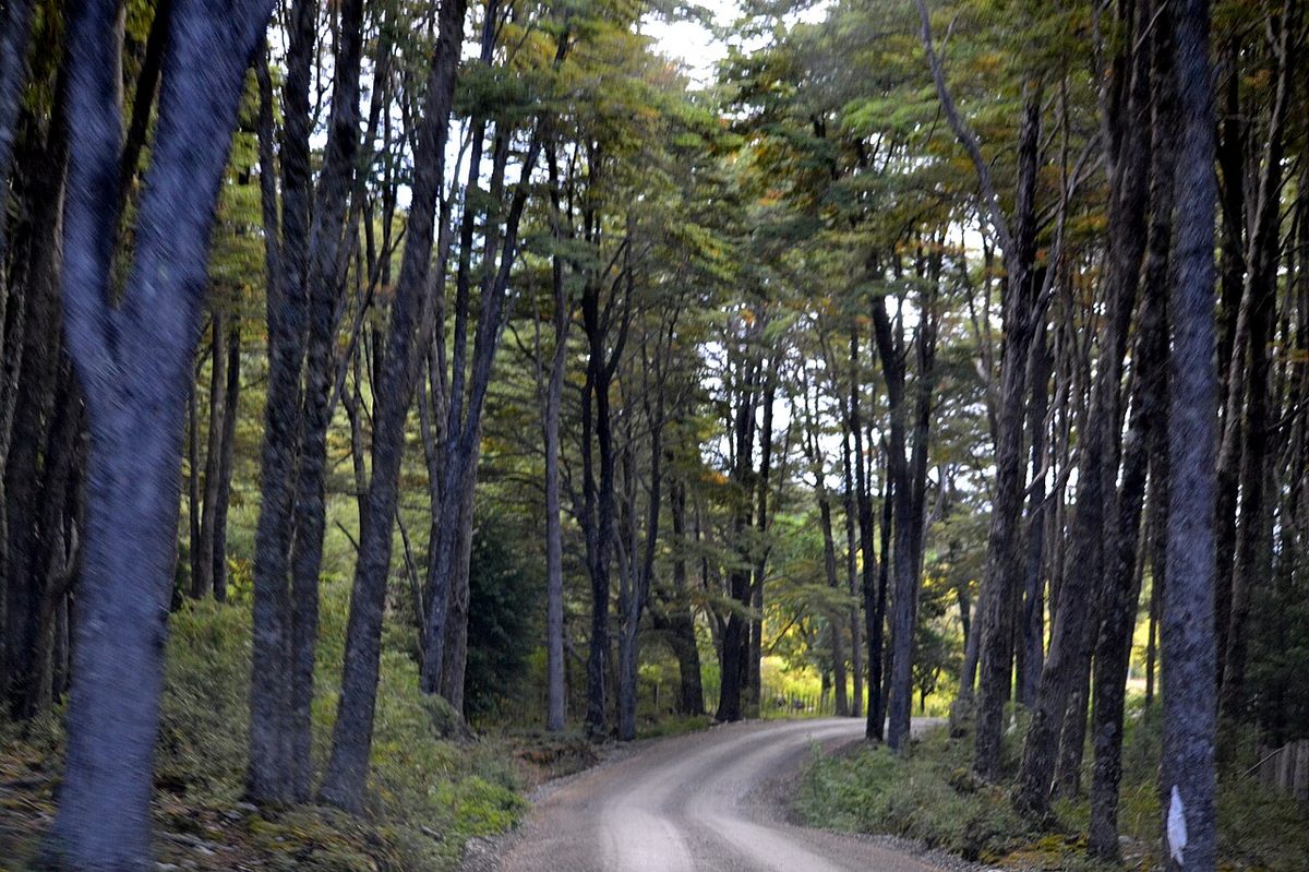
Parque Nacional Queulat was created in 1983 and protects a big swath of Valdivian temperate rainforest in the Aysén region. This is genuine rainforest: dripping moss, giant nalca leaves, ferns, and a soundtrack of the chucao bird rustling in the undergrowth. Lucky visitors spot pudú (the world’s smallest deer), huemul, or a Magellanic woodpecker. It is the most-visited park in Aysén, and on a clear summer day you will understand why instantly.
The trails: how to actually see the glacier
There is no single “right” way to see the Queulat Hanging Glacier. There are three, and they suit different people. Here is how I would think about it.
The viewpoint hike (Sendero Ventisquero Colgante / La Morrena)
This is the famous one, and the one most people drive here for. It is the trail that gets you a proper, eye-level confrontation with the ice.
CONAF signs the route at roughly 3.3 km, though plenty of trip reports clock the full out-and-back, including the approach from the car park, closer to 7 km. Either way, budget about 1.5 hours up and a bit less down, more if it is busy or wet.
It starts gently. You cross a long, well-built suspension bridge over the raging milky-blue Río Ventisquero, which drains the lagoon. The bridge is limited to about four people at a time, so on a crowded February afternoon expect a short queue here.
Then it climbs, and it does not really stop. The first stretch is the steepest, and overall you gain roughly 300 m through dense, almost entirely shaded forest. There are a couple of small bench areas to catch your breath, which matter, because the trail is narrow and stopping in the middle of it is awkward when others are coming through.
Be honest with yourself about conditions. Tree roots, mud, and slick rock are the norm here, and after rain (which is most of the time) it gets genuinely greasy underfoot. I would not attempt this in trainers. Proper boots and trekking poles make it far more pleasant, and I say that as someone who has slid around enough Patagonian trails to know better. For a fuller kit rundown, our Patagonia hiking, camping, gear and safety guide covers what actually earns its place in your pack.
At the top, you reach a flat clearing where everyone gathers for snacks and that payoff view: the glacier filling the cirque, waterfalls thundering off it, the lagoon far below. It is worth every muddy step.
The lagoon walk and the boat (Laguna Témpanos)
Not everyone wants, or is able, to grind up 300 vertical metres of slippery root staircase. Good news: you do not have to in order to see the glacier.
The Sendero Laguna Témpanos is a short, flat, easy walk of roughly 600 m, 15 to 30 minutes, that delivers you to the shore of the lagoon with the glacier looming above. This is the accessible-ish option, and on a clear day the view from the water’s edge is honestly spectacular in its own right.
From the same shore, in the warmer months, you can take a small boat trip out onto Laguna Témpanos to get closer to the ice and the waterfalls. Expect to pay around 5,000 CLP per person for the boat (kayak tours run roughly double), and verify on the day, because pricing shifts. A meaningful 2026 update: CONAF expanded the nautical operation to three boats, which the park says has cut the old waiting times considerably. In peak season that is a real upgrade.
My take: if the weather is clear, do the viewpoint hike for the drama and the lagoon walk for the contrast. If you are short on time, low on energy, or travelling with kids or anyone who can’t manage the climb, the lagoon walk plus boat is a completely satisfying visit on its own.
The quieter and free-sector trails
A couple of options thin out the crowds, and some don’t cost a peso.
Sendero Laguna los Pumas is a longer forest trail (around 5.8 km) to a quieter lagoon, with a stricter early entry cut-off. It is the one to pick if you want solitude over headline views.
Across the Cuesta del Queulat, the dramatic mountain pass south of the main entrance with its tight switchbacks, there is a free sector (El Portezuelo) with two worthwhile short trails. Salto del Padre García is a quick 320-m round trip, about 25 minutes, to a 30-m waterfall named for a Jesuit priest who explored here in the 1700s. Sendero Río Guillermo is longer and tougher, 4 km or more into deep rainforest, and rewards the effort with near-total quiet.
A little further south sits the Bosque Encantado (“Enchanted Forest”), a mossy, otherworldly walk to an iceberg-dotted lagoon. Be warned: it has a history of closures from landslides, and only the first stretch may be open. Check its status locally before you commit the detour.
This is the section that saves you a wasted morning, so read it even if you skim everything else.
You must reserve in advance
Here is the single most important thing to know: you cannot simply show up and pay at the gate anymore. Entry to Parque Nacional Queulat must be booked in advance online through pasesparques.cl, the official national parks ticketing system. When you book, make sure you select the Ventisquero Colgante sector.
Travellers who arrive without a reservation have been turned around and sent back out to find patchy signal (or a nearby campground that charges a small fee for Wi-Fi) just to book before driving back. The mobile coverage out here is poor, so do this the night before from Puyuhuapi.
Hours and fees (verify before you go)
As of the January 2026 reopening, the park runs Tuesday to Sunday, roughly 09:00 to 14:30, with a last exit around 16:30. Note it is closed Mondays. There are also trail-specific entry cut-offs: you generally need to be starting the Ventisquero Colgante trail by about 13:30, and the longer Laguna los Pumas trail earlier still. Plan to arrive in the morning, not at lunchtime.
On fees, budget around 12,000 CLP per adult for foreign visitors, with lower rates for Chileans (about 5,500 CLP) and free entry for young children. Some older sources still quote roughly 9,000 CLP for foreigners, so treat the exact number as a moving target and confirm the current price when you reserve. Either way it is one of the better-value park tickets in Patagonia for what you get.
Where it sits and how to arrive
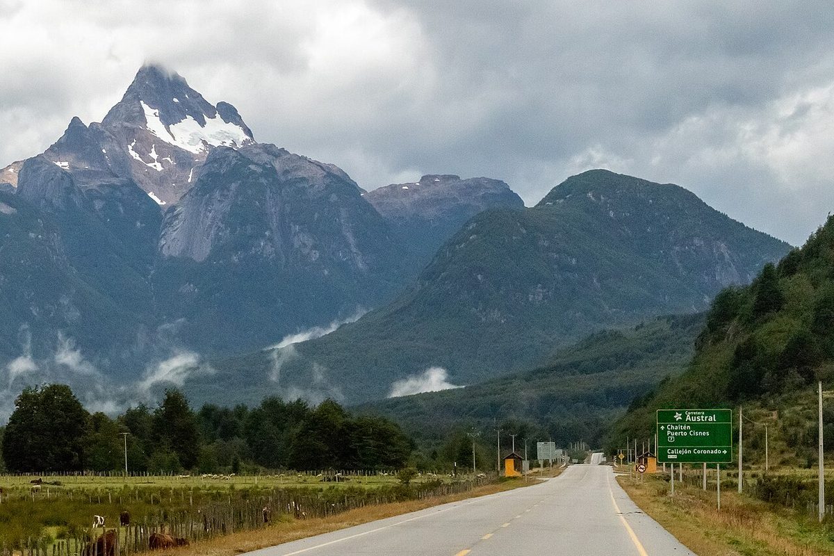
The main park entrance is about 22 km south of Puyuhuapi village, just off the Carretera Austral (Ruta 7). From Coyhaique it is roughly 165 km and about four hours of driving north, on a mix of paved and gravel road.
Most people arrive with their own wheels, which is by far the easiest way to handle the timing and the early start. If you are flying in, the nearest airport is Balmaceda (BBA) near Coyhaique; from there you rent a car, join a tour, or piece together buses. There is a local bus (Terraustral) that connects Puyuhuapi to the park in about 30 minutes, which works if you are travelling light and flexible. For the bigger picture on reaching this corner of the world, see how to get to Patagonia.
If your route involves the fjord crossings further north toward Hornopirén and Caleta Gonzalo, sort those early, because they book out; our Carretera Austral ferries guide walks through the bookable legs.
Weather and the best time to visit
I need to be straight with you about the weather, because it is the single biggest variable in whether you go home happy.
Queulat sits in a temperate rainforest, and it earns the name. This area receives something like 3,400 to 4,000 mm of rain a year. That is not a typo. Cloud, mist, and rain are the default, not the exception, and on a bad day the glacier can be completely hidden behind fog even from the viewpoint. I have stood at the top and seen mostly grey soup. It happens.
So manage your expectations and build in flexibility. If you have a spare day in the area, keep it loose so you can pounce on a clear-ish window.
The best time to visit is the Chilean summer, roughly December to March, when you get the longest days and the best odds of clear skies. February is the warmest and driest-ish, but also the most crowded, as Chilean families are on holiday. November and March are quieter shoulder months with fewer people and slightly cooler, wetter odds. Winter visits are possible but cold, short on daylight, and weather-dependent.
Whatever month you pick, pack as if it will rain, because it probably will. A proper waterproof shell and dry layers turn a damp visit from miserable into atmospheric. For the wider seasonal picture across the region, cross-check the seasonal guide to Patagonia.
You could blitz Queulat as a day stop, but I think that sells the area short. The village of Puyuhuapi, about 22 km north of the park turn-off, is the natural base, and it is a charming, slightly surreal little place.
Puyuhuapi was founded in 1935 by a small group of German immigrants, and that heritage still shows in the architecture and the unhurried feel. It sits on a pretty bay at the head of a fjord, jam-packed with hotels and restaurants in a way that, to me, feels a bit like a well-visited fishing town in Alaska.
You can still visit the old carpet factory, Alfombras Puyuhuapi, a humble shingled building that turned out surprisingly fine rugs for decades. Entry is free and it is a genuinely interesting glimpse of how this remote settlement made its way. Beyond that, the appeal is simple: a quiet bay, decent seafood, and a bed before an early park start.
The hot springs
Here is the reward after a muddy hike: this stretch of coast is hot-springs country, and soaking your legs after the glacier trail is one of life’s better small pleasures.
Termas del Ventisquero sits about 6 km south of Puyuhuapi, right on the edge of the fjord, with pools of volcanic-origin water and a cozy café for tea, coffee and pizza. Expect to pay somewhere around 17,000 CLP per person, less in the off-season, and the pools often stay open late into the evening. It is the easy, drive-up choice.
The more famous option is the Puyuhuapi Lodge & Spa, reached by a short boat ride across the fjord. It is a full thermal spa and lodge experience, beautiful but pricey, and worth it if you are after a splurge night rather than a quick dip. Either way, a soak here pairs perfectly with a glacier day.
For where to lay your head along the wider route, including this northern stretch, our where to stay on the Carretera Austral guide has the regional rundown.
Where Queulat fits on your Carretera Austral route
Queulat is a northern-Aysén highlight, and it slots most naturally into a north-to-south drive of the Carretera Austral. Coming from the Puerto Montt end, you would typically pass through the fjord-and-ferry country around Hornopirén and Pumalín before reaching Puyuhuapi and the glacier, then push on south toward Coyhaique.
That puts it in good company. Just north, Pumalín National Park offers a different flavour of rainforest, volcanoes and short trails. Far to the south, the unreal blues of the Marble Caves of Chile on Lake General Carrera are another unmissable stop. Strung together, these are the spine of a classic Aysén itinerary.
If you want help with the day-by-day sequencing, the breakdown of how long the drive takes lays out how many nights to give each stop, and driving the Carretera Austral covers the practicalities of the road itself: fuel, gravel, tyres and timing. For travellers fitting the whole Austral into a broader trip, the Patagonia itinerary shows how the north connects to the famous south.
My honest sequencing advice: give the Puyuhuapi-Queulat area at least one full night, ideally two if the weather is doing its usual moody thing. One night lets you arrive, soak, sleep, and hit the park at opening. Two nights gives you a weather buffer and time for the free-sector trails or a quieter lagoon. As a thread through the whole drive, it is worth returning to the Carretera Austral road trip guide to see how Queulat balances against the other big-ticket stops so you don’t over- or under-allocate your days.
Planning your visit: how long, what to book, what to skip
Let me distill this into the decisions that actually matter.
How long to spend. Plan a half to full day inside the park itself. The viewpoint hike plus the lagoon walk and a boat fills a morning comfortably. Add the free-sector trails or a second lagoon and you have a full day. For lodging, one night in Puyuhuapi is the minimum; two if you can spare it, purely as weather insurance.
What to book ahead. Your park ticket on pasesparques.cl is non-negotiable; book it the night before at the latest. Reserve a bed in Puyuhuapi in summer, as the village is small and fills up. If you want the boat or a kayak tour, you can usually sort that on the day, but ask at your lodging whether anything has changed.
What to skip. If the forecast is genuinely awful and the glacier is socked in, do not grind up the steep viewpoint trail in the rain for a view of fog. Do the short lagoon walk instead, soak in the hot springs, and try again the next morning if you have the time. There is no glory in suffering up a muddy climb to see nothing.
One trap to avoid. Do not arrive at lunchtime expecting to start the main hike. With the early trail cut-offs (around 13:30 for the Ventisquero Colgante trail) and the time it takes to park, cross the bridge, and climb, a late arrival can mean you are turned back. Morning is the move.
If your trip is more about scenery than summits, you can still get the full Queulat payoff from the lagoon and the boat. The wider Patagonia without the long hikes approach applies here: the best view is not always the one that costs you the most sweat.
Queulat Hanging Glacier FAQ
Is the Queulat Hanging Glacier worth visiting?
Yes, emphatically, if the weather even half-cooperates. A glacier hanging off a cliff with waterfalls pouring beneath it, set in dripping rainforest, is one of the most distinctive sights on the entire Carretera Austral. The main caveat is fog: on a heavily clouded day the glacier can hide. Build in flexibility and it is a clear highlight.
How long is the hike to the Ventisquero Colgante?
The main viewpoint trail (now signed as La Morrena) is roughly 3.3 km as marked by CONAF, though the full out-and-back including the approach is often closer to 7 km. Budget about 1.5 hours uphill and a little less down, with around 300 m of climbing. Mud and roots slow most people, so allow extra in wet conditions.
Do you need to book Queulat National Park in advance?
Yes. As of recent seasons, entry to Parque Nacional Queulat must be reserved online ahead of time through the official pasesparques.cl system, selecting the Ventisquero Colgante sector. Visitors who show up without a reservation have been turned away to find signal and book first. Mobile coverage is poor nearby, so reserve the night before from Puyuhuapi.
How much does it cost to enter Queulat National Park?
Plan on around 12,000 CLP per adult for foreign visitors, with lower rates for Chileans (about 5,500 CLP) and free entry for young children. Some sources still list roughly 9,000 CLP for foreigners, so treat the figure as approximate and confirm the live price when you book on pasesparques.cl. It remains good value for the scenery.
Can you see the glacier without doing the big hike?
Yes. The short, flat Sendero Laguna Témpanos walk (around 600 m) brings you to the lagoon shore with the glacier above, and in summer you can take a small boat onto the lagoon to get closer to the ice and waterfalls. It is a genuinely satisfying visit for anyone who can’t or doesn’t want to tackle the steep viewpoint climb.
What is the best time of year to visit Queulat?
The Chilean summer, roughly December to March, offers the longest days and the best odds of clear skies, with February the busiest. November and March are quieter shoulder months. No matter when you come, expect a lot of rain (this is temperate rainforest) and pack a waterproof shell, because the glacier can vanish into fog at any time of year.
Where should you stay to visit Queulat?
The village of Puyuhuapi, about 22 km north of the park turn-off, is the natural base, with hotels, restaurants and the hot springs nearby. Book ahead in summer, as it is small. Puerto Cisnes, further south, is a quieter alternative. Staying in Puyuhuapi lets you reserve your ticket the night before and reach the park at opening time.
Final thoughts
Queulat is one of those stops that punishes the rushed and rewards the patient. Show up at lunchtime in the rain with no reservation and you will have a frustrating day. Arrive in the morning with a ticket booked, a waterproof on, and a night in Puyuhuapi behind you, and you will stand at that viewpoint watching waterfalls peel off a hanging glacier and feel like the long drive north was entirely the point.
Give it a night, soak your legs in the hot springs afterward, and keep your day flexible enough to wait out the weather. That is the whole trick. Do that, and the Queulat Hanging Glacier will be one of the images you carry home from the Carretera Austral.