How to Drive Carretera Austral: Roads, Ferries & Fuel
How to drive Carretera Austral: paved vs gravel roads, the three mandatory ferries, one-way rental fees, fuel stops, and gravel-driving safety tips.
By Patagonia Tourism Guide · First published 1 Sep 2026 · Updated 1 Aug 2026
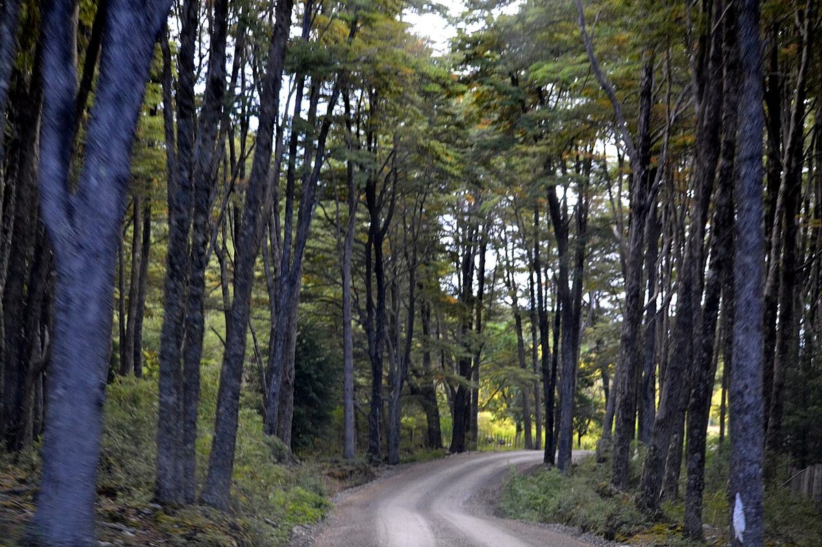
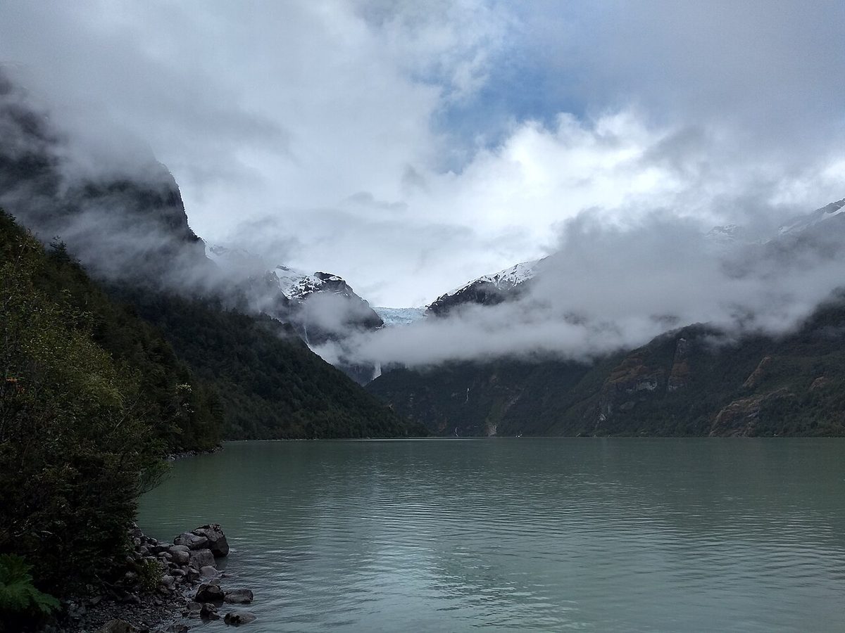
0 — 2 km Fig. 1 · A gravel section of the Carretera Austral winding through Patagonian mountains, the road many travelers come to drive Carretera Austral end to end · Photo: Manuel Cañón P. / CC BY-SA 3.0 via Wikimedia Commons
The first time I pulled onto Ruta 7 out of Puerto Montt, I had a full tank, a paper map, and the smug confidence of someone who had driven a lot of gravel roads before. Two hours later I was sitting in a ferry line at Caleta La Arena, realizing the “highway” I had come to drive was partly made of water.
That is the thing nobody quite prepares you for. When you set out to drive Carretera Austral, you are not pointing a car down one road. It is a 1,240-kilometer chain of pavement, gravel, one-lane bridges, fjord ferries, and long empty stretches where the next fuel pump is a real planning problem, not a footnote.
It is also the best driving trip I have ever done. None of what follows is meant to scare you off.
If you want the short version: to drive Carretera Austral end to end you need around two to three weeks, a vehicle with decent ground clearance, three mandatory ferries (one of which you must book ahead), a disciplined fuel habit, and patience with gravel that turns greasy in the rain. Do that, and Chile’s Route 7 is wide open to you.
This page is the operational one. It is for the traveler who has more or less decided to self-drive and now wants the logistics nailed down: surfaces, ferries, rental paperwork, fuel, and how to not put a car off a ripio curve. If you are still deciding whether to do this at all, start with the guide to driving route 7 and come back here when you are ready to plan the driving itself.
The Carretera Austral at a glance
Before the detail, here is the whole road broken into the chunks that actually matter for driving. Treat the surfaces and times as honest ballparks – construction, weather, and ferry queues all move them around, so verify before you go.
Section
Surface
Key consideration
Puerto Montt → Hornopirén
Paved + 1 ferry
Caleta La Arena–Caleta Puelche ferry, no booking
Hornopirén → Chaitén
Bi-modal ferry day
Hornopirén–Caleta Gonzalo crossing, must book
Chaitén → Coyhaique
Mostly paved
~90% paved to Puyuhuapi; construction south of it
Coyhaique → Puerto Río Tranquilo
Paved + new gravel
Fill up in Coyhaique; Marble Caves detour
Río Tranquilo → Cochrane
Mix, improving
Last big fuel at Cochrane heading south
Cochrane → Villa O’Higgins
Gravel + 1 ferry
Puerto Yungay–Río Bravo ferry, free, no booking, >300 km fuel gap
Swipe to see all columns
Table 1
If you remember one line from this table, make it the last one. The southern third – Cochrane to Villa O’Higgins – is where the road gets remote, the gravel gets real, and the fuel math gets tight.
Roads and surfaces: paved, gravel, and the bits in between
People ask “is the Carretera Austral paved?” expecting a yes or no. The honest answer is “increasingly, but not where it counts most.”
The old line that only about 12% of the route is paved is out of date. The reality in 2026 is that the northern half is in good shape. Roughly 90% of the road from Puerto Montt down to Puyuhuapi is now sealed, and you can cover those sections at a normal highway pace.
South of Puyuhuapi is where the character changes. You hit gravel – “ripio” in Chile – and active construction, and the road gets slower and rougher the further south you go. The stretch from Cochrane to Villa O’Higgins is the most consistently unpaved part of the whole route, and it is also the most beautiful, which is the Carretera Austral all over.
Ripio is not a single thing. Some of it is smooth, hard-packed, and almost as fast as tarmac. Some of it is loose, washboarded corrugations that rattle your fillings and make the steering feel vague. And some of it is freshly bladed and soft, where the loose stuff piles up on the edges and in the corners – exactly where you do not want it.
A few honest realities about the surface:
Construction can cost you an hour. Crews close stretches south of Puyuhuapi, around Coyhaique, and near Villa Cerro Castillo, often in an afternoon window roughly between 1 pm and 5 pm. If you can do your biggest driving early, you dodge the worst of the waits.
One-lane bridges are everywhere. They are well signed, but slow down and look – oncoming traffic has right of way on plenty of them, and the approaches are often loose gravel.
Rain changes the game. Wet ripio gets greasy, potholes fill and hide their depth, and the soft edges grab tires. This is a road where you drive to the conditions, not the clock.
For the wider picture of how these surfaces fit into a full Route 7 plan, the parent Carretera Austral road trip guide maps the whole thing town by town. If you want a day-by-day driving plan instead, the Carretera Austral itinerary breaks the route into manageable legs.
Here is the part that genuinely surprises first-timers: the Carretera Austral is not continuous. Fjords interrupt it in three places, and the only way through is a boat. If you want to drive the full highway from Puerto Montt to Villa O’Higgins, you take three mandatory ferries. They are part of the road, not an optional extra.
Two of them you simply turn up for. One you absolutely must book ahead. Get that distinction wrong and you can lose a day – or a whole leg of your trip.
These three are the spine. There is also a web of optional ferries that let you build loops or shortcuts, and the dedicated Carretera Austral ferries guide covers those in full. Below are the three you cannot avoid, north to south.
Caleta La Arena – Caleta Puelche (the easy one)
Just a couple of hours south of Puerto Montt, the road pauses at the Estero Reloncaví and you cross from Caleta La Arena to Caleta Puelche. It is the gentlest ferry you will take – around 30 minutes, run by Transportes del Estuario, with departures roughly every 30 to 60 minutes, day and night, all year.
No booking. You drive into the line, pay at the booth, and roll on. A car costs around CLP 11,130 at the time of writing (verify before you go); foot passengers are free, vans and motorhomes more. It is the warm-up.
Hornopirén – Caleta Gonzalo (the one you must book)
This is the crossing people get wrong. Soon after the first ferry, the road stops again at Hornopirén, and the only way south is the Hornopirén to Caleta Gonzalo route operated by SOMARCO. Locals call it “bi-modal,” and that word hides a small adventure.
You board the first boat in Hornopirén for a roughly three-to-four-hour sail across the Comau/Leptepu fjord. It docks at Leptepu, you drive about 15 minutes in convoy across a thin neck of forest to a second dock at Fiordo Largo, then board a second boat for around 45 minutes to Caleta Gonzalo. Total time is about four and a half to five hours, and it is gorgeous the whole way.
The crucial bit: you must reserve this one online in advance, especially from December to March, because it sells out. There are usually two subsidised sailings a day year-round (for example, around 10 am and 6 pm southbound), with extra non-subsidised summer departures at higher prices. A car with one driver runs around CLP 69,500, extra passengers around CLP 11,600 each (verify – these change). The SOMARCO site shows live availability, so you can watch how fast your date is filling.
You dock inside Pumalin National Park, one of the great surprises of the northern route, with Chaitén about an hour’s drive further south.
If you would rather skip this leg entirely, there is a direct Puerto Montt–Chaitén ferry (Naviera Austral, around nine hours) that bypasses Hornopirén. You miss a lovely stretch of road, but it is a legitimate time-saver.
Puerto Yungay – Río Bravo (the free, frustrating one)
To reach Villa O’Higgins and the official end of the road, you cross the Mitchell Fjord from Puerto Yungay to Río Bravo. The crossing takes around 45 minutes to an hour, and it is free – subsidised by the government.
It is also the one most likely to cost you time. There is no booking and no reservation – it is first-come, first-served, and in summer people regularly miss the boat and wait two hours for the next one. Sailings scale with the season: roughly four a day in the low season (April–September), about eight in the shoulder (October–December), and up to ten a day in high summer (January–March). Departure times shift with those seasons, so check the current timetable – the regional government posts updates – and line up early.
There is no vehicle alternative here. If you want to drive to the end of the Carretera Austral, this ferry is the only way across.
A footnote some travelers fixate on: from Villa O’Higgins you can continue to El Chaltén in Argentina by a famous boat-hike-boat crossing over Lago O’Higgins and Laguna del Desierto. It is wonderful – but it is for foot passengers and cyclists only, not cars, and it runs October to April, weather permitting. You cannot take a rental that way. If a self-drive border crossing is what you are after, that belongs to the Ruta 40 side of things, which I cover below.
Renting a car and the one-way fee trap
A rental car is the right tool for this road for most people. Buses do now connect the main towns, but they tie you to schedules, and half the joy here is stopping for a glacier, a roadside empanada, or a guanaco that has decided to own the lane. If you are weighing the trade-offs against bus and tour travel, the Carretera Austral road trip guide lays them out.
A few things matter more here than on a normal rental.
One-way fees are brutal. Most people want to start in Puerto Montt (or fly into Balmaceda near Coyhaique) and not double back. Picking up in one city and dropping in another triggers a one-way drop-off fee that is often around US$500. It is not a typo. The companies that even allow one-way rentals on this route – Europcar/Tattersall, Econorent, and Mitta among them – charge real money for the privilege. Budget for it, or plan a loop that returns the car where you got it.
You cannot drop a Chilean car in Argentina. This catches people out constantly. You must return the vehicle within the same country. You can pick up and drop off in different Chilean cities (for a fee), but a Santiago-to-Bariloche style one-way across the border is not a thing with a standard rental.
Crossing into Argentina and back is possible, with paperwork. If your route dips into Argentina and returns – say, looping via Ruta 40 – you need a notarized authorization letter from the rental company permitting international travel, plus extra cross-border insurance that runs around CLP 80,000 (roughly US$117). Arrange both at least 10 days before you travel, not at the counter. Some companies simply do not allow it, so confirm when you book. The paperwork and crossings are covered in detail in the Patagonia road trip and Ruta 40 border crossings guide.
Do you need a 4×4? Honestly, no, not for the main road in dry summer conditions. A sturdy two-wheel-drive with good ground clearance handles the Carretera Austral fine. Where 4×4 earns its keep is on the rough side-roads – the spur to a trailhead, a lakeshore, a remote campsite. If your budget stretches and you plan to wander off Ruta 7, the extra capability is nice insurance. A higher wheelbase matters more than the badge.
For the bigger budget picture – rental rates, fuel, ferries, food – the full cost breakdown for Patagonia puts numbers to the whole trip.
Fuel and distances: the planning that actually matters
If there is one logistical habit that keeps you out of trouble on this road, it is this: fill up whenever you can, not when you need to. Distances between stations are deceptive, and running low in the south is a genuinely bad situation with no quick fix.
In the north, stations sit roughly every 100 km – Puerto Montt, Hornopirén, Chaitén, La Junta, Puyuhuapi – and you rarely have to think hard about it. Coyhaique is the big one: the largest town on the route, the most reliable fuel, and the place to top up properly before you head south.
The south is where the math gets serious. From Coyhaique, the next dependable fuel is Puerto Río Tranquilo, then Cochrane. And here is the rule to tattoo on your steering wheel: fill up completely in Cochrane heading south, because the next fuel is Villa O’Higgins – more than 300 km away down gravel that burns more fuel than you expect.
Here is the spacing that matters most, south of the main hub:
Stretch
Approx. distance
Fuel note
Coyhaique → Puerto Río Tranquilo
~220 km
Fill in Coyhaique; Río Tranquilo has fuel
Río Tranquilo → Cochrane
~115 km
Cochrane is your staging point
Cochrane → Villa O’Higgins
~230 km+
Last fuel until Villa O’Higgins – fill to the brim
Swipe to see all columns
Table 2
Should you carry a jerry can? Opinions split, and both camps are right depending on the driver. If you are disciplined and top up at every station, you can do the whole route without one. But on the southern legs – and especially if your vehicle has a modest range – a spare can of fuel turns a nervous calculation into a non-event. My personal rule is to never let the gauge drop below about a quarter tank south of Coyhaique, and I would rather carry an extra can I do not use than coast into Cochrane on fumes. The small informal “bidón” sellers you sometimes hear about are unreliable; do not plan around them.
One more habit: pay attention to your range readout, keep it comfortably above 100 km of remaining range in the south, and never assume a small dot on the map is an open station. Some are seasonal, some are out of fuel, and a few are simply gone.
How to drive Carretera Austral safely: gravel, rain, wind, and animals
The Carretera Austral is not a dangerous road for a careful driver. It is an unforgiving one for a careless or rushed driver. The difference is technique and humility, not bravery.
I would put it this way: this road rewards confident drivers and punishes hurried ones. If you have never driven loose gravel, you can learn it here, but learn it slowly.
Gravel-driving technique that actually keeps you on the road
The single biggest mistake people make on ripio is carrying too much speed into corners. Here is what works:
Slow down – genuinely. Keep it at or below around 60 km/h on gravel, and far less in curves, soft sections, or anything bladed and fresh. Speed is what turns a wobble into a slide.
Brake before the corner, not in it. Get your speed off on the straight, then steer through smoothly. Braking mid-corner on gravel is how cars end up in the verge.
Both hands on the wheel, light grip. The steering will dance over washboard. Hold it steady, do not fight every twitch, and avoid sudden inputs.
Leave a big gap behind any vehicle. Dust kills visibility and flying stones crack windshields. A long following distance solves both – this is the main reason rentals come back with chipped glass.
Watch the edges. The loose, soft stuff collects on the outside of the road and in the corners. Keep to the firmer wheel tracks where you can.
Do not drive at night. No streetlights, free-roaming animals, unmarked hazards, and gravel that hides potholes. Plan your days to arrive before dark.
Rain and wind
Wet gravel behaves like a different surface – greasy, with hidden potholes under standing water and edges that grab. Slow down further and brake earlier than feels necessary.
Patagonian wind is the other constant. On open stretches, on bridges, and stepping off a ferry, a crosswind can shove the car sideways with no warning. High-sided vehicles feel it worst. Two hands, moderate speed, and don’t get surprised.
Animals and obstacles
Cattle, sheep, guanacos, and the occasional protected huemul step onto the road without looking. So do dogs near towns. Scan the verges constantly, ease off when you see livestock ahead, and remember that a hard swerve on gravel is more dangerous than the animal. Construction flag crews, one-lane bridges, and slow trucks round out the list – none of them a problem if you are not in a hurry.
Check your spare before you leave the city. Confirm the car has a usable spare tire (a “neumático” in Chile) and a working jack (a “gata”), and know where they are. Punctures happen on this road; some drivers carry two spares on the southern legs. For the full kit – what to pack for self-driving and camping in this region – the Patagonia hiking, camping and gear safety guide goes deeper.
The Carretera Austral runs almost entirely inside Chile, but several side-roads cross into Argentina, and a couple of them are genuinely useful for shaping a longer Patagonia trip.
The most practical vehicle crossings branch off the central and southern parts of the route – for example near Coyhaique toward the Argentine side, and the famous Chile Chico crossing near Lago General Carrera. These connect Route 7 to Ruta 40 in Argentina, the artery that carries you down toward El Chaltén, El Calafate, and the Perito Moreno Glacier.
Two rules apply to every one of these crossings in a rental car. First, the paperwork I mentioned above – notarized authorization plus cross-border insurance, arranged at least 10 days ahead. Second, Chile is strict about agricultural goods: no fresh fruit, vegetables, meat, dairy, honey, or seeds across the border. Bags get scanned. Eat or bin that apple before the post.
The non-vehicle exception is the Villa O’Higgins–El Chaltén boat-and-trek crossing, which only works on foot or by bike. For everyone driving, the Patagonia road trip and Ruta 40 border crossings guide is the place to plan the logistics, and if you are still assembling the overall route into and out of the region, how to get to Patagonia zooms out to the full picture.
How to plan it: what to book, what to skip, when to go
Now the practical layer – the decisions that make or break a self-drive.
Book ahead:
The Hornopirén–Caleta Gonzalo ferry. This is the one non-negotiable reservation. Do it as soon as your dates firm up, especially for January to March.
Your rental car, early, particularly if you need a one-way or a 4×4 – the fleets in Coyhaique and Puerto Montt are not enormous.
Cross-border insurance and authorization, at least 10 days out, if Argentina is on your route.
Accommodation in the small southern towns (Caleta Tortel, Villa O’Higgins, Río Tranquilo) in peak season – they fill, and there is no overflow.
Don’t bother pre-booking:
The Caleta La Arena and Puerto Yungay ferries. You cannot reserve them anyway – just arrive early and join the line.
Every single night’s lodging if you are camping or flexible. Part of this road’s magic is changing plans when the weather or a view demands it.
What to skip if you are short on time: the full push to Villa O’Higgins is as much about the satisfaction of reaching the end of the road as the scenery, and it costs you a long gravel out-and-back plus a fickle ferry. If you have under ten days, many travelers turn around at Río Tranquilo or Cochrane and feel they saw the best of it. The headline sights – Queulat’s hanging glacier, the Marble Caves, Cerro Castillo, and Patagonia National Park – all sit on the more accessible northern and central stretches.
When to go: the realistic driving season is roughly December to March, when days are long, ferries run their fullest schedules, and the gravel is mostly dry. Shoulder months (November, April) are quieter and beautiful but riskier for weather, ferry frequency, and early snow on the southern passes. Winter driving is for the experienced and well-equipped only. For the month-by-month trade-offs, see best time to visit Patagonia.
A realistic daily-distance reality check. This is where most first-timers overreach. On paper, the whole road is “only” 1,240 km – a day’s drive in a normal country. Here it is three to four days of hard driving with the ferries, and that is with almost no stopping. The sane pace is 120 to 200 km a day, which usually means a few hours of driving and an afternoon free to walk, paddle, or stare at a glacier. It is rare that a whole day should be pure driving. Plan around that, not around the map’s tidy distances, and you will have the trip people come home raving about. Where to base each night is its own puzzle – the where to stay on the Carretera Austral guide sorts the towns into useful stopovers.
Driving the Carretera Austral FAQ
How many days do you need to drive the Carretera Austral?
To drive the full route from Puerto Montt to Villa O’Higgins and actually enjoy it, plan at least 10 days, with two weeks comfortable and three weeks ideal. You can technically drive it in three to four days with minimal stops, but the gravel, ferries, and sheer beauty mean a rushed trip wastes the whole point. Aim for 120-200 km of driving per day.
Do you need a 4×4 to drive the Carretera Austral?
No, not for the main road in dry summer conditions. A sturdy two-wheel-drive car with good ground clearance handles Route 7 fine. A 4×4 earns its place only if you plan to explore rough side-roads to trailheads, lakes, or remote camps. A higher wheelbase and a confirmed spare tire matter more than four-wheel drive itself.
Is the Carretera Austral safe to drive?
Yes, for a careful driver. It is not a technically dangerous road, but it is unforgiving of speed and inattention on gravel. The real hazards are loose ripio in corners, dust and flying stones from other vehicles, one-lane bridges, animals on the road, and crosswinds. Slow down, never drive at night, and it is very manageable.
How many ferries are on the Carretera Austral and do I need to book?
Three ferries are mandatory to drive the full route: Caleta La Arena-Caleta Puelche, Hornopirén-Caleta Gonzalo, and Puerto Yungay-Río Bravo. Only the Hornopirén-Caleta Gonzalo crossing requires advance booking, and it sells out in summer. The other two are first-come, first-served – just arrive early and line up.
Can you cross into Argentina from the Carretera Austral by car?
You can cross and return, but you cannot drop a Chilean rental in Argentina – it must come back to Chile. For the crossing you need a notarized authorization letter from the rental company and extra cross-border insurance (around CLP 80,000), arranged at least 10 days ahead. Confirm your company allows it; some refuse international travel entirely.
Is the Carretera Austral paved?
Partly, and increasingly. The northern half is roughly 90% paved from Puerto Montt to Puyuhuapi, where you can drive at normal speeds. South of Puyuhuapi you hit gravel and active construction, and the stretch from Cochrane to Villa O’Higgins is mostly unpaved. Expect a slower pace and longer real-world driving times on the southern third.
Final thoughts
The Carretera Austral is one of the few roads that fully lives up to the hype, and it asks for a little competence in return. None of the logistics here are hard once you see them laid out: book the one ferry that needs booking, keep the tank full south of Coyhaique, slow down on the gravel, and give yourself far more days than the distances suggest.
Do that, and the road takes care of the rest – the fjord crossings at first light, the empty gravel unspooling toward a glacier, the small towns where the only traffic is a farmer moving cattle. It is the kind of trip you spend years talking about. Get the practicalities right, and you get to spend that time talking about the scenery instead of the breakdowns.
Drive carefully, fill up early, and enjoy every kilometer of it.