A realistic Carretera Austral itinerary for 7, 10 and 14 days: the stops in order, drive days, ferries to pre-book, and where to start and end.
By Patagonia Tourism Guide · First published 31 Aug 2026 · Updated 1 Aug 2026
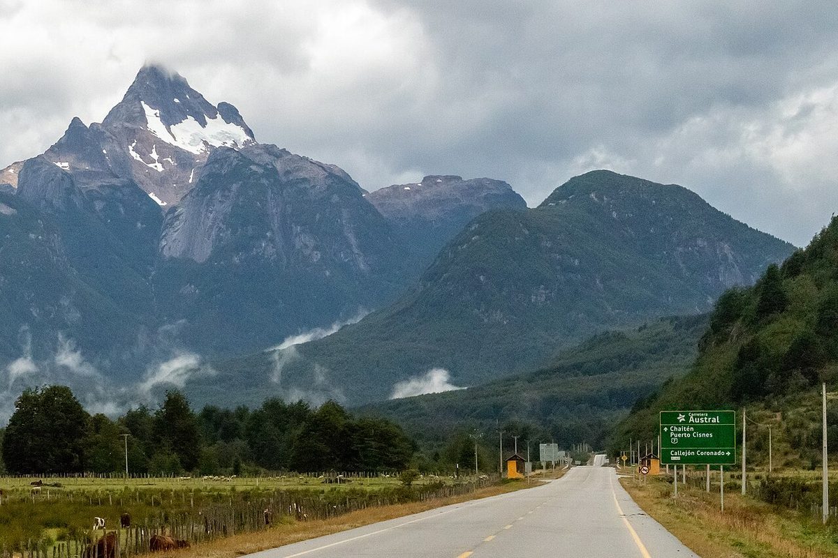
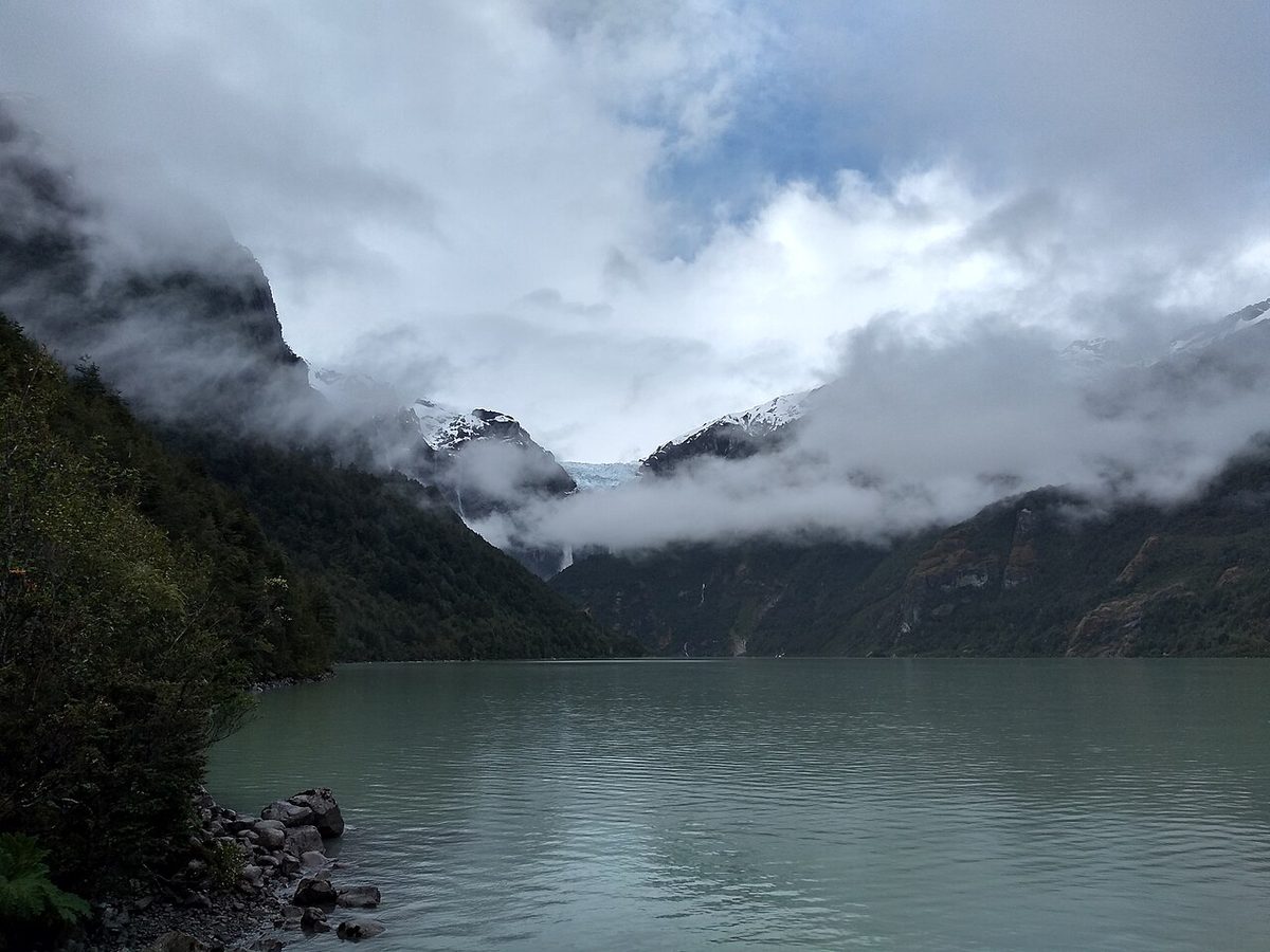
0 — 2 km Fig. 1 · Ruta 7 winding through Aysén, the core of any Carretera Austral itinerary · Photo: Camila Eyzaguirre / CC BY-SA 3.0 via Wikimedia Commons
The first time I planned a Carretera Austral itinerary, I made the classic mistake. I drew a line from Puerto Montt to Villa O’Higgins, saw “about 1,240 km,” divided by seven days, and thought it looked very doable. It is not very doable. That math gave me roughly 175 km a day, which on a normal highway is a long lunch. On Ruta 7, half of it gravel, broken up by ferries that don’t care about your schedule, it’s a full day of driving with your hands at ten and two.
So I want to save you that miscalculation. The road is one of the great drives on earth, but it punishes anyone who treats it like a highway instead of an expedition.
Here’s the short version. The best Carretera Austral itinerary depends entirely on your days: with 7 days, drive one rich section (Coyhaique down to the Marble Caves) rather than racing the whole road; with 10 days you can link Pumalin in the north to the Marble Caves; and with 14 days you can drive the full Puerto Montt to Villa O’Higgins route at a human pace.
This guide is for the traveler who has decided to drive Chile’s Ruta 7 and now needs a real plan, keyed to how much time you actually have. If you’re still deciding whether the whole road trip is for you, start with our Carretera Austral road trip guide, then come back here to lock in your days.
.jpeg)
One promise up front, repeated because it matters: every distance, drive time, ferry, and price below is approximate and seasonal. Ruta 7 changes. Roads get paved, ferry timetables shift with the tides and the season, and a landslide can close a section for a day. Treat the numbers as a realistic range, hedge anything that involves money or a boat, and verify the specifics with the operators close to your travel dates. I’ll point you at the right official sources as we go.
Carretera Austral itinerary at a glance
Before the day-by-day detail, here’s how the three durations compare. This is the decision most people get wrong, so I’d read this table twice.
Trip length
Route focus
Best for
Drive intensity
7 days
Coyhaique loop: Queulat or Cerro Castillo + Marble Caves, fly in and out of Balmaceda
First-timers short on time who still want the icons
Moderate — 2-3 real drive days
10 days
Chaiten/Pumalin in the north down to the Marble Caves and Río Baker
Travelers who want north and south without the full out-and-back
High — 4-5 drive days
14 days
The whole road, Puerto Montt to Villa O’Higgins, at a sane pace
The full bucket-list drive, with weather buffer built in
High — most days involve driving
Swipe to see all columns
Table 1
A few honest notes on that table. Seven days is not enough to drive the entire road and see anything, full stop. Anyone selling you a 7-day Puerto Montt to Villa O’Higgins self-drive is selling you a windshield tour. Two weeks is the real minimum for the complete route, and three weeks is genuinely better if you can swing it. With ten days you’re making a smart compromise: you get the north and the south, but you’ll likely fly out of Balmaceda or loop into Argentina rather than backtrack.
If your bigger trip also includes Torres del Paine or El Chalté, factor that in now — those are a flight or a long Argentina drive away from Aysé, and people consistently underestimate the gap. Our Patagonia itinerary planner covers how the regions stitch together.
How the route works (and why pacing is everything)
The Carretera Austral, officially Ruta 7, runs about 1,240 km from Puerto Montt south through Chile’s remote Aysé region to Villa O’Higgins, where the road simply stops at a lake. Chile’s roads authority (MOP) formally defines it as a scenic route in ten sections, 1,240 km plus a final 7 km spur to Puerto Bahamondes, the true terminus just past Villa O’Higgins.
The stops, in order from north to south, are the spine of every itinerary here:
Hornopirén — northern ferry gateway, edge of the fjords
Chaité and Pumalín National Park — Valdivian rainforest, volcanoes, the first true wow
Puyuhuapi and Queulat National Park — the Ventisquero Colgante hanging glacier
Coyhaique — the regional capital and supply hub, roughly the midpoint
Cerro Castillo — jagged basalt spires and one of the best day hikes in Patagonia
Puerto Río Tranquilo — launch point for the Marble Caves on Lago General Carrera
Río Baker and Cochrane — Chile’s biggest river, the gateway to Patagonia National Park
Caleta Tortel — a village of cypress boardwalks instead of streets
Villa O’Higgins — the literal end of the road
Now the part that breaks plans. On the gravel sections, realistic moving speed is around 40-50 km/h, and that’s before you stop for the views you came for (you will stop constantly). Pure end-to-end driving is roughly 29-35 hours. So a “short” 250 km day between Cochrane and Villa O’Higgins is not a couple of hours — it’s most of a day once you add a ferry and photo stops.
That’s why I keep hammering the pacing. A good Carretera Austral itinerary budgets drive days as drive days and protects the days where you actually do things. Our deep-dive on driving the Carretera Austral breaks down the road conditions section by section if you want the granular version.
The 7-day Carretera Austral itinerary (Coyhaique core loop)
With a week, do not try to drive the whole road. Fly into Balmaceda airport near Coyhaique, rent there, and explore the central section that packs in the most per kilometer. You’ll skip the long northern ferry slog and still see a hanging glacier, jagged peaks, and the Marble Caves.
Here’s the pacing I’d use.
Days 1-2: Coyhaique and Cerro Castillo
Land at Balmaceda, pick up the car, and base in Coyhaique. Stock up here — it’s the last big supermarket and fuel for a while. On day 2, drive about 100 km south (around 1.5 hours) to Villa Cerro Castillo. The full Las Horquetas traverse is a multi-day, self-sufficient affair, but there’s a tough, rewarding day hike up to the Laguna beneath the spires. Sleep in Cerro Castillo or back in Coyhaique.
Days 3-4: Puerto Río Tranquilo and the Marble Caves
Drive south to Puerto Río Tranquilo on Lago General Carrera — roughly 240 km from Coyhaique, about 5 hours, partly gravel. The next morning, take a guided boat or kayak out to the Marble Caves early, before the lake gets choppy and the wind kills the trips. This is weather-dependent, so build in a buffer day if you can. Full detail on timing and tours is in our Marble Caves guide.
Day 5: Queulat hanging glacier (or Río Baker)
You’ve got a choice. Backtrack north toward Coyhaique and continue to Queulat National Park to see the Ventisquero Colgante (about 165 km north of Coyhaique, a short 3 km walk to the viewpoint) — covered in our Queulat hanging glacier guide. Or push a little south of Río Tranquilo to see the turquoise Río Baker, Chile’s most voluminous river. My pick for a first-timer is Queulat, because it sets up an easy exit.
Days 6-7: Coyhaique and fly out
Drive back to Coyhaique, return the car, and fly out of Balmaceda. Keep the last morning loose — Patagonian weather and gravel both love to add an hour you didn’t plan for.
Honest verdict on 7 days: it’s a moderate-intensity trip with two or three genuine drive days and time to actually hike and boat. You miss the north (Pumalín) and the deep south (Tortel, Villa O’Higgins), but you see the highest-value middle. That’s a fair trade for a week.
The 10-day Carretera Austral itinerary (north to Marble Caves)
Ten days is the sweet spot for travelers who can’t give the road two full weeks but refuse to skip Pumalín. The trick is to go one direction and not backtrack: fly into Puerto Montt, drive south, and exit from the middle (fly out of Balmaceda) or loop into Argentina. You won’t reach Villa O’Higgins, and that’s fine.
Days 1-2: Puerto Montt to Chaité via the ferries
This is the northern ferry gauntlet, and it’s the part that needs pre-booking. From Puerto Montt you drive to Caleta La Arena for a short, frequent, no-reservation ferry to Caleta Puelche, then continue to Hornopirén for the longer Hornopirén-Caleta Gonzalo crossing (the “bimodal” route, roughly 3.5-4.5 hours including a short gravel link). Book that one ahead — more on this in the planning section below. Alternatively, take the direct overnight Naviera Austral ferry from Puerto Montt to Chaité and skip the small ferries entirely. Sleep in or near Chaité.
Days 3-4: Pumalín National Park
Chaité is the gateway to Pumalín, part of the Tompkins rewilding legacy and one of my favorite parks in all of Patagonia. Hike the Chaité Volcano trail or the alerce and waterfall trails near El Amarillo. Give it two nights if you can — the rainforest here is unlike anywhere else on the route. Our Pumalín National Park guide has the trail breakdown.
Drive south to Puyuhuapi, your base for Queulat National Park and its hanging glacier. The next day, continue to Coyhaique to resupply and sleep in a real bed with real food.
Days 7-8: Cerro Castillo and Puerto Río Tranquilo
Head south through Cerro Castillo (day hike if you have the legs) and on to Puerto Río Tranquilo for the night.
Day 9: Marble Caves
Morning boat or kayak to the Marble Caves, then either start your loop back toward Balmaceda or push south to glimpse the Río Baker confluence near Puerto Bertrand, where the turquoise Baker meets the grey Nef.
Day 10: Exit
Fly out of Balmaceda, or if you’ve arranged a one-way rental and the border paperwork, cross into Argentina at Chile Chico (via the Puerto Ibáñez ferry across the lake) to join Ruta 40. That border-and-Ruta-40 option is covered in our Ruta 40 and border-crossings guide.
Honest verdict on 10 days: high intensity, four or five real drive days, but you bookend the route’s two best regions. The compromise is the deep south — you don’t get Tortel or Villa O’Higgins. For most people, that’s the right cut.
The 14-day Carretera Austral itinerary (the whole road)
Two weeks is where you can finally drive the entire thing, Puerto Montt to Villa O’Higgins, without it feeling like a forced march. This is the trip people dream about. It still has plenty of driving — most days involve some — but you get a weather buffer and time to breathe at the big stops.
Days 1-4: Puerto Montt through Pumalín to Coyhaique
Run the same northern opening as the 10-day plan: the ferries (or the overnight Puerto Montt-Chaité ferry), two nights at Pumalín, then Puyuhuapi/Queulat, arriving Coyhaique around day 4 to resupply.
Days 5-6: Cerro Castillo and Puerto Río Tranquilo
South to Cerro Castillo for the day hike, overnight there or push to Río Tranquilo. Day 6, the Marble Caves in the morning. This is the heart of the trip and worth not rushing.
Days 7-8: Río Baker, Cochrane, and Patagonia National Park
Drive south along the Río Baker — stop at the Confluencia near Puerto Bertrand where the colors collide. Base in Cochrane and give a full day to Patagonia National Park in the Valle Chacabuco, the Rewilding Chile flagship where guanacos and condors have replaced grazing cattle. The main entrance sits about 30 km north of Cochrane. Our Patagonia National Park guide covers the hikes.
Drive south toward Caleta Tortel, the cypress-boardwalk village with no roads, just walkways over the water. From nearby Puerto Yungay, take the free Puerto Yungay-Río Bravo ferry (roughly hourly in summer, no reservation), then continue the final, lonely stretch to Villa O’Higgins. Walk or drive the last 7 km to Puerto Bahamondes — the official end of the road — and take the photo you earned.
Days 11-12: Villa O’Higgins and the turnaround
Spend a day at the end of the world. The Altavista trail offers huge valley views; there are glacier and lookout hikes too. Then face the reality: there’s no rental return here, and you basically have two ways out. Drive back north the way you came, or — if you planned ahead — exit via one of the long ferries. Backpackers (not cars) can cross to El Chalté via the Lago O’Higgins ferry plus a border hike.
Days 13-14: The drive back (with buffer)
Budget two days minimum to retrace north to your drop-off point, whether that’s Coyhaique/Balmaceda or back to Puerto Montt. Build slack in — this is exactly where a delayed ferry or a closed road eats your flight if you cut it fine.
Honest verdict on 14 days: this is the complete experience, and the pacing works. If you have a 15th or 16th day, spend it as a buffer rather than adding a stop. The road will find a way to use it.
North to south or south to north?
Almost everyone drives north to south, starting in Puerto Montt or flying into Balmaceda. The reason is brutally practical: you basically cannot rent a car in Villa O’Higgins. There are no rental offices at the southern end, so a self-driver has to begin in the north (or in Coyhaique) and either return or loop out through Argentina.
South to north is mostly a backpacker move. If you’re coming from El Chalté in Argentina, you can cross the border on foot and by ferry into Villa O’Higgins and then travel north using buses and hitchhiking — covered in our Patagonia without a car and budget planning. It’s a brilliant adventure, but it’s not a self-drive in the normal sense.
My pick for most readers: fly into Balmaceda for a 7- or 10-day trip (you skip the slowest northern driving), or start in Puerto Montt for the full 14-day route so you don’t miss Pumalín.
Planning: rental car, ferries, fuel, and when to go
This is the section that actually makes or breaks the trip. Read it before you book anything.
The rental car and the one-way fee
A 4×4 is generally not required. A 2WD with decent ground clearance and good tires handles the gravel fine in dry conditions, though a higher-clearance SUV is more comfortable on washboard. Confirm the car has a real spare tire before you sign — non-negotiable.
The big gotcha is the one-way drop-off fee. Returning the car to a different city than you collected it from can cost around USD 500. For many people it’s actually cheaper to do an out-and-back to the same city than to pay the one-way premium. And if you want to cross into Argentina, you must arrange a notarized border permit with the rental company in advance — give them a couple of weeks. Costs add up fast on this route; our daily budget ranges by travel style helps you model it.
The ferries you must pre-book
If you’re driving the full route north to south, these crossings shape your whole schedule:
Caleta La Arena – Caleta Puelche — short (around 30-45 min), frequent, no online booking, first-come-first-served. Just turn up.
Hornopirén – Caleta Gonzalo — the long bimodal crossing (around 3.5-4.5 hours including a gravel link). This is the one to book ahead, especially in January and February, via Somarco/Barcazas or Naviera Austral. Vehicle spaces are limited and sell out. Around USD 160 for a car plus two people on the summer extra sailing.
Puerto Yungay – Río Bravo — toward Villa O’Higgins. Free, no reservation, roughly hourly 10am-7pm in summer.
There’s also the Puerto Ibáñez – Chile Chico ferry across Lago General Carrera if you’re looping into Argentina, and a long (~41-hour) ferry from the Tortel/Puerto Yungay area to Puerto Natales if you want to exit south without driving back. Full breakdown in our Carretera Austral ferries guide. Verify every timetable directly with Naviera Austral close to your dates — these change.
Fuel
Fill up whenever you can, not when you’re low. Big towns (Puerto Montt, Chaité, Coyhaique, Cochrane) have reliable stations, and even Villa O’Higgins has fuel, but supply can be inconsistent and the gaps between stations can exceed 200 km. The rule on Ruta 7 is simple: pass a station with under half a tank, top it off.
When to go
The drivable season is summer, roughly December to March, for the best weather, longest days, and open services. December and March are my picks — slightly fewer crowds, easier ferry bookings, and lower prices than the January-February peak, when boats and beds fill up. The weather is wild year-round regardless; pack for four seasons in a day. For the month-by-month view, see the best time to visit Patagonia.
What to skip
If you’re tight on time, skip the full out-and-back to Villa O’Higgins (it’s a long way for a sign) and skip trying to add Futaleufú rafting unless you’re building a longer trip. Don’t skip the Marble Caves or Queulat — those are the highest reward per hour on the whole road. And don’t skip booking the Hornopirén ferry; an unbooked car at that ramp in February is the single most common way this itinerary falls apart.
Once you’ve got your route, sort out where you’ll sleep — beds are sparse and seasonal out here. Our where to stay on the Carretera Austral guide maps the towns with actual accommodation. And for getting to the start line in the first place, how to get to Patagonia covers flights into Puerto Montt and Balmaceda.
Carretera Austral itinerary FAQ
Is 7 days enough for the Carretera Austral?
Seven days is enough for one rich section, not the whole road. Fly into Balmaceda, base around Coyhaique, and cover Cerro Castillo, the Marble Caves, and Queulat. Trying to drive Puerto Montt to Villa O’Higgins in a week means six-hour driving days and almost no time to stop. Pick quality over distance.
How long does it take to drive the whole Carretera Austral?
Pure driving end-to-end is roughly 29-35 hours, but nobody does it that way. With ferries, photo stops, and gravel slowing you to around 40-50 km/h, the full Puerto Montt to Villa O’Higgins route needs two weeks minimum to enjoy, and three weeks is more comfortable. The road is the destination, so budget accordingly.
Should I drive the Carretera Austral north to south or south to north?
Drive north to south. You basically cannot rent a car in Villa O’Higgins, so self-drivers start in Puerto Montt or Coyhaique and either return or loop out through Argentina. South to north is really a backpacker route, crossing from El Chalté by ferry and foot, then using buses and hitchhiking northward.
Do you need a 4×4 for the Carretera Austral?
Usually no. A 2WD with good ground clearance and solid tires handles the gravel fine in dry summer conditions. A higher-clearance SUV is more comfortable on washboard sections, and it helps if you hit rain or want to explore rougher side roads. Whatever you rent, confirm it has a proper spare tire before you drive off.
Which Carretera Austral ferries do I need to book in advance?
The critical one is Hornopirén-Caleta Gonzalo, the long northern bimodal crossing — book it ahead via Somarco/Barcazas or Naviera Austral, especially in January and February. Caleta La Arena-Puelche and Puerto Yungay-Río Bravo are first-come-first-served and don’t take reservations. Always reconfirm timetables with the operator close to your travel dates.
When is the best time to drive the Carretera Austral?
December to March, the southern summer, when services are open, days are long, and roads are at their best. December and March are my picks for thinner crowds, easier ferry bookings, and lower prices than the January-February peak. Expect wild weather any month, though — pack rain gear and warm layers regardless of the forecast.
Can you do the Carretera Austral without a car?
Yes, but slowly. Buses connect the bigger towns and hitchhiking is a long-standing tradition in summer, though both are unreliable and weather-dependent. Add several extra days versus driving. A rental car is far more flexible for reaching trailheads and parks; going carless suits budget backpackers with time more than travelers on a fixed schedule.
Final thoughts
The Carretera Austral rewards the planner who respects the distances and punishes the one who doesn’t. I’ve watched people arrive with a seven-day plan to “do the whole road” and leave frustrated, having mostly seen it through a windshield. I’ve also watched people with the same week, sensibly based around Coyhaique, come away calling it the best drive of their lives.
So be honest about your days. Seven days: one great section. Ten days: north and south, no backtrack. Fourteen days: the whole magnificent thing, with a buffer. Book the Hornopirén ferry, fill the tank when you can, and leave room for the weather to do what Patagonian weather does. The road will take care of the rest.