Seven Lakes Route: The Complete Driving Guide (Ruta de los Siete Lagos)
How to drive the Seven Lakes Route in Patagonia: the lakes in order, stops, road conditions, best season, self-drive vs tour, and where to start.
By Patagonia Tourism Guide · First published 17 Aug 2026 · Updated 1 Aug 2026
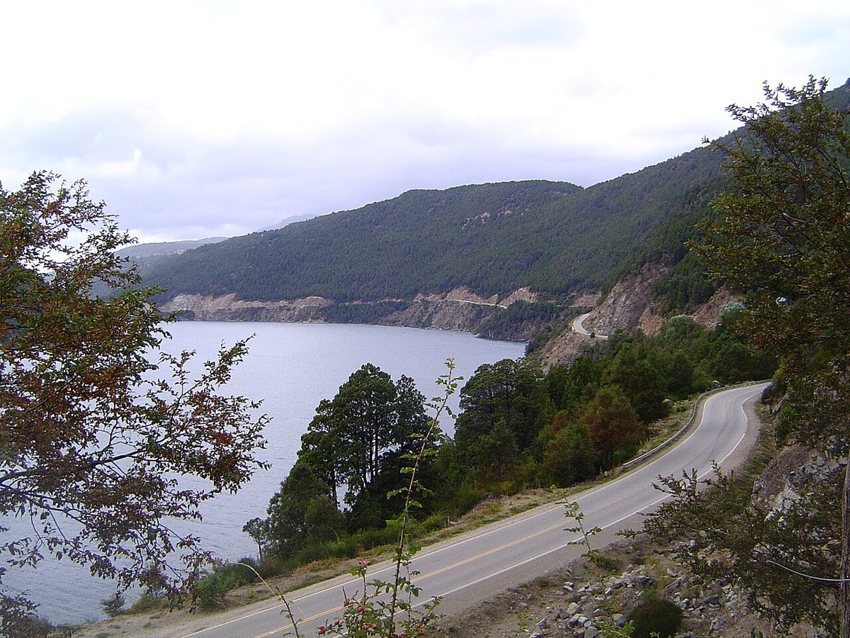
0 — 2 km Fig. 1 · Lakes and forested mountains along the Seven Lakes Route in Patagonia, Argentina · Photo: Public domain via Wikimedia Commons
I have driven the Seven Lakes Route in the wrong direction, at the wrong time of day, with the sun straight in my eyes and a fuel gauge I should have taken more seriously. I have also driven it slowly, on a calm morning, when Lago Espejo was so still it looked like someone had laid a mirror across the valley. The second version is the one you want, and it is not hard to get if you plan a little.
This is the famous stretch of Patagonia that everyone photographs and very few people plan properly. So let me give you the version I wish someone had given me.
The Seven Lakes Route (Ruta de los Siete Lagos) is the scenic section of Ruta 40 between Villa La Angostura and San Martin de los Andes, around 110 km past a string of lakes, waterfalls, and forest in the Argentine Lake District. Non-stop it takes about 2 hours, but with stops it is a full, generous day. It is paved the whole way.
This guide is for anyone deciding how to do it: self-drive or guided tour, one-way or round trip, from Bariloche or from a closer base, and in which season. It sits under our rundown of the Argentine Lake District, which is the place to start if you are still planning the wider region.
The Seven Lakes Route at a glance
Here is the route from south to north (Villa La Angostura to San Martin de los Andes), which is the direction most people drive it. You can do it the other way too, and I will get to that.
Stop (in order, S to N)
What it is
Why stop
Villa La Angostura
Southern gateway, on Lago Nahuel Huapi
Base, fuel, food, Los Arrayanes
Lago Espejo + Mirador
“Mirror Lake”, short detour on RN231
The postcard reflection shot
Lago Correntoso
Large lake, Rio Correntoso
Beaches, bays, the “shortest river”
Lago Espejo Chico
~2 km gravel detour at Ruca Malen bridge
Quiet beach, picnic, river
Lago Escondido
The “hidden” lake, smallest of the seven
Glimpses through coihue forest
Lago Villarino
Joined to Falkner by a narrow isthmus
Viewpoint from above
Cascada Vullignanco
Roadside waterfall before Falkner
Easy photo, pull-over parking
Lago Falkner
Beach right on Ruta 40
Easiest swim/beach stop, camping
Lago Machonico
Viewpoint over a more arid basin
Stretch your legs, big view
Lago Lacar + San Martin
Northern end, glacial lake
Base, beaches, food, sunset
Swipe to see all columns
Table 1
Two useful detours hang off this list: Lago Hermoso (a short, bumpy 2 km turn-off that several people swear is the prettiest of all) and Villa Traful / Lago Traful (a longer detour on gravel, around 25 km, with a dramatic clifftop viewpoint). You cannot do everything in one day, so pick your detours before you set off.
What the Seven Lakes Route actually is
The Seven Lakes Route is not a separate highway. It is a named, especially beautiful chunk of National Route 40, Argentina’s legendary north-south road.
Wikipedia describes it as the scenic portion of Ruta 40 between San Martin de los Andes and Villa La Angostura, in Neuquen province, a road of around 107 km that crosses two national parks: Lanin in the north and Nahuel Huapi in the south. The official Villa La Angostura and national tourism sites usually round it to around 110 km. Either way, the route proper is the bit between those two towns.
People get confused because of Bariloche. Bariloche is the big-name city most travelers fly into, and it is south of Villa La Angostura. So when someone says “the Seven Lakes Route from Bariloche”, they mean a longer day: Bariloche up to Villa La Angostura, then the lakes section to San Martin, and (usually) back again. Bariloche official tourism puts Bariloche to San Martin at around 185 km one way, which is why a Bariloche-based day is so long. More on that below.
The short version: the route is around 110 km of lakes and forest between Villa La Angostura and San Martin de los Andes, and the towns at each end are your natural bases.
Which are the actual seven lakes?
This trips people up, and the honest answer is that the “seven” depends on who you ask.
The list you will see most often, and the one Visit Argentina and Wikipedia use, is: Lacar, Machonico, Falkner, Villarino, Escondido, Correntoso, and Espejo. Those are the seven the route is named for, running from the San Martin end to the Villa La Angostura end.
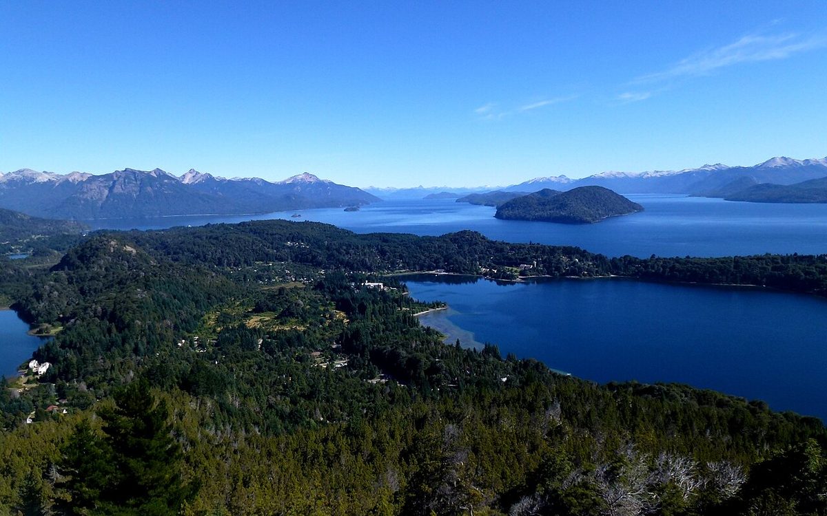
But you will also pass Nahuel Huapi, the enormous lake at the Villa La Angostura end, and some lists swap it in for Lacar. As Welcome Argentina notes, you can actually see eight lakes from the road without taking a single detour. And if you add the easy turn-offs, you collect Espejo Chico, Hermoso, Bailey Willis, Meliquina, and Traful too.
So do not waste energy counting to exactly seven. The number is a brand, not a rule. The point is a forested mountain road that strings together a dozen lakes, and you stop at the ones that look good when you are there.
I will run this south to north, Villa La Angostura to San Martin, because that is how most travelers based in or near Bariloche will drive it. If you are starting in San Martin, just read it backwards.
Villa La Angostura and Lago Espejo
Villa La Angostura sits on the northern shore of Lago Nahuel Huapi, and it is where the lakes section really begins. It is worth treating as more than a fuel stop. This is the home of Los Alerces National Park‘s lesser-known cousin, the Arrayanes forest, and it makes a far calmer base than Bariloche.
Just after you leave town heading north, take the short detour onto RN231 toward the Cardenal Samore border pass. About 1 km in, on a cliff to the right, is the Mirador Lago Espejo, the official viewpoint. Espejo means “mirror”, and on a windless day the lake earns the name completely. The Villa La Angostura tourism office calls this one of the route’s signature panoramas, and I would not skip it.
Lago Correntoso and Lago Espejo Chico
Back on Ruta 40, you reach Lago Correntoso, one of the biggest lakes on the circuit, with bays, beaches, and a blue-green color that holds even on grey days. Near Villa La Angostura it connects to Nahuel Huapi by the Rio Correntoso, which locals like to call one of the shortest rivers in the world.
A little further, at the bridge over the Ruca Malen stream, a short gravel detour (around 2 km) drops you at Lago Espejo Chico. This is a quiet beach with a campground and picnic area, and it is one of those small stops that rewards you for bothering. If you have ten extra minutes, take it.
Lago Escondido, Villarino and Falkner
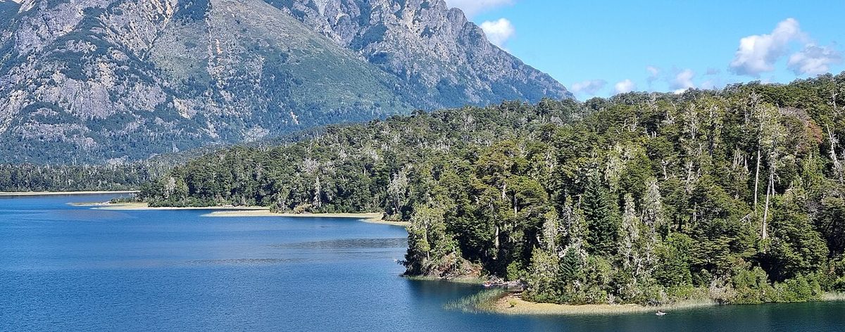
Continuing north, Lago Escondido is the smallest of the named seven and lives up to its name (“hidden”). You only catch it in glimpses through the coihue forest from a small viewpoint, but the teal water is lovely.
Then come Villarino and Falkner, joined by a narrow isthmus. The road shows you Villarino from above, then descends and runs right alongside Falkner at water level. Falkner is the easiest beach stop on the whole route, because the sand is essentially on the shoulder of the highway. There is a wild camping area here, open roughly November to April. Look up at the dark rock towers of Mount Buque on the southern shore, where condors nest, according to Welcome Argentina.
Cascada Vullignanco
Just before Lago Falkner, watch the left side of the road for the Cascada Vullignanco (you will also see it spelled Vuliñanco or Vullinanco). It is a roadside waterfall, somewhere around 20 to 35 m depending on the source, splitting into two streams over a large rock. There is space to pull over. Plenty of drivers blow past it at speed, so slow down and look.
Lago Machonico and the continental divide
North of Falkner the landscape gets a little drier and you reach the Lago Machonico viewpoint, looking down on the lake from above.
Somewhere around here, if you are driving from the San Martin side, you also pass one of my favorite quiet curiosities on the route: the Arroyo Partido, near the Pil Pil viewpoint. Welcome Argentina explains that this little stream splits, with one branch eventually reaching the Pacific and the other the Atlantic. It is the kind of thing you would never notice without a sign, and it makes the map feel real.
Lago Lacar and San Martin de los Andes
Finally you drop toward Lago Lacar and San Martin de los Andes, the northern town and, for my money, the prettier of the two end points. San Martin is built right on the lake, with beaches like Catritre and Quila Quina, the Bandurrias viewpoint above town, and easy access to Lanin National Park.
If you have driven up from Villa La Angostura and you are turning around, the last few kilometers before San Martin have wide shoulders where it is safe to pull over for sunset over Lacar. It is a good place to stop, pour a mate (or a glass of wine, which is my preference at that hour), and decide whether you really want to drive all the way back tonight.
The route does most of the work for you. The viewpoints are well signed, usually with around 500 m of warning so you can slow down and pull off safely. You do not need a guidebook to find them.
Beyond the lakes themselves, here is what is worth the extra effort.
Cascada Vullignanco
Covered above, but worth repeating because it is the easiest waterfall on the route: roadside, just before Falkner, with parking. No hiking required.
Villa Traful and the Mirador del Viento
About midway, Provincial Route 65 turns off toward Villa Traful and Lago Traful, around 25 km away on gravel. It is a real commitment of time, often 30 to 40 minutes each way, and the road is bumpy. But Traful is a genuinely quiet, beautiful lake town, and the Mirador del Viento (“windy viewpoint”) perched on a cliff over the lake is spectacular. Visit Argentina also points to a submerged petrified forest popular with divers and the short Co Lemu waterfall hike. If you want Traful, plan for it to eat a big chunk of your day, or sleep there.
Lago Hermoso and Lago Meliquina
Lago Hermoso is a short detour (around 2 km, bumpy) closer to the San Martin end, and more than one experienced visitor will tell you it is the most beautiful lake of the lot. Lago Meliquina is a longer gravel turn-off, also near San Martin, with strikingly clear water. Both are quieter than the main lakes precisely because they require leaving the highway.
Ñivinco Waterfall
If you want to stretch your legs on an actual walk, the Cascada Ñivinco is an easy hike of roughly 30 to 40 minutes each way. Note that, per Visit Argentina, you may need to wade across a river to reach it, so bring footwear you do not mind soaking.
Self-drive vs guided tour
This is the real decision, and the answer depends on whether you have, or want, a car.
Self-drive
This is what I recommend if it is at all possible. The whole appeal of the Seven Lakes Route is stopping when you want, at the beach or viewpoint that looks good to you, for as long as you like. A tour cannot give you that.
You can rent a car in Bariloche, Villa La Angostura, or San Martin de los Andes. You do not need a 4×4 or anything expensive; the route is paved, and the smallest rental category handles it fine. The gravel detours (Espejo Chico, Hermoso, Traful, Meliquina) are usually in decent shape too, though they get rougher in winter.
For the wider self-drive picture, including renting, insurance, and border rules, see our Patagonia road trip, Ruta 40 and border crossings guide. Driving the Seven Lakes Route is one of the gentlest introductions to Ruta 40 you can get.
Guided tour
If you do not drive, do not want to drive, or are nervous about winter conditions, a guided day tour is a perfectly good option. Tours run from Bariloche and from the two end towns. Bariloche tourism notes that authorized tours from Bariloche typically take around 10 to 11 hours, which tells you how long the full out-and-back day is.
The tradeoff is obvious: you stop where the operator stops, for as long as the schedule allows. On a route whose entire personality is “pull over whenever the lake looks too good to ignore”, that is a real loss. But a tour you can relax on beats a self-drive day where you are too anxious about the road to enjoy it.
Cycling
Worth a mention: La Ruta Natural, Argentina’s official scenic-routes program, calls the Seven Lakes Route a traditional road-cycling route. Fit cyclists do ride it over several days, camping along the way. It is not a casual undertaking, but it exists.
Good news first: the Seven Lakes Route is fully paved. This has not always been the case, which is why some older articles warn about gravel sections (Welcome Argentina’s older description still mentions pavement ending near Villarino). Today the main route between Villa La Angostura and San Martin is sealed and in good condition, and you do not need a special vehicle. Only the detours to side lakes like Espejo Chico, Hermoso, Traful, and Meliquina remain gravel.
On driving time, here is the honest math:
The route proper, non-stop: around 2 hours for the ~110 km, per La Ruta Natural and Wikipedia. Nobody actually does this, because the entire point is to stop.
The route with proper stops: a full day. Plan on something like 6 to 9 hours of stopping, walking, and looking, depending on how many beaches and detours you take.
From Bariloche, out and back: a long day. Bariloche to San Martin is around 185 km one way, and a same-road round trip is roughly 370 km, which is why guided tours run around 10 to 11 hours.
A few practical realities everyone should know before they set off:
Cell signal is patchy to nonexistent along the lakes section. Download an offline map before you go.
There are no gas stations on the route itself. Fill the tank in Villa La Angostura, San Martin, or Bariloche before you start. This is the single most common rookie mistake, and I have made it.
Carry water and snacks. Many roadside restaurants and food trucks only open in peak summer (roughly December to early March).
For the bigger planning picture, including how this drive fits into a longer trip, see our Patagonia itinerary planner.
Where to start and where to base
Where you sleep changes this trip more than anything else. You have three realistic choices.
From Bariloche
Bariloche is the obvious base because it is the regional hub with the most flights, hotels, and rental cars. But it is also the furthest from the lakes. As I noted above, doing the route as a day trip from Bariloche means a very long day, and if your hotel is out along the Circuito Chico, you add even more time just crossing the city and the extra distance to Villa La Angostura.
If Bariloche is your only base, that is fine, just go in with eyes open: this is a 10-to-11-hour day, so leave early. For everything else Bariloche-related, our Bariloche activity guide guide and the Bariloche itinerary cover how the Seven Lakes day fits around the rest.
From Villa La Angostura
Villa La Angostura is my preferred base for the Seven Lakes Route if you want a day trip rather than a one-way transfer. It sits right at the southern start of the lakes section, so you skip the long Bariloche approach entirely. It is also calmer and smaller than Bariloche, with the Arrayanes forest and Cerro Bayo close by. La Ruta Natural notes it is only about an hour from Bariloche’s airport, so it is easy to reach.
From San Martin de los Andes
San Martin sits at the northern end on Lago Lacar, and it is a lovely place to either start or finish. It has its own airport (Chapelco/CPC), good beaches, and easy access to Lanin National Park. If you are continuing north afterward, finishing in San Martin makes total sense.
My honest recommendation, which echoes what we say in the guide to Bariloche and the Lake District: the Seven Lakes Route is better as a road trip than as a trophy day trip. If your itinerary allows, sleep in Villa La Angostura or San Martin (or both) and let the lakes be places, not just photo stops. If you are also exploring south of Bariloche toward visiting El Bolson, build that as a separate arm of the trip rather than trying to cram everything into a single base.
Best time to drive the Seven Lakes Route
You can drive the route year-round, but the seasons are genuinely different experiences.
Summer (December to March)
This is the easiest and most popular window. The weather is warmest, the beaches are usable, the food trucks and lakeside cafes are open, and the days are long. The tradeoff is crowds and price. January in particular is peak Argentine holiday season, so book your rental car and any accommodation well ahead. For warm-weather swimming and water sports, this is the season.
Autumn (April and May)
For my money, autumn is the most beautiful time on this route. The coihue, lenga, and ñire forests turn red, yellow, and orange, and the light goes soft. La Ruta Natural specifically flags April and May for fall color. There are fewer people than in January, though some seasonal services start to wind down. If you can be flexible, this is a wonderful time.
Winter (June to September)
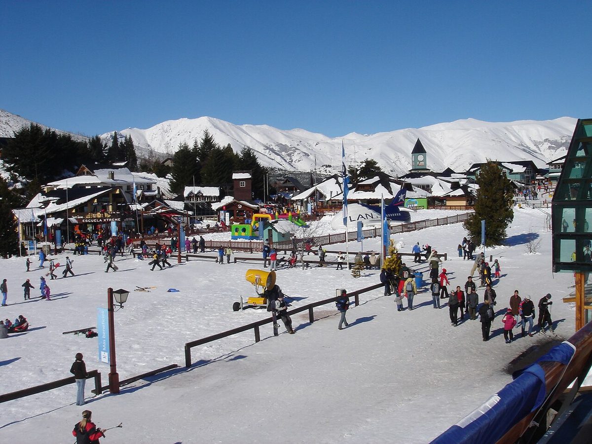
Winter is when you need to pay attention. La Ruta Natural states that snow chains are mandatory between May and September, and that you should check road conditions before you go. The route can still be stunning under snow, and it is ski season at nearby Cerro Catedral, Cerro Bayo, and Chapelco. But this is not a casual summer drive. If you are renting, confirm chains, insurance, and the rental company’s winter rules, and ask a local (your hotel or host) whether you need chains on a given day. A late-morning start also lets the sun melt overnight ice.
Spring (September to early December)
Spring is a transition: lingering snow up high, unsettled weather, fewer crowds, and the bright yellow retama flowers starting to line the road. It can be lovely, but plan with flexibility and check conditions, especially early in the season.
For the broader regional picture, our Patagonia seasons rundown guide compares months across the whole of Patagonia, which does not always match the lake district’s calendar.
Fuel up before you start. No gas stations on the route. Fill in Villa La Angostura, San Martin, or Bariloche.
Bring food and water. Many roadside spots only open in peak summer. The reliable meal stops are the two end towns (Villa La Angostura and San Martin), plus Villa Traful if you take that detour. San Martin and Villa La Angostura both do excellent trout, lamb, smoked meats, and craft beer.
Download offline maps. Cell coverage is unreliable along the lakes.
National park fees may apply. The route crosses Lanin and Nahuel Huapi national parks. Most of the drive itself is free, but if you enter fee-collection areas or nearby park attractions, charges can apply, so carry some cash and check current rates.
Toilets and changing rooms exist at the busier beaches like Falkner, but do not count on much else.
One-way or round trip?
This is genuinely a matter of itinerary, not right or wrong.
Round trip (out and back from Villa La Angostura, San Martin, or Bariloche) works if the route is a day excursion and you are returning to the same base. A common worry is that the return drive will be boring, but in my experience it is not. The light has changed, you are seeing every lake from the opposite angle, and you can stop at the places you skipped on the way out. It honestly feels like a different drive.
One-way works beautifully if the Seven Lakes Route is part of a longer journey, for example Bariloche to San Martin (or the reverse) as you move between bases. You see the whole route once, properly, without backtracking. The catch is the car: if you rent in one town and drop in another, ask about the one-way (drop-off) fee, which is sometimes reasonable and sometimes not.
If you only have a single day and you are based in Villa La Angostura or San Martin, a relaxed round trip is the simplest, most rewarding option. If you are route-tripping through the region, go one-way and keep moving.
Seven Lakes Route FAQ
How long does it take to drive the Seven Lakes Route?
Driven non-stop, the roughly 110 km route between Villa La Angostura and San Martin de los Andes takes around 2 hours, according to La Ruta Natural. But almost nobody does it that way. With stops at viewpoints, beaches, and detours, plan a full day. A round trip from Bariloche typically runs around 10 to 11 hours.
Can you do the Seven Lakes Route in one day?
Yes, easily. Most people drive it in a single day, either one-way between bases or as a round trip. The key is to start early, fill the tank first, and choose your detours in advance, because you cannot fit Villa Traful, Lago Hermoso, long beach stops, and a leisurely lunch all into one day.
What are the seven lakes on the Seven Lakes Route?
The most common list is Lacar, Machonico, Falkner, Villarino, Escondido, Correntoso, and Espejo, running from San Martin to Villa La Angostura. Some lists swap in Nahuel Huapi, and you also pass extras like Espejo Chico, Hermoso, and Traful. The “seven” is really a name, not a strict count.
Is the Seven Lakes Route paved? Do you need a 4×4?
The main route between Villa La Angostura and San Martin de los Andes is fully paved and in good condition, so any standard rental car handles it. You do not need a 4×4. Only the short detours to side lakes such as Espejo Chico, Hermoso, Traful, and Meliquina are gravel, and those are usually fine too.
Do you need snow chains on the Seven Lakes Route?
Between May and September, snow chains are mandatory, according to La Ruta Natural, and you should check road conditions before setting out. The route stays open in winter, but it is not a casual summer drive. If you ar