Loma del Pliegue Tumbado: El Chalten’s All-in-One Panorama Hike
Loma del Pliegue Tumbado is El Chalten's panorama hike with Fitz Roy and Cerro Torre from one ridge. Route, distance, difficulty, weather and when to go.
By Patagonia Tourism Guide · First published 1 Aug 2026
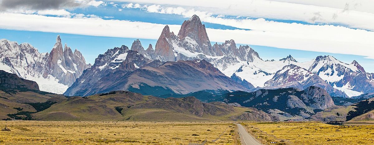
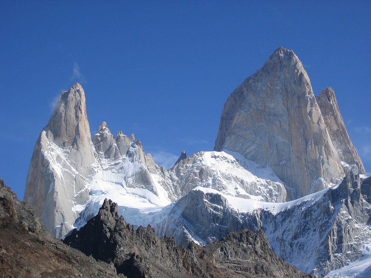
0 — 2 km Fig. 1 · Panorama of the Fitz Roy and Cerro Torre massifs seen together from the Loma del Pliegue Tumbado ridge near El Chalten · Photo: A S / CC BY 2.0 via Wikimedia Commons
Most people leave El Chalten having stood at the base of Fitz Roy and the base of Cerro Torre on two separate days, and never once seeing both at the same time. There is a hike that fixes that. It does not walk you into either valley. It climbs above both of them, onto a long bare ridge, and hands you the whole mountain range at once.
That hike is Loma del Pliegue Tumbado, and on the right day it is the most underrated thing you can do in El Chalten.
Loma del Pliegue Tumbado in a nutshell
Loma del Pliegue Tumbado is a long day hike from the El Chalten visitor center up to a high, exposed ridge that gives you a single panorama of both the Fitz Roy and Cerro Torre massifs, plus Laguna Torre, Glaciar Torre, and Lago Viedma. It runs around 19 to 23 km round trip, takes around 7 to 9 hours, climbs about 1,100 m, and rates moderate to hard. The catch: it is only worth it on a clear, low-wind day.
This guide is for the hiker who already has Laguna de los Tres and Laguna Torre on the list and is wondering whether a third big day is worth it, and what makes this one different. It is also for anyone deciding which hike to “spend” their one good weather window on. Short version: if the forecast is genuinely clear and calm, this might be the best view in the whole area. If it is not, do something else and come back another day. The view is the entire point of this hike, and the mountain gives it to you or it does not.
This is one of the three big day hikes I cover in the El Chalten and Fitz Roy hiking guide, and it is the one I would slot in last, after you have already banked a clear Fitz Roy day.
Loma del Pliegue Tumbado at a glance
Detail
What to expect
Trailhead
APN Ceferino Fonzo Visitor Center, about 1 km south of town
Distance
Around 19 to 23 km round trip to the summit (shorter if you stop at the viewpoint)
Time
Around 7 to 9 hours including breaks
Elevation gain
Around 1,100 m to the main viewpoint, a bit more to the summit
High point
Around 1,500 m at the viewpoint; the summit sits a little higher
Difficulty
Moderate to hard: long, steady climb, no scrambling, but fully exposed up top
Trail type
Out and back
Best season
Roughly November to May; December to February for the best clear-weather odds
Crowds
Far quieter than Laguna de los Tres or Laguna Torre
Non-negotiable
A clear, low-wind day. Otherwise skip it
Park access
Paid entry to Los Glaciares; buy your ticket online before you hike
Swipe to see all columns
Table 1
Treat every number here as “around.” Different sources measure this trail differently, partly because some stop at the first viewpoint and some push on to the summit, and partly because GPS tracks in open alpine terrain rarely agree. I will untangle that in the route section. Always check current conditions at the visitor center before you go.
Why this hike is different from the rest
Here is the thing nobody tells you until you are standing up there.
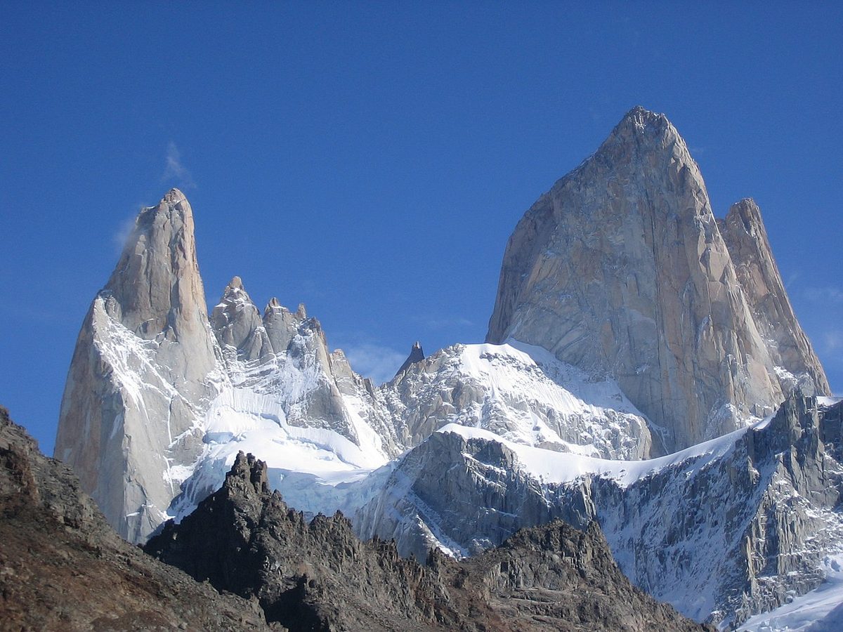
Laguna de los Tres takes you to the foot of Fitz Roy and presses you right up against the granite. Laguna Torre takes you to a glacier lake under Cerro Torre. Both are spectacular, and both are essentially one mountain, seen up close, from below. You crane your neck. You feel small. That is the appeal.
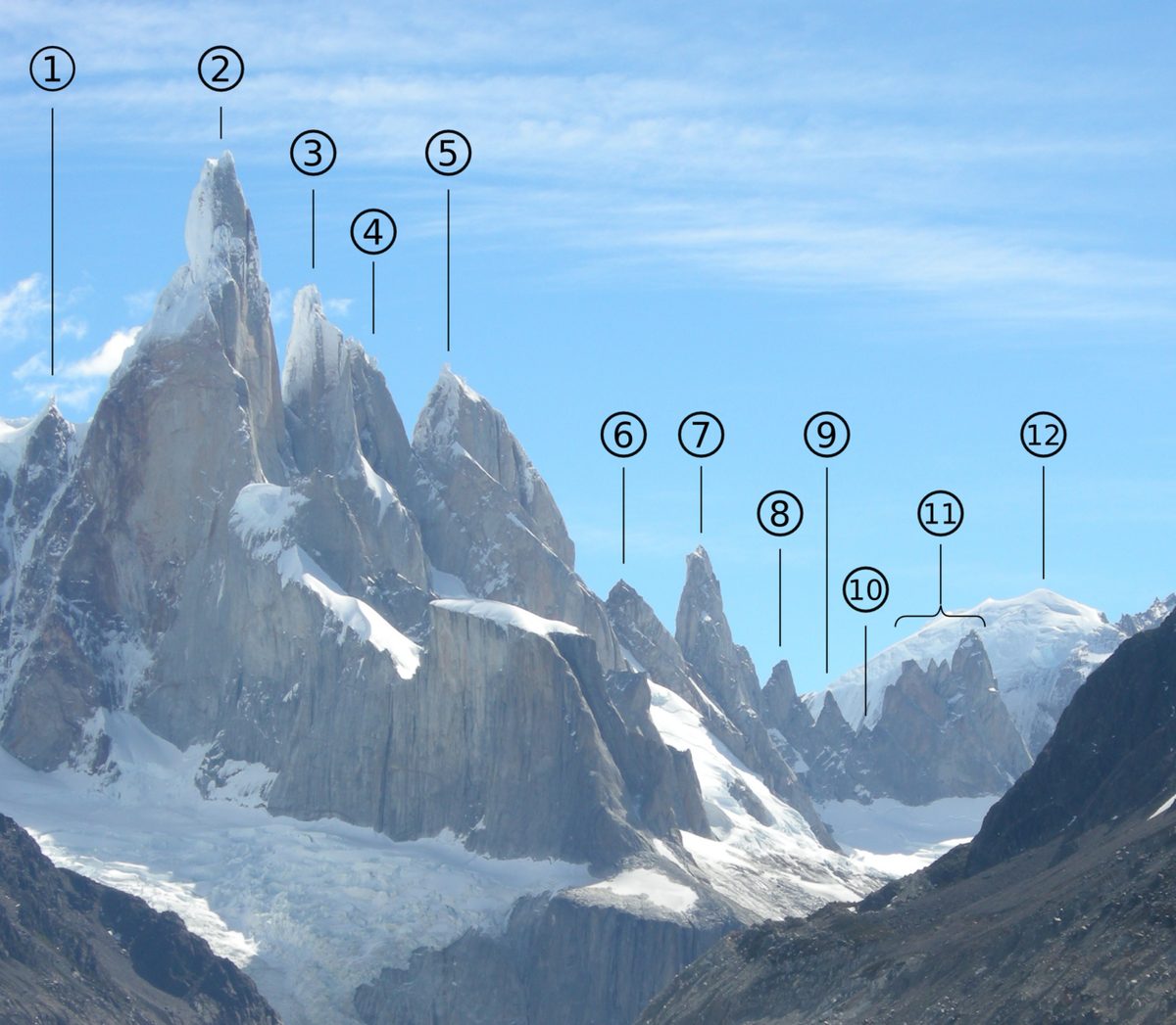
Loma del Pliegue Tumbado does the opposite. It pulls back. Instead of standing under one tower, you climb to eye level with the whole range and see how it all fits together: Fitz Roy on one side, Cerro Torre and Glaciar Torre on the other, Laguna Torre tucked in the valley below, the Rio Fitz Roy threading back toward town, the Patagonian steppe rolling east, and the enormous milky blue of Lago Viedma to the south. It is the only one of the three classic day hikes where both massifs share the same photograph.
That zoomed-out perspective is exactly why local guides quietly call it their favorite, and why writers who have done it tend to use the phrase “secretly the best hike in El Chalten.” It is also why it is so easy to skip. There is no lake to swim beside, no iconic single image that has been printed on a thousand postcards. The reward is wide rather than close, and you have to earn it with a long, unbroken climb. Plenty of people run out of days, or arrive on the third morning with tired legs, and choose the lake instead.
I think that is a mistake on a clear day. I also think it is the right call on a cloudy one. Which brings us to the part that actually decides everything.
The route, section by section
The whole hike is essentially one long uphill, then the same long downhill. There is almost no flat, and almost no losing-then-regaining elevation. You go up, up, up to the ridge, then down, down, down to town. Knowing that shape ahead of time helps you pace it.
Getting to the trailhead
The trail starts at the National Park’s Ceferino Fonzo Visitor Center, which sits less than a kilometer south of town. From the center of El Chalten, walk south, cross the Rio Fitz Roy bridge just past the bus station, and you will see the visitor center on the right with signs to the trailhead. There is a fork right at the start: left goes to the Los Condores and Las Aguilas viewpoints, right goes toward Loma del Pliegue Tumbado and Laguna Toro. Take the right.
You do not need a car. Like most El Chalten hikes, this one begins on foot from town, which is part of what makes this such an easy place to base yourself. If you want the full picture on lodging and where to position yourself for early starts, I get into it in where to stay in Patagonia.
One navigation note: a good chunk of the lower trail is shared with the first day of the Huemul Circuit and the route to Laguna Toro. Where they split, there are clear signs. Pay attention at the junctions and you will be fine.
Grassland and the Pampa de las Carretas
The first stretch climbs gently out of the valley through open grassland and scrub. Look behind you here for a lovely view back over El Chalten and the Rio de las Vueltas valley. After about an hour you cross a plain the park calls the Pampa de las Carretas, the “plain of the carts,” and the scenery opens up: Monte Huemul, Lago Viedma to the south, and the first proper glimpse of the big peaks to the northwest.
You may share this section with cows. It is oddly charming to watch Fitz Roy appear over the shoulder of a grazing Patagonian cow. Keep your eyes open for birds too; people regularly spot Magellanic woodpeckers and caracaras down here.
The lenga forest
The trail then ducks into a beautiful lenga beech forest. Enjoy it, because it is the last real shelter you will get. On a windy day this forest is a genuine mercy, and the shade is welcome on a hot one. The path here is well maintained and obvious.
As you climb out of the forest, the landscape changes fast. Trees give way to low bushes, bushes give way to moss, and moss gives way to rock. Somewhere in the stones up here you can find marine fossils that are roughly 100 million years old, a strange reminder that this whole ridge was once under a sea.
This is where the hike earns its reputation. Above treeline the path gets rockier, steeper, and fully exposed. The defined trail fades in places, but it stays marked with yellow posts, so keep scanning ahead for the next marker rather than staring at your feet. There is a stream up here, past the trail fork, where you can refill, and then it is a final, steady push to the Mirador del Pliegue Tumbado, the main viewpoint at around 1,500 m.
For many people, this viewpoint is the destination, and it is already a huge reward. But there is more above you.
Viewpoint or summit?
From the mirador you will see a rocky hill rising to your left, with a faint zig-zag path etched into it. That is the actual summit of Loma del Pliegue Tumbado, and it adds roughly another hour, somewhere around 230 to 280 m of extra climbing on a steeper, looser slope. The path can be hard to spot at first; once you eye it, it becomes obvious enough to follow.
Is the summit worth the extra effort? On a clear, calm day, yes. The first viewpoint is almost as good, but the top opens up the view in the opposite direction, especially down onto the many shifting blues of Lago Viedma, and gives you that full 360-degree sweep. If the weather is still holding and your legs have anything left, I would keep going.
The one firm exception: snow. The summit pitch is exactly the kind of steep, rocky, easy-to-lose-the-line terrain where a dusting of snow turns a fun scramble into a genuine hazard. The official trail page is blunt about this, and so am I. If there is snow on that final hill and you are not equipped and confident, the main viewpoint is a fine place to turn around. Nobody hands out medals for the last 280 metres.
The descent
It is an out and back, so you return the way you came: down through the rock, back into the forest, across the plain, and home to town. The descent is faster but it is long and relentless on the knees, so trekking poles are genuinely useful here. Plan your timing so you are off the exposed upper section and back in daylight, and you will roll into El Chalten ready for a very well-earned dinner.
Difficulty and exposure: what you are signing up for
Loma del Pliegue Tumbado is moderate to hard. It is not technical. There is no scrambling, no exposure to drop-offs, no route-finding nightmare in normal summer conditions. What makes it tough is the combination of length and sustained, almost unbroken climbing, capped by a steep summit push when your legs are already tired.
In pure grade terms, it is arguably gentler than the brutal final 400 m to Laguna de los Tres. The gradient stays manageable until that last 40 minutes or so. But “easier climb” does not mean “easier day,” because two things raise the stakes here in a way the lake hikes do not.
First, you are above treeline and fully exposed for the whole top half. There is no forest to duck into when the weather turns, and in Patagonia the weather turns constantly. Wind that would be a nuisance in a sheltered valley becomes a real factor on a bare ridge.
Second, the trail thins out up high. It is marked and, on a clear day, easy to follow, but low cloud or fresh snow can erase it quickly and make it surprisingly easy to get disoriented on the descent. That is the scenario the park rangers warn about, and it is why the upper section deserves respect rather than a casual attitude.
Honestly assess your day before you commit. If you have hiked Laguna de los Tres the day before and your legs are shot, this is a hard ask. For broader fitness and conditioning context across all the Patagonia hikes, the safety checklist for multi-day treks is the place to start.
The payoff: Fitz Roy and Cerro Torre from one ridge
When you reach the top on a clear day, you understand immediately why anyone bothered.
Your eyes go first to the impossible sight of Cerro Torre and Fitz Roy standing side by side, with Glaciar Torre spilling down into Laguna Torre in the valley below. Then you start turning. There are river valleys threading north. There is the steppe stretching east until it dissolves into haze. There is Lago Viedma to the south, which from up here seems to hold a dozen different shades of blue depending on where the clouds sit. The terrain right around you looks almost Martian, with reddish, perfectly rounded mounds of rock, and because this is Patagonia, there is a decent chance of strange lens-shaped clouds hovering somewhere on the horizon.
It is, simply, the best wide view in the El Chalten area, and you will likely have a fraction of the crowd you would meet at Laguna de los Tres. Some people sit up there for an hour or two, just turning in slow circles, not knowing where to point the camera. This is the best viewpoint for Fitz Roy and Cerro Torre together that you can reach on a day hike, and it is the reason the whole exhausting climb makes sense.
That is the version with a clear sky. The other version is the one I need to talk about.
Why weather makes or breaks this hike
I cannot say this strongly enough: Loma del Pliegue Tumbado is a view hike, and if there is no view, there is no hike worth doing.
The whole reason to climb a bare, windswept ridge for four hours is what you see at the end. Take that away, and you have spent a long, cold, gusty day staring at the inside of a cloud. Writers who have done this trail are unusually honest about it. One did it twice, years apart, and got clouded out both times, ending up huddled behind a stone wind-shelter wall eating a sandwich in the cold, never once seeing the panorama the rangers had promised her. That can absolutely be you if you go on the wrong day.
The park rangers themselves do not recommend this route when the forecast calls for wind or rain, precisely because it climbs higher and more exposed than both Laguna Torre and Laguna de los Tres. That is a meaningful thing for the people who know the trail best to say out loud. Take the hint.
So what are you looking for? A clear sky and low wind. Locals tend to swear by Windguru for the Fitz Roy area, and what you want to see is low cloud cover, low wind speed, and no precipitation. Even on a beautiful day, expect a lot of wind up top; a genuinely calm day is a gift. If the forecast is iffy, this is not the hike to gamble on. One of the lake hikes will still be atmospheric in moody weather. Pliegue Tumbado will not.
A useful rule I would actually follow: if you have exactly one clear day and you have not yet done Fitz Roy, spend it on Laguna de los Tres. Pliegue Tumbado is the hike for your second or third clear day, once the iconic view is already in the bank. For help reading the patterns and timing your window, see the dedicated El Chalten weather breakdown and the broader why shoulder season often wins guide.
How it compares to Laguna de los Tres and Laguna Torre
Most people are really asking one question: with limited days, is this worth it over the two famous lakes? Here is how I would think about it.
Question
Loma del Pliegue Tumbado
Laguna de los Tres
Laguna Torre
Star mountain
Both Fitz Roy and Cerro Torre at once
Fitz Roy, up close
Cerro Torre, up close
View style
Wide panorama from above
Iconic close-up at the base
Glacier lake in the valley
Distance
Around 19 to 23 km
Around 25 km
Around 19 km
Effort
Long, steady climb, exposed top
Long day with a brutal final climb
Longest gentle valley walk
Weather sensitivity
Extreme: needs a clear, calm day
High: best with a clear Fitz Roy window
Moderate: still good in moody weather
Crowds
Quiet
Busy, can be mobbed in peak season
Moderate
When to choose it
Your second or third clear day
Your first clear day
A grey day, or tired legs
Swipe to see all columns
Table 2
The pattern is simple. Laguna de los Tres is the non-negotiable icon and gets your first clear morning. Laguna Torre is the reliable, lower-stakes valley day that still delivers when the sky is grey. Loma del Pliegue Tumbado is the high-ceiling, high-variance option: the best view of the three on a perfect day, and the worst use of a day on a bad one.
If you only have time for one big hike, do Laguna de los Tres. If you have two, add Laguna Torre. If you have three good days, this is the one I would add, and I would happily trade a busy lake for this quiet ridge if the forecast cooperated. I compare all three in more depth, with day-by-day plans, in the El Chalten and Fitz Roy hiking guide, and you can read the full standalone writeups of the Laguna de los Tres hike and the Laguna Torre hike too.
When to do it, and how to fit it into your days
Season-wise, the trail is generally a November-to-May proposition, with December through February giving you the best odds of the clear, calm sky this hike demands. Late spring and autumn (October to November, March to April) are quieter and can be gorgeous, but the weather is more variable and snow lingers longer on the upper section. Outside those months you are looking at a more serious winter undertaking that needs local advice and possibly a guide. For the month-by-month view, the trekking season breakdown guide lays it out.
Within your trip, the key is to keep this hike flexible and weather-driven rather than pinning it to a fixed calendar day. My ideal order, if I had three good hiking days:
Laguna de los Tres on the clearest Fitz Roy morning.
Laguna Torre on the next decent valley day.
Loma del Pliegue Tumbado if a clear, low-wind day shows up and your legs agree.
If the best weather of your whole stay lands on your last day, save Pliegue Tumbado for then. The order serves the mountain, not your spreadsheet. This is also exactly why I push people not to rush El Chalten. With only two or three nights, this hike is the first thing to fall off the list when the weather does not cooperate. Give yourself four or five and it becomes a realistic, glorious bonus rather than a gamble. I work through how many nights you actually need in the guide on planning enough days for Fitz Roy, and how El Chalten slots into a bigger trip in the Patagonia itinerary planner.
The packing list for Loma del Pliegue Tumbado looks like any big Patagonia day hike, with two things underlined: wind protection and water.
A windproof, waterproof shell. This is the one item I would never leave behind on this trail. The upper ridge has no shelter, and the wind can be relentless even on a sunny day.
Warm layers. A fleece or light puffy plus a base layer. It can be cold and gusty at the top even in summer, and a small snowfall is not unusual up high.
Hat, gloves, and sunglasses. Wind protection for your head and hands, and serious sun protection for your eyes on the exposed sections.
Sunscreen. Hours with zero shade. The Patagonian sun burns even when the air feels cold.
At least 2 litres of water per person. There is a creek near the start and a small stream past the trail fork, but nothing reliable on the long exposed climb. Fill up when you can.
Lunch and snacks. It is a long day. Pack a proper meal and more food than you think you need.
Proper hiking boots. There is a lot of rock and loose scree, especially on the summit pitch. Trail runners can technically do it, but boots are safer, and essential if there is any snow.
Trekking poles. Genuinely helpful on both the summit scramble and the long descent.
A real headlamp, a charged phone with an offline map, sunscreen, a small first aid kit, and your park ticket. The official advice is specific: carry a flashlight, not just your phone, in case you are caught out near dusk.
Almost everything that can go wrong on this hike goes wrong in the top third, so that is where your judgement matters most.
Start early. The official advice is to set off at first light, and to plan your timing around sunset so you finish in daylight. An early start also gives the weather more chances to be in your favor and more margin if it turns.
Watch the cloud, not just the forecast. If the peaks are already socked in when you reach the plain, ask yourself honestly whether the long exposed climb is worth it. It is fine to turn a Pliegue Tumbado day into a shorter walk if the view has clearly gone.
Respect the wind. On a bare ridge, strong wind is not just uncomfortable, it affects your balance and your safety. If it is howling, the lake hikes are a smarter choice that day.
Treat snow on the summit pitch as a stop sign. That steep, loose final hill is where a little snow does the most damage. The viewpoint is a perfectly good place to turn around.
Stay on the markers. Above treeline the path fades. Follow the yellow posts, and if cloud rolls in and you lose them, do not improvise across open ground; backtrack to the last marker you are sure of.
Check trail status at the visitor center first, and remember cell signal is weak to nonexistent out here, so carry an offline map and do not count on your phone for navigation or rescue.
Most prepared hikers do this self-guided in summer, and the trail is well known and popular enough that you will rarely be truly alone. But if you are visiting in shoulder season or winter, are uneasy about navigation, or simply want the local knowledge, hiring a National Park-registered guide or a local agency is a reasonable call. The official El Chalten and Visit Argentina pages both point toward licensed guides for exactly this kind of more exposed route.
Frequently asked questions
Is Loma del Pliegue Tumbado worth it?
On a clear, low-wind day, absolutely: it gives you both Fitz Roy and Cerro Torre in one panorama, plus Laguna Torre and Lago Viedma, with far fewer people than the famous lakes. On a cloudy or windy day it is not worth it, because the view is the entire reward. Save it for genuinely good weather, ideally after you have already done Laguna de los Tres.
How long is the Loma del Pliegue Tumbado hike?
Plan on around 7 to 9 hours and roughly 19 to 23 km round trip if you go all the way to the summit, with about 1,100 m of climbing to the main viewpoint and a bit more to the top. Sources vary because some measure only to the first viewpoint (closer to 17 km). It is an out-and-back, so the distance is fixed by how high you choose to go.
How hard is Loma del Pliegue Tumbado?
It is moderate to hard. There is no technical climbing or scrambling in normal summer conditions, but it is a long, almost continuous uphill with a steeper final push to the summit. The real difficulty is the full exposure up top, where wind and weather raise the stakes. The gradient is gentler than Laguna de los Tres, but it is still a serious full-day effort.
Do you need a clear day to hike Pliegue Tumbado?
Yes, more than for any other El Chalten hike. The whole point is the panorama, and the upper trail is completely exposed with no forest to fall back on. Local rangers do not recommend it in forecast wind or rain. If the sky is iffy, choose Laguna Torre or a sheltered valley hike instead, and save this ridge for a clear, calm window.
Is there water on the Loma del Pliegue Tumbado trail?
There is a creek near the start and a small stream a few hundred metres past the trail fork at around the 4 km mark, but nothing reliable on the long exposed climb above it. Carry at least 2 litres of water per person, and top up at the stream before you head up onto the ridge, especially on a warm or windy day.
Where does the Loma del Pliegue Tumbado trail start?
It starts at the National Park’s Ceferino Fonzo Visitor Center, less than a kilometer south of El Chalten. Walk south through town, cross the Rio Fitz Roy bridge just past the bus station, and you will see the center and trailhead signs on the right. At the first fork, go right toward Pliegue Tumbado and Laguna Toro, not left toward Los Condores.
Is Loma del Pliegue Tumbado the best hike in El Chalten?
On a perfect day, many hikers and local guides think so, because no other day hike shows you both massifs and the whole range at once. But it is the most weather-dependent of the three classics, so “best” comes with a giant asterisk. Laguna de los Tres is the safer iconic choice; Pliegue Tumbado is the high-reward option when conditions line up.
Final thoughts
I have a soft spot for this hike precisely because it asks something of you. It does not hand over its view at the trailhead, and it will happily punish you with a cold, gray, gusty slog if you read the sky wrong. But when you get it right, when you walk up out of that lenga forest onto the open ridge under a clear sky and the whole range unfolds at once, Fitz Roy and Cerro Torre side by side with Lago Viedma glowing behind you, it is one of those mountain moments that rearranges what you thought a single day could give you.
So here is my honest advice. Do not put Loma del Pliegue Tumbado on a fixed day and march up regardless. Hold it loosely. Bank your Fitz Roy day first, keep watching the forecast, and the moment a clear, calm day appears, take it and climb. Bring more water and more wind protection than feels necessary, start early, and give yourself permission to turn around at the viewpoint if the summit is snowed in. Do that, and you will come down with the best panorama in El Chalten and a trail you had half to yourself. That is a very good trade.
Panorama of the Fitz Roy and Cerro Torre massifs seen together from the Loma del Pliegue Tumbado ridge near El Chalten — A S / CC BY 2.0 via Wikimedia Commons