Laguna Torre Hike: Cerro Torre Views, Route, Difficulty and Tips
The Laguna Torre hike is El Chalten's gentler big day hike: ~18-22 km to Cerro Torre and the Grande glacier. Route, difficulty, cloud odds and tips.
By Patagonia Tourism Guide · First published 31 Jul 2026 · Updated 1 Aug 2026
0 — 2 km Fig. 1 · Cerro Torre rising above Laguna Torre and its icebergs at the end of the Laguna Torre hike near El Chalten · Photo: Gagea / CC BY-SA 3.0 via Wikimedia Commons
The first time I walked out to Laguna Torre, Cerro Torre never showed its face. Cloud sat on the spire for the entire day, the wind tried to push me back down the valley, and the lake at the end was the color of weak coffee. I loved it anyway. That is the strange gift of this hike: even on a grey day, it is one of the most beautiful walks I have done in Patagonia.
The Laguna Torre hike is the gentler of El Chalten’s two great day hikes. It follows the Fitz Roy river valley to a glacial lake at the base of Cerro Torre, where icebergs from the Grande glacier drift against the shore. It runs around 18 to 22 km round trip, takes roughly 6 to 8 hours, and is moderate: long, but with only a short climb and no brutal final push. It is the hike I send people on when they want big Patagonia scenery without the steep suffering of Laguna de los Tres.
This guide is the one I wish I had read before my first walk up the valley. It covers the route section by section, exactly how hard it is and who it suits, why Cerro Torre is so often hidden and how to swing the odds in your favor, the Mirador Maestri extension, an honest Laguna Torre versus Laguna de los Tres decision if you only have one day, plus weather, water, and what to pack. It sits under our main hiking to Fitz Roy, so if you are still planning your whole stay, start there and come back for the trail detail.
Laguna Torre Hike at a Glance
Here are the numbers up front, hedged on purpose. Different sources and GPS apps measure this trail slightly differently depending on where they start counting and whether they include the Mirador Maestri extension, so treat these as a realistic range rather than a promise.
Detail
What to expect
Distance
Around 18-22 km round trip (about 9 km each way to the lake)
Time
Around 6-8 hours round trip, plus stops
Elevation gain
Modest, around 250-500 m total (sources vary; it is spread out)
Difficulty
Moderate; only the first ~2 km climbs, the rest is gentle valley walking
Trailhead
End of Los Charitos Street in El Chalten (“Senda a Laguna Torre”)
Main view
Cerro Torre, the Adela range, Laguna Torre, the Grande/Torre glacier and its icebergs
Best time of day
Start early; mornings are clearest and calmest, afternoons windiest
Guide needed?
No; the trail is well marked and easy to follow
Dogs
Not allowed (national park)
Cost
Trail access currently free at this trailhead; verify, fees here are in flux
Swipe to see all columns
Table 1
The headline most pages miss: the difficulty here is distance and wind, not climbing. The official El Chalten trail page calls Laguna Torre a medium-difficulty, 7 to 8 hour, roughly 11.8 mile route with only around 800 feet of elevation gain. Compare that with Laguna de los Tres, where the last kilometer climbs around 400 m on rough ground. Laguna Torre never hits you with that kind of wall. It just asks you to keep walking a beautiful valley for most of a day.
Who This Hike Is For
Hike Laguna Torre if you want a full Patagonia mountain day without a punishing climb, if you are traveling with mixed fitness or older legs, if your knees dislike steep descents, if Fitz Roy is clouded in and you still want to be out walking, or if you simply want the quieter, more meditative of El Chalten’s two big hikes. It is also the friendlier choice for fit kids and anyone easing into long-distance hiking, because you can turn around at several natural points without feeling you failed.
It is not the right pick if your single clear weather window has arrived and Fitz Roy is the image in your head. On that day, the iconic payoff is at Laguna de los Tres, and you should go there instead. We will get into that trade-off properly further down.
The Route, Section by Section
What I love about Laguna Torre is that it reads like a story with clear chapters. The trail signage even counts you down (“Km 6 de 9”), so you always know where you are. Here is how the day unfolds.
Section
Roughly
What happens
Town to Mirador Cascada Margarita
~1 km / ~15 min
First viewpoint, the early uphill begins
To Mirador Cerro Torre (Mirador del Torre)
~halfway in
Big panorama; a natural shorter-day turnaround
Valley walk along the Rio Fitz Roy
the long middle
Flat forest and open plains, constant views
De Agostini camp
~9 km / ~3 h from town
Forested campsite just before the lake
Moraine crest
~15 min past camp
Short climb to the crest, then down to the water
Laguna Torre
~9 km, the endpoint
The glacial lake, icebergs and Cerro Torre
Mirador Maestri (optional)
+~2 km / +~1-1.5 h
Higher view over the Torre glacier
Swipe to see all columns
Table 2
Town to Mirador Cascada Margarita
You can start from almost anywhere in El Chalten. The official trailhead is at the end of Los Charitos Street, marked with a “Senda a Laguna Torre” sign. There are actually two trailheads in town and the paths merge within about five minutes, so do not stress about picking the “right” one.
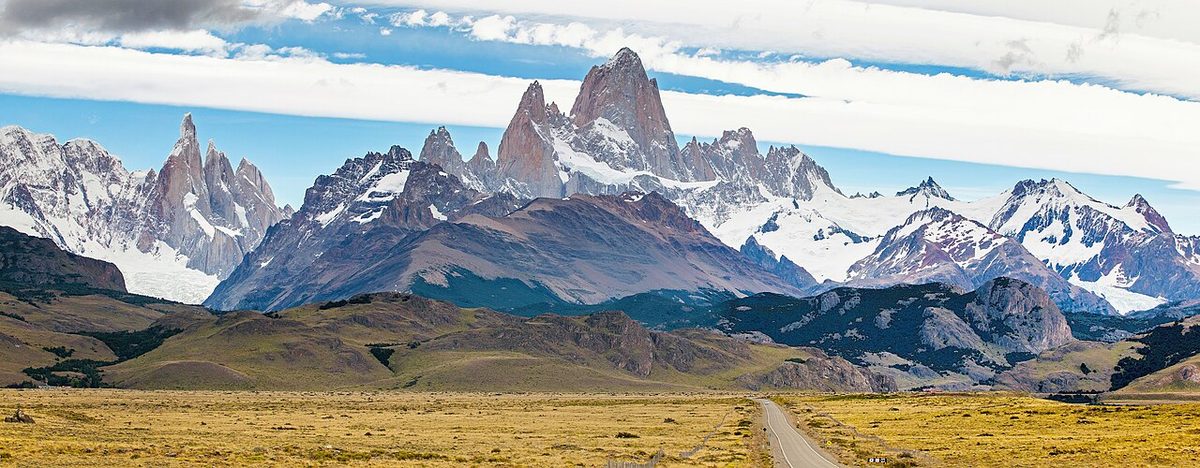
This first stretch is the only part that really climbs. It is a gradual uphill for the first two kilometers or so, and the very first section is a little rocky. Within about 15 minutes you reach Mirador Cascada Margarita, a viewpoint at the gorge of the Fitz Roy river. On a clear morning you already get a panorama of Cerro Solo, the Adela range, Cerro Torre and even Mount Fitz Roy, with the Margarita waterfall tumbling down the far side of the canyon. It is a generous reward for very little effort, and it sets the tone.
Mirador Cerro Torre and the valley
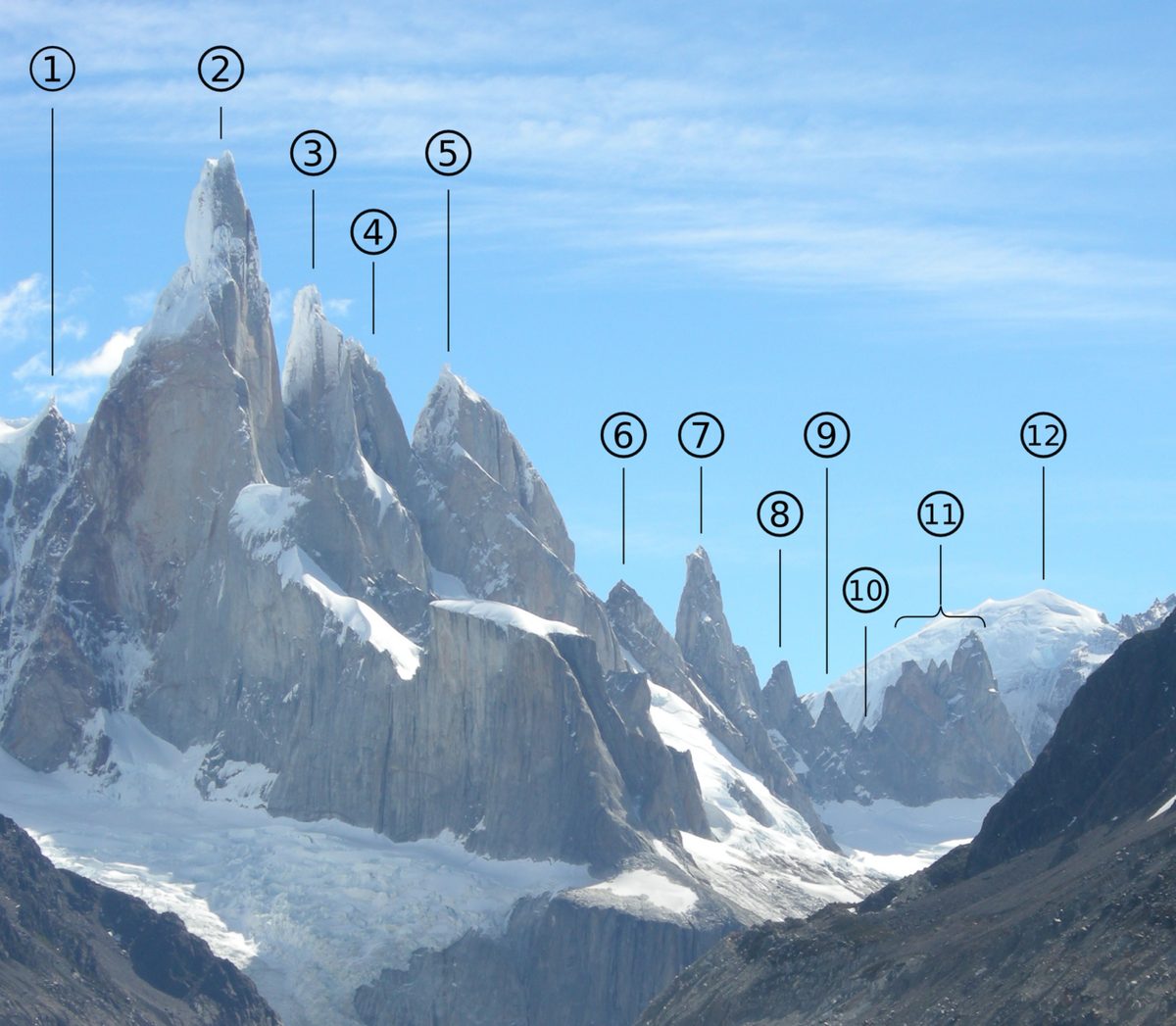
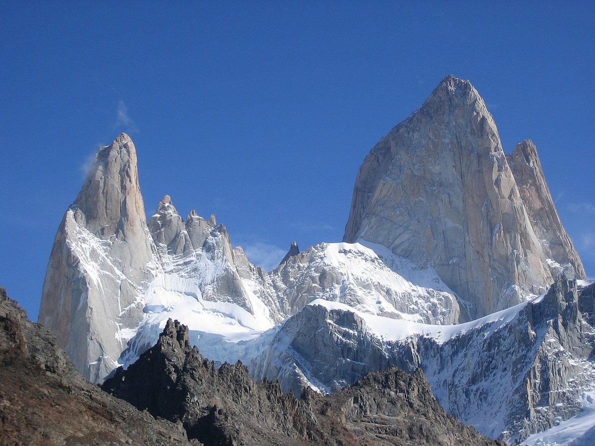
After the early climb, the trail eases and you settle into a rhythm. Roughly halfway along you reach Mirador Cerro Torre, sometimes called Mirador del Torre, a natural viewpoint looking out at the Adela range, Cerro Torre and its slender satellite needles. This is worth knowing about, because it doubles as a turnaround point. On a cloudy or short day, walking to Mirador del Torre and back is a perfectly good half-day in itself, and it is even listed separately as an easy three to four hour route. If the sky is hopeless, you can call it here without regret. If the cloud lifts, you simply keep going.
From here the hike becomes a valley journey. You walk alongside the Rio Fitz Roy through sub-antarctic forest of lenga and ñire, then open plains, crossing boardwalk sections and passing a string of viewpoints. There is one stretch nicknamed the “valley of death and rebirth” after an old avalanche scar that the forest is slowly reclaiming. The mountains are almost always in view ahead, and the river keeps you company. This is where the wind tends to funnel, so it can feel exposed even when town felt calm.
A short distance before the lake you pass the De Agostini base camp, tucked into a dense stand of tall trees. This is where overnight hikers stay to catch sunrise on Cerro Torre (more on that below, including the fact that it is no longer free). Just past the camp, the trail climbs a frontal moraine for around 15 minutes to reach its crest, and then you drop down to the water.
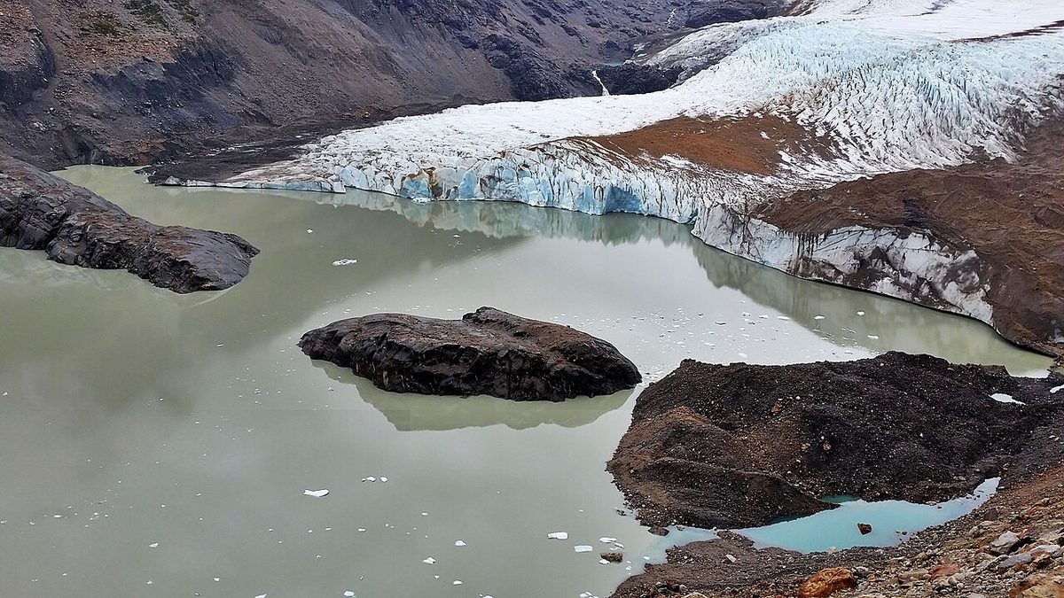
And there it is: Laguna Torre, a glacial lake sitting right at the base of the Cerro Torre massif. Be ready for the lake itself to be brown and muddy rather than the turquoise you might be imagining. That is normal, it is full of rock flour ground up by the glacier. The magic is what floats on it. Icebergs calved from the front face of the Grande glacier collect along the shore, sometimes in surprising numbers, and the jagged Torre group rises behind. Walking out to Laguna Torre takes around three hours from town, and the way back is a touch quicker because it is gently downhill. The wind off the lake can be fierce, so find a sheltered spot for lunch and keep a layer handy.
Difficulty and Who It Suits
Let me be clear about the word “moderate,” because it gets misread in both directions.
Laguna Torre is not a casual stroll. It is a long day on your feet, around 18 to 22 km, and the wind can turn the open sections into a genuine workout. People who treat it as an “easy” recovery walk after Laguna de los Tres sometimes finish more tired than they expected. The return leg, in particular, can drag when your legs are done and a headwind has set in.
But it is also not technical or steep in the way the Fitz Roy hike is. There is no scrambling, no exposure, no rope, and no thin air, the whole route stays low. The only real climbing is that gradual first two kilometers out of town, and the brief moraine bump near the end. There is nothing here resembling the rocky, lung-busting final kilometer to Laguna de los Tres. That single difference is why I rate Laguna Torre as the more forgiving day: the hard part is the length, and length is something you can manage with an early start, snacks, and an honest pace.
In practice that makes it suitable for a wide range of people. Reasonably active hikers will find it very doable. Families with kids who have hiked before can manage it, the first two kilometers are the test, and if children clear that they usually cope with the flatter remainder. It is the more knee-friendly of the two big hikes, and it is easier to shorten if the weather sours, thanks to those natural turnaround points.
If you want a fuller breakdown of how El Chalten’s trails compare and how to slot them around the forecast, the parent trekking out of El Chalten lays out the whole menu, and our El Chalten short hikes guide covers the easier options for arrival days and bad weather.
Seeing Cerro Torre: Why It Hides and How to Improve Your Odds
Here is the honest truth nobody likes to print in bold: there is a real chance you will not see Cerro Torre clearly on the day you hike. The spire is famously shy. It is one of the hardest summits in the world to climb partly because of the same weather that keeps it wrapped in cloud.
The reason is geography. El Chalten sits where moist maritime air off the Pacific meets the drier continental side of the Andes. Those westerly winds slam into the mountains and are forced upward, and as they rise they cool and condense, so the peaks effectively brew their own weather. Cerro Torre and Fitz Roy can be buried in cloud while the town below sits in sunshine, or the other way around. You cannot judge the summits from your hostel window.
So you play the odds. A few things genuinely help.
Start early. This is the single biggest lever. Mornings in summer are usually the clearest and calmest, roughly from dawn until late morning, before the sun heats the valley and stirs up cloud and wind through the afternoon. The official advice is to be walking before 8 a.m. in the summer months, and I would take that seriously. It is also worth knowing that the Torre group faces west, which means the sun only lights the granite walls directly in the morning. The most spectacular moment of all is sunrise, when the walls glow a saturated red-orange for a few minutes.
Give yourself more than one chance. If Cerro Torre matters to you, do not pin everything on a single afternoon arrival. Build a buffer into your stay so you can pick the best-looking morning. Our how many days in El Chalten guide makes the case for staying longer than feels efficient, precisely because of moments like this.
Consider camping at De Agostini. If you really want that sunrise alpenglow, the best way to get it is to sleep at the De Agostini camp and walk the final stretch to the lake before dawn with your camera ready. That is the only way to reliably catch the first light on the walls.
And finally, make peace with the mountain. Some days it simply will not appear. When that happens, the valley, the forest, the river and the floating icebergs are still genuinely worth the walk. I have had cloudy Laguna Torre days that I remember more fondly than some sunny ones. For the bigger picture on when the skies cooperate, see our El Chalten weather guide and the regional picking the right season for your trip.
If you reach the lake with energy to spare and the weather is behaving, you can keep going to Mirador Maestri. This is the upgrade view, and on a clear day it is worth the effort.
From the lake, the route continues along the moraine ridge for roughly another two kilometers, adding around an hour to an hour and a half round trip. The payoff is a higher vantage point that looks down over the lower Torre glacier, giving you a much better sense of the glacier’s scale than you get from the lakeshore. Many hikers say the glacier view from up there is dramatically better than from the main lake. The viewpoint takes its name from Cesare Maestri, the Italian climber tied to Cerro Torre’s tangled climbing history, which adds a little extra weight to the spot if you know the story.
But this extension comes with honest caveats, and I would not gloss over them. The path along the moraine is rocky, uneven and not marked. It is the genuinely tricky part of the whole outing. Do not attempt it alone in strong wind, when the loose, exposed ridge becomes a poor place to be. And only commit to it if you started early and still have daylight for the full return to town.
If any of that is in doubt, skip it without a second thought. A great Laguna Torre day does not require Mirador Maestri. The lake on its own is a complete experience, and there is no prize for grinding out every optional extra when the conditions or your legs are saying no.
Laguna Torre vs Laguna de los Tres: Which Should You Do?
This is the question I get more than any other about El Chalten, so let me give you a real answer rather than a shrug.
If you have two hiking days, the answer is easy: do both. They show you different mountains and different moods, and together they are the heart of an El Chalten trip. Save Laguna de los Tres for whichever day has the best forecast, because its iconic Fitz Roy payoff depends far more on clear skies.
If you only have one day, it comes down to weather, fitness and what you most want to see.
Question
Laguna Torre
Laguna de los Tres
Main mountain
Cerro Torre
Mount Fitz Roy
Distance / time
~18-22 km, ~6-8 h
~20-25 km, ~8-10 h
The hard part
Length and wind; no steep finish
A brutal final ~1 km climb (~400 m) and a knee-taxing descent
The cleanest way I can put the contrast: Laguna Torre is a long, steady valley day, while Laguna de los Tres is a long day with a tough final exam. Both are wonderful. Neither is objectively “better.” They are complementary, the Cerro Torre valley versus the Fitz Roy altar.
So here are my decision rules. If your one day is genuinely clear with manageable wind and you are fit enough for a steep finish, go to Laguna de los Tres, because clouds can steal Fitz Roy and it is the view you will most regret missing. If the day is marginal, if you are unsure about your fitness, if your knees protest on steep descents, or if you simply want the gentler outing, choose Laguna Torre, you can still have a superb day, and it is far easier to call it early without disappointment. And if the wind is severe everywhere, neither high payoff is much fun, so consider a sheltered short hike and try again tomorrow. For the full side-by-side on the Fitz Roy route itself, see the Laguna de los Tres hike guide, and for a third option with a panoramic ridge view of both peaks at once, the Loma del Pliegue Tumbado hike is the one to read.
Camping at De Agostini and Combining the Hikes
There are two good reasons to think beyond a simple day hike: chasing sunrise, and linking Laguna Torre with Laguna de los Tres into a multi-day loop.
For sunrise, the play is to spend a night at the De Agostini camp, which sits in forest just before the lake. From there you can be at the water for first light, when Cerro Torre’s walls glow red, without an exhausting pre-dawn march from town. Be aware, though, that the old advice you will still read on many blogs, that De Agostini is free and needs no booking, is out of date. Since late December 2024 the camp operates on a reservation system with a daily fee of around ARS 15,000 per person, managed by the Asociación Amigos del Parque Nacional Los Glaciares, with a capacity cap of around 70 people. Children under 12 and El Chalten residents are free. Because numbers are limited, you need to reserve and pay in advance, so check the official Asociación Amigos campsites page before you count on a spot, and treat the fee as time-sensitive.
For a bigger adventure, you can connect Laguna Torre and Laguna de los Tres into a two-night backpacking loop of roughly 38 km, camping at Poincenot on the Fitz Roy side and De Agostini on the Torre side, often with a side trip to the Piedras Blancas glacier viewpoint along the way. It is a fantastic route if you have the gear and the time, but it is a real backpacking trip with reservations, pack weight and weather to manage, not a casual extension. The parent El Chalten and Fitz Roy hiking guide covers the camping logistics and rules in more depth, and our primer on camping in Patagonia is the place to start if you are new to mountain camping.
The broad hiking season runs from October to April, with the most reliable summer weather from December to March. November and April bring fewer crowds but more weather risk, you can get lucky or get hammered by wind, rain and cold. In winter, from June to September, the route is often still walkable but snow, ice and melting mud can affect the final moraine stretch, so always check current trail conditions at the Los Glaciares Visitor Center near the entrance to town before you set out. For month-by-month detail, lean on our Patagonia seasons rundown and when to hike in Patagonia guides.
Whatever the month, plan around the wind. The Fitz Roy river valley acts as a wind tunnel, and gusts can be intense even when conditions in town feel mild. A windproof, waterproof shell is not optional here.
Water is one of the small joys of hiking in El Chalten. The town’s tap water comes straight off the glaciers and is some of the freshest you will ever drink, so fill your bottles before you leave. On the trail itself there are not many obvious refill points, so I would start with around two liters per person. There is a good cold stream roughly two-thirds of the way along, near the lake, and many hikers drink straight from the streams and the lake without trouble. If you prefer to be cautious, carry a filter, the official advice is simply to bring water, so the call is yours.
What to Pack for Laguna Torre
You do not need technical gear, but Patagonia does not become tame just because the hike is gentle and starts from town. The official El Chalten trail page lists the essentials, and I would add a few of my own. Here is what I carry for a Laguna Torre day.
Waterproof and windproof shell jacket, the most important item on the list
A warm layer plus a warm hat and gloves, even in summer
Sun hat and sunglasses, the glacial glare is strong
Sunscreen, Patagonia sun burns even when the air is cold
Broken-in hiking shoes or boots that handle rocky ground
Lunch and snacks, more than you think you will eat
Around two liters of water, with a filter if you want to refill safely
Trekking poles, genuinely useful for the moraine and the long return
An offline map on your phone and a battery pack
A headlamp if you are starting very early or chasing sunrise
A bag to carry out all your trash, nothing gets left behind
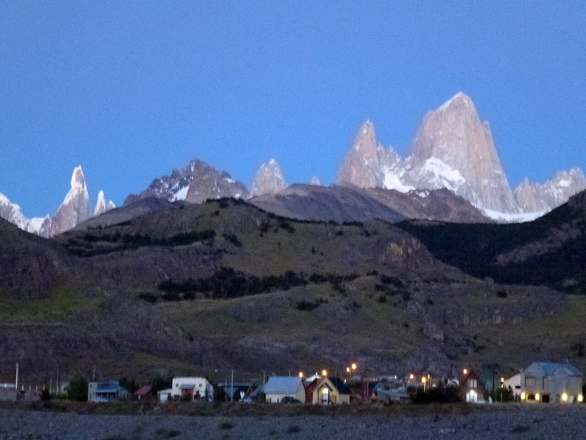
Fig. 5 · The town of El Chalten below the mountains, the starting point for the Laguna Torre hikePhoto: CC BY 2.0 via Wikimedia Commons
Where Laguna Torre Fits in an El Chalten Trip
If you have three nights or more in El Chalten, Laguna Torre is the hike I would protect right after Laguna de los Tres. The ideal rhythm for most hikers looks like this: use your single clearest morning for Laguna de los Tres and the Fitz Roy view, take Laguna Torre on the next good valley day, and keep a third day flexible for Loma del Pliegue Tumbado, a short hike, or simply a buffer in case the weather scrambles your plans. Laguna Torre is also the perfect “Fitz Roy is clouded in” hike, a long, rewarding day out when the famous peak refuses to appear.
Because El Chalten works on the weather and not on your spreadsheet, stay a night or two longer than feels efficient. That extra buffer is what turns a frustrating gamble into a relaxed trip where you get to pick your mornings. The town is small and walkable, the trailheads start from your doorstep, and you do not need a car for Laguna Torre or any of the main hikes.
El Chalten pairs naturally with El Calafate and the glaciers a few hours south. If your route includes both, the Perito Moreno glacier walkthrough covers that side, and the Patagonia itinerary planner shows how to balance hiking days against everything else.
Laguna Torre Hike FAQ
How long is the Laguna Torre hike?
The Laguna Torre hike is around 18 to 22 km round trip, or roughly 9 km each way to the lake. Most people take around 6 to 8 hours including stops, walking out in about 3 hours and returning a little faster since it is gently downhill. Adding the Mirador Maestri viewpoint extends both the distance and time by an hour or more.
Is the Laguna Torre hike hard?
Laguna Torre is moderate rather than hard. The difficulty comes from the distance and the wind, not from climbing. Only the first two kilometers out of town genuinely ascend, and the rest is gentle valley walking with no steep final push. It is the more forgiving of El Chalten’s two big day hikes and is doable for most reasonably active hikers.
Is Laguna Torre or Laguna de los Tres better?
Neither is objectively better, they show different mountains. Laguna de los Tres gives the iconic Fitz Roy view but is harder, with a steep final climb. Laguna Torre is gentler and reaches Cerro Torre and a glacier lake. If you have one clear day and good fitness, choose Laguna de los Tres. If the weather is marginal or you want an easier day, choose Laguna Torre.
Can you see Cerro Torre from the hike?
Yes, when the weather cooperates, you get superb views of Cerro Torre, the Adela range and the Grande glacier from the lake and from several viewpoints along the way. But Cerro Torre is famously cloud-shy, because the peaks brew their own weather. Start early for the best chance, since mornings are usually clearest and the granite walls only catch sun in the morning.
Do you need a guide for Laguna Torre?
No, you do not need a guide. The Laguna Torre trail is well marked, popular and easy to follow, and most hikers do it self-guided. A guide can still be worthwhile in winter or shoulder-season snow and ice, if you are nervous about navigation, or if you want local interpretation of the glaciers and peaks. Always check trail conditions at the Visitor Center first.
Is the Laguna Torre hike free?
At the time of writing, access to the Laguna Torre trailhead itself is still free, with no entry booth set up for this route, though El Chalten’s fee system has been changing and other trails now charge. The De Agostini campsite, however, is no longer free: since late 2024 it requires an advance reservation and a daily fee. Verify current rules before you go.
What is Mirador Maestri?
Mirador Maestri is a higher viewpoint about 2 km beyond Laguna Torre, reached by following the moraine ridge for roughly an extra hour to ninety minutes round trip. It offers a much better view down over the Torre glacier than the lakeshore does. The path is rocky, uneven and unmarked, so skip it if you are alone in strong wind, low on daylight, or already tired.
Can you camp at Laguna Torre?
Yes, you can camp at the De Agostini base camp, which sits in forest just before the lake and is the classic spot for catching sunrise on Cerro Torre. As of late 2024 it operates on a reservation system with a daily fee of around ARS 15,000 per person and a limited capacity, managed by the Asociación Amigos del Parque Nacional Los Glaciares. Reserve and pay in advance, and verify the current fee.
Final Thoughts
Laguna Torre is the El Chalten hike I recommend without hesitation, especially to people who hear “Patagonia” and picture only the brutal, iconic climbs. It gives you a full day in a glacial valley, a lake full of drifting icebergs, and the chance, if the sky is kind, to stand beneath one of the most beautiful and difficult mountains on earth, all without a punishing ascent.
Manage your expectations about the summit and you will rarely be disappointed. Go early, carry a windproof shell and a good lunch, and let the valley unfold at its own pace. Whether Cerro Torre shows itself in full or stays hidden behind the cloud, the walk out to Laguna Torre is one of the easiest “yes” decisions you will make in El Chalten. And if you have a second day, do Laguna de los Tres too, you will be glad you saw both faces of this extraordinary range.