Where Is Patagonia? A Clear Map of Argentina and Chile
Where is Patagonia? A clear answer: the region, the six Argentine provinces, the Chilean regions, what counts, and where the famous places sit.
By Patagonia Tourism Guide · First published 20 Jun 2026 · Updated 1 Aug 2026
0 — 2 km Fig. 1 · Map of Patagonia showing where it lies across southern Argentina and Chile · Photo: Modifizierung der Karte OpenStreetMap / CC BY-SA 4.0 via Wikimedia Commons
The first time I tried to point to Patagonia on a map, I got it wrong. I jabbed at the bottom of South America, somewhere near the tip, and felt confident about it. Then I started planning an actual trip and realized I had been imagining a single dot when the truth is a region the size of a small country, split down the middle by a mountain range and shared by two nations that each do it differently.
So let me save you that confusion.
Where is Patagonia? Patagonia is a vast region at the southern end of South America, shared by Argentina and Chile. It is not a country and has no official border. Roughly, it begins about 1,000 kilometers south of Buenos Aires and Santiago and stretches all the way down to Tierra del Fuego near the bottom of the continent.
This guide is for anyone who has seen the photos, heard the name, maybe even bought the jacket, and now wants the real geography: which countries Patagonia is in, the six Argentine provinces, the Chilean regions, what counts as Patagonia and what does not, how big it actually is, and where the famous places sit. Whether you are settling a dinner-table argument or starting to plan a trip, you will leave with a clear mental map.
If you are here to plan rather than just to know, pair this with our full how Argentina and Chile connect, which picks up where the map ends.
Patagonia at a Glance: Regions, Country, and What’s There
Before the long version, here is the short one. This table is the cheat sheet I wish I had on day one. It maps the main parts of Patagonia to their country and to the places you have probably heard of.
The heart of the Carretera Austral, Marble Caves, Cerro Castillo
Magallanes
Chile
Torres del Paine, Puerto Natales, Punta Arenas, the Strait of Magellan
Swipe to see all columns
Table 1
Notice that the granite towers of Torres del Paine and the famous Perito Moreno Glacier are in different countries. That single fact reshapes more trips than any other.
So, Where Is Patagonia, Really?
Picture the long, tapering tail of South America. Now slide your finger down past the middle of the continent until the land starts to narrow and fracture into islands and channels. That whole lower section, shared by Argentina and Chile, is Patagonia.
The cleanest way to hold it in your head is this: the Andes mountains run down the spine like a seam. Everything west of the seam is Chile. Everything east of it is Argentina. The mountains do more than divide two countries, though. They divide two completely different landscapes.
On the Chilean side, wet Pacific winds slam into the Andes and dump their moisture, so the west is a world of fjords, glaciers, temperate rainforest, and ice fields. On the Argentine side, those same winds arrive dry, so the east unrolls as vast, windswept steppe, scrub, and big sky all the way to the Atlantic. Britannica describes the Argentine portion as a semiarid plateau of steppe and desert, bounded by the Patagonian Andes to the west, the Colorado River to the north, the Atlantic to the east, and the Strait of Magellan to the south.
So when someone says they are “going to Patagonia,” the honest follow-up question is always: which part? Glaciers and granite in the deep south? Lakes and forests in the north? Fjords and a wild road on the Chilean side? Whales on the Atlantic coast? They are all Patagonia. They are not all close together.
Is Patagonia a Country?
No. Patagonia is not a country, and this trips up a lot of people, partly because the name sounds like one and partly because a clothing brand made it famous worldwide.
Patagonia is a geographic and cultural region that crosses an international border. The southern third of Argentina and roughly the southern half of Chile both fall inside it. Each country governs and develops its own part. There is no Patagonian passport, no Patagonian capital, and no single government. Visit Argentina puts it plainly: Patagonia is not a country but a vast geographical and cultural region, and each country manages its portion independently.
By land area, the split is lopsided. A commonly cited figure puts roughly 90 percent of Patagonia in Argentina and around 10 percent in Chile, though because the boundaries are not official, you should treat that as a rough split rather than a surveyed fact. The point that matters for you is simpler: most of Patagonia by area is Argentine, but some of its most iconic scenery, including Torres del Paine, is firmly Chilean.
The Argentina Side: The Six Provinces of Patagonia
Argentina holds the larger share, and its tourism authority defines Argentine Patagonia across six provinces. Visit Argentina lists them as La Pampa, Neuquén, Río Negro, Chubut, Santa Cruz, and Tierra del Fuego, spanning roughly 2,500 kilometers north to south and around 800 kilometers east to west at its widest.
Here is what each one actually means to a traveler, north to south.
Neuquén
The northwest corner of Argentine Patagonia, where the Andes are still high and forested. Think volcanoes, alpine lakes, ski resorts like Cerro Chapelco near San Martín de los Andes, and some of the richest dinosaur fossil country on earth. The start of the famous Seven Lakes Route sits up here.
Río Negro
Home to Bariloche, the unofficial capital of the Argentine Lake District and, for many people, the gateway to Patagonia. This is chocolate-shop-and-mountain-lake Patagonia: Nahuel Huapi National Park, forests, viewpoints, and easier logistics than the deep south. If your image of Patagonia is turquoise lakes ringed by peaks, much of that is Río Negro.
Chubut
The province that proves Patagonia is not only mountains. On the Atlantic coast, Chubut holds Península Valdés and Puerto Madryn, one of the best marine-wildlife regions in the Americas, with southern right whales, penguins, sea lions, and elephant seals. Inland it has Welsh-heritage towns like Gaiman and Trevelin and the ancient forests of Los Alerces National Park.
Santa Cruz
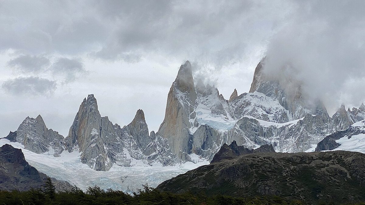
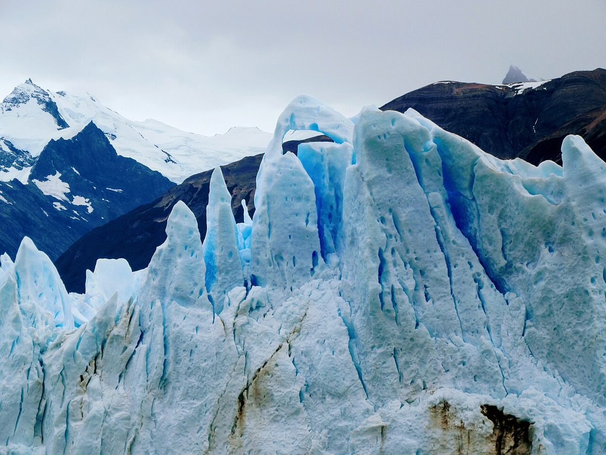
If you have a single mental picture of Patagonia, it probably lives here. Santa Cruz contains Los Glaciares National Park, which means El Calafate and the Perito Moreno Glacier, plus El Chaltén and the spires of Mount Fitz Roy. This is the glacier-and-granite heartland of the Argentine south.
Tierra del Fuego
The big island at the bottom, split between Argentina and Chile. The Argentine side holds Ushuaia, the city that bills itself as the end of the world, the Beagle Channel, Tierra del Fuego National Park, and most departures for Antarctica cruises. It feels, genuinely, like the edge of the map.
La Pampa
The outlier. La Pampa is mostly dry plains and steppe in the north, and you will notice that many geographers and Wikipedia define Argentine Patagonia using only five provinces, leaving La Pampa out. Argentina’s tourism board includes it; stricter definitions start Patagonia at the Colorado or Río Negro rivers. Either way, it is rarely the reason anyone flies south.
The Chile Side: Aysén, Magallanes, and the Debated Edges
Chilean Patagonia is the narrower, wetter, wilder-feeling sliver on the Pacific side of the Andes. It is where the continent shatters into fjords, islands, and channels, and where the Andes finally slide into the sea. Chile Travel describes it as the land of fjords, forests, crystal-clear rivers, the great ice fields, and southernmost cities like Punta Arenas and Puerto Williams.
Chile does not slice Patagonia into neat provinces the way Argentina does. Instead, think in administrative regions, and two of them are beyond dispute.
Aysén
The middle of Chilean Patagonia and the spiritual home of the Carretera Austral, Chile’s legendary southern highway. Aysén is thick rainforest, hanging glaciers, the surreal Marble Caves on Lake General Carrera, Cerro Castillo, and a lot of gravel road with very few people on it. It is remote, road-trip Patagonia at its purest.
Magallanes
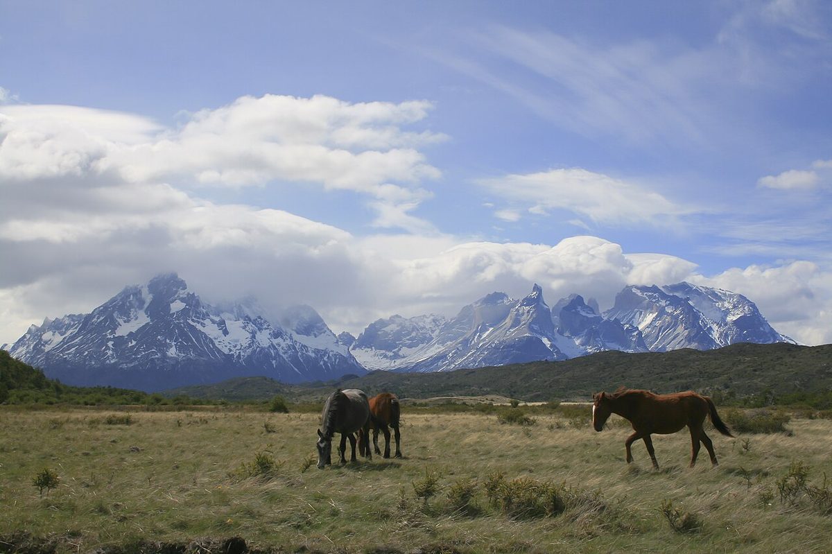
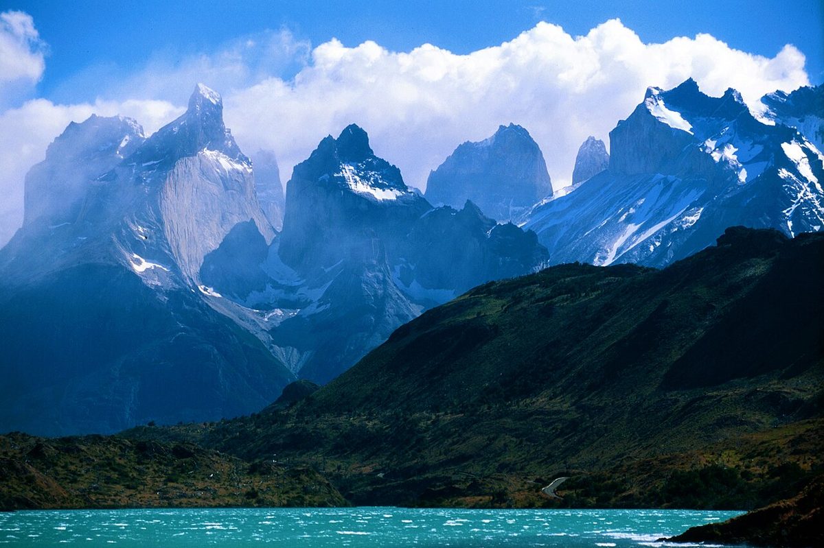
The far-southern region, and the one most visitors actually come for, even if they do not know the name. Magallanes holds Torres del Paine National Park, the gateway town of Puerto Natales, the regional capital Punta Arenas, the Strait of Magellan itself, and the Chilean half of Tierra del Fuego. If you have ever seen a photo of three sheer granite towers above a turquoise lake, that is Magallanes.
The debated edges
Where Chilean Patagonia begins in the north is genuinely contested. The Palena area in the Los Lagos Region, around the top of the Carretera Austral, is usually counted in. Beyond that, it gets fuzzy. Some include Chiloé Island and more of the Los Lagos and Los Ríos regions; others, like the guidebook author behind Worldly Adventurer, draw the line further south and exclude Chiloé as culturally distinct. Chileans themselves disagree. There is no wrong answer here, only conventions.
This is the part nobody quite settles, and it is worth being honest about, because half the “where is Patagonia” confusion comes from arguing about edges that were never officially drawn.
There is no legal boundary for Patagonia. It is a regional identity, not a line on a government map. That said, a few conventions are widely agreed.
The northern edge is the slippery one. On the Argentine side, the Colorado and Barrancas rivers are the classic textbook northern limit, and many people use the Río Negro and Bariloche as the practical “you’re in Patagonia now” marker. On the Chilean side there is no equivalent agreement at all; you will see Patagonia claimed to start anywhere from Puerto Montt down to Hornopirén at the top of the Carretera Austral, and some stretch it as far north as the Araucanía. The northern boundary, in other words, sits at different latitudes depending on which side of the Andes you are on.
Tierra del Fuego is usually included. The big island at the bottom, shared by Argentina and Chile, is conventionally counted as part of Patagonia, and Britannica notes the region south of the Strait of Magellan is often included too. Ushuaia, the southernmost city, sits here.
A few things are commonly left out, or argued over:
The Falkland Islands and the deep sub-Antarctic islands are generally treated as separate, not as Patagonia.
Antarctica is a different continent entirely. Ushuaia is the launch point, but Antarctica is not Patagonia.
Chiloé Island and the Chilean Lake District around Puerto Varas are culturally distinct and only sometimes folded in.
The far north of both countries, the wine country and the Atacama Desert in Chile, the Pampas around Buenos Aires, is firmly not Patagonia.
My practical rule, when people ask: if you are south of the Lake District and you are in Argentina or Chile, you are in Patagonia. Everything else is a debate for geographers and bar arguments.
How Big Is Patagonia? Size and Distances You Should Know
Patagonia is big in a way that quietly wrecks under-planned trips. This is the section to read twice.
The Argentine portion alone covers around 673,000 square kilometers, about 260,000 square miles, according to Britannica. Add the Chilean side and the various looser definitions, and you will see the whole region quoted at over a million square kilometers, which by some comparisons is in the ballpark of France and Spain combined. Treat the largest figures as approximate, since they depend entirely on where you draw the edges.
In dimensions you can feel: Argentine Patagonia runs roughly 2,500 kilometers from its northern provinces down to Tierra del Fuego, and around 800 kilometers from the Andes to the Atlantic at its widest, per Visit Argentina. The whole region starts about 1,000 kilometers south of Buenos Aires and Santiago before it even begins.
What that means in practice:
Patagonia is not a day trip from Buenos Aires or Santiago. Almost everyone flies south first, then explores from a regional hub.
The famous places are far apart. El Calafate to El Chaltén is a manageable few hours, but El Calafate to Bariloche is a long flight or a multi-day drive, and Ushuaia is a separate flight again.
Driving the length of it is a serious undertaking. Operators routinely note that road journeys between major Patagonian attractions can run 20 hours or more, which is why most itineraries fly between regions and drive only within them.
This is the single biggest planning lesson, and it is the reason the breakdown of how many days to spend where exists: you do not “see Patagonia.” You pick a corner of it and do that corner well.
Half of understanding where Patagonia is comes down to knowing where the postcard places live, because they are scattered across both countries and thousands of kilometers. Here is the orientation, roughly north to south.
Bariloche and the Lake District sit in the north, in Argentina’s Río Negro and Neuquén provinces. Lakes, forests, chocolate, skiing in winter. The easiest first taste of Patagonia.
Península Valdés and Puerto Madryn are on the Atlantic coast in Chubut, Argentina, well east of the mountains. This is the wildlife coast: whales, penguins, sea lions. Our wildlife viewing planner covers the seasons.
El Calafate and the Perito Moreno Glacier are in Santa Cruz, Argentina, in the deep south. One of the most accessible great glaciers on the planet.
El Chaltén and Mount Fitz Roy are also in Santa Cruz, a few hours north of El Calafate. Argentina’s trekking capital and the home of those jagged granite spires.
Torres del Paine is in Chile, in the Magallanes region, reachable from Puerto Natales. This is the big Chilean icon, and it is a border crossing away from the Argentine glacier towns even though they look close on a map.
The Carretera Austral runs through Chile’s Los Lagos and Aysén regions, far up the Pacific side. A 1,200-kilometer road trip through fjords and rainforest, a world away from the southern granite.
Ushuaia sits at the very bottom, in Argentine Tierra del Fuego. The end of the world, the Beagle Channel, and the door to Antarctica.
The thing to internalize: Torres del Paine and the Argentine glacier towns form one tight southern cluster you can realistically combine, while Bariloche, the wildlife coast, the Carretera Austral, and Ushuaia are each their own region requiring their own flight and their own days.
How to Think About Patagonia When You’re Planning a Trip
Now that you can place Patagonia on a map, here is how to turn that map into a sane trip, because the geography directly shapes the logistics.
Think in zones, not in a checklist. Five zones cover most of it: the northern lakes around Bariloche, the southern glacier-and-granite corridor around El Calafate, El Chaltén and Torres del Paine, the Chilean fjords and the Carretera Austral, the far-south island of Tierra del Fuego around Ushuaia, and the Atlantic wildlife coast around Puerto Madryn. Pick one or two zones per trip, not all five.
Let the Andes guide your expectations. Choosing the Chilean side means fjords, rain, ferries, and a wilder road-trip feel. Choosing the Argentine side usually means drier weather, easier town-to-town logistics, and a strong network of domestic flights from Buenos Aires. Most first-timers’ classic route actually crosses the border once, combining Argentine glacier towns with Chilean Torres del Paine, because that southern cluster is close enough to connect. We weigh the two sides properly in choosing between Argentina and Chile.
Respect the distances when you count days. Because the icons are far apart, a week is enough for one zone, not for the whole region. Two weeks covers the classic southern corridor. Three weeks or more lets you add a second zone, like Bariloche or Ushuaia, without spending the trip in transit.
Match the season to the zone. The southern hiking corridor and the wildlife coast run on different calendars, and Bariloche has a real winter ski season. Sort that out early with our Patagonia seasons rundown guide before you book flights.
Get the airports right. You almost always fly into Buenos Aires or Santiago first, then take a domestic flight to a regional hub like El Calafate, Bariloche, Ushuaia, or Punta Arenas. Our how to get to Patagonia guide maps the gateways to the regions.
If you are still deciding whether the trip is even right for you, is Patagonia worth visiting is an honest take, and if you want to skip the classic rookie errors, mistakes first-time visitors make is the one to read. For a visual reference you can keep coming back to, our dedicated Patagonia map lays the regions out side by side.
A quick detour, because it is the question that always comes next. The name comes from the Tehuelche, the Indigenous people who lived across the southern plains long before Europeans arrived. Sixteenth-century Spanish explorers called them “Patagones,” and the name stuck to the land.
The romantic version, recorded on Ferdinand Magellan’s expedition around 1520, claimed the Patagones were giants. That myth of a race of giants persisted for two centuries until later voyages, including Bougainville’s in 1767, found people of ordinary height and quietly retired the legend. Britannica notes one account in which Magellan coined the name after a monster in a Spanish romance of the era. The giants were never real. The wind, the space, and the sense of being at the edge of the world very much are.
Where Is Patagonia FAQ
Is Patagonia a country?
No. Patagonia is a geographic region, not a country. It sits at the southern end of South America and is shared by two nations, Argentina and Chile. Each country governs its own portion. There is no Patagonian government, capital, or passport, which is exactly why the region has no single official border.
What countries is Patagonia in?
Patagonia is in two countries: Argentina and Chile. The Andes mountains divide the two sides, with Argentine Patagonia to the east and Chilean Patagonia to the west. By land area most of Patagonia is in Argentina, but Chile holds some of the most famous scenery, including Torres del Paine National Park in the Magallanes region.
Is Patagonia in Argentina or Chile?
Both. It is not an either/or. The famous Perito Moreno Glacier, El Chaltén, Bariloche, and Ushuaia are in Argentina, while Torres del Paine, the Carretera Austral, and Punta Arenas are in Chile. Many first-time trips combine the two by crossing the border once in the far south, where the highlights sit close together.
How far is Patagonia from Buenos Aires?
Patagonia begins roughly 1,000 kilometers south of Buenos Aires, and the popular southern destinations are much farther still. The flight from Buenos Aires to El Calafate, gateway to the Perito Moreno Glacier, takes around three hours. Almost everyone flies rather than drives, because road distances within Patagonia can run 20 hours or more.
What is Patagonia known for?
Patagonia is known for dramatic, end-of-the-world landscapes: the granite towers of Torres del Paine and Fitz Roy, the Perito Moreno Glacier, the vast Patagonian Ice Fields, the windswept steppe, and the fjords of the Chilean coast. It is also famous for wildlife, including whales, penguins, and guanacos, and for serious hiking and road trips.
What is the capital of Patagonia?
There is no capital of Patagonia, because Patagonia is a region rather than a country. Within it, regional capitals exist on each side, such as Punta Arenas in Chile’s Magallanes region and provincial capitals like Río Gallegos in Argentina, but no single city governs or represents the whole of Patagonia.
How big is Patagonia?
Patagonia is enormous. The Argentine portion alone covers around 673,000 square kilometers, and the whole region, including the Chilean side, is often quoted at over a million square kilometers, roughly comparable to France and Spain combined. It runs about 2,500 kilometers north to south. Treat the largest figures as approximate, since the boundaries are unofficial.
What language do they speak in Patagonia?
Spanish is the main language across both Argentine and Chilean Patagonia. In tourist towns and on popular routes you will find English spoken at hotels, agencies, and many restaurants. Some communities, such as the Welsh-heritage towns in Argentina’s Chubut province, also keep older languages and traditions alive alongside Spanish.
Final Thoughts
Once you stop picturing Patagonia as a single dot and start seeing it as a region with a mountain seam down the middle, everything gets easier. You know that Chile is the wet, fjord-and-granite west, Argentina is the dry, steppe-and-glacier east, and the famous names you have been collecting are scattered across two countries and a lot of empty space.
That is also the whole secret to a good trip. You are not going to “do Patagonia.” You are going to pick a corner of one of the largest, emptiest, most beautiful regions on earth and give it the time it deserves. Get the map right first, and the rest of the planning falls into place.