Los Alerces National Park: Ancient Trees, Lakes and Towns
Plan Los Alerces National Park: the ancient alerce boat trip, turquoise lakes on RP 71, fishing, Esquel and La Trochita, Trevelin, season and days.
By Patagonia Tourism Guide · First published 22 Aug 2026 · Updated 1 Aug 2026
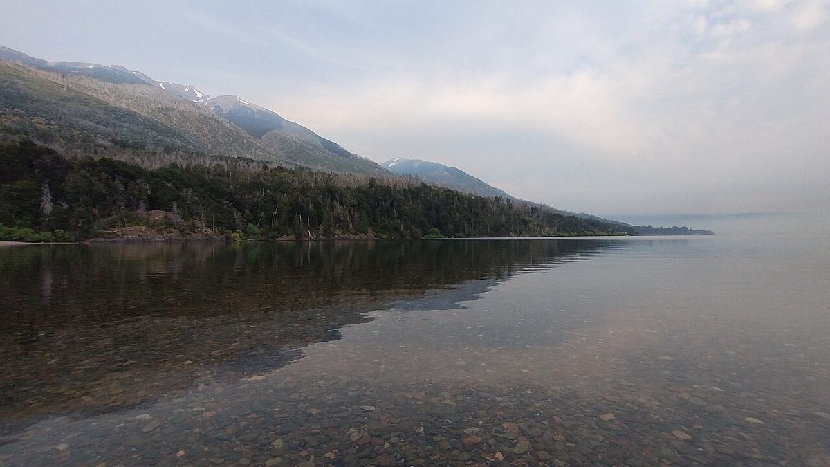
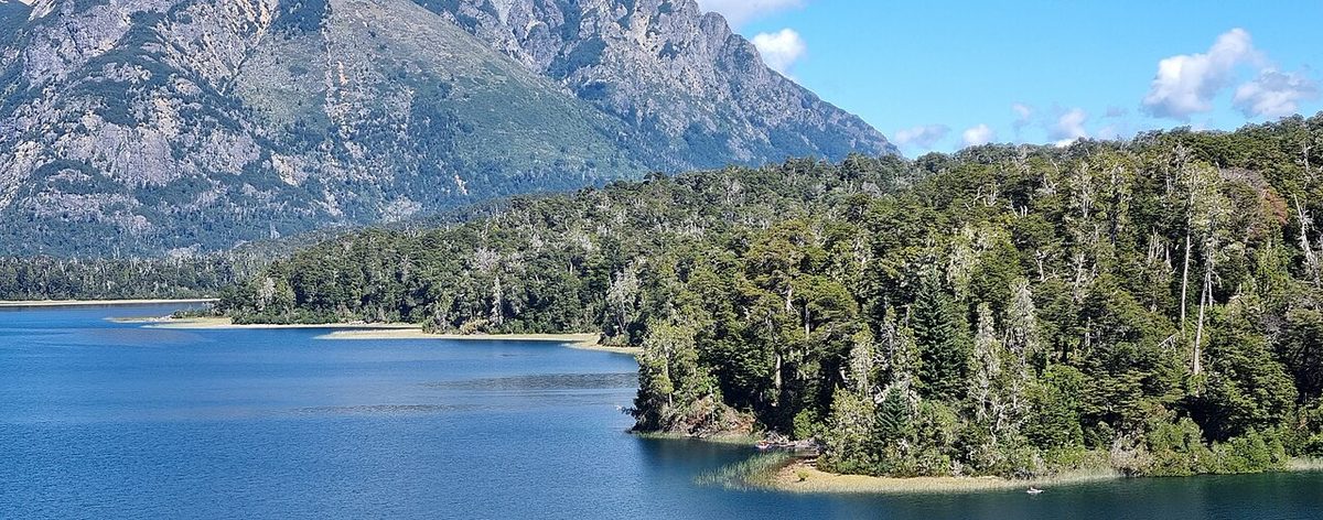
0 — 2 km Fig. 1 · Turquoise lake and forested mountains in Los Alerces National Park, Patagonia · Photo: Ucriesidelplata / CC BY-SA 4.0 via Wikimedia Commons
Most people find Los Alerces by accident.
They come to Patagonia for the famous names, start reading about Bariloche, drift south through El Bolson, and then keep seeing a UNESCO World Heritage park they had never heard of, full of turquoise lakes and trees older than the Roman Empire. And then they have to decide, quickly, whether it is worth the detour.
I think it usually is. Here is how to do it well.
Los Alerces National Park is a UNESCO World Heritage national park in Chubut, Argentine Patagonia, protecting ancient alerce trees and a chain of glacier-fed turquoise lakes. The headline experience is the Lago Menendez boat to El Alerzal Milenario and the “Grandfather” larch, reached through the gateway towns of Esquel and Trevelin.
This guide is for travelers who want a quieter, greener, more ancient side of Patagonia than the granite-tower icons. It works for road trippers extending a Bariloche or Northern Patagonia trip, for slow travelers who like forests and lakes more than crowds, for anglers, and for anyone who wants to stand next to a 2,600-year-old tree without queuing for it. It is part of our wider Bariloche and Northern Patagonia guide.
Los Alerces National Park at a Glance
Here is the fast version, so you can see the shape of a trip before reading the detail.
Highlight
Where
Time to allow
The ancient alerces (El Alerzal Milenario)
Lago Menendez, by boat from Puerto Chucao
Most of one day
Turquoise lake circuit (Rivadavia, Verde, Futalaufquen)
Provincial Route 71, north-south through the park
Half to full day driving and stopping
Rio Arrayanes and its hanging bridge
Between Lago Verde and Futalaufquen
1-2 hours
Easy walks (Cascada Irigoyen, Lago Verde, El Dedal viewpoint)
Northern lakes and Villa Futalaufquen
1-6 hours depending on choice
Fly fishing for trout
Rio Arrayanes, Lago Verde, Lago Futalaufquen
Half to full day, license required
La Trochita steam train
Esquel
Around half a day
La Hoya skiing
Near Esquel, winter only
Full day
Welsh tea houses and Nant y Fall waterfalls
Trevelin
Half day
Swipe to see all columns
Table 1
Base yourself in Esquel or Trevelin (or inside the park if you want to wake up on the lakeshore), give the park two or three days if you can, and visit between roughly November and April for the easiest conditions. If you only have one day, choose the boat OR the lake drive, not both.
What Los Alerces Actually Protects
The whole reason this park exists is a tree.
Los Alerces was created in 1937, specifically to protect the alerce, also called the lahuan or Patagonian larch. The scientific name is Fitzroya cupressoides, and it is one of the longest-living tree species on Earth, in the same conversation as California’s sequoias and bristlecone pines. The park’s English name simply means “the larches.”
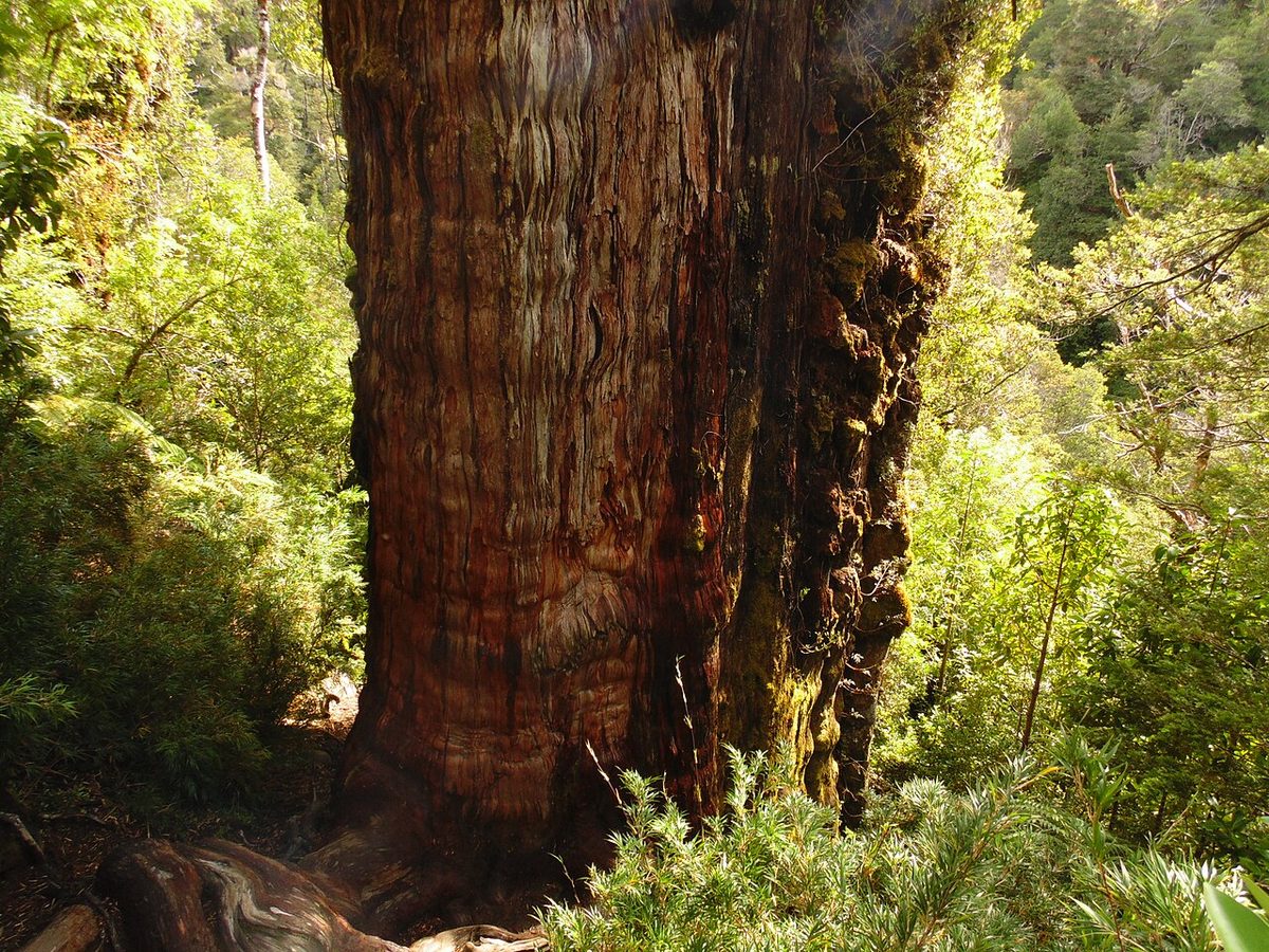
The star is a tree the rangers call El Abuelo, “the Grandfather.” Argentina’s national parks authority puts it at around 2,620 years old and roughly 60 metres tall. To stand next to it is genuinely strange. When that tree was a sapling, Rome was a village and the Parthenon had not been built.
But the park is not only old trees. Argentina’s national parks describe it as a World Heritage Site conserving more than 259,000 hectares of Patagonian forest. Visit Argentina lists the area as 259,570 hectares and the climate as warm-to-cold and humid, with summer lows around 14C and highs that can top 30C, and winter that brings snow. This is the largest stretch of Valdivian rainforest on the Argentine side of the Andes, which is why the forest feels so dense, mossy and green compared with the dry steppe just to the east.
La Ruta Natural, Argentina’s official travel-routes site, sums up the appeal well: turquoise lakes and rivers, glaciers, waterfalls, and the Alerzal Milenario, all inside a Valdivian forest with larch trees more than 2,500 years old, declared a World Natural Heritage Site by UNESCO in 2017.
So the honest pitch is this. Los Alerces gives you three things at once: some of the oldest living things on the planet, a chain of almost luridly turquoise lakes, and a sense of space that the busier Patagonia parks have lost. It is not as dramatic as Fitz Roy or the Torres. It is quieter, softer and older, and for the right traveler that is exactly the point.
Who should actually go
Go if you like forests, lakes, slow days and few crowds; if you are already heading through Bariloche or El Bolson’s market, beer and trails and can spare two or three days; if you fish; or if you want a Patagonia stop that feels gentle rather than punishing.
Think harder if your trip is short and your heart is set on the granite-and-glacier icons of the deep south. Los Alerces is a detour, not a substitute for a full Patagonia itinerary, and reaching it costs time.
The grove of the oldest alerces, the Alerzal Milenario, sits in a strictly protected area you cannot drive or freely hike to. The only way in is by boat across Lago Menendez, and that restriction is the reason the forest is still intact.
Here is how the trip works, drawing on La Ruta Natural and the official Esquel tourism and Trevelin tourism pages. You start near the northern lakes and cross the Rio Arrayanes on a small hanging bridge, then follow a short trail to Puerto Chucao on the shore of Lago Menendez. From Chucao, a catamaran sails across the lake, which takes around an hour, to Puerto Sagrario. From there a guide leads you on a walk of about 2 kilometres through untouched Valdivian forest to the ancient grove. The official sources put the guided walk at roughly 45 minutes, and there is a shorter adapted variant for visitors with reduced mobility.
In that grove you see alerces of every age, from “young” trees of 100, 200 or 500 years old up to giants reaching about 60 metres. The trail passes Lago Cisne and the river of the same name, leading to the foot of the Lahuan, the grandfather larch of more than 2,600 years.
A few honest planning notes:
Block out most of a day. Between the drive to the embarkation point, the bridge and trail, the lake crossing each way, and the guided forest walk, this is not a quick outing. Plan for the better part of a day end to end.
Book ahead in high summer. Departures run all year, with the highest frequency in summer and reduced frequencies the rest of the year. In January and February especially, reserve in advance through the operators or the park office rather than hoping for a same-day seat.
It is weather-dependent. This is a boat on a Patagonian lake. Wind and conditions can change schedules, so build in a buffer day if the alerces are the reason you came.
There is a glacier version. From the same Lago Menendez navigation, some excursions continue to the Torrecillas glacier, a hanging glacier that the Chubut tourism authority dates to roughly 24,000 years old. If you have an extra day and the weather cooperates, it is a spectacular add-on.
I would not overthink which operator you choose. The route, the lake and the grove are the same. What matters is reserving early in peak season and giving yourself a calm, unhurried day for it.
The Lake Circuit on Provincial Route 71
The second great experience here costs nothing but a tank of fuel and some patience.
Provincial Route 71 runs north to south through the park and traces its main lakes, and driving it slowly is the best way to understand the place. The official advice is simple and correct: you can visit for the day, but it is far better to spend more time and explore corner by corner.
From north to south, the headline stops are:
Lago Rivadavia
At the northern end, Lago Rivadavia is the big, wide lake you meet first if you arrive from the El Bolson direction. It has accommodation, trails and a calm, broad feel, and it is a natural place to start or end a circuit.
Lago Verde and the Rio Arrayanes
This is the postcard. Lago Verde is small, intensely green and ringed by forest, with trails and viewpoints. Just south, the Rio Arrayanes begins, and its water is so clear it looks fake. The famous hanging bridge over the Arrayanes is one of the prettiest short walks in the park and the gateway to the Lago Menendez boat. If you only get out of the car once, get out here.
Lago Futalaufquen
Further south sits Lago Futalaufquen, the park’s largest lake and the practical centre of gravity. The small settlement of Villa Futalaufquen is the park’s administrative hub, with the intendencia (park headquarters) and an information centre where you register for trails, buy fishing licences and get current conditions. There is lodging here, plus beaches and trailheads.
Lago Futaleufu
At the southern limit you reach Lago Futaleufu, where there is a hydroelectric dam. From here you are close to Trevelin and the road toward the Chilean border.
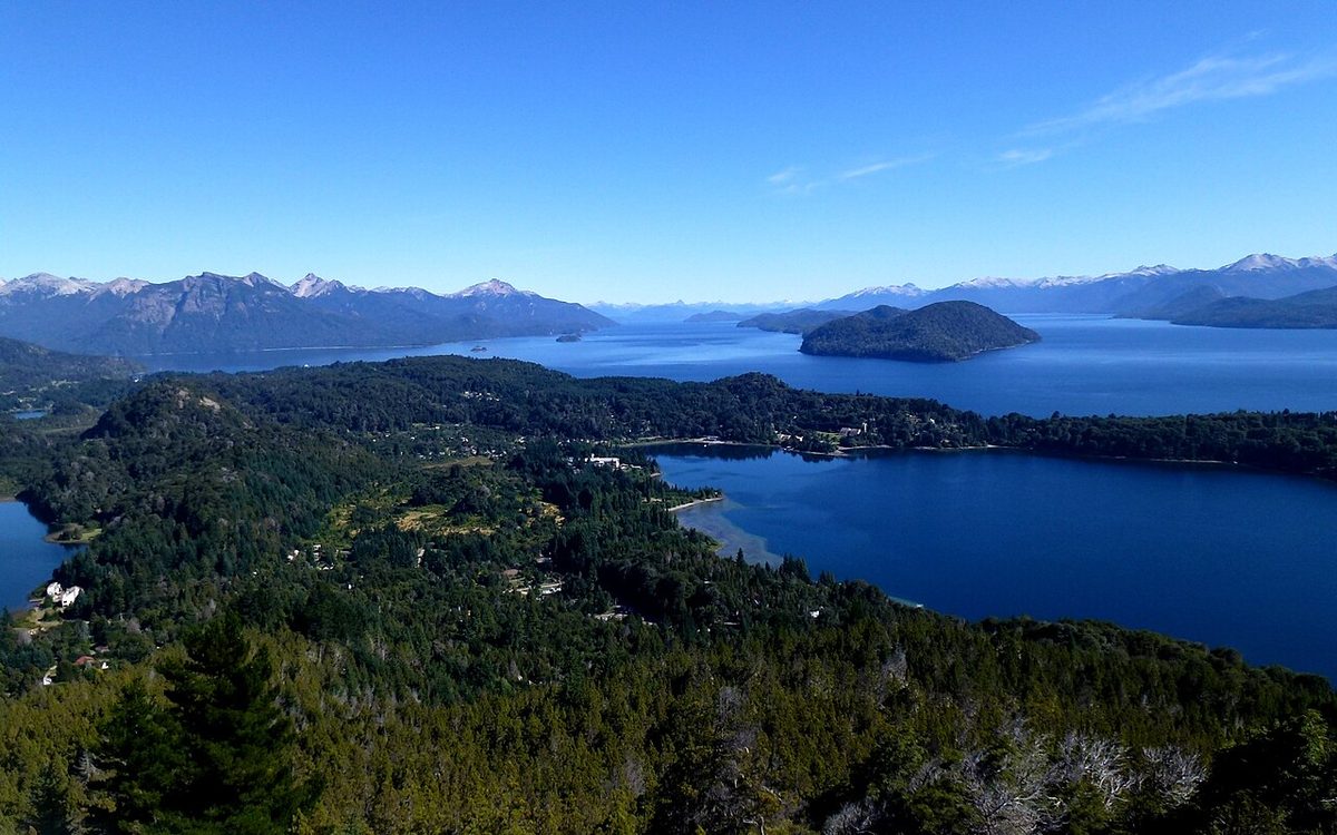
The turquoise of these lakes is not a filter. It comes from glacial flour, fine rock ground by ice and suspended in the water, and on a bright day it is genuinely hard to photograph because it does not look real.
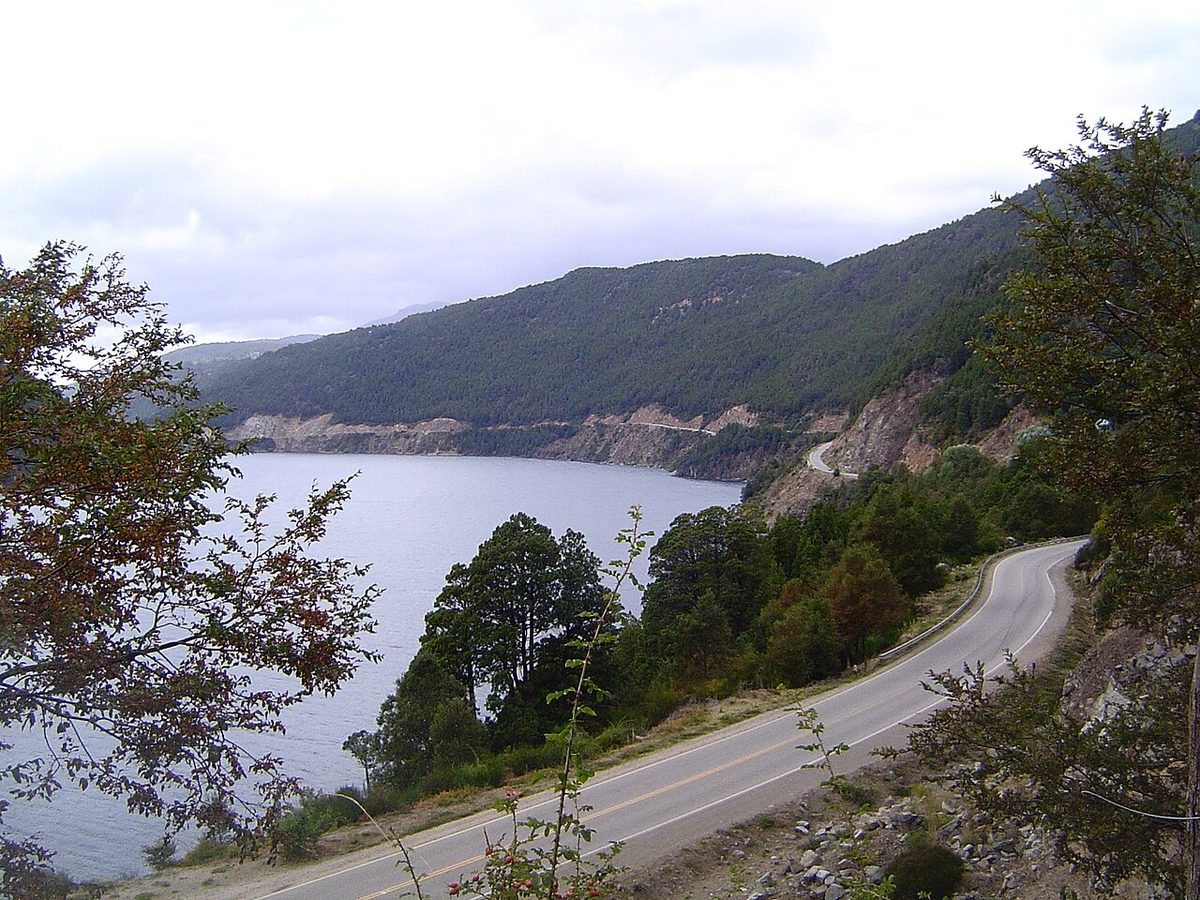
A practical word on driving. Inside the park, expect a mix of paved and good gravel roads that are narrow in places. The Chubut tourism authority asks drivers to fill up with fuel before entering (there are no services inside the park), keep to about 60 km/h on gravel, avoid sudden braking, and watch for animals on the road. Pets are not allowed in the park. For the broader self-drive picture, our rundown of the Argentine Lake District and the route planner for Patagonia put this stretch in context.
Beyond the boat and the drive, Los Alerces rewards travelers who get out and move, at whatever level suits them.
Walks and trails
The Chubut tourism authority counts around 19 hiking options of different difficulty levels, and the consistent official instruction is to register at the information centre before you set off and to stay on marked trails. That is not box-ticking. Weather changes fast, cell signal is limited, and the forest is genuinely wild.
Good options across the range:
Cascada Irigoyen. A short, easy walk through humid forest to a waterfall, near the northern lakes. A lovely introduction to Valdivian forest if you only have an hour.
Lago Verde and the Arrayanes bridge. Easy lakeshore walking with viewpoints and the hanging bridge. Family-friendly and very scenic.
El Dedal viewpoint. A steeper, longer hike climbing from the Villa Futalaufquen area to panoramic views over Lago Futalaufquen and the surrounding peaks. This is a proper half-day-plus hike, so take it seriously, register, and start early.
Rock-art trail. A short walk near Villa Futalaufquen visits ancient Indigenous rock paintings on a cliff above the lake, a reminder that people have known this valley for thousands of years.
For longer and more remote routes, including multi-day backcountry treks toward Lago Kruger that involve boat access and backcountry registration, treat this as a real expedition. Get current information and register in person at the park, and read our Patagonia hiking, camping, gear and safety guide before you commit. If you want a gentler dose of Northern Patagonia trails first, Bariloche hiking is the easier place to start.
Fishing
Anglers quietly regard Los Alerces as one of the best trout fisheries in South America, and they are not wrong. The Rio Arrayanes between Lago Verde and Lago Futalaufquen, plus the lakes themselves, hold brown and rainbow trout, some of them large.
Two practical things. First, you need a fishing licence, which you can buy in Esquel or at Villa Futalaufquen inside the park. Second, the season is limited; sport fishing in this region generally opens around November and runs through the warmer months, and much of the park is catch-and-release with rules on hooks and methods. Check current dates and regulations at the information centre, because they change and they are enforced.
Water and slower pleasures
You can also kayak the lakes, camp on quiet shores, ride horses outside the park, and simply sit on a beach with a book. La Ruta Natural lists camping, cottages, hiking, trekking, kayaking, lake navigation, horseback riding and “enjoying nature at its best” as the core menu. That last one is underrated. Some of my best hours here were spent doing very little next to very blue water.
Esquel and La Trochita
You will almost certainly base part of your trip in Esquel, and it is more interesting than its role as “the gateway” suggests.
Esquel is the main town of the region, with the airport, bus connections, hotels, gear shops, restaurants and the practical services you will not find inside the park. It sits in a green valley where the Andes meet the steppe, and it has a frontier, working-town feel rather than a resort polish.
La Trochita, the Old Patagonian Express
Esquel’s signature attraction is a train.
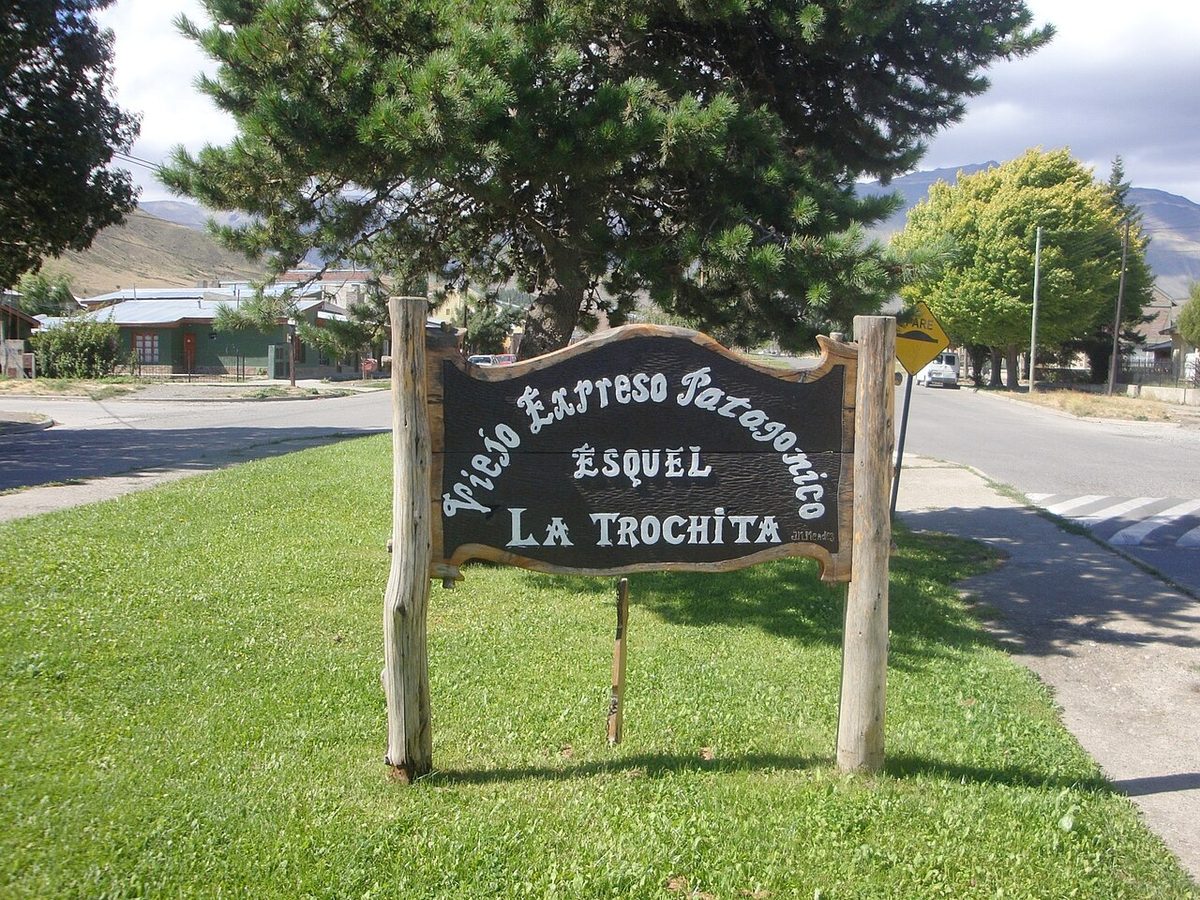
La Trochita, officially the Viejo Expreso Patagonico, is a 750 mm narrow-gauge steam railway. Paul Theroux’s 1979 travel book The Old Patagonian Express gave it the English name it carries today. The historic line ran for hundreds of kilometres through the Andean foothills between Esquel, El Maiten and Ingeniero Jacobacci. After the line was closed as unprofitable in the 1990s, local government stepped in to save it as a heritage railway.
Today the tourist run from Esquel is a short, atmospheric trip of around 18 kilometres out to Nahuel Pan, a Mapuche-Tehuelche community on the steppe, taking roughly a couple of hours round trip. Traditionally it has run on set days such as Tuesday, Thursday and Saturday, with more frequent departures in the December-to-Easter high season. The locomotives are genuinely old, including a Baldwin from the United States and a Henschel from Germany, pulling original wooden carriages with little wood stoves for winter. Schedules and days vary by season, so check the current timetable before you build a day around it.
It is touristy, slow and a little theatrical, and I enjoyed every minute. If you have kids, or any soft spot for old machines, do not skip it.
La Hoya skiing
In winter, Esquel becomes a ski town. La Hoya, the ski area just north of town, runs roughly from June into October, with a base around 1,350 metres and lifts climbing to roughly 2,000 metres. It has a reputation for dry powder and good value, and it is far less expensive and less crowded than the big resort at Bariloche. If you are visiting Northern Patagonia in winter and want snow, this is the reason to come south.
Half an hour south of Esquel is one of the more surprising small towns in Patagonia.
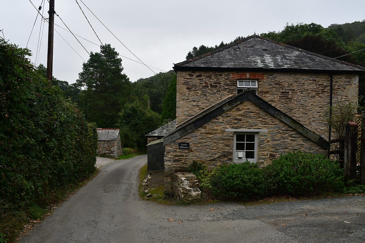
Trevelin was settled by Welsh colonists in the late 19th century, an offshoot of the larger Welsh settlement on the Atlantic coast around the Chubut valley. The name comes from the Welsh Trefelin, meaning “mill town,” after the flour mills the settlers built. More than a century later, the Welsh thread is still visible.
The tea houses
The thing to do in Trevelin is sit down for a Welsh afternoon tea. The town’s tea houses serve the famous torta galesa, a dense, dark, spiced fruit cake, alongside scones, homemade bread, cakes and regional jams. It is a generous, old-fashioned ritual, and after a few days of trail snacks it feels like a small luxury. For more on how this fits the wider regional table, see our notes on Patagonian cuisine and customs.
Nant y Fall waterfalls
Just outside town, the Nant y Fall reserve protects a string of waterfalls in native forest. A well-marked trail of around half a kilometre and beyond links several viewpoints over different falls, with names like La Petisa (“the short one”), Las Mellizas (“the twins”) and El Salto Grande (“the big jump”), the tallest dropping a good distance. It is an easy, pretty walk that pairs naturally with a tea-house stop.
Spring tulips and the border
If you come in spring, Trevelin is also known for its tulip fields, a brief, brilliant bloom that draws visitors in October and November. And the town is the gateway to the southern part of the park and to the Futaleufu border crossing into Chile, which matters if you are continuing toward the Carretera Austral. For the bigger road-trip picture, our Bariloche and Northern Patagonia guide ties these threads together.
How to Get There and Where to Base
This is the part that decides whether Los Alerces fits your trip, so let me be specific.
Getting to Esquel
Visit Argentina notes that Esquel has around three weekly flights from Buenos Aires, plus buses from much of the country. The airport is Brigadier General Antonio Parodi (airport code EQS). Flights are limited and can fill, so book early; if dates do not line up, many travelers fly into Bariloche, which has far more connections, and continue south by bus or car. For the national picture, see how to get to Patagonia.
By road, the distances that matter are:
From El Bolson: around 2 to 3 hours south. The park’s northern gate is reachable via National Route 40 and Provincial Route 71, roughly 105 km in total with around 28 km of gravel, passing Cholila and Lago Rivadavia. This makes Los Alerces a natural extension of an El Bolson stop.
From Bariloche: roughly 4 to 5 hours and around 250 to 300 km south on National Route 40, through Villa La Angostura and El Bolson. It is a long but scenic day, and it links cleanly to a guide to structuring your Bariloche days or the lake-by-lake driving rundown further north.
Getting into the park
La Ruta Natural gives the key figure: from Esquel to Villa Futalaufquen is about 52 km of paved road on National Route 259 and Provincial Route 71, roughly an hour. From Trevelin you can reach the southern part of the park and the Futaleufu area. There is also a daily bus service from Esquel that passes through Villa Futalaufquen and stops at points of interest along RP 71, which means you can visit without a car if you plan around the schedule.
That said, a car changes the trip. The whole pleasure of RP 71 is stopping when a lake looks too good to pass, and buses and tours cannot give you that. If you are comfortable driving Patagonian gravel and can rent a vehicle in Esquel or Bariloche, do it. If not, combine the daily bus, taxis or remises from Esquel, and an organised boat excursion, and you will still see the best of the park.
Where to base yourself
You have three sensible choices:
Esquel. The most practical base, with the widest range of hotels, restaurants, services and transport. Best if you want comfort, want to ride La Trochita or ski La Hoya, and do not mind driving in for the day.
Trevelin. Smaller, prettier and more characterful, with the tea houses and easy access to the southern park and the border. A lovely choice if you want charm over convenience.
Inside the park. Villa Futalaufquen and the lakeshores offer cabins, hosterias and a range of organised and wild campsites. This is the move if you want to wake up on the water and minimise driving. Book ahead in January.
For a wider view of regional lodging strategy, our Lake District travel notes covers the corridor as a whole.
Park fees
Los Alerces is a fee-charging park. The official APN access-fee page, with values in effect from early January 2025, listed Los Alerces day access (Pase diario) at $20,000 for general (international) visitors, $7,000 for Argentine nationals, and $5,000 for provincial residents and students, in Argentine pesos. There are also Flexipass options, with a 3-day pass listed at $40,000 general and a 7-day pass at $70,000 general, plus a 50% discount on a second day’s visit within 72 hours. Children aged 0 to 5, local residents, retirees, people with disabilities and certain other categories are exempt. Because peso values change, treat these as a guide and check the official portal close to your trip; bring your passport, since the fee depends on your visitor category.
Timing and trip length are the two questions people get wrong, so here is my honest take.
When to go
Visit Argentina advises visiting between November and April, and that matches my experience. From roughly October through April you can camp and hike comfortably, the boat runs most frequently, and the lakes are at their best. The shoulder months of March and April are a sweet spot if you can take them: fewer people, autumn colour in the forests, and calmer days, though some services begin to wind down later in April.
Winter, roughly June through September, is a different park. The boat excursions largely stop, many campsites close, and the focus shifts to snow. La Ruta Natural notes that this is the season for skiing and snow activities at La Hoya near Esquel. The park stays open and the Villa Futalaufquen area remains accessible, but if your goal is the ancient alerces by boat, do not come in deep winter. For the regional view, see the best time to visit Patagonia.
Spring, October and November, is variable: lingering snow up high, unsettled weather, the first wildflowers, and Trevelin’s tulips. Rewarding, but pack for anything.
How many days
Visit Argentina recommends a stay of 1 to 3 days, and I would frame it like this:
One day. Doable as a day trip from Esquel, but you must choose: either the Lago Menendez boat to the alerces, or the RP 71 lake drive with a walk or two. Trying to cram both into a single day means rushing the thing you came for.
Two days. The realistic minimum to do the park justice. One day for the boat and ancient forest, one day for the lake circuit, a walk and some time by the water.
Three days. The comfortable sweet spot. Add the Torrecillas glacier navigation, a longer hike like El Dedal, a fishing morning, or a day split between Esquel’s La Trochita and Trevelin’s tea houses.
Four or more. Worth it if you fish seriously, want a multi-day backcountry trek, or are treating Esquel and Trevelin as destinations in their own right rather than gateways.
If you are building a longer regional loop, three nights here slots neatly into a Northern Patagonia route after Bariloche and El Bolson, as our Bariloche itinerary and planning a Patagonia route lay out.
Los Alerces National Park FAQ
Is Los Alerces National Park worth visiting?
Yes, if you like forests, lakes and quiet over crowds and drama. Los Alerces protects some of the oldest trees on Earth and a chain of turquoise lakes, with far fewer visitors than Torres del Paine or El Chalten. It is a detour rather than a must-see icon, but for slow travelers and anglers it is one of Patagonia’s most rewarding parks.
How do you get to Los Alerces National Park?
Base in Esquel, which has an airport (EQS) with around three weekly flights from Buenos Aires and bus links nationwide. From Esquel it is about 52 km, roughly an hour, to Villa Futalaufquen on National Route 259 and Provincial Route 71. The park is around 2 to 3 hours south of El Bolson and 4 to 5 hours south of Bariloche by road.
How do you see the ancient alerce trees?
The oldest grove, El Alerzal Milenario, is reachable only by boat. You cross the Rio Arrayanes hanging bridge to Puerto Chucao, take a catamaran across Lago Menendez (around an hour) to Puerto Sagrario, then walk roughly 2 km with a guide through protected forest to the trees, including the 2,600-year-old “Grandfather” larch. Allow most of a day and book ahead in summer.
How many days do you need in Los Alerces?
Visit Argentina recommends 1 to 3 days. One day forces a choice between the boat and the lake drive. Two days lets you do both comfortably. Three days is the sweet spot, adding a longer hike, a fishing morning, the Torrecillas glacier boat, or time in Esquel and Trevelin. Four or more suits anglers and backcountry trekkers.
What is La Trochita?
La Trochita, the Old Patagonian Express, is a historic 750 mm narrow-gauge steam railway running from Esquel. The tourist trip travels around 18 km out to Nahuel Pan and back, roughly a couple of hours, behind old Baldwin and Henschel locomotives pulling original wooden carriages. Paul Theroux’s 1979 book gave it its English name. Check the current timetable, as days and frequency vary by season.
Is Esquel or Trevelin a better base?
Esquel is the practical choice, with the most hotels, restaurants, services, the airport, La Trochita and the La Hoya ski area. Trevelin is smaller and prettier, with Welsh tea houses, the Nant y Fall waterfalls and easy access to the southern park and the Chile border. Many travelers use Esquel for logistics and visit Trevelin for a charming half day.
Can you visit Los Alerces without a car?
Yes, with planning. A daily bus from Esquel runs through Villa Futalaufquen and stops along Provincial Route 71, and you can join an organised boat excursion to the alerces and use taxis or remises from Esquel. A rental car is still far better for the lake circuit, since the joy of RP 71 is stopping freely, but the park is doable car-free.
When is the best time to visit Los Alerces?
Visit Argentina advises November to April, with October through April good for camping and hiking and the boat running most often. March and April bring autumn colour and fewer people. Winter, June to September, largely stops the boat and closes many campsites but opens skiing at La Hoya near Esquel. For the alerce boat trip, avoid deep winter.
Can you fish in Los Alerces National Park?
Yes, and it is excellent. The Rio Arrayanes, Lago Verde and Lago Futalaufquen hold brown and rainbow trout. You need a fishing licence, available in Esquel or at Villa Futalaufquen, and the season generally opens around November and runs through the warmer months. Much of the park is catch-and-release with rules on hooks and methods, so check current regulations at the information centre.
Final Thoughts
I have a soft spot for Los Alerces precisely because nobody arrives obsessed with it.
It does not have the marketing weight of Torres del Paine or the hiker’s mythology of Fitz Roy. What it has is older and quieter: a forest of trees that were already ancient when those mountains were getting their first European names, lakes so blue they embarrass your camera, and two gateway towns, a Welsh tea stop and a steam-train frontier town, that are genuinely charming rather than merely functional.
If you are already coming through Bariloche or El Bolson, give it two or three days. Take the boat to the Grandfather larch on a calm morning, drive Route 71 slowly with no fixed plan, eat too much cake in Trevelin, and ride a hundred-year-old train across the steppe. It is the part of Patagonia people forget to tell you about, and it might be the part you remember most.