Bariloche Hiking: Best Trails, Refugios & Nahuel Huapi
Bariloche hiking from easy viewpoints to Refugio Frey, Lopez, Jakob and the Nahuel Huapi traverse. Distances, times, registration, season and safety.
By Patagonia Tourism Guide · First published 19 Aug 2026 · Updated 1 Aug 2026
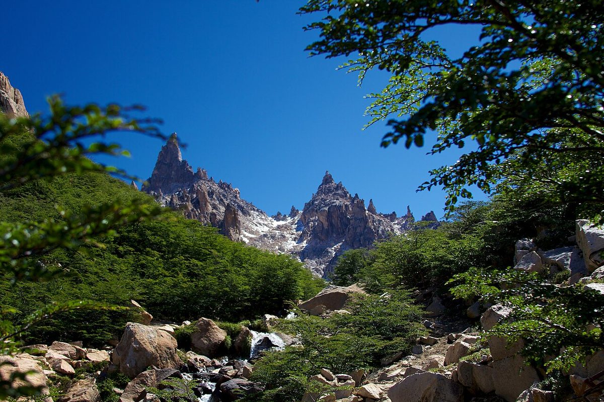
0 — 2 km Fig. 1 · Refugio Frey beside Laguna Toncek ringed by granite spires, a classic Bariloche hiking destination in Patagonia · Photo: McKay Savage from London, UK / CC BY 2.0 via Wikimedia Commons
Most people arrive in Bariloche planning to look at the lake, eat chocolate, and maybe ride a chairlift. Then they see the granite spires above Villa Catedral, watch a steady line of hikers heading up with packs, and start quietly rearranging their week.
That is the thing about Bariloche hiking: it sneaks up on you. This is one of the few places in Patagonia where you can do a 30-minute viewpoint walk and a five-day refugio-to-refugio traverse from the same town, sleeping in your own bed in between if you want.
Bariloche hiking ranges from flat lakeshore strolls and short viewpoint climbs like Cerro Campanario to serious mountain days at Refugio Frey, Refugio Lopez and Refugio Jakob, and on to the multi-day Nahuel Huapi Traverse linking four mountain huts. Most trails sit inside Nahuel Huapi National Park, the high season runs December to April, and trekking registration is mandatory and free.
This guide is for anyone trying to figure out which Bariloche trails are worth their legs, in what order, and what they actually involve. I have written it for the day hiker who wants the one perfect outing, the viewpoint walker who would rather not scramble, and the refugio hiker eyeing the traverse. If you are still building the bigger trip, read it alongside the guide to Bariloche and the Lake District, which is the parent hub for everything in this region.
Bariloche hiking at a glance: the trail comparison table
Before we go trail by trail, here is the honest shortlist. Distances and times vary a lot between sources and depend on your exact start point and pace, so treat everything here as “around” and verify current conditions with Club Andino Bariloche before you go.
Hike
Distance / time
Difficulty
The payoff
Cerro Campanario
~30 min up (or 7-min chairlift)
Easy
The famous 360° lake panorama, fast
Cerro Llao Llao + Llao Llao park
~1–1.5 hrs to the lookout
Easy
Forest, beaches, lake views, kid-friendly
Lago Escondido / Arrayanes loop
~20 min–2 hrs, mostly flat
Easy
Still-water reflections, recovery-day calm
Cerro Otto
~1.5–2.5 hrs up (cable car option)
Easy–moderate
Town-close summit, different angle on the lakes
Refugio Lopez
~5 km / ~3 hrs up, ~800 m gain
Moderate
Pink hut over Nahuel Huapi, short but steep
Refugio Frey (classic)
~10–12 km / ~4–5 hrs up
Moderate
Laguna Toncek ringed by granite spires
Refugio Frey “por el filo” (ridge)
~6 km / ~4 hrs from chairlift top
Hard (scrambling)
The ridgeline, but only in clear weather
Refugio Jakob
~18 km / ~5–6 hrs one way
Moderate–hard
The newest hut above Laguna Jakob
Refugio Laguna Negra
~14 km / ~5–6 hrs one way
Moderate–hard
A dark glacial lake, a local favorite
Nahuel Huapi Traverse (4 refugios)
~4–5 days, 4–9 hrs/day
Hard / high
Linking all four huts across the range
Swipe to see all columns
Table 1
If you only take one thing from that table, take this: the easy walks and the marquee refugio hikes are not the same kind of trip, and the traverse is a different sport again. Pick honestly.
Easy walks and viewpoints: the no-scramble Bariloche
Not every Bariloche hike has to be a test. Some of my favorite mornings here have been short ones, and on a cloudy day a quick viewpoint can be smarter than committing to a long climb you will spend staring at fog.
Cerro Campanario
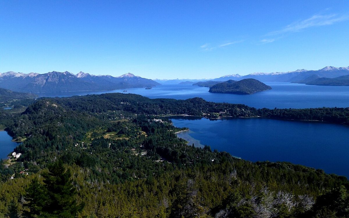
If you do one easy thing, make it Cerro Campanario. The official Bariloche tourism site notes the base sits at km 17.5 of Avenida Bustillo, the chairlift takes about 7 minutes, and the forest trail up runs around 30 minutes for most able-bodied walkers. National Geographic has called the view one of the best in the world, and from the top you see Nahuel Huapi and Moreno lakes, Victoria Island, the Llao Llao peninsula, and the surrounding peaks all at once.
My advice: go early if the sky is clear, because clouds roll in and the view is the entire point. Take the chairlift up and walk down, or the reverse. There is no shame in the lift here.
Cerro Llao Llao and the Llao Llao park trails
Out at the end of the Circuito Chico, the Parque Municipal Llao Llao is the gentlest hiking in Bariloche. The climb up Cerro Llao Llao is short and rewarding, the official trail rating is Low, and reaching the lookout takes around an hour to an hour and a half. I have passed families with small kids on it.
Around it sit even flatter options: the Arrayanes trail and the walk to Lago Escondido, where on a still morning the mountains lay out perfectly on the water. You can string Cerro Llao Llao, Villa Tacul, Lago Escondido and the Arrayanes trail into a loop of around 16 km if you want a longer easy day without any real climbing. Bus 20 to the Puerto Panuelo stop gets you there.
Cerro Otto
Cerro Otto is the town-close option, which gives it a different feel from the trails further out along the lake. There are a few ways up, from a winding gravel road off km 1 of Avenida Pioneros to a steeper forest track from around km 4.5, taking somewhere between 1.5 and 2.5 hours depending on the route. There is a cable car too, and a rotating restaurant at the summit near 1,405 m.
One candid note: some of the summit trails have been closed off and on in recent seasons, and the complex at the top can feel touristy. Check with Club Andino for current trail status before you build a day around it. The views over the lakes are still genuinely good.
The classic day hikes: Frey, Lopez, and choosing your big day
These are the hikes people actually fly to Bariloche for. They are real mountain outings with exposure, limited cell service, and conditions that change with the season. Do not put them in the same mental box as the viewpoint walks above.
Refugio Frey, the classic
Refugio Frey is the iconic Bariloche day hike, and if conditions are good and you do only one harder trail here, this is the one. The standard “classic” route starts and ends at the base of Cerro Catedral. You follow a well-marked path with footbridges along the early, more exposed section above Lago Gutierrez, hit the junction with the trail coming up from Los Coihues, then climb into the forest and up to the refugio on the shore of Laguna Toncek, ringed by the granite spires that climbers come from all over for.
Distances vary by source and by exactly where you start, so I will hedge: figure on around 20 to 24 km round trip, roughly four to five hours up and three down, rated moderate. It is not technical on the classic route, but it is long, and the last push is a real climb. Bus 55 from town reaches Villa Catedral in about 35 minutes.
There is a second, harder way in: “Frey por el filo,” the ridgeline variant. You ride the gondola and chairlift up from the Catedral ski base, then traverse the ridge with some genuine rock scrambling before dropping to Frey. It is spectacular and you never retrace your steps, but it involves using your hands, it should only be done in clear, stable weather, and it is not for nervous or first-time hikers. Confirm the lifts are running before you commit, since that route depends on them.
Is Frey worth it? Yes, almost everyone agrees it is, and a lot of hikers say staying overnight to catch sunrise and sunset over Toncek is even better. The scenery-to-effort ratio is excellent.
Refugio Lopez
Refugio Lopez is the shorter, sharper alternative, and it is my pick when I want big lake views without a full-day commitment. It is also deceptively tough for its length. In around 5 km you gain something like 800 m, with most of the climbing front-loaded in the forested first half, and the whole ascent takes about three hours at a moderate grade. The pastel-pink hut sits near 1,620 m above Lago Nahuel Huapi, and the panorama from up there is the reason to go.
The trailhead is right on the Circuito Chico at Arroyo Lopez, around km 22.5, marked by a kiosk locals know for selling, genuinely, one of the better hot dogs you will eat after a hike. Bus 10 toward Colonia Suiza drops you there. If you have legs left at the top, the climb to Pico Turista adds roughly two to three hours round trip.
If the Frey ridge scramble makes you nervous but you want similar drama, there is also the Cerro Goye and Cerro Bellavista combination between Frey and Lopez. It is steep in places but involves no scrambling, and one of its trailheads sits in Colonia Suiza, which means coffee before and a beer after.
Llao Llao and Lopez Bay, the gentle classics
Worth naming alongside the big hikes are the genuinely easy “classic” walks the official tourism site rates Low: the Llao Llao and Villa Tacul circuit (around 50 minutes to 1 hour 20 to the lookout) and Lopez Bay (around 1 hour 30). These pair perfectly with a Circuito Chico day and ask nothing of your knees.
Refugios and the Nahuel Huapi Traverse
Here is where Bariloche hiking becomes a trip of its own. The refugios are staffed mountain huts where you arrive after a long day to a hot meal, a mattress in a dorm, and a social, slightly rowdy room of hikers playing cards and sharing mate. You can hike to any of them as a day hike or a single overnight, or you can link them.
How the refugios work
A few things I wish someone had told me the first time. Bring cash in Argentine pesos, because beyond the booking deposit, food and extras are usually cash-only and cards are not accepted. Many refugios stop taking dinner orders around 7pm, so arrive with time to spare even on long summer evenings, both to order and to claim a good bunk. Boots usually come off at the door, so pack light camp slippers. Plan for no electricity and carry a headlamp and a power bank. And carry your trash back out.
The four huts that anchor the system are Refugio Frey, Refugio Jakob (also called General San Martin), Refugio Laguna Negra (Italia / Manfredo Segre) and Refugio Lopez. Refugio Jakob was rebuilt in 2018, making it the newest and most comfortable, with small rooms instead of one big dorm. Laguna Negra, on a dark glacial lake reached by a final lung-burning set of switchbacks locals nickname the “maldito caracol,” is a quiet local favorite. As single hikes, Jakob runs around 18 km and five to six hours one way, and Laguna Negra around 14 km and five to six hours, both moderate to hard.
The big one is the Nahuel Huapi Traverse, which links all four huts. The official Bariloche tourism site lists this “Four Lodge Tour” as difficulty High, four to five days, with four to nine hours of walking per day, and notes it can be done in full or in parts.
The rough shape: day one is the classic climb to Frey; day two crosses to Jakob with rock scrambles, loose sections and the Brecha Negra ridge; day three pushes on to Laguna Negra; day four works around the lake and over toward Lopez ridge; day five descends from Lopez to the Circuito Chico. The crossings on days two and three are the serious part, often with faded paint marks instead of clear trail, scree, and real route-finding. At Jakob you may be asked to attend a briefing and sign a waiver before continuing, because the next section carries the highest difficulty rating.
If the full traverse is too much, the most popular shorter version is Frey to Jakob over two nights. Plenty of hikers also single out the Laguna Negra to Lopez leg as the most scenic. For a route this committing, most people who know the range recommend going with a certified guide, and a guide is the norm for the most technical crossings. For the gear and safety mindset this kind of multi-day mountain travel needs, read the primer on camping in Patagonia before you commit.
Club Andino Bariloche and trekking registration
You cannot really talk about Bariloche hiking without Club Andino Bariloche (CAB). The club has run mountaineering and refugios here for decades, and it is the practical authority on trail and hut conditions.
Two rules matter most. First, trekking registration in Nahuel Huapi National Park is mandatory and free. You do it online, and the official guidance is to register within 48 hours before you set out, because the form is tied to current weather and trail conditions. Keep a copy on your phone or printed to show if asked. The form doubles as a useful pre-trip checklist: did you check the forecast, are you equipped for the worst, does someone know your itinerary.
Second, registration is not the same as a bed. Overnight reservations are made directly with each refugio through its own website or WhatsApp, not through the club, and you should book ahead in high season. Save your reservation confirmation too. CAB members get a steep discount on overnight stays, but the booking still goes through the hut.
Refugio opening also shifts year to year. Frey and Jakob tend to be the most reliably open, while huts like Laguna Negra and the higher Otto Meiling can be seasonal, and high traverse links between huts often do not open until well into the summer. Check CAB’s current refugio status rather than trusting any blog’s snapshot, including this one.
Season and conditions: when to hike in Bariloche
Bariloche has a real hiking season, and pretending otherwise is how people end up postholing through snow in October.
The reliable trekking window is roughly December to March, when the trails are clearest and the days longest. The refugios generally open somewhere around October or November and close around April, but the trails that connect the huts across the high country often stay closed until January, and the crossing between Jakob and Laguna Negra can hold snow into February. April is a beautiful time to be on the lower trails, with the lenga forest turning gold, though higher routes get more conditional.
Winter, roughly June to September, does not end hiking so much as change it. The easy lakeshore walks and viewpoints still work on clear days, and refugios like Lopez become destinations for guided snowshoe and ski trips. But the high trails demand snow and ice skills, sometimes crampons, and going with a guide stops being optional. If you are visiting in the cold months and want the snow side of Bariloche, the winter guide to Bariloche guide covers it properly. For lining your trip up with the right season across the whole region, see best time to visit Patagonia and the more trail-specific best time to hike Patagonia.
The infrastructure here can make these mountains feel tamer than they are. The weather turns fast, cell service drops on most trails, and routes that are mellow in January can be icy in November. Nahuel Huapi’s official trekking guidance is worth following to the letter: match the route to your ability, stay on marked trails, avoid hiking alone where possible, respect your declared itinerary, check weather and closures, expect limited signal, carry proper gear, and do not light fires on the mountain trails.
For a day hike, I carry a wind layer, a warm layer, rain protection, sun protection, plenty of water, food, an offline map, a headlamp, sturdy footwear, and a bag for my trash. For refugio overnights, add cash in pesos, your reservation, camp slippers, a change of clothes, a warmer jacket, a power bank, basic toiletries, and ideally a satellite messenger, since most of this terrain has no phone coverage. A first-aid kit travels on every trip.
Two safety habits make the biggest difference. Start early, so weather and daylight are working for you, not against you. And be willing to turn around. The granite spires at Frey and the ridge above Catedral will be there next season; the smart move on a bad-weather day is the easy lakeshore walk, not the scramble. For the broader cross-Patagonia version of all this, the Patagonia hiking, camping, gear and safety guide goes deeper.
Bariloche hiking by fitness level
Because the range here is so wide, it helps to sort it by what you actually want.
If you want easy and scenic. Cerro Campanario for the panorama, the Llao Llao park trails and Cerro Llao Llao for forest and lake, Lago Escondido for flat calm, and Lopez Bay. These suit families, recovery days, and anyone who would rather not climb hard. Most are reachable by city bus, no car needed.
If you want one great day hike. Refugio Frey on the classic route if you have a full day and decent fitness, or Refugio Lopez if you want big views in less time and do not mind a steep, front-loaded climb. Both end at a hut where you can buy a snack and soak in the scene before heading down.
If you want a challenge or a multi-day trip. Frey “por el filo” for the ridge scramble in good weather, Refugio Jakob or Laguna Negra as longer single objectives, and the Nahuel Huapi Traverse, in full or as the popular Frey-to-Jakob section, for the real thing. Register, reserve ahead, and strongly consider a guide for the technical crossings.
If hiking is the core of your visit, build the rest of the trip around it. The day plans for Bariloche shows how to slot these trails into a sensible number of days, what to do in Bariloche covers the rest-day options, and the seven lakes route is the obvious scenic drive to bolt on. For the whole-trip frame, the Patagonia itinerary planner keeps you from drowning the good hiking days in transfers.
Frequently asked questions about Bariloche hiking
What is the best hike in Bariloche?
For most visitors the best single hike is Refugio Frey, the classic day hike from the base of Cerro Catedral to a granite-ringed alpine lake. If you want big views in less time, Refugio Lopez is the strong runner-up. For an easy option, Cerro Campanario delivers the famous 360-degree lake panorama in about half an hour.
How long is the Refugio Frey hike and how hard is it?
The classic Refugio Frey route is around 20 to 24 km round trip, roughly four to five hours up and three down, rated moderate. It is long but not technical. The harder “por el filo” ridge variant from the Catedral chairlift involves rock scrambling and clear weather only. Distances vary by source, so verify before you go.
Do you need to register to hike in Bariloche?
Yes. For trails in Nahuel Huapi National Park, trekking registration is mandatory and free. You complete it online, and the official advice is to register within 48 hours before departure because it is tied to weather and trail conditions. Keep a copy on your phone or printed. Overnight refugio stays must be booked separately with each hut.
Do you need a guide to hike in Bariloche?
Not for the popular day hikes like Frey classic, Lopez, Campanario or the Llao Llao trails, which are well marked and busy in season. A guide is recommended, and sometimes effectively required, for the multi-day Nahuel Huapi Traverse and its technical crossings, and for winter snow trips. If you are unsure of your skills, hiring one is money well spent.
When is the best time to hike in Bariloche?
The reliable trekking season runs December to March, with the longest days and clearest trails. Refugios generally open around October or November to April, but high trails linking the huts often stay closed until January. April brings gold autumn forest on the lower routes. Winter hiking is possible but needs snow skills and usually a guide.
Can you go hiking in Bariloche without a car?
Yes, easily. Many of the best trailheads are on city bus routes: bus 55 to Villa Catedral for Refugio Frey, bus 10 toward Colonia Suiza for Refugio Lopez and Laguna Negra, and bus 20 to Puerto Panuelo for Cerro Campanario and the Llao Llao park trails. Check current timetables locally, as schedules and crowding change with the season.
How many days do you need for the Nahuel Huapi Traverse?
The full four-refugio traverse takes around four to five days, with four to nine hours of walking per day and the toughest, most technical crossings in the middle. You can also do shorter sections: Frey to Jakob over two nights is the most popular. Reserve each refugio ahead, register, and seriously consider a guide for the hard crossings.
Is hiking in Bariloche safe?
The popular trails are safe in good conditions for prepared hikers, but this is real mountain terrain with fast-changing weather, limited cell service, and snow on high routes outside midsummer. Register your trek, check the forecast and trail status, carry proper gear, start early, and be willing to turn back. The technical traverse crossings demand experience or a guide.
Final thoughts
What I love about Bariloche hiking is that it does not force you into one identity. You can be the person who rides the Campanario chairlift, takes a photo, and goes for ice cream, and you can be the person sweating up to Frey at dawn. On the same trip. With the same base.
If you have one good-weather day and the legs for it, give it to Refugio Frey. If you have a week and a taste for huts, the refugios will quietly take over your itinerary, and you will leave already planning the traverse. Either way, register, check the conditions, pack the layers, and start early. The mountains here reward people who treat them seriously and still know how to enjoy a lake view.
When you are ready to fit the hiking into the wider trip, head back to the northern Patagonia overview and build out from there.