Pumalin National Park: Trails, Chaitén & Access Guide
Plan a trip to Pumalin National Park: the Tompkins story, the best trails, Chaitén volcano, the Hornopirén ferry, camping, fees and where it fits.
By Patagonia Tourism Guide · First published 4 Sep 2026 · Updated 1 Aug 2026
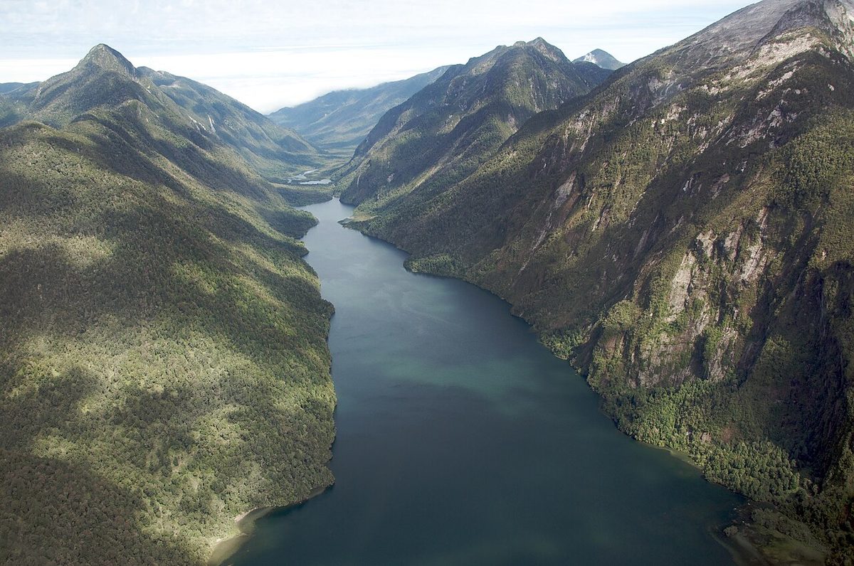
0 — 2 km Fig. 1 · Fjord and rainforest at Caleta Gonzalo in Pumalin National Park on the northern Carretera Austral · Photo: Sam Beebe/Ecotrust / CC BY-SA 3.0 via Wikimedia Commons
The first time I drove off the ferry at Caleta Gonzalo, I sat in the car for a full minute before I could make myself get out. The fjord was glassy, the forest came right down to the water, and a single wooden sign pointed up a gravel road into a wall of green. I had read about this place for years. I still wasn’t ready for how quiet it was.
That is the thing nobody quite prepares you for about Pumalin National Park and the far north of the Carretera Austral. You expect mountains. You don’t expect a temperate rainforest so dense and dripping that it feels prehistoric, three-thousand-year-old trees a short walk from your tent, and almost no one else around.
Pumalin National Park, officially Parque Nacional Pumalín Douglas Tompkins, is the protected heart of that landscape, and it is one of the most generous, strangest, most moving places I have spent time in Patagonia. This guide is how I would help a friend plan it.
What is Pumalin National Park, and how do you visit? It is a roughly 994,000-acre Valdivian rainforest reserve on the northern Carretera Austral near Chaitén, donated to Chile by conservationists Doug and Kris Tompkins. You reach it by car or bus plus the Hornopirén ferry from the north, or from Chaitén in the south. Day entry is free; trails are well marked.
This guide is for the road-tripper or independent hiker pointing south down Chile’s Carretera Austral road trip who wants to know what the park actually is, which trails are worth your legs, how the maddening ferry works, and where it fits on a northbound or southbound run. If you only have a vague sense that there’s “a Tompkins park up north,” by the end of this you’ll have a real plan.
I’ll hedge anything that changes between seasons, especially ferries and fees. Verify those before you commit. Everything else is the park I know.
Pumalin National Park at a glance
Here’s the shape of it before we go deeper. Every figure is approximate and the access details shift by season, so treat this as orientation, not gospel.
Official name
Parque Nacional Pumalín Douglas Tompkins
Where
Northern Carretera Austral, Los Lagos Region, near Chaitén
Size
~994,000 acres (~402,000 ha) of mostly temperate rainforest
Two sectors
North (Caleta Gonzalo), reached from Chaitén; South (El Amarillo), ~25 km south of Chaitén
Trails
~11 marked trails, 45+ miles total, from 30-minute strolls to all-day climbs
Headline hikes
Sendero Los Alerces, Cascadas Escondidas, Sendero Volcán Chaitén, Darwin’s frog trail, Ventisquero El Amarillo
Getting there
Car/bus + Hornopirén–Caleta Gonzalo ferry from the north; road from Chaitén in the south
Entry
Day entry free; designated camping around CLP 6,000 per person; no guide required
Best time
December to March; November and March quieter shoulders
Fits with
Hornopirén, Chaitén, then south toward Queulat and the rest of the Carretera Austral
Swipe to see all columns
Table 1
If you take one idea from that table, take the two-sector model. Almost every planning mistake I see comes from people not realising the park has a northern half around Caleta Gonzalo and a southern half at El Amarillo, with the town of Chaitén tucked between them. Hold that map in your head and everything else falls into place.
What Pumalin actually is, and the Tompkins story
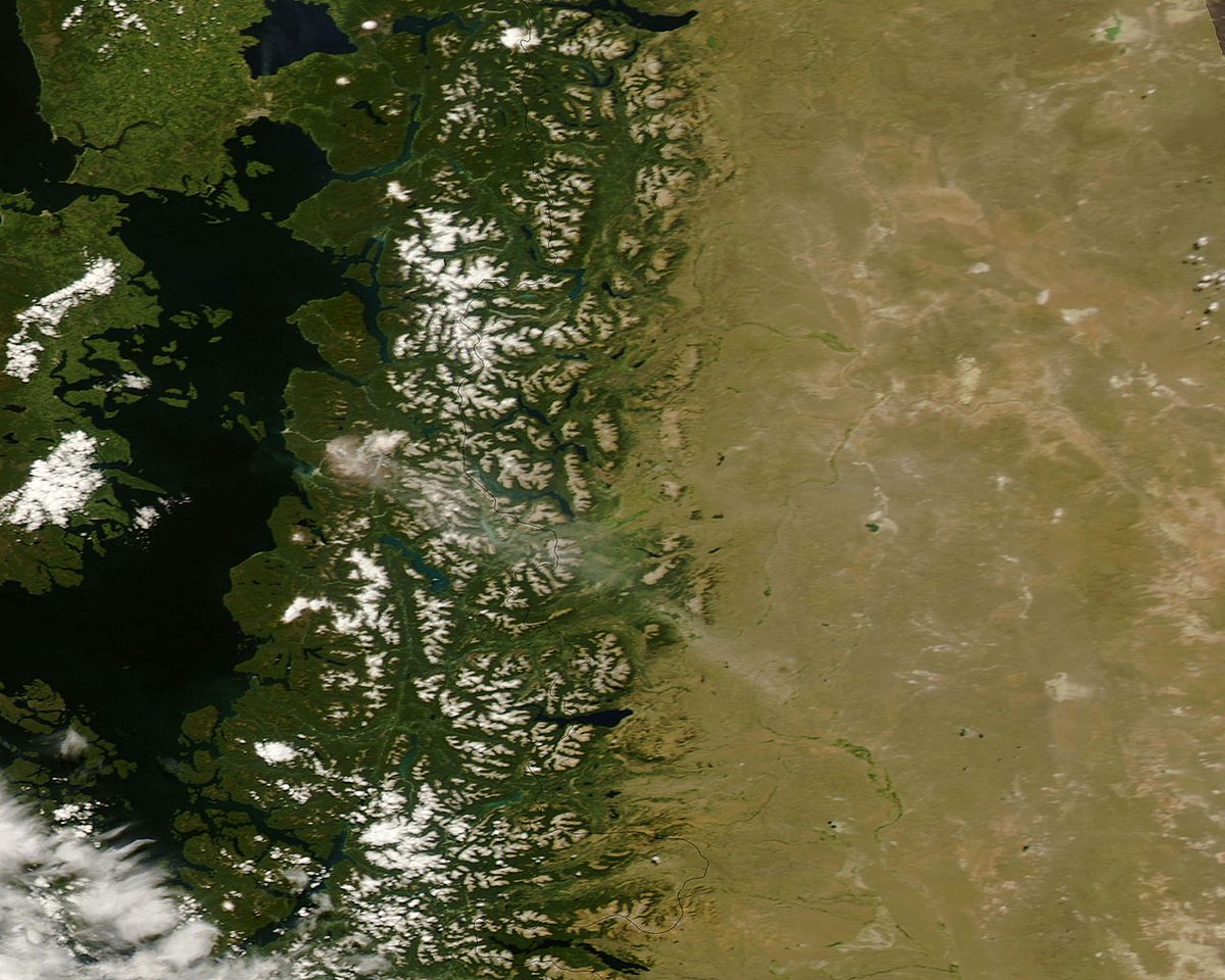
Pumalín means “watery place” in the language of the Huilliche people, and it is the right name. This is one of the wettest corners of Chile, a mosaic of fjords, rivers, granite walls, hanging glaciers, waterfalls and, above all, forest. Not just any forest, either. This is Valdivian temperate rainforest that the last ice age largely missed, which is why it shelters species you won’t find in tidier woods, and why roughly a quarter of all of Chile’s surviving millennial alerce trees still grow here.
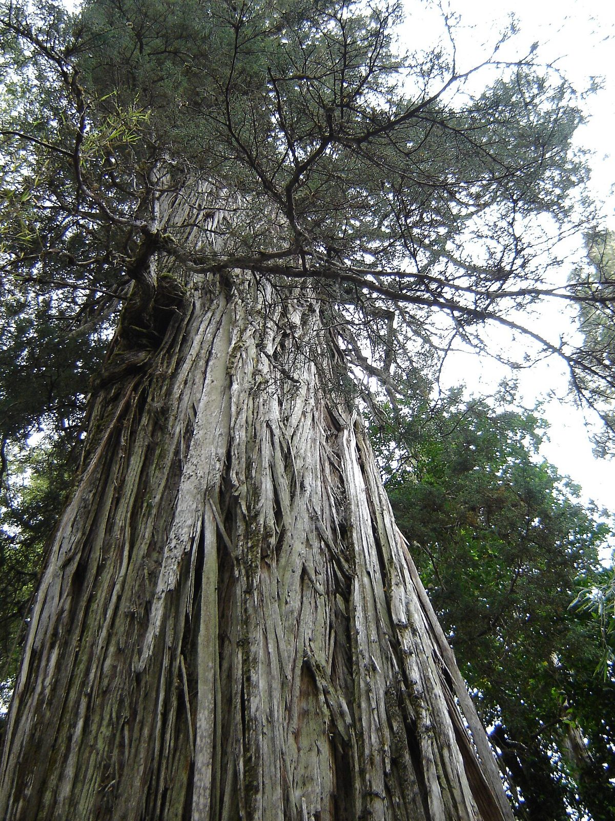
The alerce, Fitzroya cupressoides, is the reason this whole park exists. These are among the oldest living trees on Earth, some over three thousand years old, and in the late 1980s they were being logged. In 1989 an American named Doug Tompkins, the founder of The North Face and a co-founder of Esprit, flew over these forests and decided to do something about it.
What he did was extraordinary. Starting in 1991 he began buying land, around 41,500 acres in the Reñihué valley at first, then steadily more through the organisation he and his wife Kris Tompkins built, eventually assembling close to 700,000 acres of private reserve. The goal from early on was not to own it forever. It was to protect it, build careful public infrastructure, and ultimately hand it back to Chile as a national park.
That plan was controversial. Chile had little tradition of large-scale environmental philanthropy, and the sight of a wealthy foreigner buying up a swathe of Patagonia bred suspicion about his motives. To reassure people and add protection, the project secured Natural Sanctuary status in 2005. Doug Tompkins died in a kayaking accident on Lago General Carrera in late 2015, and he did not live to see the finish. But in 2017 his foundation and the Chilean government signed the donation, and in 2018 the land formally became Parque Nacional Pumalín Douglas Tompkins.
It did not stop there. Pumalín became the northern anchor of the Route of Parks of Patagonia, a chain of seventeen national parks running all the way south, and a sister donation created the much larger Patagonia National Park in Chile further down the Carretera Austral. The Tompkins gift is often called the largest private land donation in history, and standing in it you feel the intent everywhere: the hand-built trails, the meticulous signage, the dark-timber campground shelters, the little café at Caleta Gonzalo. Someone loved this place into being a park.
I think that’s why Pumalin feels different from a wilder, rougher reserve. It was designed to be visited gently, and that design was donated to the country along with the land. Knowing the story changes how you walk the trails.
The trails: which ones are worth your legs
There are around eleven marked trails covering more than 45 miles, and they range from a thirty-minute boardwalk to a brutal all-day climb. Crucially, they’re split across the two sectors. Most sit in the northern Caleta Gonzalo sector; a handful are down south at El Amarillo. You hike them as day walks from whichever campground or trailhead is closest, so plan your nights around the trails you want.
Here are the ones I’d actually prioritise.
Sendero Los Alerces (the one you cannot skip)
Short, easy, and unforgettable. The Sendero Los Alerces is a roughly 1.4 km loop, about 30 to 40 minutes, on a boardwalk through a grove of ancient alerce trees. Some of these are pushing three thousand years old, second only to bristlecone pines among the world’s oldest living things.
It is gentle enough for almost anyone, the trailhead sits around 12.5 km south of Caleta Gonzalo on the Carretera Austral, and it delivers the single clearest “oh, this is why the park exists” moment available. If you do one walk here, do this.
Cascadas Escondidas
An easy forest walk of around 3.5 km round trip, roughly two hours, ending at a series of hidden waterfalls (the name means exactly that). It starts from the Cascadas Escondidas campground, about 14 km south of Caleta Gonzalo, which makes it an ideal pairing: camp there, walk this in the afternoon, do Los Alerces nearby. The first fall comes after about twenty minutes, so even a short out-and-back rewards you.
Sendero Cascadas (verify before you count on it)
The classic Cascadas trail from the Caleta Gonzalo pier, around 5.6 km return through mossy rainforest to a big waterfall, is one of the park’s signature walks, with little wooden bridges and ladders threading the forest. It has also been prone to closure for maintenance, because those bridges and ladders fall into disrepair in this climate. When I last checked it was closed and being reworked into a new lookout route. Lovely if it’s open; assume nothing and confirm at the Caleta Gonzalo office.
Laguna Tronador
A steeper, more committing forest hike, roughly 4.8 km return and three to four hours, much of it on wooden stairs and ladders to a small mountain lagoon. The trailhead is at the Tronador bridge, about 11 km south of Caleta Gonzalo. Not one for a heavy-rain day, when those steps turn slick, but a satisfying climb when it’s dry.
Sendero Volcán Chaitén (the strange, scarred one)
This is the trail people remember, and the one that connects you directly to the park’s most dramatic recent event. The Sendero Volcán Chaitén is around 4.4 km round trip, about two and a half hours, climbing steeply up to a viewpoint over the caldera of the volcano that erupted in 2008.
The forest here is still recovering. You walk up through bare, bleached, ash-grey trees, the landscape utterly unlike the lush green elsewhere in the park, and from the top, on a clear day, you can see all the way to the sea and Chiloé. It’s a stiff up-and-down with no real flat, so save it for decent weather. The trailhead is a few kilometres north of the El Volcán campground.
The El Amarillo trails (down south)
The southern sector, reached from the El Amarillo entrance about 25 km south of Chaitén, has its own character and three main walks:
Darwin’s frog trail (sometimes signed Sendero Cascadas/Ranita de Darwin) — an easy 2.5 km, about 90 minutes, through rainforest with viewpoints. If you’re very lucky and very quiet you might spot the tiny, ground-coloured Darwin’s frog, one of the rainforest’s shyest residents.
El Mirador — a roughly 6 km loop, about two hours, climbing to lookouts over the valley and the Amarillo glacier. For the views, it was one of my favourites.
Ventisquero El Amarillo — a longer ~20 km round trip, around six hours but not especially steep, taking you right up close to the El Amarillo glacier with the Michinmahuida volcano behind it.
There’s also a genuinely long, hard option, the Michinmahuida trail (around 24 km, eight to nine hours), which is more about the challenge than the views. Skip it unless you specifically want a big-mileage day.
You cannot understand this area without the volcano. On 2 May 2008, the Chaitén volcano erupted for the first time in roughly nine thousand years, blasting a column of ash nearly twenty kilometres into the sky. All of nearby Chaitén town, around five thousand people, was evacuated. Then the rain came, and lahars, torrents of ash and mud and rock, sent the Río Blanco bursting its banks and carving a new channel straight through the middle of town, burying and wrecking much of it.
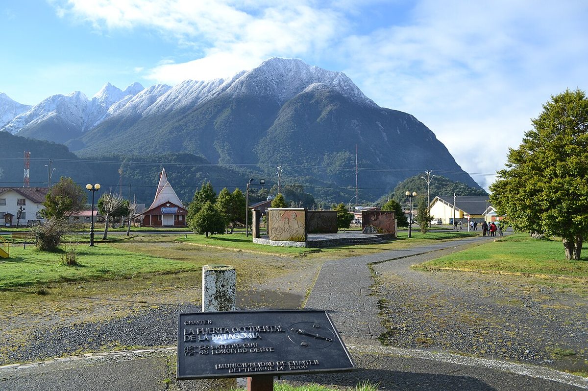
The government initially declared Chaitén uninhabitable and pushed to relocate it. The residents refused. They fought to come back and rebuild, and they did. Today Chaitén is a small, functioning, oddly moving town: rebuilt streets and a fresh waterfront alongside half-buried houses and dead grey trees still standing where the mud caught them. It hasn’t tidied the disaster away, and it’s the better for it.
For a visitor, Chaitén is the practical base for the park, especially the southern sector and the volcano trail. It has a clutch of hostels and cabins, a couple of restaurants and small shops, and a ferry port. Two honest warnings, though: there are essentially no ATMs you can rely on, and not everywhere takes cards, so arrive with cash. And it is small, so don’t expect a supermarket sweep, stock up in Puerto Montt or Hornopirén if you’re self-catering in the park.
Getting to Pumalin: the road and the famous ferry
This is the part to read twice, because the journey is the single biggest planning challenge and the place people come unstuck. How you arrive depends entirely on which sector you want and which direction you’re travelling.
From the north (Puerto Montt and Hornopirén)
If you’re starting from Puerto Montt and heading south, the northern Caleta Gonzalo entrance involves a chain of road and ferry that is genuinely part of the adventure, but has to be planned.
First you drive south to Caleta Arena and take a short ferry (around 20 minutes, frequent, cheap, no booking needed) across to Caleta Puelche. From there it’s about 60 km of road to the village of Hornopirén. And then comes the big one: the Hornopirén to Caleta Gonzalo ferry, which is the only land-based way into the northern park.
That ferry is really two sailings with a short drive between them: Hornopirén to Leptepú (around 3.5 hours), then a 10-minute drive across the isthmus to Fiordo Largo, then a second ferry to Caleta Gonzalo (around 40 minutes). Total transit is around four and a half hours, and it is spectacular, threading fjords most of the way.
Three things you must know about this ferry. It runs only in the high summer season, broadly around January and February with shoulders depending on the year, so it does not operate year-round. Sailings are limited, often just a couple a day. And you must reserve in advance through the operator, because vehicle space is finite and it fills. The booking site has a reputation for being clunky and for not releasing tickets far ahead, so check it well before your trip and again as your dates near. Treat “verify the current ferry schedule and book early” as non-negotiable. The wider Carretera Austral ferries guide goes deeper on how these crossings work.
The alternative from the north is to skip the ferry chain and take the larger Puerto Montt to Chaitén ferry (operated by Naviera Austral, around 8.5 hours, several sailings a week), which drops you at Chaitén town. From there you reach the park’s southern and northern trailheads by road. This is often the simpler choice if the Hornopirén ferry is full or not running.
If you’re already at Chaitén, or arriving by air or the Puerto Montt ferry, access is straightforward road travel. Caleta Gonzalo and the northern trails sit around 56 to 60 km north of Chaitén on the Carretera Austral, with the popular northern trailheads spread along that stretch. The southern El Amarillo entrance is about 25 km south of town. Buses run from Chaitén toward both, though infrequently and not every day, and hitchhiking is common and generally easy here, especially if you’re not a group of five with giant packs.
The honest summary: a car is a huge advantage in Pumalin, because the trailheads are strung along many kilometres of road and public transport is thin. If you don’t have one, base yourself at a campground, do the nearby trails on foot, and use buses or hitchhiking to move between sectors. For the bigger picture of doing the whole route with or without a vehicle, see the drive the Carretera Austral guide and the broader how to get to Patagonia overview.
Do you need a guide or a permit?
No. Pumalin can be visited completely independently, with no guide and no special permit. The trails are well marked and easy to follow without GPS. You’re generally asked to register your visit, and wild camping isn’t allowed, you camp at designated sites, but otherwise you’re free to wander as long as you like. Always confirm current rules with CONAF before you go, because regulations and closures shift.
Camping, the lodge and facilities
Pumalin is set up beautifully for camping, and camping is how I’d recommend experiencing it. There are around seven designated campgrounds spread along the park’s length, most with a similar simple standard: toilets, often a covered shelter with tables for cooking out of the rain, and sometimes cold showers. The donated, hand-built quality shows here too, these are some of the nicest basic campgrounds I’ve used anywhere.
In the northern sector the main sites are Río Caleta Gonzalo (right by the ferry pier), Cascadas Escondidas, Lago Negro, Lago Blanco and El Volcán. In the southern El Amarillo sector the two are Camping Grande and Ventisquero. Two former sites, Carlos Cuevas and Vuelta del Río, are now picnic-only despite still appearing on some maps, so don’t plan to sleep there.
Fees change, but as a rough guide camping in the park’s designated sites runs around CLP 6,000 per person per night, while day entry to the park is free. The privately run camping and the Lodge Caleta Gonzalo, the only indoor accommodation actually inside the park, with cosy timber cabins and an on-site café-restaurant, cost more. Hedge all of these and verify on arrival.
Two practical realities. There is essentially no electricity in the park, so charge everything beforehand (the long ferry has outlets, grab a seat near one). And in summer the biting flies (tábanos) can be relentless on warm, still days, especially near water, so bring repellent and long sleeves and make peace with them. For where to sleep along the rest of the route, the town-by-town lodging guide guide picks up where the park leaves off.
Best time to visit Pumalin
Northern Patagonia is milder than the far south, but it is wet, properly, gloriously wet, more or less always. The practical window is December to March, the summer, when temperatures are comfortable (daytime highs roughly 16–20°C), the campgrounds and café are running, and crucially the Hornopirén ferry is operating.
Within that, I’d flag a few things. January and February are the warmest and busiest, and the only months the northern ferry reliably runs, but they’re also peak fly season. November and March are quieter, often lovely shoulders, but check ferry operation carefully. April onward gets very wet and services wind down. Whatever month you choose, pack as if it will rain for days, because it might. The best time to visit Patagonia guide sets this in the wider regional context.
One mindset shift helps enormously: don’t fight the rain here, plan around it. Save the steep, ladder-heavy and viewpoint trails (Volcán Chaitén, Tronador, El Mirador) for clearer windows, and do the gentle forest walks (Los Alerces, Cascadas Escondidas, Darwin’s frog) on the grey, drizzly days, when honestly the rainforest looks its most magical anyway.
Where Pumalin fits on a Carretera Austral road trip
Pumalin is the very first great stop heading south, the gateway to the whole Carretera Austral, and how you slot it in depends on your direction.
Northbound to southbound (the classic). Most people start in Puerto Montt and drive south. In that case Pumalin is your opening act: ferry chain from Hornopirén into Caleta Gonzalo, two or three nights exploring the northern trails, down to Chaitén, then the southern El Amarillo trails, before carrying on south. From here the road delivers the Queulat hanging glacier, then deeper south the marble caves at General Carrera and eventually Patagonia National Park. It’s a natural, building sequence.
Southbound finishers. If you’ve driven up from the south and Pumalin is near the end of your trip, the logic flips: you’ll likely come up through Chaitén and do the park from there, then decide whether to tackle the northern ferry out to Hornopirén or take the Chaitén–Puerto Montt ferry to close the loop.
Either way, don’t rush it. The mistake I see is people treating Pumalin as a drive-through photo stop on the way to somewhere “more famous.” It isn’t a stop. It’s a destination, and the ferry logistics alone reward giving it real days rather than hours. To sequence the whole drive properly, the complete planning a drive down route 7 and the more detailed Carretera Austral itinerary are the right next reads, alongside the broader Patagonia itinerary planner. And if alerce forests grab you, their Argentine cousin across the border in Los Alerces National Park is worth knowing about too.
Planning Pumalin: how long, what to book, what to skip
A quick, opinionated planning summary.
How long? I’d give Pumalin a minimum of two nights and ideally three to four. One night means you’ll see Los Alerces and one other walk and leave frustrated. With three or four you can do the northern trails properly, drop down to Chaitén and the volcano, and reach the El Amarillo sector and its glacier.
What to book ahead? Really just two things, but book them seriously: the Hornopirén–Caleta Gonzalo ferry (or the Puerto Montt–Chaitén ferry) if you’re coming from the north, and any cabin at Lodge Caleta Gonzalo if you want a roof. Campgrounds are first-come and rarely full. The ferry is the make-or-break reservation.
What to skip? If you’re tight on time or weather, skip the Michinmahuida marathon and any closed trail (check Sendero Cascadas before counting on it). Don’t skip Los Alerces, the volcano trail in good weather, or simply sitting at Caleta Gonzalo watching the fjord.
What to bring? Cash (no reliable ATMs near the park), food if you’re self-catering, serious rain gear, fly repellent, and a fully charged power bank. Treat the park as genuinely off-grid, because it is.
Pumalin National Park FAQ
Is Pumalin National Park free to enter?
Day entry to Pumalin National Park is free, which is unusually generous for a park this well maintained, a deliberate legacy of the Tompkins donation. You pay only if you camp, roughly CLP 6,000 per person per night at designated sites, with the private Caleta Gonzalo camping and lodge costing more. No guide or permit is needed. Always verify current fees on arrival, as they change.
How do you get to Pumalin National Park?
From the north, drive or bus from Puerto Montt to Hornopirén, then take the summer-only Hornopirén–Caleta Gonzalo ferry, which you must book ahead. Alternatively, take the Puerto Montt–Chaitén ferry. From the south, it’s straightforward road travel: Caleta Gonzalo sits about 56–60 km north of Chaitén, and the El Amarillo entrance about 25 km south of town.
Is Pumalin National Park worth visiting?
Yes, emphatically, if you like rainforest, ancient trees and solitude. It’s still off most itineraries, so trails are quiet, and the donated infrastructure makes it easy and pleasant to explore independently. The ancient alerce groves, the fjord at Caleta Gonzalo and the scarred Chaitén volcano trail are genuinely special. If you only want big granite peaks, head elsewhere; if you want primeval forest, come.
What is the best trail in Pumalin?
For most visitors, Sendero Los Alerces is the unmissable one, a short, easy boardwalk loop through three-thousand-year-old trees. For a bigger effort with a payoff, the Sendero Volcán Chaitén climbs to a viewpoint over the 2008 eruption’s caldera through eerie ash-bleached forest. Cascadas Escondidas is the best easy waterfall walk. Choose based on weather and how much climbing you want.
What happened to the Chaitén volcano?
The Chaitén volcano erupted on 2 May 2008 after roughly nine thousand years of dormancy, sending ash nearly twenty kilometres up and forcing the evacuation of Chaitén town. Lahars then rerouted the Río Blanco straight through the town, destroying much of it. Residents later fought to rebuild, and today you can hike the Sendero Volcán Chaitén up to the still-steaming caldera.
Do you need a guide for Pumalin National Park?
No. Pumalin is designed for independent visits, with well-marked, easy-to-follow trails that don’t require a guide, permit or GPS. You’re generally asked to register your visit, and camping is limited to designated sites rather than wild camping. This independence is part of the park’s appeal. Confirm current regulations with CONAF before your trip, since rules and trail closures can change between seasons.
Where should you stay to visit Pumalin?
Inside the park, camp at one of the designated campgrounds, Río Caleta Gonzalo and Cascadas Escondidas are great northern bases, or book a cabin at Lodge Caleta Gonzalo for the only indoor option. Outside, the town of Chaitén has hostels, cabins and restaurants and is the natural base for the southern sector and the volcano trail. Bring cash, as ATMs are unreliable.
When is the best time to visit Pumalin National Park?
December to March is the practical season, with comfortable temperatures, open facilities and, critically, the operating Hornopirén ferry. November and March are quieter shoulders but verify ferry operation. Expect rain in any month, this is temperate rainforest, and brace for biting flies in midsummer. Plan steep viewpoint hikes for clear days and gentle forest walks for the wet ones.
Final thoughts
Pumalin is the park that made me slow down. After the rush to “get to Patagonia,” it asked me to sit at a fjord, walk quietly under thousand-year-old trees, and accept that I’d be damp for a few days. I’m grateful it did.
It’s also a place with a story you can feel in every hand-built step and every careful sign: a forest someone bought, protected and gave back to a country, now the northern gateway to the whole Route of Parks. Knowing that, you walk it differently.
My honest advice: give it real time, sort the ferry early and treat it as the immovable piece of your plan, bring cash and rain gear, and do the gentle forest trails in the rain and the climbs in the clear. Do that and Pumalin won’t be a stop on the way to somewhere better. It’ll be one of the reasons you remember the Carretera Austral at all.
Then check the current ferry schedule, fees and trail closures before you go. Those are exactly the details that shift between seasons, and one official update can save you a very long, very wet detour.