O Circuit Patagonia Guide: Route, Campsites, Permits and Difficulty
Plan the O Circuit Patagonia loop: day-by-day route, the anticlockwise rule, John Gardner Pass, campsites and operators, permits, season and difficulty.
By Patagonia Tourism Guide · First published 27 Jul 2026 · Updated 1 Aug 2026
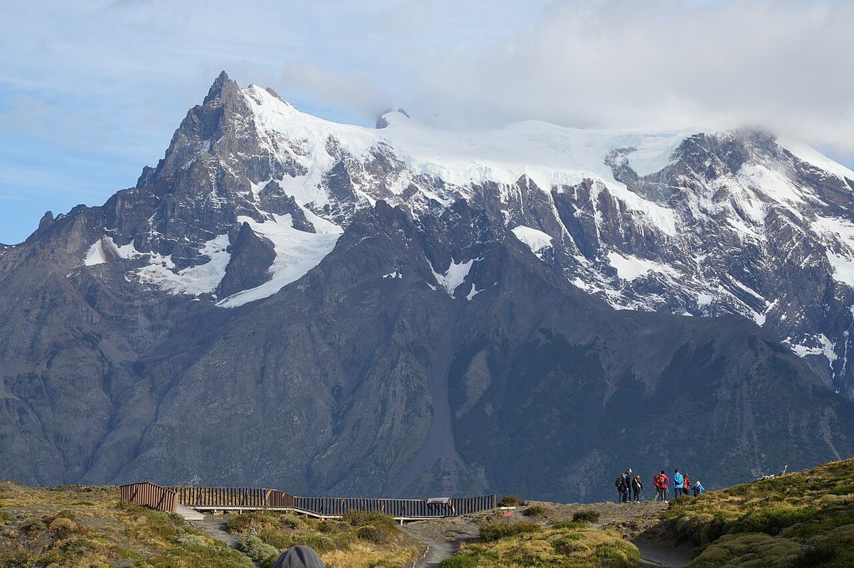
0 — 2 km Fig. 1 · A hiker on John Gardner Pass above the Grey Glacier, the high point of the O Circuit Patagonia loop in Torres del Paine · Photo: Marcosleal / CC BY-SA 4.0 via Wikimedia Commons
The first time I stood at the top of John Gardner Pass, I could not feel my fingers and I did not care. The wind was trying to take my hood off my head, and below me the Grey Glacier just kept going, a frozen river so wide it stopped looking like ice and started looking like weather. That moment is the whole reason people walk the backside of the Paine Massif instead of stopping at the W.
The O Circuit Patagonia route is the full loop around the Cordillera del Paine in Torres del Paine National Park, Chile. It is roughly 110 to 130 km over about 7 to 9 trekking days, walked in a mandatory anticlockwise direction. It includes the entire W Trek plus the quiet, remote northern side and the high crossing of John Gardner Pass. It is harder, longer, and less forgiving than the W, and it is worth it for the right hiker.
This guide is for the person who has already half-decided to do the full circuit and now wants the honest version: the day-by-day shape, the campsite chain and who runs what, how booking actually works, the permits, the season, and a straight answer about whether you should attempt it at all.
Here is the whole loop in one table. These are planning numbers, not promises. Distances, hours, and which camps are open all shift between sources and seasons, so treat everything as “around” and confirm against current operator and CONAF information before you build a schedule.
Day
Sector to sector
Approx distance
Approx hours
Sleep
Notes
1
Central/Las Torres to Serón
~13 km
~3-4 h
Serón
Gentle start; the only weight is your full pack and a week of food
2
Serón to Dickson
~18 km
~6 h
Dickson
One exposed, windy pass; otherwise rolling; lake and glacier views
3
Dickson to Los Perros
~12 km
~4.5 h
Los Perros
Short; the climb begins; hanging glacier and lagoon
4
Los Perros to John Gardner Pass to Grey
~15 km
~8-9 h
Grey
The big day; the pass and a long, steep descent
5
Grey to Paine Grande to Frances
~18-19 km
~6.5 h
Frances (or split at Paine Grande)
Rejoin the W; suspension bridges; Grey Glacier
6
Frances to Cuernos to Chileno/Central
~18-19 km
~6 h
Chileno or Central
Optional French Valley side trip with a light pack
7
Chileno to Mirador Las Torres to exit
~14 km
~5.5 h
Puerto Natales
Sunrise option at the towers, then the bus out
Swipe to see all columns
Table 1
That is the classic seven-day shape. Plenty of people add a night at Paine Grande to split the long Grey-to-Frances day, which turns it into eight or nine days and gives you room for the French Valley. A fit minority compress it into six. I would lean longer, not shorter, and I will explain why in the difficulty section.
What the O Circuit Actually Is
The O is the circular trek around the entire Paine Massif. The W Trek covers the three southern valleys and makes a W shape on the map. The O takes that same W and wraps it into a closed loop by adding the northern, backside sectors that most park visitors never see.
So the O is not a different trail from the W. It contains the W. If you walk the O, you walk the W too, plus a remote arc through Serón, Dickson, Los Perros, and over John Gardner Pass before you drop down to Grey and rejoin the familiar route. That is the single most useful thing to understand: you are not choosing between two treks, you are choosing whether to add the harder, quieter half.
The numbers float depending on who measured and where they started. Swoop Patagonia calls it 112 km over seven days. Stingy Nomads logged 120 km. The Packable Life puts it nearer 123 to 126 km. Other guides round to 130 km. The honest range is around 110 to 130 km, and the reason it matters less than you think is that the distance is rarely the hard part. The terrain, the weather, the pack, and the one big pass are what you will remember.
The reward for the extra effort is solitude and scale. The backside is genuinely quiet. You trade the social, well-serviced W for forest, river valleys, a couple of hanging glaciers, and a high pass that opens onto the Southern Patagonian Ice Field. As the parent pillar puts it, the O is not just “more W.” It is a different commitment.
The Route and the Mandatory Anticlockwise Direction
You do not get to choose your direction on the O. The backside is walked anticlockwise, full stop. The official park reservation page spells out the order: Serón, then Dickson, then Los Perros, then Paso. The booking systems are built around it, and rangers enforce it.
The reason is John Gardner Pass. Swoop Patagonia explains it cleanly: the circuit is done anticlockwise because the pass is considered too steep to hike from the opposite direction. Going the standard way, you climb to the pass from Los Perros on a long but manageable gradient, then descend the brutally steep western side toward Grey. Reverse it and that steep side becomes a dangerous, scrambling climb. Anticlockwise keeps the worst slope as a controlled descent rather than an exposed ascent.
So the shape of every O Circuit Patagonia itinerary is the same skeleton:
Start at Central, near the Hotel Las Torres and the Laguna Amarga entrance.
Head north up the quiet eastern arm to Serón.
Continue to Dickson, then Los Perros, climbing into the mountains.
Cross John Gardner Pass and descend to Grey.
Follow the W westernmost arm to Paine Grande.
Walk the French Valley and the Cuernos sector toward Central.
Finish with Base Torres, then exit by bus.
You can technically start at Paine Grande or Grey instead of Central if you arrive by catamaran, then loop around and finish back at the lakeshore, but the backside still goes anticlockwise. Most people start and end at Central because the logistics are simplest. Whatever you do, do not fall in love with a custom direction. The only legal way around the back is one way.
This is the part you are really paying for, and it is the part most first-timers underestimate. The backside is not a warm-up for the W. It is the heart of the O.
Serón
The first day from Central to Serón is the easiest walking of the whole trek, around 13 km of open, rolling pampa along the Paine River with guanacos and a lot of sky. The catch is that this is also the day your pack is heaviest, loaded with a full week of food and gear. People who train with a light daypack and then shoulder 15 kg here get a rude lesson in the first three hours. Serón itself is a calm, grassy camp run by Las Torres Patagonia, often windy by afternoon.
Dickson
Serón to Dickson is around 18 km and about six hours, and it includes one short, exposed pass that is notorious for wind even though the climb itself is mild. You register at the Coirón ranger station partway, where staff check your passport and your bookings. Then the trail drops to Dickson, a stunning camp on the shore of a glacial lake with the Dickson Glacier across the water. It is one of the most beautiful places to pitch a tent in the park, and it is run by Vértice Patagonia.
Los Perros
Dickson to Los Perros is short, around 12 km and four and a half hours, and it is where the trek starts to climb in earnest. You gain elevation steadily through forest to reach the Los Perros camp, set near a hanging glacier and a milky glacial lagoon. It is colder, rougher, and more exposed than Dickson, and it sits at the foot of the pass. Most people stop here specifically to tackle John Gardner Pass fresh the next morning, which is exactly the right call.
By the time you leave Los Perros you have done the quiet half and you have not yet joined the crowds. That contrast, empty backside then busy W, is one of the defining features of the loop.
John Gardner Pass
If the O has a single defining moment, this is it. John Gardner Pass is the high point of the circuit at around 1,200 m, sometimes cited at 1,241 m. It does not exist on the W at all, which is part of why the loop is a step up. The pass is named after John Garner, a member of the 1957 to 1958 British Chilean university expedition that mapped much of the then little-known Paine Massif.
Here is the honest shape of the day. You leave Los Perros early, ideally by 7 or 8 am, and climb steadily for roughly 600 to 900 m. The Las Torres blog describes the ascent as continuous but not technical, and that matches my memory: it is a grind, often into a headwind, but it is walking, not climbing. You top out, the Grey Glacier and the ice field appear below you, and it is genuinely one of the great views in Patagonia.
The descent is the part people warn you about, and they are right. The western side falls away fast. You lose well over a thousand meters, by some accounts close to 4,000 feet in only a few kilometers, on a steep, rooty, often muddy trail through forest. It is hard on the knees and slippery in the wet. Trekking poles are not optional here. The descent, not the climb, is where most people are physically tested.
Two safety realities matter. First, the pass is exposed and the wind can exceed 100 km/h. On dangerous days, rangers will not let you go over, and you wait. Second, you want to be through the high checkpoint before mid-afternoon, so an early start is non-negotiable. Bring a windproof shell, a warm hat, and gloves to the top even if Los Perros looked calm at dawn. The weather changes in minutes up there.
Campsites, Refugios and Which Operator Runs What
On the O, your itinerary is not abstract. It is a chain of reservations, and that chain runs across two different companies with two different booking systems. You will deal with both.
Operator
Sectors they run
Rough style
Vértice Patagonia
Dickson, Los Perros, Grey, Paine Grande
Simpler, generally cheaper camps; the backside
Las Torres Patagonia (Fantástico Sur)
Central, Serón, Frances, Los Cuernos, Chileno
Pricier camps and refugios; the W side and the first leg
Swipe to see all columns
Table 2
A few things about this that trip people up:
The two systems do not talk to each other. You book Vértice sectors on the Vértice site and Las Torres sectors on the Las Torres site, then stitch the dates together yourself. Getting one operator booked and assuming the other will fit is how people end up with a broken itinerary.
Dickson, Los Perros and Grey are booked together on Vértice. The booking engine for the O will not let you reserve just one of them. This is a deliberate constraint that keeps you moving through the backside chain in order, and it surprises a lot of first-time bookers.
Some camps are closed in some seasons. Recent trip reports list the old free camps such as Italiano, Paso, and the basic Torres camp as closed, so practical itineraries now lean on paid camps only. The historic free CONAF camps shut down and have not reliably reopened. Always check current openings.
Products vary wildly. “Camping” might mean a bare patch where you pitch your own tent, or a fully equipped pre-set tent, or a dorm bed in a refugio. Meals can be self-catered, bought à la carte, or booked as full board. Read exactly what each reservation includes before you pay. The mechanics are the same as on the W, and the W Trek refugios guide breaks the accommodation types down in more detail.
Aggregator services and tour operators will book both systems for you for a fee, or sell a guided package. That can be worth it if the two-system shuffle stresses you out, your dates are tight, or you would rather not own the logistics. Prices change every season and between camps, so I am not going to quote you a number that will be wrong by the time you read this. Use the Patagonia trip cost and budget guide to frame the budget, and verify current rates directly with each operator.
There is no special climbing permit for the O, but there is a hard rule that catches people out: you cannot enter the mountain area without confirmed accommodation bookings for every night. The official park site states it plainly. No reservations, no entry to the trek. That is the real permit.
Here is what you actually need:
A park entrance pass, bought online at least 24 hours before you arrive via Pases Parques. Bring it as a QR code on your phone or printed.
Accommodation reservations for every night, across both operators, printed or on your phone.
Your passport, and the migration card you receive on entering Chile.
You register and show all of this at the Laguna Amarga entrance, and again at the Coirón ranger station on the backside. Rangers check bookings and ID at these points, so keep everything accessible and keep offline copies.
On fees, the official 2025 tariff for a foreign visitor staying more than three days, which is every O hiker, was CLP 48,500, roughly US$50. National adult rates are lower. Fees are revised yearly, so confirm the current number before you travel. For the full ticketing picture, see the Torres del Paine tickets guide.
A few standing rules worth repeating: you may camp only at designated, reserved sites, wild camping is not allowed anywhere in the park, open fires are banned, and camping stoves are permitted only at campsites. Some camps further restrict stove use during high fire-risk periods, so check at each reception.
Season and Closures
The O Circuit is a summer route. The realistic season runs from around November 1 to March 31. The backside camps open in early November, and the pass closes for winter, roughly April to September, because of snow and avalanche risk. The Las Torres blog is explicit that John Gardner Pass is shut to the public in the winter months. Swoop confirms the whole O closes in winter while only the W stays open, and only for guided groups.
Inside the season, the tradeoffs are familiar Patagonia tradeoffs. December through February brings the warmest temperatures and the longest daylight, but also the most wind and the biggest crowds, with late December and early January the busiest stretch. February tends to be the least windy and least rainy of the summer months, which is why a lot of experienced hikers quietly target it despite the crowds. November and March are quieter and carry beautiful light, but you trade that for more weather risk and a higher chance of a cold, wild day on the pass. The best time to hike Patagonia breaks the months down further.
One current, date-specific note. A CONAF notice checked on May 26, 2026 listed the O Circuit closure as advanced through October 31, 2026, with visitors directed to winter activity regulations, alongside an authorized-guide requirement for Base Torres and a closed W mountain circuit in June and July. Those details are specific to this season and will change. Do not copy them blindly for a future year. Treat them as proof that rules move, especially in shoulder and winter periods, and verify current dates with CONAF and the operators before you commit. If you are even thinking about the edges of the season, read Torres del Paine in winter first.
How the O Differs From and Is Harder Than the W
People love to ask which trek is harder, and the answer is genuinely simple: the O, because the O is the W plus more. Every difficulty the W throws at you, the O throws too, and then it adds the backside and the pass.
The common shorthand is that the W has about two hard days and the O has about three. The O runs roughly 7 to 9 days against the W’s 4 to 5, around 110 to 130 km against 70 to 80 km, and 6 to 9 hours of walking a day against 5 to 8. But the real differences are not just the totals:
Remoteness. The backside has far fewer people, fewer services, and fewer ways out. On the W you are rarely far from a refugio or a boat. On the backside, once you are committed to the pass, there is no easy bailout.
Camping dependence. The O leans harder on camping, especially on the quiet northern sectors where the camps are more basic. Resupply only really exists on the W side.
The John Gardner Pass. This is the headline. A 1,200 m crossing with a punishing descent and real weather exposure has no equivalent on the W, whose high point is the Base Torres viewpoint at around 850 to 900 m.
A stricter season and tighter logistics. The two-operator backside chain and the winter pass closure leave less room for error than a flexible W.
I want to be clear that this is not about toughness as a personality trait. The W is a superb trek and the right choice for most first-time Patagonia hikers. The O is the right choice when you specifically want the extra days, the solitude, and the commitment. For an honest, segment-by-segment breakdown of what makes the shared sections hard, the W Trek difficulty guide does the heavy lifting, and the W Trek itinerary lays out the southern arms day by day so I do not have to repeat them here.
If you have read up on the W, your kit is most of the way there. The O just asks for a bit more of everything, because you are out longer, higher, and more remote. The full clothing and safety checklist lives in the layering and food plan for the w and the broader gear choices for wind and rain, so here I will only flag what changes for the loop.
What the O demands more of:
A proper windproof and waterproof shell, warm hat, and gloves you can rely on at the pass. This is the day your rain gear earns its place. Carry it to the top even on a calm morning.
Trekking poles. The descent from John Gardner Pass to Grey is steep, long, and slippery. Poles save your knees and your footing.
A pack that genuinely fits a multi-day load. Swoop benchmarks around 10 to 15 kg for the loop. On a self-supported camping O you may carry more.
More food, planned more carefully. Resupply is essentially a W-side luxury. Across the backside you carry what you eat, or you pre-book meals at the camps that offer them. Many people buy dehydrated meals in Puerto Natales for the remote nights.
On food strategy, the same logic as the W applies, just stretched over more days: full board lightens your pack and costs more, carrying your own is cheaper but heavier, and a hybrid often wins. The W Trek food guide covers the meal-versus-carry math in detail. Drinking water is generally available from streams along the route and is widely reported as good quality, but carry capacity for the dry, exposed stretches like the run toward Serón.
Who Should and Shouldn’t Attempt It
This is the section I wish more O Circuit pages were honest about. The loop is not a trophy to collect because it sounds more impressive than the W. It is a real backcountry trek, and it punishes people who took it on for the wrong reasons.
Do the O Circuit if:
You have around 7 to 9 trekking days, plus a buffer for weather and a recovery night in Puerto Natales.
You can comfortably walk roughly 15 to 20 km on uneven ground and back it up the next morning, repeatedly.
You have some multi-day hiking experience and are comfortable with camping or supported camping.
You are genuinely fine with remoteness, basic camps, and the fact that your next bed is always ahead of you.
You can book the full backside and W chain across both operators, or you are happy to pay someone to do it.
Think hard, or choose the W instead, if:
This is your first multi-day trek and you have not trained with a loaded pack.
Long, steep descents wreck your knees. The drop off John Gardner Pass is unforgiving.
You are very wind- or cold-averse, or anxious about being far from help.
Your dates are tight and the only way to fit the loop is to compress it dangerously.
If you are close but not quite there, you have good middle options. Go guided, which removes the logistics and adds a safety margin, especially valuable for the remote backside. Choose supported camping with meals to lighten your pack. Build the schedule conservatively, with an extra night, rather than cramming it into six days. Or do the W now, get strong, and come back for the O. The honest decision-making framework for all of this sits in the parent W Trek and O Circuit guide. And if the loop turns out not to fit your trip at all, the W Trek alternatives guide covers day hikes and shorter options that still get you the scenery.
Safety on the Backside
Patagonia weather is not background information on the O. It is an active participant, and the backside raises the stakes because help is further away. CONAF reminds visitors that Torres del Paine is a protected wild area where mountain assistance can take several hours. On the loop, take that literally.
The habits that matter most here:
Check CONAF notices and the forecast before you start, and ask rangers at each checkpoint. Conditions on the pass can differ wildly from the valleys.
Start the pass day early and accept a rest day if rangers close the crossing. A closed pass is a safety decision, not an inconvenience.
Do not let your reservations push you into a bad call. The hardest psychological trap on a booked trek is that your next camp is ahead of you. Build conservative days, and be willing to wait out weather even when it costs you a night.
Carry layers, poles, a headlamp, offline maps, a power bank, and blister care, and keep your bookings and ID accessible.
Stay on marked trails, camp and cook only where permitted, and give wildlife space.
The single best safety upgrade for most people is a realistic schedule and an honest assessment of their own fitness and experience, made before they leave home rather than at the foot of the pass.
Most hikers plan around 7 to 9 trekking days for the O Circuit, plus a preparation night in Puerto Natales before and ideally a recovery or buffer night after. A fit minority compress it into six, and some take ten to add a Paine Grande night or a full French Valley day. The exact length depends on current camp openings and availability.
How long is the O Circuit in kilometers?
The O Circuit is around 110 to 130 km, depending on who measured and exactly where they started and finished. Swoop Patagonia cites about 112 km, Stingy Nomads logged 120 km, and other guides round to 130 km. The distance is rarely the hardest part. The terrain, the weather, the pack weight, and John Gardner Pass shape the difficulty far more than the kilometers.
Why is the O Circuit walked anticlockwise?
Because John Gardner Pass is too steep and dangerous to descend the other way. Walking anticlockwise, you climb the pass on a long, manageable gradient from Los Perros and descend the steep western side toward Grey. Reverse it and that steep slope becomes a hazardous climb. The official park rules require the backside order of Serón, Dickson, Los Perros, then Paso, and bookings enforce it.
How hard is John Gardner Pass?
It is the toughest day on the O. The high point is around 1,200 m. The ascent from Los Perros is steady and not technical, often into strong wind. The real test is the descent to Grey, which loses well over a thousand meters on a steep, slippery, rooty trail. Winds can exceed 100 km/h, and rangers close the pass on dangerous days.
Do you need a guide for the O Circuit?
No, the O can legally be hiked self-guided by prepared, experienced trekkers with reservations and the right gear, and many people do exactly that. Some operators, such as Swoop, will not support self-guided O treks because of the remote northern sector and recommend going guided. A guide adds safety, logistics, and local knowledge, which can be worth it on the backside.
When is the O Circuit open?
The O Circuit season runs roughly from November 1 to March 31. The backside camps open in early November, and John Gardner Pass closes for winter, around April to September, due to snow and avalanche risk. Only the W Trek stays open in winter, and only for guided groups. Dates shift year to year, so verify the current season with CONAF and the operators before booking.
How do you book the O Circuit campsites?
You book across two systems. Vértice Patagonia runs Dickson, Los Perros, Grey, and Paine Grande, while Las Torres Patagonia runs Central, Serón, Frances, Cuernos, and Chileno. On the Vértice O flow, Dickson, Los Perros, and Grey must be booked together. Reservations for every night are mandatory, or you will not be allowed into the mountain area. Book months ahead for the summer season.
Is the O Circuit harder than the W Trek?
Yes. The O includes the entire W Trek and adds the remote backside and John Gardner Pass, so it is longer, more weather-exposed, and more committing. The W has roughly two hard days and the O about three, over 7 to 9 days instead of 4 to 5. The O is not simply more W. It is a genuinely bigger undertaking that asks for more fitness, experience, and tolerance for remoteness.
Final Thoughts
The O Circuit is the most rewarding way to experience Torres del Paine, and it is also the one most likely to humble you. The backside is quiet and beautiful in a way the W never quite is, and the view from John Gardner Pass is the kind of thing you remember for years. But the loop earns its reputation honestly: longer days, basic remote camps, a strict anticlockwise rule, a two-operator booking puzzle, and one genuinely hard pass with a descent that tests your knees and your nerve.
If you have the days, the legs, and a real appetite for the remote side, book early, build a conservative schedule, and go. If you are not quite there yet, do the W, get strong, and come back. Either way, the right trek is the one that lets you enjoy the park instead of fighting your own expectations for a week. When you are ready to lock in dates, return to the Torres del Paine W Trek and O Circuit guide and the Puerto Natales travel guide to stage the trip properly, and think about how to get to Patagonia before you commit flights.