Plan a Ruta 40 Patagonia road trip section by section: paved and gravel stretches, the 73 Malditos closures, distances, detours and where to check the road.
By Patagonia Tourism Guide · First published 20 Oct 2026
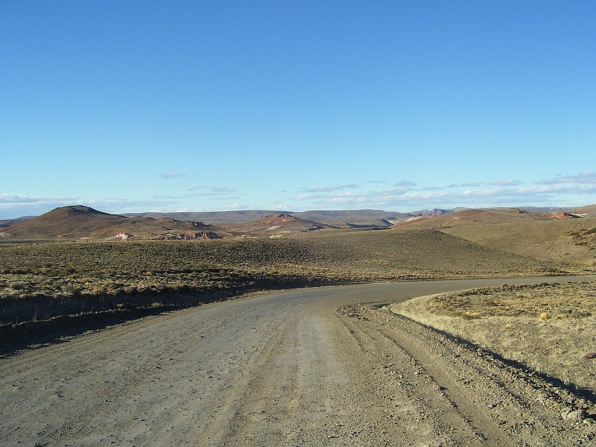
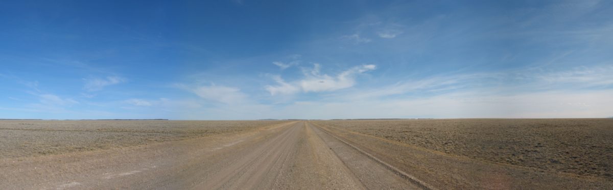
0 — 2 km Fig. 1 · A gravel stretch of Ruta 40 curving across the dry steppe of Santa Cruz province under a clear sky · Photo: Oscar871217 / CC BY 3.0 via Wikimedia Commons
A Ruta 40 Patagonia road trip in 2026 is mostly a long drive on asphalt, with the Andes on your left or right depending on which way you are heading, guanacos on the verges and very little in between the towns. The road is paved almost end to end from Bariloche down to the El Calafate turn-off. The exception that shapes every trip is a stretch of about 73 km of gravel in Santa Cruz, between Tres Lagos and Lago Cardiel, known locally as the “73 Malditos”. In early October 2026 the province closed it to all vehicles after rain, and it is the one part of the route you cannot plan from home.
This page takes the Patagonian half of Ruta Nacional 40 apart section by section, from kilometre zero at Cabo Vírgenes north to the Mendoza border. For each stretch you get the surface, the rough distances, where the towns are, the detours worth the extra kilometres and the problems the road agencies reported in 2026. It also tells you where to check the road on the morning you drive it, which matters more on this route than any itinerary.
Road status, distances and park fees were checked in October 2026 against Vialidad Nacional, Santa Cruz’s road agency (AGVP), the national parks service and the provincial and municipal tourism offices. Distances are approximate and rounded.
If you are still deciding whether to drive Patagonia at all, or how to fit a border crossing into the trip, start with the wider guide to planning a Patagonia road trip. This page assumes you have already settled on Argentina’s Route 40 and want to know what the road is actually like.
Road status in October 2026: three things to know before you go
Three stretches of the Patagonian RN40 had problems reported in the second half of 2026. None of them stops the trip, but each changes how you plan it.
The 73 Malditos (Santa Cruz). On 28 September 2026 Santa Cruz’s provincial road-safety agency restricted traffic for all vehicles between Gobernador Gregores and Tres Lagos after rain, mud and standing water. On 5 October 2026 the provincial road-safety undersecretary, María Sanz, told local press the stretch was impassable again and would stay shut until further notice. Check its status with AGVP Santa Cruz and Vialidad Nacional on the morning you leave Tres Lagos or Gregores, and keep a spare day in hand.
Facundo to Los Tamariscos (Chubut). A paved section between Río Mayo and Gobernador Costa has broken up so badly that Vialidad Nacional runs traffic on gravel detours around it, between km 1,433 and km 1,467. Vialidad’s Chubut report for 6 October 2026, as carried by Canal 12, still showed a muddy gravel detour with a 60 km/h limit.
The Seven Lakes (Neuquén). A landslide closed RN40 near San Martín de los Andes on 30 July 2026. Vialidad reopened it with assisted traffic from 31 July, and on 8 August restored traffic between the RN231 junction and Río Hermoso with ice, snow and compulsory chains, trucks still restricted. The episode is a reminder that mountain stretches can shut at short notice, so check on the day.
Ruta 40 Patagonia road trip at a glance
Ruta Nacional 40, “la 40” to Argentines, runs the length of the country from Cabo Vírgenes, on the Strait of Magellan in Santa Cruz, to the Bolivian border at La Quiaca. Visit Argentina, the national tourism body, gives its length as 5,194 km. Vialidad Nacional places kilometre zero at Cabo Vírgenes, so the kilometre posts count upward as you drive north, which is useful: a post reading 1,450 tells you that you are in central Chubut, a long way from anywhere.
The Patagonian part runs through four provinces, Santa Cruz, Chubut, Río Negro and Neuquén, and well over 2,000 km of the road lies within them. It ends, for the purposes of this guide, at Barrancas on the Río Colorado, where Neuquén meets Mendoza.
The single most useful thing to grasp before you look at a map is that RN40 does not actually go into most of the places people drive it for. It passes the junctions for them. El Calafate is 32 km west of the road. El Chaltén sits about 90 km up its own paved access road. Perito Moreno National Park, Cueva de las Manos, Los Antiguos and Los Alerces are all detours, some of them on gravel. A Ruta 40 trip is really a spine with ribs, and the ribs are where most of your time goes.
Here is the spine, south to north, with the surface as Vialidad Nacional and AGVP Santa Cruz reported it in 2026.
Section
Approx. length
Surface
Known issues in 2026
Cabo Vírgenes to Río Gallegos (on RP1 and RN3)
~127 km
Mostly gravel on RP1
Dead-end detour, no services on RP1
Río Gallegos to Río Turbio
~260 km
Paved except about 125 km of gravel: 78 km Bella Vista to Puente Blanco and 47 km Puente Blanco to Turbio Viejo
Mud on the gravel in AGVP’s August 2026 report
Río Turbio to Tres Lagos (El Calafate and El Chaltén junctions)
~440 km
Paved
Winter frost, potholes and patching crews
Tres Lagos to Lago Cardiel (“73 Malditos”)
~73 km gravel within ~110 km
Gravel
Closed to all vehicles after rain on 28 Sep and again on 5 Oct 2026; 4×4 only with chains in AGVP’s August 2026 report
Lago Cardiel to Gobernador Gregores to Perito Moreno town
~410 km
Paved
Potholes and frost in winter
Perito Moreno town to Esquel
~538 km
Paved, except gravel detours between Facundo and Los Tamariscos
60 km/h limit and mud on the detour (6 Oct 2026)
Esquel to Bariloche
~290 km
Paved
Nothing out of the ordinary
Bariloche to Zapala (Seven Lakes)
~436 km
Paved
Landslide closure 30 Jul 2026, since reopened; chains in winter
Zapala to Barrancas
~336 km
Paved
Winter weather on the northern passes
Swipe to see all columns
Table 1
Lengths are approximate and rounded; the kilometre posts and your odometer will disagree with each other by a few kilometres on every section. For a wider picture of where these towns sit in relation to the parks and the Chilean side, the Patagonia map is the page to keep open alongside this one.
Is Ruta 40 paved? The 2026 gravel map
Most of what has been written about Ruta 40 describes a gravel adventure road. In Patagonia that road is largely gone. Between Bariloche and the El Calafate junction you will drive on asphalt for all but about 73 km, plus the Chubut detours. What gravel remains falls into four places, and only two of them are on the route most visitors drive.
The 73 Malditos: Tres Lagos to Lago Cardiel
This is the one that matters. AGVP Santa Cruz breaks the stretch north of Tres Lagos down like this: 37 km of pavement from Tres Lagos to Estancia La Lucía, then 44 km of gravel to the junction with RP73, then another 29 km of gravel to the Lago Cardiel junction, and then 65 km of pavement on to Gobernador Gregores. Those two gravel pieces add up to the 73 km that gives the stretch its nickname.
The surface is the problem. It is a clay-heavy gravel that turns to mud and standing water after rain, and once it dries it is left rutted. Late September 2026 is a good example: rain, mud and poor visibility were the reasons Santa Cruz’s road-safety agency gave for closing it on 28 September. When the closure came back a week later, undersecretary Sanz said closures like this happen all the time, not only in winter, and that the lasting repair is not her agency’s to make and rests with the road agencies.
In winter it gets stricter. AGVP’s August 2026 report listed both gravel segments as open to four-wheel-drive vehicles only, with snow on the road and chains compulsory.
Why is it still gravel? Vialidad Nacional’s own May 2023 news release describes the paving contract as awarded, covering 75.7 km “que actualmente son de ripio” (currently gravel) between km 791.68 and km 864. As of October 2026 it is still gravel. In February 2025 AGVP began re-gravelling the carriageway as a stopgap; its president told Señal Calafate at the time that it was not a definitive solution. Plan as though it will still be gravel when you arrive, and treat a paved surface as a pleasant surprise.
The Chubut detour: Facundo to Los Tamariscos
Technically, Perito Moreno town to Esquel is all paved. Practically, there is a section in the middle of Chubut, between km 1,433 and km 1,467, where the asphalt has broken up and Vialidad Nacional has routed traffic onto gravel detours, about 14 km and 13 km long, either side of a patched section of roughly 7 km. Vialidad’s 13th District reported improvement work on the detour in January 2025. Even so, the report for 6 October 2026 described it as wet and muddy, asked for extreme caution and set a maximum of 60 km/h. Allow extra time between Río Mayo and Gobernador Costa and check Vialidad’s Chubut report before you set off.
The far south: Río Gallegos to Río Turbio, and the road to Cabo Vírgenes
West of Río Gallegos, RN40 runs up the Gallegos valley towards Río Turbio and the Chilean border. AGVP’s report of 9 August 2026 listed 47 km of gravel between Puente Blanco and Turbio Viejo and another 78 km between Bella Vista and Puente Blanco, about 125 km in all, more than the 73 Malditos. Check AGVP before you commit to this leg in wet weather. The road to kilometre zero at Cabo Vírgenes is a provincial gravel road, RP1, covered below.
Most people never drive either of these. If you are heading from El Calafate to Puerto Natales, the guide to travelling between Puerto Natales and El Calafate covers the crossings that actually make sense for that trip.
How you drive gravel, wind and long empty stretches is a separate subject, and the driving in Patagonia guide covers speed, tyres, windscreens and trucks. The short version for the 73 Malditos: slow down well before the surface changes, keep out of the deepest ruts, and do not try it in a low hire car straight after rain.
Ruta 40 section by section, south to north
The kilometre posts run from south to north, so this guide does too. If you are driving north to south, read it from the bottom up; the sections work the same way in reverse.
Section 1: Cabo Vírgenes, kilometre zero, and Río Gallegos
Kilometre zero is at the Cabo Vírgenes lighthouse, on the Strait of Magellan at the far south-eastern tip of Santa Cruz. You will not reach it on RN40, though. Vialidad’s own alignment has no built road between Cabo Vírgenes and Punta Loyola, near Río Gallegos, so the drive to the zero post is on the provincial road, RP1, which leaves RN3 south of Río Gallegos and is mostly gravel.
Allow a full day out and back from Río Gallegos, about 127 km each way. There are no towns on RP1, so leave Río Gallegos with a full tank. The draw, besides the photo at the post, is the Magellanic penguin colony at Cabo Vírgenes, which is a provincial reserve; check its season and visiting arrangements with Santa Cruz’s tourism office before you drive down, and see the penguins in Patagonia guide for how it compares with the other colonies. Punta Dungeness, at the Chilean border, is a few kilometres further on.
Be honest with yourself about this one. If kilometre zero matters to you, it is a satisfying start. If it doesn’t, nobody will think less of a Ruta 40 trip that begins at El Calafate.
Section 2: Río Gallegos to Río Turbio
From Río Gallegos the road heads west through Güer Aike and Bella Vista towards Río Turbio, on the Chilean border. This is the leg with the most gravel left on the main route (see above), and services are sparse: it is about 250 km from Río Gallegos to 28 de Noviembre, near Río Turbio.
Most travellers bound for El Calafate from Río Gallegos skip it and take the paved provincial road, RP5, from Güer Aike to La Esperanza, where it rejoins RN40. Visit Argentina puts Río Gallegos to El Calafate at about 300 km. The Río Turbio leg mostly matters if you are linking the trip with Puerto Natales and Torres del Paine. Río Turbio is close to Puerto Natales, and the border crossings in this corner, including Dorotea and Río Don Guillermo (Cancha Carrera), are covered in the Chile–Argentina border crossings guide. Before you take an Argentine rental car into Chile, read up on the cross-border permit for rental cars; without it you will be turned around at the post.
Section 3: Río Turbio to Tres Lagos, the El Calafate and El Chaltén section
This is the stretch most people picture when they think of Ruta 40: open steppe, a wind that never quite stops, and the ice-capped Andes appearing on the western horizon as you come north. It is paved all the way, about 440 km, though AGVP’s winter report flagged frost, potholes and road crews at several points, including Tapi Aike, La Esperanza, Cuesta de Miguez and both the El Calafate and El Chaltén junctions.
Going north from Río Turbio, the main waypoints are Tapi Aike (about 80 km), La Esperanza (about 175 km, where RP5 comes in from Río Gallegos), El Cerrito, and then the long descent of the Cuesta de Miguez to the Santa Cruz river. After the bridge comes Río Bote and the junction for El Calafate, 32 km to the west. The road then crosses the La Leona river, passes the El Chaltén junction and reaches Tres Lagos about 440 km from Río Turbio.
One warning: between Tapi Aike and La Esperanza there is an older, gravel alignment of the road, now a provincial road (RP7). Some GPS apps still route you onto it. Stay on the paved RN40 unless you want the gravel deliberately.
The stops on this section are the reason many people drive Ruta 40 at all.
El Calafate and the Perito Moreno Glacier. The glacier is 80 km from El Calafate on RP11, about 90 minutes by car, and visitors can come all year. Los Glaciares National Park’s daily pass for foreign visitors has been ARS 50,000 since 1 June 2026. The El Calafate and Perito Moreno Glacier guide covers the town, and how to visit the Perito Moreno Glacier covers the walkways, boats and ice treks.
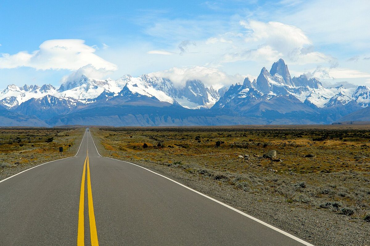
El Chaltén. About 90 km up a paved road from its RN40 junction, and about 215 km from El Calafate. If you are coming from El Calafate rather than driving straight through, getting from El Calafate to El Chaltén compares car, bus and transfer, and hiking around El Chaltén is the trail guide.
Estancias. Several working sheep ranches along this section take guests, and they make a quieter base than either town. See Patagonia estancias for how they work and how to book one.
There are a few gravel side roads to remote estancias and the south shore of Lago Viedma off this section. They are long, slow dead ends; leave them for a second trip unless you are staying at the end of one.
Fig. 2 · The paved road to El Chaltén running straight across the steppe towards the Fitz Roy massifPhoto: CC BY 2.0 via Wikimedia Commons
Section 4: Tres Lagos to Perito Moreno town, the 73 Malditos
About 520 km, and the section that decides whether your trip runs to plan. North of Tres Lagos you get the 73 km of gravel, then pavement past Lago Cardiel to Gobernador Gregores, about 175 km from Tres Lagos. North of Gregores the road is paved all the way to Perito Moreno town, through country so empty that a passing truck counts as an event.
Gobernador Gregores is the only proper town between Tres Lagos and Perito Moreno. It has lodging, shops and a hospital, and it is the logical place to sleep if you have just come through the gravel heading north, or want an early start on it heading south. At the Lago Cardiel junction a gravel provincial road, RP29, cuts north towards the steppe and skips Gregores; it has no services and saves nothing that matters, so stay on RN40.
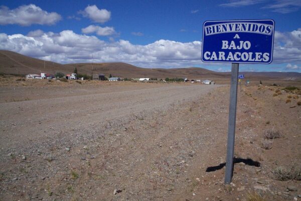
From Gregores it is roughly 216 km to Bajo Caracoles, a tiny roadside settlement at the RP39 junction, and roughly 130 km more to Perito Moreno town. On the way you pass Las Horquetas, the turn-off for Perito Moreno National Park on gravel RP37, and north of Bajo Caracoles the turn-offs for Cueva de las Manos (RP97) and for Paso Roballos into Chile (RP41).
If the 73 Malditos is closed when you get to Tres Lagos, there is no easy way round. The road east from Tres Lagos, RN288, is itself largely gravel; AGVP’s August 2026 report listed long gravel sections on it with mud. In practice the choice is between waiting in El Chaltén or Tres Lagos for the road to reopen, or reworking the trip. That is why a spare day belongs in every plan that crosses this stretch, and why El Chaltén is a much better place to wait than a petrol forecourt.
For riders: the 73 Malditos has a record of serious motorcycle accidents. La Nación reported in June 2025 about ten accidents on the stretch in a single summer season, including a fatal motorcycle crash. If you are on two wheels, do not ride it wet, and do not ride it tired at the end of a long day from El Chaltén.
The detours on this section:
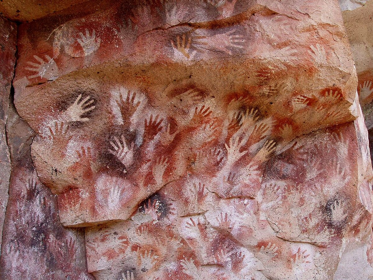
Cueva de las Manos. A UNESCO World Heritage Site since 1999 and a provincial park since 2018, in the canyon of the Río Pinturas, with rock art of stencilled hands. Visits are guided only, in groups of up to 20, roughly every hour, and the timetable can change with the weather. Tickets are bought in advance on the park’s own website, and access is limited in low season and winter. There are toilets, a rest area and Wi-Fi at the site, and no camping. Perito Moreno’s municipal tourism office lists three ways in. The usual one for drivers is from Bajo Caracoles on RP97, about 47 km of gravel the office rates as fair and passable in an ordinary car. The second is via RP101, 80 km south of Perito Moreno town, with 28 km of poor gravel that needs a 4×4. The third, from the Portal Cañadón Pinturas 54 km south of town, is a demanding trek down the Bajada de los Toldos. Confirm tour times with the Perito Moreno tourist office or on the park’s website before you commit a day to it.
Perito Moreno National Park. Not to be confused with the glacier. A long gravel road, RP37, leaves RN40 at Las Horquetas. The national parks service lists the season as 1 October to 30 April, varying with the state of the roads, and every visitor has to register at the Centro Operativo Clemente Onelli, open 09:00 to 19:00, arriving in daylight. There is no fuel in the park, so go in with a full tank and a spare can if your rental allows one. The park’s huts and campsites are covered in the Patagonia refugios guide.
Lago Posadas and Lago Pueyrredón. West of Bajo Caracoles on RP39. In 2023 Vialidad Nacional described works to pave the road to Lago Posadas, until then the only town in Santa Cruz without a paved access. Ask locally about its state before you turn off.
Paso Roballos. A gravel road west into Chile and towards Patagonia National Park and Cochrane. It is remote and seasonal; read the Patagonia National Park in Chile guide and the border-crossings page before you plan on it.
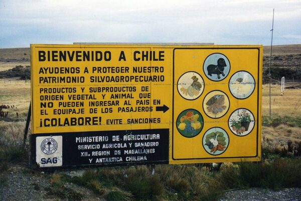
About 538 km, paved, with the Chubut detour in the middle. Perito Moreno town is a functional stop with lodging and services. Most people who have the time drive the 57 km west on RP43 to Los Antiguos, on the shore of Lago Buenos Aires, which is a far nicer place to spend the night and the crossing point to Chile Chico on the other side of the lake. From Chile Chico, roads lead on to Chile’s Route 7, the Carretera Austral, and to the Marble Caves at Puerto Río Tranquilo, which chile.travel puts 240 km south of Coyhaique. Everyone aged 18 and over entering Chile has to complete the SAG sworn declaration for plant and animal products, free, online up to a day before or on paper at the border.
North of Perito Moreno, RN40 crosses into Chubut at the 46th parallel. The junction for Paso Huemules (RN260, gravel) towards Coyhaique comes up about 30 km before Río Mayo; Vialidad’s 6 October 2026 report noted mud and water on parts of that road and works between its km 59 and 82, so check before you head that way. Río Mayo is the next town. North of it, the RN26 junction leads east towards Sarmiento and the coast, and then come the Facundo detours described above. After that the road runs on through Gobernador Costa and Tecka to Esquel.
Treat Río Mayo and Gobernador Costa as the overnight choices on this stretch, about 228 km apart. Neither is a destination, and both are fine for a bed and an early start.
Esquel is where the steppe ends and the lakes begin, and it is the base for Los Alerces National Park. The park’s daily pass for foreign visitors was ARS 35,000 from 1 June 2026, and the RP71 road through it is gravel.
Section 6: Esquel to Bariloche
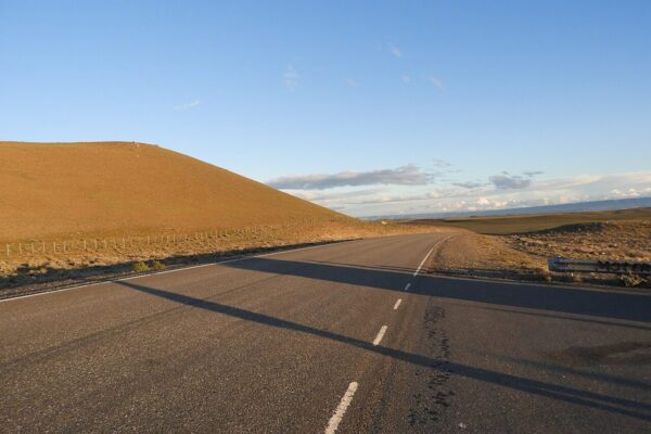
About 290 km, paved, and the most pleasant driving on the whole route. North of Esquel the road passes the turn-offs for Cholila and the northern end of Los Alerces, then drops through the Comarca Andina: Epuyén, El Hoyo, Lago Puelo and El Bolsón. Bariloche’s tourism office gives El Bolsón to Bariloche as 129 km, and Lago Puelo National Park is 16 km from El Bolsón. North of El Bolsón the road runs on past lakes into Bariloche.
Once you reach Epuyén the towns come close together, and fuel and food planning stops being a daily worry. The old gravel alignments of RN40 that run parallel through El Maitén and along the La Trochita railway are there for anyone who misses the dust.
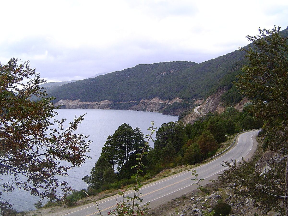
About 436 km, paved. From Bariloche, RN40 runs round Lago Nahuel Huapi to Villa La Angostura, about 80 km, and then onto the Road of the Seven Lakes, 107 km through Nahuel Huapi and Lanín national parks to San Martín de los Andes. Bariloche’s tourism office puts Bariloche to San Martín de los Andes at 185 km and says the route is open all year, with weather sometimes restricting access and chains recommended in winter. Lanín and Nahuel Huapi charged foreign visitors ARS 35,000 for a daily pass from 1 June 2026.
Expect heavy truck traffic between Bariloche and Villa La Angostura, the way to the Paso Cardenal Samoré crossing.
The Seven Lakes Route guide goes lake by lake and viewpoint by viewpoint, so there is no point repeating it here. What this page adds is the July 2026 landslide near San Martín de los Andes. It closed the road completely on 30 July, about 3 km from San Martín de los Andes, Vialidad let traffic through under supervision in set time windows from the following evening, and on 8 August traffic was restored between the RN231 junction and Río Hermoso with ice, snow and compulsory chains. If you are driving it in winter or after heavy rain, check Vialidad’s report that morning.
From San Martín de los Andes the road continues to Junín de los Andes, where gravel RP61 leads to the Lanín side of the park, and then out of the mountains to Zapala.
Fig. 4 · Ruta 40 curving above a forest-lined lake on the Seven Lakes stretch between Villa La Angostura and San Martín de los AndesPhoto: Public domain via Wikimedia Commons
Section 8: Zapala to Barrancas
About 336 km, paved, and the least-driven part of Patagonian RN40 by international visitors. It runs north through Las Lajas, where RN242 heads for the Pino Hachado crossing into Chile, then Chos Malal and Buta Ranquil to Barrancas on the Río Colorado, the border with Mendoza. Caviahue and the Copahue hot springs are a long paved detour west from Las Lajas.
Diario Río Negro reported Pino Hachado closed by a viento blanco, a snowstorm with high winds, on 3 August 2026, which is a fair indication of what the northern crossings can do in winter.
Fuel on Ruta 40: distances between towns, and how to plan them
Fuel is where Ruta 40 punishes casual planning. Pumps in small settlements run out, close for the night, lose power or stop taking cards, and Ente Patagonia itself warns of temporary shortages caused by the weather. No single pump between Tres Lagos and Esquel should be the whole plan.
The rule that works: fill up at every pump you pass, even if you are three-quarters full. Carry a jerrycan if your rental contract allows one, and phone ahead to your next night’s lodging to ask whether fuel is available in town and how it is being paid for. Cash in pesos is the safest fallback.
These are the rough distances between the settlements on the main route. They are the legs to plan your tank around.
Leg (south to north)
Approx. distance
What to plan for
Río Gallegos to 28 de Noviembre (near Río Turbio)
~250 km
Sparse services and long gravel stretches; most visitors skip it
Río Gallegos to Cabo Vírgenes and back
~254 km
No towns on RP1
Río Turbio to Tapi Aike to La Esperanza
~80 km, then ~95 km
Small settlements; fill up where you can
La Esperanza to Tres Lagos
~265 km
Passes the El Calafate and El Chaltén junctions; El Calafate is 32 km off the road. Fill up before the gravel
Tres Lagos to Gobernador Gregores
~175 km
Includes the 73 km of gravel, where you burn more fuel than you expect
Gobernador Gregores to Bajo Caracoles
~216 km
One of the longest runs between settlements on the main route; no towns at all
Bajo Caracoles to Perito Moreno town
~130 km
Add about 94 km of gravel return trip for Cueva de las Manos on RP97
Perito Moreno town to Río Mayo
~110 km
Los Antiguos is a 57 km detour west
Río Mayo to Gobernador Costa
~228 km
Includes the Facundo gravel detours
Gobernador Costa to Tecka to Esquel
~80 km, then ~100 km
Small towns, then Esquel
Esquel to Bariloche and north
~290 km and on
Several towns along the way
Swipe to see all columns
Table 2
The stretch that needs real thought is Gobernador Gregores to Perito Moreno town, especially if you want Cueva de las Manos or Perito Moreno National Park on the way. Leave Gregores full, add your can, and call ahead. The driving in Patagonia guide has more on range, jerrycans and what to do when a pump is dry.
Nobody drives RN40 for the road surface. These are the detours that justify the kilometres, roughly in the order most visitors would rank them, with what each one costs you in extra driving.
The Perito Moreno Glacier, from El Calafate. El Calafate is 32 km off RN40; the glacier is 80 km beyond town on RP11. Paved throughout. Budget a full day.
El Chaltén and the Fitz Roy trails. About 90 km of paved road from the junction. Two or three nights if you want to hike.
Cueva de las Manos. About 47 km of gravel each way on RP97 from near Bajo Caracoles, plus the guided visit. Half a day minimum, and book the tour in advance.
Los Antiguos and the Chile Chico crossing. 57 km west of Perito Moreno town on RP43. Worth it for the lake alone; essential if you are linking with the Carretera Austral.
Los Alerces National Park. From Esquel; the road through the park is gravel. A day at least.
The Seven Lakes. On RN40 itself between Villa La Angostura and San Martín de los Andes; a scenic day rather than a detour.
Perito Moreno National Park. A long gravel road from Las Horquetas, open October to April. Only worth it if you will stay at least a night; it is a wilderness park, not a viewpoint.
El Bolsón and Lago Puelo. Right on the route, and the best place to break the Esquel–Bariloche day.
Cabo Vírgenes and kilometre zero. A full day of gravel from Río Gallegos, for completists and penguin fans.
Lago Posadas. Off RP39 from Bajo Caracoles, for travellers who want the empty, turquoise-lake end of Santa Cruz to themselves.
Most of the parks on this list charge an entry fee, and the national parks set them centrally each year; Patagonia park fees has the current table.
When to drive Ruta 40, and what closes it
Visit Argentina recommends December to March for its Ruta 40 circuits in Patagonia, and that is the safest window: long days, the Perito Moreno National Park season in full swing, every lodging open, and the best odds of dry gravel. It is also the busiest time at El Calafate and El Chaltén, so book beds ahead.
October, November and April work well on the paved sections, with fewer people and long enough days. Late September and early October 2026 are a reminder that the 73 Malditos is a rain problem as well as a snow problem, though, so shoulder-season trips need the spare day more than summer ones. The Patagonia in October guide and Patagonia weather by month cover what to expect.
Winter, roughly June to August, is a different trip. In AGVP’s August 2026 report, the 73 Malditos was open to four-wheel-drive vehicles only, with chains compulsory and snow on the road; other sections in Santa Cruz had frost, potholes and drifting snow cutting visibility near Perito Moreno town. The Seven Lakes needs chains and can close. Northern crossings like Pino Hachado shut in storms. Perito Moreno National Park is outside its season. It can be done, and the paved sections can be beautiful, but plan short days, carry chains and read Patagonia in winter first.
Where to check the road on the morning you drive
Road status on RN40 changes faster than any guidebook, this one included. These are the official sources to check before every long day, and especially before the 73 Malditos, the Chubut detour and the Seven Lakes.
Vialidad Nacional, Estado de Rutas. The national road agency’s status page for national routes, with phone lines 0800-222-6272 and 0800-333-0073. On concession roads, the emergency number is 140.
AGVP Santa Cruz. The provincial road agency publishes a road-status report (parte de transitabilidad) for national routes in Santa Cruz, segment by segment. Check the date at the top of the file before you trust it.
Santa Cruz’s provincial road-safety agency. It is the body that issued the September and October 2026 closures of the 73 Malditos, and the local press in Santa Cruz carries its notices.
Vialidad Nacional’s Chubut district report for the Facundo detour and the RN260 road to Paso Huemules.
Ente Patagonia’s route-status page, linked from its Route 40 page.
Ask at your lodging the evening before as well. In Tres Lagos, Gregores or El Chaltén, someone will have driven the gravel that day.
How many days, which direction and what car
How long does the drive take?
From Bariloche to El Calafate is roughly 1,500 km including the access road into El Calafate. Five long days at the wheel is the minimum to cover it, and that is a drive rather than a trip. Ten to fourteen days lets you stop at Los Alerces, Los Antiguos, Cueva de las Manos and El Chaltén without rushing. Add one spare day for the 73 Malditos regardless. For day-by-day plans, see Patagonia road-trip itineraries.
Long days on RN40 are tiring in a way that the distances don’t convey: the wind pushes the car about, the gravel needs full attention, and there are long stretches without anywhere to stop for a coffee. Plan to be off the road by late afternoon, and never plan to arrive somewhere new after dark.
North to south, or south to north?
Neither direction is better in general, but they fail differently. Driving south to north puts the 73 Malditos early, right after El Chaltén. If it is shut, you wait somewhere with trails, restaurants and a good bed. Driving north to south brings you to it from Gregores, where there is much less to do while you wait. The wind is a crosswind for most of the route whichever way you go.
The direction matters more for the rental. A one-way rental along RN40 carries a drop fee, and in either direction it is often the single largest line on the bill. Renting a car in Patagonia covers how those fees work and how to keep them down.
Do you need a 4×4?
Not in summer, if your rental contract allows gravel. The paved sections are ordinary driving, and the 73 Malditos, the RP97 road to Cueva de las Manos and the Chubut detours are passable in a standard car when dry, though higher clearance and good tyres make them far less stressful. The one place a 4×4 becomes a legal requirement is the 73 Malditos in snow, when AGVP orders it closed to anything else and makes chains compulsory. The RP101 approach to Cueva de las Manos and the remote side roads to Perito Moreno National Park and Paso Roballos are where you will be glad of one.
Before you sign, check that the contract allows gravel roads and what the insurance covers on them; the rental guide linked above goes through the clauses to look for.
What about doing it without a car?
Long-distance buses run parts of the route, such as El Calafate to El Chaltén and Bariloche to El Bolsón and Esquel, but stitching the whole Patagonian RN40 together by bus takes patience and timetable checking. The Patagonia buses guide sets out the main companies and routes; check each company’s own timetable for the season you are travelling.
Ruta 40 vs the Carretera Austral
They are often compared and often combined. They are very different drives.
Ruta 40 (Argentina)
Carretera Austral (Chile, Route 7)
Landscape
Open steppe with the Andes on the horizon; lakes and forests in the north
Fjords, temperate rainforest, glaciers and rivers
Surface in 2026
Almost all paved north of El Calafate; about 73 km of gravel in Santa Cruz plus the Chubut detours
Long gravel sections
Ferries
None on the main route
Several along the route
Fuel planning
Long runs, up to about 216 km between settlements on the main route
Shorter distances, slower roads
Where they connect
Los Antiguos–Chile Chico, Paso Huemules, Paso Roballos
The same crossings from the Chilean side
Swipe to see all columns
Table 3
The classic combination is RN40 down from Bariloche to Perito Moreno town, across to Chile Chico, and then the Carretera Austral north or south from there. If that appeals, read the Carretera Austral road trip guide and the Carretera Austral ferries page, and sort out the cross-border paperwork for the car before you book anything else.
Ruta 40 FAQ
Is Ruta 40 paved in Patagonia?
Almost all of it, in 2026. The main exception on the route most people drive is about 73 km of gravel between Tres Lagos and Lago Cardiel in Santa Cruz, the “73 Malditos”. There is also gravel on the far-south legs, on RP1 to Cabo Vírgenes and between Bella Vista and Turbio Viejo on the way to Río Turbio, and gravel detours around broken asphalt between Facundo and Los Tamariscos in Chubut.
What are the 73 Malditos?
The unpaved stretch of RN40 between Tres Lagos and Lago Cardiel, about 73 km of gravel in two pieces. Vialidad Nacional awarded a contract to pave it, covering km 791.68 to 864, and it remains gravel in October 2026. It turns to mud after rain: Santa Cruz closed it to all vehicles on 28 September 2026 and again in early October. In snow, AGVP restricts it to 4x4s with chains.
Can you drive Ruta 40 in winter?
The paved sections, yes, with care, chains and short days. In AGVP’s August 2026 report the 73 Malditos was restricted to four-wheel-drive vehicles with compulsory chains. The Seven Lakes stretch needs chains in winter and can close for snow or landslides, and Perito Moreno National Park is closed outside its 1 October to 30 April season.
Where is kilometre zero of Ruta 40?
At the Cabo Vírgenes lighthouse in Santa Cruz, about 127 km from Río Gallegos. There is no built RN40 between Cabo Vírgenes and Punta Loyola, so you reach it on the gravel provincial road RP1 and drive back the same way. There are no towns on the way, so set off with a full tank.
How far apart are the fuel stops on Ruta 40?
One of the longest stretches between settlements on the main Patagonian route is Gobernador Gregores to Bajo Caracoles, about 216 km. In the far south, Río Gallegos to 28 de Noviembre near Río Turbio is about 250 km. Fill up at every pump, carry a jerrycan if your rental allows it, and phone ahead, since small-town pumps can run dry.
Do you need a 4×4 for Ruta 40?
Not for a summer trip on the main route, provided your rental contract allows gravel. Higher clearance helps on the 73 km of gravel, on RP97 to Cueva de las Manos and on the Chubut detours. A 4×4 with chains is required on the 73 Malditos when AGVP declares snow conditions.
How many days do you need from Bariloche to El Calafate?
The drive is about 1,500 km. Five long driving days is the bare minimum; ten to fourteen lets you add Los Antiguos, Cueva de las Manos and El Chaltén at a sensible pace. Keep one extra day spare in case the 73 Malditos is closed.
Does Ruta 40 go through El Calafate and El Chaltén?
No. It passes their junctions. El Calafate is 32 km west of RN40, and El Chaltén is about 90 km up its own paved access road. The same applies to Cueva de las Manos, Perito Moreno National Park and Los Antiguos.
How do I visit Cueva de las Manos from Ruta 40?
The usual approach is from Bajo Caracoles: about 47 km of gravel on RP97, which the Perito Moreno tourist office rates as fair and passable in an ordinary car. Visits are guided only, in groups of up to 20, and tickets are bought in advance on the park’s own website. Confirm the current tour times with the Perito Moreno tourist office before you go.
Where can I check Ruta 40 road conditions?
Vialidad Nacional’s Estado de Rutas page and its phone lines (0800-222-6272 or 0800-333-0073), AGVP Santa Cruz’s road-status report for national routes in the province, and Santa Cruz’s road-safety agency for closures on the 73 Malditos. Check on the morning you drive, not the week before.
Final thoughts
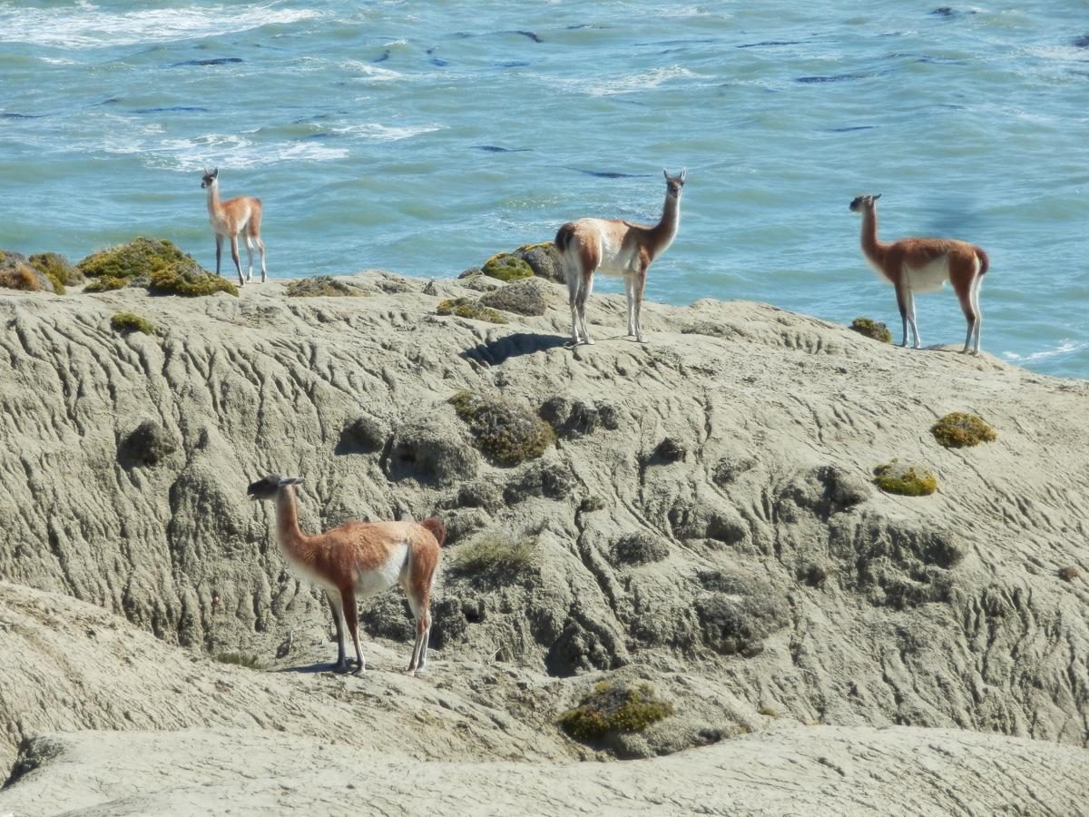
The Ruta 40 Patagonia road trip has changed. The long gravel ordeal of older accounts has shrunk to one 73 km stretch in Santa Cruz and a muddy detour in Chubut, and the rest is paved road through country that still feels enormous and nearly empty. What has not changed is that the road decides the schedule. Build in the spare day, fill up at every pump, check the road agencies before the gravel, and treat the junctions as the destinations, because the glacier, the trails, the hand paintings and the lakes are all a turn-off away. Then drive slowly enough to see the guanacos before they see you.
Sources
Road status and park details checked in October 2026.
Ruta 40 curving above a forest-lined lake on the Seven Lakes stretch between Villa La Angostura and San Martín de los Andes — Public domain via Wikimedia Commons