Best Patagonia Road Trip Routes for 7, 10, 14 and 21 Days
Eight measured Patagonia road trip routes for 7, 10, 14 and 21 days, with daily km and hours, pick-up and drop-off rules, border hours and ferry legs.
By Patagonia Tourism Guide · First published 22 Oct 2026
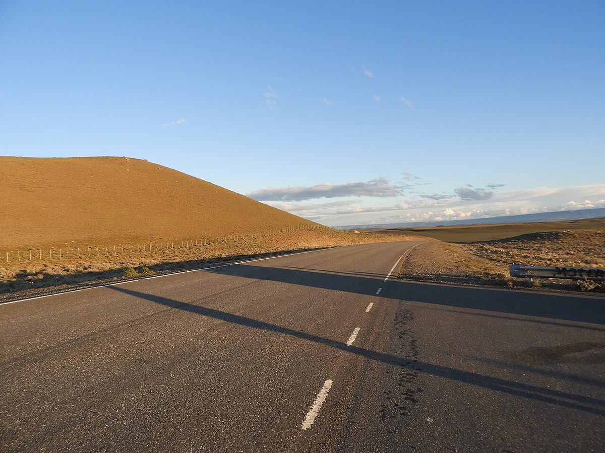
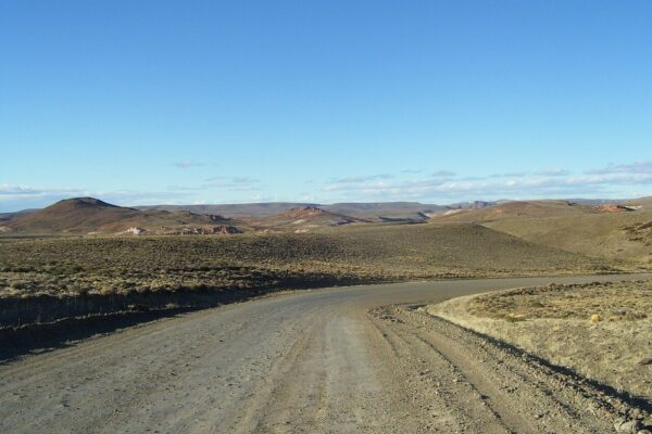
0 — 2 km Fig. 1 · Paved Ruta 40 sweeping past a bare, sunlit hillside on the Santa Cruz steppe · Photo: Raf24 / CC BY 4.0 via Wikimedia Commons
The best Patagonia road trip routes are the ones sized to the days you actually have, measured day by day, and drawn the right way round for your rental contract. That last part catches more people than gravel or wind. On one major company’s published terms, an Argentine rental car can end its trip in Chile on a handful of southern routes, while that company’s Chilean cars have to come home. Get the direction wrong and a route that looks perfect on a map simply can’t be booked.
This guide gives you eight complete self-drive plans: two for a week, three for ten days, one for two weeks and two for three weeks. Each one has a day-by-day table with the drive, approximate kilometres, approximate driving hours and where you sleep, plus the car logic (loop, one-way, or one-way across a border), the border crossings and ferries it depends on, the months it works and who should skip it. For the bigger picture on whether to drive at all, how route shapes work and what to carry, start with the complete Patagonia road trip guide and come back here when you’re ready to commit to a line on the map.
Quick answer: the best Patagonia road trip routes by trip length
If you only read one section, read this one.
7 days, first trip: the El Calafate loop to Perito Moreno Glacier and El Chaltén. No border, no ferry, no permit, about 650-790 km in total.
7 days in winter or with young kids: Bariloche and the Seven Lakes, an all-paved loop that the tourism board lists as open all year, with chains in the car in winter.
10 days, both icons: El Calafate, El Chaltén and Torres del Paine, ending in Punta Arenas. This is the route that the direction rule matters most for.
10 days, lakes and volcanoes: a two-country figure-of-eight from Bariloche through Pucón and Puerto Varas.
10 days, the far south: a Punta Arenas loop to Ushuaia across the Strait of Magellan.
14 days, the drive is the point: Ruta 40 from Bariloche to El Calafate.
21 days, overlanding: the Carretera Austral south from Futaleufú, back into Argentina at Los Antiguos and down Ruta 40 to El Calafate.
21 days, all south: El Calafate to Ushuaia by way of El Chaltén, Torres del Paine and Tierra del Fuego.
Two warnings before you fall for any of them. The 14-day Ruta 40 route and the 21-day Carretera Austral route both run through the gravel stretch between Tres Lagos and Lago Cardiel, which was closed to all traffic in early October 2026; read the warning in the 14-day section before you book a one-way car. And if your plan relies on flying in or out of Puerto Natales between January and March 2027, check it first: that airfield has scheduled closures for that whole period, with commercial flights mainly at weekends.
Eight Patagonia road trip routes compared at a glance
Distances are rounded and marked “about” because the exact figure depends on where in town you start and which side roads you take. Driving hours in the day tables assume roughly 75-80 km/h on open paved road and 40-50 km/h on gravel or twisting mountain road, before stops, photo pull-offs, fuel queues and border controls.
Route
Days
Start → end
Car logic
Total distance
Longest day
Borders
Ferries
Best months
El Calafate, glacier and El Chaltén
7
El Calafate → El Calafate
Loop
about 650-790 km
about 220 km
None
None
October-April
Bariloche and the Seven Lakes
7
Bariloche → Bariloche
Loop
about 750 km
about 255 km
None
None
All year (chains in winter)
Southern classic to Torres del Paine
10
El Calafate → Punta Arenas
One-way into Chile
about 1,300-1,400 km
about 330 km
Río Don Guillermo
None
October-April
Lakes District figure-of-eight
10
Bariloche → Bariloche
Loop, two countries
about 1,100-1,250 km
about 325 km
Mamuil Malal, Cardenal Samoré
None
November-April
Far south and Tierra del Fuego
10
Punta Arenas → Punta Arenas
Loop, two countries
about 1,300 km
about 420 km
San Sebastián (twice)
Strait of Magellan (twice)
November-March
Ruta 40 south
14
Bariloche → El Calafate
Domestic one-way
about 2,200-2,300 km
about 540 km
None
None
November-March
Carretera Austral and Ruta 40
21
Bariloche → El Calafate
Domestic one-way (or loop)
about 2,600 km
about 300 km
Futaleufú, Jeinimeni
None required
December-March
Glaciers to the end of the world
21
El Calafate → Ushuaia
Domestic one-way via Chile
about 2,300 km
about 420 km
Río Don Guillermo, San Sebastián
Strait of Magellan
November-March
Swipe to see all columns
Table 1
Distances follow the national and provincial tourism boards’ own figures where they publish them (El Calafate to El Chaltén, Río Gallegos to Ushuaia, the Seven Lakes loop, Coyhaique to Puerto Río Tranquilo and others) and route-planner distances for the rest, so check them against your own map.
Pick-up, drop-off and direction: settle this before the route
Before you fall for a route, check which way round your rental company lets you drive it. The gap between where you collect the car and where you hand it back decides whether you pay a one-way fee, a cross-border fee, both or neither.
There are three shapes. A loop returns the car where you found it and carries no one-way fee. A domestic one-way (Bariloche to El Calafate, say) usually carries a fee that companies set case by case. An international one-way, collecting in one country and returning in the other, is the one most road-trip guides say is impossible. On at least one company’s published terms it isn’t, but only in one direction.
Avis Argentina’s rental conditions page, read in October 2026, lists these international drops from Argentina into Chile, each charged on top of a separate Chile border-crossing fee:
Start → end
Car
What that company’s published terms say
What to do
El Calafate → El Calafate (via Chile)
Argentine
Loop; the Chile crossing fee applies (ARS 206.611,57 listed for El Calafate)
Ask for the crossing paperwork at least 7 working days ahead
El Calafate or Río Gallegos → Puerto Natales or Punta Arenas
Argentine
One-way listed at ARS 225.000, plus the crossing fee
Get the total in writing before you pay
Ushuaia or Río Grande → Punta Arenas
Argentine
One-way listed at ARS 600.000, plus the crossing fee
Compare with driving back to Ushuaia
Ushuaia or Río Grande → Puerto Natales
Argentine
“Not Allowed”
Drop in Punta Arenas instead
Punta Arenas (or anywhere in Chile) → El Calafate
Chilean
Avis Chile: “Vehicle return in Argentina is not allowed.”
Drive it as a loop back into Chile
Bariloche → El Calafate
Argentine
Domestic one-way possible at many branches; extra charge depending on the branch and car group, no figure listed
Ask for the fee in writing
Puerto Montt → Balmaceda or Punta Arenas
Chilean
Not on Avis Chile’s list of domestic one-way cities, which runs from Iquique to Puerto Montt
Ask other companies directly
Swipe to see all columns
Table 2
Those are one company’s terms, from undated rate cards, and the page doesn’t say whether the ARS 206.611,57 crossing fee includes VAT. Treat them as proof that the route can exist, not as the market price. Whichever company you rent from, ask for three things in writing before you pay a deposit: whether the car may cross, whether it may end in the other country, and the full fee for each.
Avis Argentina also asks for the Chile crossing request at least 7 working days before pick-up, wants a copy of your passport and licence emailed in advance, and makes its collision damage waiver compulsory for the crossing. Avis Chile’s permit for Argentina costs CLP 120,000 + VAT, prepaid, needs 72 working hours’ notice, comes with a minimum guarantee of CLP 3,000,000 on your card and is valid for a maximum of 30 days. Chile’s customs authorisation for rental cars leaving temporarily for Argentina can run up to 90 calendar days and covers several trips while it’s valid, so the 30-day cap is that company’s own rule; others may differ. The permit process itself has its own guide: see how the rental car border permit works, and whether to rent a car in Patagonia at all if you’re still on the fence.
One more piece of the map changed for 2026-27. Puerto Natales’ Teniente Julio Gallardo airfield has scheduled closures from 1 January to 31 March 2027, with normal operation only from 1 to 10 January and commercial flights mainly on weekends after that. Punta Arenas airport operates normally all year. For a fly-drive in those three months, start or finish in Punta Arenas or El Calafate.
How much to drive in a day is a judgement call, but a sensible ceiling is 300-400 km on paved road and 150-250 km on gravel, and never a border, a long gravel stretch and a booked tour on the same day. Wind, guanacos on the road and the temptation to stop every ten minutes all eat time. The guide to driving in Patagonia explains why those limits are lower than they look.
7 days: El Calafate, Perito Moreno Glacier and El Chaltén loop
This is the route for a first Patagonia road trip with one week and no appetite for paperwork. You collect the car at El Calafate airport, keep it inside Argentina and hand it back at the same desk. No border, no ferry, no permit, no one-way fee.
The driving is light and almost all paved. The glacier is 80 km from El Calafate on Ruta Provincial 11, about 90 minutes each way. El Chaltén is about 215-220 km north (the Argentine tourism board publishes both figures on different pages), roughly three hours, with a leg-stretch at La Leona on the way. Sleep in El Chaltén rather than day-tripping it: the hikes start in town, the weather gives you windows rather than days, and press reports say the town started charging a fee to day visitors who don’t stay overnight in March 2026 (confirm the current amount with the municipality).
Day
Drive
Approx. km
Approx. hours
Overnight
1
El Calafate airport to town; Laguna Nimez walk
about 22
25 min
El Calafate
2
El Calafate to Perito Moreno Glacier and back
160
3 h (90 min each way)
El Calafate
3
El Calafate to El Chaltén
about 215-220
3 h
El Chaltén
4
Hiking day: Laguna de los Tres or Laguna Torre
0
0
El Chaltén
5
Optional: Portal Río Eléctrico on Ruta Provincial 41 (about 16 km each way), or a second hike
0-35
up to 1 h
El Chaltén
6
El Chaltén to El Calafate
about 215-220
3 h
El Calafate
7
Optional Estancia Nibepo Aike (56 km each way on gravel), then airport
up to 135
up to 3.5 h
Fly out
Swipe to see all columns
Table 3
Total: about 650-790 km depending on the optional days. Longest day: about 220 km. Zero-driving days: one or two.
Day 5 is your weather buffer. If day 4 is blown out, swap it. If both are clear, use day 5 for the shorter trails and leave the car parked. For which trail to use your best day on, see how many days to spend in El Chaltén; for glacier tickets and boat options, see how to visit Perito Moreno Glacier.
Who it suits: first-time self-drivers, hikers with a week, anyone nervous about borders. Skip it if Torres del Paine is non-negotiable: that needs the 10-day route below.
7 days in the north: Bariloche and the Seven Lakes
If your week falls in winter, or you’re travelling with young children who don’t want five-hour hikes, the north is the better week. Bariloche’s tourism board describes the Seven Lakes road as open all year, with weather sometimes restricting access and snow chains recommended in winter. Take that seriously: after a landslide on the Seven Lakes stretch of Ruta 40 in late July 2026, Vialidad Nacional reopened the road in stages, and on 8 August 2026 physical chains were compulsory on it.
Bariloche’s own figures: Bariloche to San Martín de los Andes by the Seven Lakes is 185 km, the Seven Lakes section itself between Villa La Angostura and San Martín is 107 km, and the full loop back via Junín de los Andes and La Rinconada is about 440 km of paved road. The shorter return over Paso Córdoba makes 350 km in total but includes 70 km unpaved.
Day
Drive
Approx. km
Approx. hours
Overnight
1
Bariloche: Circuito Chico lakeside loop
about 60
1.5 h with stops
Bariloche
2
Bariloche to Villa La Angostura
about 80
1.25 h
Villa La Angostura
3
Villa La Angostura to San Martín de los Andes on the Seven Lakes
107
2-2.5 h
San Martín de los Andes
4
Rest day in San Martín
0
0
San Martín de los Andes
5
San Martín to Bariloche via Junín de los Andes and La Rinconada (paved)
10 days: El Calafate to Torres del Paine and Punta Arenas
This is the trip most people picture when they say “Patagonia road trip”: Perito Moreno Glacier, Fitz Roy from El Chaltén, then across the border to the towers of Torres del Paine. Ten days is the shortest version that doesn’t feel like a relay race.
The smart way to drive it is one-way, El Calafate to Punta Arenas, in an Argentine car. That’s the pairing Avis Argentina’s published terms allow (ARS 225.000 for the one-way plus the Chile crossing fee, on the rate card read in October 2026). It saves you the full day of backtracking from Torres del Paine to El Calafate, and Punta Arenas airport runs normally through the Puerto Natales airfield closures of January to March 2027. Outside that window, Puerto Natales is also on the same company’s one-way list.
Day
Drive
Approx. km
Approx. hours
Overnight
1
El Calafate airport to town; check the permit papers at the counter
about 22
25 min
El Calafate
2
Perito Moreno Glacier and back
160
3 h
El Calafate
3
El Calafate to El Chaltén
about 215-220
3 h
El Chaltén
4
Hiking day
0
0
El Chaltén
5
Hiking or weather buffer
0
0
El Chaltén
6
El Chaltén to El Calafate; fill the tank
about 215-220
3 h
El Calafate
7
El Calafate to the Río Don Guillermo crossing (Cancha Carrera / Cerro Castillo), then 52 km to the park’s Sarmiento gate
about 250-330
4-5 h plus the border
Torres del Paine
8
Inside Torres del Paine: Base Torres or a lakeside day
about 50-100
1-2 h
Torres del Paine
9
Inside Torres del Paine: Grey, Pehoé and the viewpoints
about 50-100
1-2 h
Torres del Paine
10
Park to Puerto Natales (80 km), then 250 km of paved road to Punta Arenas; drop the car
about 330
4.5 h
Fly out
Swipe to see all columns
Table 5
Total: about 1,300-1,400 km. Longest day: about 330 km, all on paved road. Zero-driving days: two.
Day 7 is the one to plan carefully. There’s a shorter line via a gravel shortcut and a longer, all-paved line through La Esperanza; that’s the 250-330 km spread in the table. CONAF notes there are no fuel stations in or around the park, so fill up in El Calafate before you set off. For the border crossings on this stretch, see the guide to travelling between Puerto Natales and El Calafate. Check Río Don Guillermo’s hours on Chile’s Pasos Fronterizos site or Argentina’s Migraciones page the day before, and aim to reach the border by early afternoon so a queue doesn’t push you into the evening.
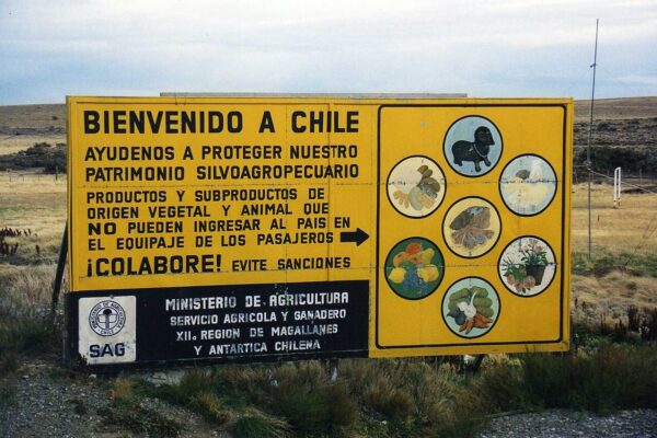
Two Chile-side rules shape that day. Everyone aged 18 or over entering Chile signs a SAG sworn declaration for any plant or animal products, on paper at the border or online up to a day before, and a new one is needed on every entry; finish or bin the fruit and cheese in El Calafate. And Torres del Paine tickets are sold online only, for a date, through Pases Parques; you can’t buy at the entrance. Buy them before the border day. The Torres del Paine tickets guide walks through it, and the park’s summer hours (October to April) are 07:00 to 21:00.
Loop version: back to El Calafate
If your rental company won’t do the international drop, or the fee breaks the budget, run the same nine days and drive back from Torres del Paine to El Calafate on day 10, about 250-330 km and four to five hours plus the border again. You pay the crossing fee but no one-way fee, and you fly out of El Calafate. It’s tighter: you lose the evening in Puerto Natales and you’ll want an early start to make your flight.
Starting in Punta Arenas instead
You can mirror the trip from Chile, but on Avis Chile’s terms only as a loop, because that company doesn’t allow its Chilean cars to end in Argentina. Punta Arenas to Puerto Natales (250 km), the park, across to El Calafate, up to El Chaltén and back to El Calafate, then the long run home to Punta Arenas (about 560 km, better split with a night in Puerto Natales). That’s 11 or 12 days to do it without rushing, and it adds roughly 500 km over the one-way version. It suits travellers whose cheapest flights land in Punta Arenas. The Punta Arenas to Puerto Natales guide covers the first leg.
Who it suits: first-timers with ten days who want both icons, couples, photographers. Skip it if you can’t get the cross-border permit confirmed in writing. If you’d rather not drive at all, the 10-day bus version covers the same ground on public transport.
10 days in the north: the two-country Lakes District loop
If you’ve done the glaciers, or you’d rather swap ice for volcanoes, hot springs and lake towns, this figure-of-eight from Bariloche crosses into Chile at Mamuil Malal, runs down to Puerto Varas and comes home over Cardenal Samoré. Because it’s a loop, it works with an Argentine car from Bariloche (Avis Argentina lists Bariloche among the branches charging its Chile crossing fee) or with a Chilean car collected in Puerto Montt and driven the other way round.
Day
Drive
Approx. km
Approx. hours
Overnight
1
Arrive Bariloche; collect the car and the Chile papers
short
short
Bariloche
2
Bariloche to Villa La Angostura
about 80
1.25 h
Villa La Angostura
3
Seven Lakes to San Martín de los Andes
107
2-2.5 h
San Martín de los Andes
4
San Martín to Junín de los Andes, Mamuil Malal crossing, Pucón
about 195
3-3.5 h plus the border
Pucón
5
Pucón: Villarrica volcano views, hot springs
0-50
up to 1 h
Pucón
6
Pucón to Puerto Varas, mostly on Chile’s Ruta 5
about 325
4 h
Puerto Varas
7
Optional: Petrohué and the Todos los Santos lakeshore
about 120 return
2 h
Puerto Varas
8
Puerto Varas to Osorno, Cardenal Samoré crossing, Villa La Angostura
about 220
3.5 h plus the border
Villa La Angostura
9
Villa La Angostura to Bariloche
about 80
1.25 h
Bariloche
10
Drop the car in Bariloche
short
short
Fly out
Swipe to see all columns
Table 6
Total: about 1,100-1,250 km. Longest day: about 325 km on Chile’s main highway.
Cardenal Samoré is the crossing with published hours: Argentina’s border-centre page lists 8:00 to 19:00 daily, the pass sits at 1,305 m, and the page warns of snow, especially in winter. Mamuil Malal is the one to watch. Gendarmería closed it for road works for several afternoons in September 2026, and further interruptions are possible; check its hours on Pasos Fronterizos or Migraciones before day 4, and have the fallback ready (stay on the Argentine side and cross at Samoré both ways).
Who it suits: repeat visitors, families, food-and-lakes travellers. Skip it if you have only a week; the all-Argentine Seven Lakes loop above does the best of it with no border.
10 days in the far south: Punta Arenas, Tierra del Fuego and Ushuaia
There is a road to Ushuaia, and it runs through Chile. Argentina’s own Tierra del Fuego page puts Río Gallegos to Ushuaia at 593 km by road, crossing the Strait of Magellan by ferry (at Primera Angostura or Segunda Angostura) and re-entering Argentina at San Sebastián. From Punta Arenas you join that line at Punta Delgada.
The simplest car logic is a loop in a Chilean car with an Argentina permit, out on the Primera Angostura ferry (Punta Delgada to Bahía Azul) and back either the same way or on the Porvenir to Punta Arenas ferry. Both crossings are run by TABSA, whose site takes bookings for cars. Check TABSA for the current timetable, crossing times and car fares before you set a day.
Day
Drive
Approx. km
Approx. hours
Overnight
1
Arrive Punta Arenas; collect the car and Argentina permit
about 20
25 min
Punta Arenas
2
Punta Arenas to Punta Delgada, Primera Angostura ferry, San Sebastián border, Río Grande
about 420
about 6 h plus the ferry and two border posts
Río Grande
3
Río Grande to Tolhuin and over the mountains to Ushuaia
about 210
3 h
Ushuaia
4
Tierra del Fuego National Park
about 50
1 h
Ushuaia
5
Puerto Almanza on the Beagle Channel (75 km each way)
150
3 h
Ushuaia
6
Ushuaia: Beagle Channel boat, no driving
0
0
Ushuaia
7
Ushuaia to Río Grande
about 210
3 h
Río Grande
8
Río Grande to San Sebastián, Porvenir, ferry to Punta Arenas
about 220 plus the ferry
3.5-4 h plus the ferry and border
Punta Arenas
9
Punta Arenas: Isla Magdalena penguin boat (October to mid-April)
0
0
Punta Arenas
10
Drop the car
about 20
25 min
Fly out
Swipe to see all columns
Table 7
Total: about 1,300 km. Longest day: about 420 km, and it’s a long one.
Day 2 and day 8 each pass through two sets of border controls at San Sebastián, and the hours there are published: Argentina’s border-centre page lists opening at 08:00, exit from both countries closing at 21:40 and entry to both closing at 22:00. Work backwards from that, add the ferry and a margin for wind, and leave Punta Arenas early. If you start instead from Río Gallegos on the Argentine side, Integración Austral opens at 08:00, with exit closing at 21:45 and entry at 22:00.
The other car logic is a one-way in an Argentine car, Ushuaia to Punta Arenas, which Avis Argentina lists at ARS 600.000 plus the crossing fee. The same card marks Ushuaia to Puerto Natales “Not Allowed”. For the sights at the end of the road, see Ushuaia and Tierra del Fuego, and for the Isla Magdalena colony, penguins in Patagonia.
Who it suits: end-of-the-world travellers, Antarctica cruise passengers adding a road trip, anyone finishing a longer southern trip. Skip it if you only want Ushuaia itself: fly in and use tours. In winter, Ushuaia’s daylight drops to just over seven hours, which changes the maths on day 2 entirely; see Ushuaia in winter.
14 days: Ruta 40 from Bariloche to El Calafate
This is the trip for people who want the road itself: the lake country around Bariloche, the valleys around Esquel and Trevelin, the long empty steppe of northern Santa Cruz, the cave paintings at Cueva de las Manos, and Fitz Roy rising out of the plain at the end. It’s a domestic one-way, Bariloche to El Calafate, in an Argentine car. Avis Argentina says many of its branches allow returning the car at another Avis office in Argentina for an extra charge that depends on the branch and car group; it doesn’t publish the figure, so ask every company you quote for the exact one-way fee in writing. For what each section of road is like, kilometre by kilometre, see Ruta 40 section by section.
Warning: the Tres Lagos to Lago Cardiel gravel. This route, and the 21-day Carretera Austral route below, depend on the stretch of Ruta 40 between Gobernador Gregores, Lago Cardiel and Tres Lagos. About 75 km of it is still gravel (Vialidad Nacional’s paving contract covers 75.7 km), locals call it the “73 malditos”, and the province closed it to all vehicles in early October 2026: on 5 October Santa Cruz’s road-safety undersecretary said the stretch was impassable again, with no reopening date. Before you commit to a one-way car on this route, check the road’s status with Vialidad Nacional’s Estado de Rutas service (0800-222-6272 or 0800-333-0073) and the Santa Cruz roads agency (AGVP), then check again the evening before day 9. Build in a spare day.
The fallback if it’s still closed: go round it to the east. From Gobernador Gregores drive to Comandante Luis Piedra Buena, then west to Tres Lagos, which rejoins Ruta 40 at the southern end of the closed stretch. That’s about 545 km to El Chaltén instead of about 300, so it becomes two days, not one; ask Vialidad which roads on that detour are open and paved before you set off. If you can’t spare the day, take the spare day out of El Chaltén rather than drive the closed road.
Day
Drive
Approx. km
Approx. hours
Overnight
1
Arrive Bariloche; collect the car
short
short
Bariloche
2
Bariloche to El Bolsón
about 120-130
1.75 h
El Bolsón
3
El Bolsón to Esquel; afternoon in Trevelin
about 165
2-2.5 h
Esquel
4
Los Alerces National Park and back
about 125
2.5 h
Esquel
5
Esquel to Perito Moreno town (or split at Río Mayo); includes a gravel detour near Facundo on Ruta 40
about 540
7 h or more
Perito Moreno
6
Perito Moreno to Los Antiguos on Lago Buenos Aires and back
about 120
1.5 h
Perito Moreno
7
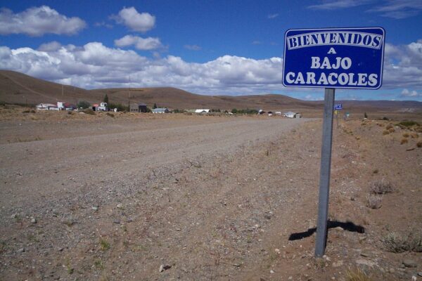
South to Bajo Caracoles (130 km), then 47 km on Ruta Provincial 97 to Cueva de las Manos and back
about 225
3.5-4 h
Bajo Caracoles
8
Bajo Caracoles to Gobernador Gregores
about 225
3 h
Gobernador Gregores
9
Gobernador Gregores to Tres Lagos and El Chaltén (includes about 75 km of gravel when open)
about 300
5 h
El Chaltén
10
Hiking day
0
0
El Chaltén
11
Hiking or weather buffer
0
0
El Chaltén
12
El Chaltén to El Calafate
about 215-220
3 h
El Calafate
13
Perito Moreno Glacier and back
160
3 h
El Calafate
14
Drop the car at El Calafate airport
about 22
25 min
Fly out
Swipe to see all columns
Table 8
Total: about 2,200-2,300 km. Longest day: about 540 km on day 5, on the main road but long, with a gravel detour near Facundo (check Vialidad Nacional’s road reports); split it at Río Mayo if you’d rather not. Zero-driving days: two.
Cueva de las Manos is open all year for guided visits only, in groups of up to 20 that leave roughly hourly, with tickets bought on the park’s website. Perito Moreno town’s tourism office describes the Bajo Caracoles access road (Ruta Provincial 97) as in fair condition and fine for low cars; confirm tour times with the office in Perito Moreno before you set off. Bajo Caracoles is a very small settlement, so book day 7’s bed before you leave Perito Moreno, or treat the cave as a long day trip and sleep in Perito Moreno twice.
Fuel on the middle section is the other constraint. The regional tourism board warns of temporary shortages on Ruta 40 when weather disrupts supply. Fill up at every pump you pass between Perito Moreno and El Chaltén, whatever the gauge says, and carry a jerrycan if your rental allows it. For the park day near Esquel, see Los Alerces National Park.
Who it suits: confident drivers, second-time visitors, people for whom the drive is the point. Skip it if El Chaltén and the glacier are the point: fly to El Calafate and take the 7-day loop.
Three weeks lets you string Chile’s Carretera Austral and Argentina’s Ruta 40 into one trip. Chile’s tourism board describes the Austral as more than 1,200 km long, with summer, December to March, as the best season. This route drives the middle and southern part of it, from Futaleufú to Cochrane, then crosses back into Argentina at Chile Chico and Los Antiguos and runs down Ruta 40 to El Calafate.
Start in Argentina. An Argentine car from Bariloche can cross into Chile at Futaleufú and come back at Los Antiguos on a crossing permit, and end anywhere in Argentina the company allows. A Chilean car can’t end in Argentina at Avis Chile, and its permit there is capped at 30 days. Ask your Argentine company in writing whether its permit covers two crossings and how long it’s valid.
The Ruta 40 half of this route uses the same Tres Lagos to Lago Cardiel stretch as the 14-day plan, so the same warning and fallback apply: about 75 km of gravel, closed to all vehicles in early October 2026, check with Vialidad Nacional (0800-222-6272) and AGVP before day 16, and use the Piedra Buena detour or the loop-back option below if it’s still shut.
Day
Drive
Approx. km
Approx. hours
Overnight
1
Arrive Bariloche; collect the car and Chile papers
short
short
Bariloche
2
Bariloche to El Bolsón
about 120-130
1.75 h
El Bolsón
3
El Bolsón to Esquel and Trevelin
about 190
2.5 h
Trevelin
4
Trevelin to the Futaleufú crossing and Futaleufú town
about 50
1 h plus the border
Futaleufú
5
Futaleufú to Villa Santa Lucía, then south on the Austral to Puyuhuapi
about 190
4 h
Puyuhuapi
6
Puyuhuapi past Queulat National Park to Coyhaique
about 220
4 h
Coyhaique
7
Coyhaique: rest, laundry, supplies
0
0
Coyhaique
8
Coyhaique to Puerto Río Tranquilo
240
about 5 h
Puerto Río Tranquilo
9
Marble Caves boat trip
0
0
Puerto Río Tranquilo
10
Puerto Río Tranquilo to Cochrane
about 115
2.5 h
Cochrane
11
Parque Nacional Patagonia, Valle Chacabuco entrance
about 60-100
2 h
Cochrane
12
Cochrane to Puerto Guadal and along the lakeshore to Chile Chico
about 180
4 h
Chile Chico
13
Chile Chico to the Jeinimeni crossing, Los Antiguos, Perito Moreno
about 75
1 h plus the border
Perito Moreno
14
Cueva de las Manos via Bajo Caracoles
about 225
3.5-4 h
Bajo Caracoles
15
Bajo Caracoles to Gobernador Gregores
about 225
3 h
Gobernador Gregores
16
Gobernador Gregores to Tres Lagos and El Chaltén (gravel stretch: check status)
about 300
5 h
El Chaltén
17
Hiking day
0
0
El Chaltén
18
Hiking or weather buffer
0
0
El Chaltén
19
El Chaltén to El Calafate
about 215-220
3 h
El Calafate
20
Perito Moreno Glacier and back
160
3 h
El Calafate
21
Drop the car at El Calafate airport
about 22
25 min
Fly out
Swipe to see all columns
Table 9
Total: about 2,600 km. Longest day: about 300 km (day 16). Zero-driving days: four.
A few notes on the Chilean half. Queulat National Park is 165 km north of Coyhaique, and the hanging glacier walk fits on day 6 if you leave Puyuhuapi early; see the Queulat hanging glacier. The Coyhaique to Puerto Río Tranquilo leg is 240 km and about five hours on Chile’s tourism board’s figures, and it recommends a gravel-capable vehicle. The Marble Caves are visited only by guided boat or kayak from Puerto Río Tranquilo; see Marble Caves boat trips. For Parque Nacional Patagonia, CONAF’s directions are to turn east 17 km before Cochrane and drive about 11 km in; see Patagonia National Park in Chile. Expect gravel on parts of the Chilean half; the guide to driving the Carretera Austral covers surfaces and technique, and the Carretera Austral itineraries give 7, 10 and 14-day versions of the Chilean side alone.
There’s an optional shortcut on day 12: the barge across Lago General Carrera from Puerto Ibáñez to Chile Chico, which skips the lakeshore road. Check the current crossing times with the operator, Somarco, before planning around it; the lakeshore road via Puerto Guadal is the default. The Austral’s other barges, further north, aren’t needed on this routing because it enters at Futaleufú; the Carretera Austral ferries guide covers them if you start in Puerto Montt instead.
Border hours for Futaleufú and Jeinimeni change with the season. Check the crossing’s hours on Chile’s Pasos Fronterizos site or Argentina’s Migraciones page before you set out, and don’t plan a crossing late in the day.
Loop-back option: from Perito Moreno on day 13, turn north instead of south and drive Ruta 40 back to Esquel (about 540 km) and Bariloche (about 290 km more) over two or three days. You end where you started, pay no domestic one-way fee and avoid the Tres Lagos gravel entirely, at the cost of El Chaltén and the glacier.
Who it suits: overlanders, photographers, people who have done the big-name parks. Skip it if this is your first trip and you want Torres del Paine; take the all-south route below instead.
21 days all south: glaciers to the end of the world
For a first long trip that takes in all the southern icons, join the 10-day southern classic to the far-south loop and keep driving: El Calafate, El Chaltén, Torres del Paine, Punta Arenas, across the Strait of Magellan and down to Ushuaia. Use an Argentine car collected in El Calafate. It crosses into Chile at Río Don Guillermo and back into Argentina at San Sebastián, so it starts and finishes in Argentina: a domestic one-way (ask the fee in writing) plus the Chile crossing fee. Avis Argentina’s card also carries a separate note for Tierra del Fuego rentals, with a minimum rental length and its own permit charge; ask how it applies to a car arriving from the mainland.
Day
Drive
Approx. km
Approx. hours
Overnight
1
El Calafate airport to town
about 22
25 min
El Calafate
2
Perito Moreno Glacier and back
160
3 h
El Calafate
3
El Calafate to El Chaltén
about 215-220
3 h
El Chaltén
4-6
Hiking days
0
0
El Chaltén
7
El Chaltén to El Calafate
about 215-220
3 h
El Calafate
8
El Calafate to Río Don Guillermo and Torres del Paine
about 250-330
4-5 h plus the border
Torres del Paine
9-11
Inside Torres del Paine
about 50-100 a day
1-2 h a day
Torres del Paine
12
Torres del Paine to Puerto Natales
80
1.5 h
Puerto Natales
13
Puerto Natales to Punta Arenas
250
3 h
Punta Arenas
14
Isla Magdalena penguin boat, no driving
0
0
Punta Arenas
15
Punta Arenas, Primera Angostura ferry, San Sebastián, Río Grande
about 420
about 6 h plus ferry and border
Río Grande
16
Río Grande to Ushuaia
about 210
3 h
Ushuaia
17-20
Ushuaia: national park, Puerto Almanza, Beagle Channel
up to 150 a day
up to 3 h
Ushuaia
21
Drop the car in Ushuaia
short
short
Fly out
Swipe to see all columns
Table 10
Total: about 2,300 km, counting the Ushuaia excursions. Longest day: about 420 km (day 15). The 3-week Patagonia itinerary covers the same corners by bus and plane if the car logistics don’t work out.
Border crossings and ferries each route uses
Every two-country route above depends on a crossing being open when you get there. Only three of the crossings these routes use have official hours pages that settle the question:
Route
Crossing
Official hours (Argentine border-centre page)
Ferry
10-day southern classic; 21-day all south
Río Don Guillermo (Cancha Carrera / Cerro Castillo)
Check Pasos Fronterizos or Migraciones before you set out
None
10-day Lakes loop
Mamuil Malal
Check before you set out; works closures in September 2026
None
10-day Lakes loop
Cardenal Samoré
8:00-19:00 daily; snow possible, especially in winter
Optional Puerto Ibáñez-Chile Chico barge (Somarco)
Swipe to see all columns
Table 11
For each crossing, the place to check on the day is Chile’s Pasos Fronterizos site, the Interior Ministry’s border unit, which lists the border complexes, or Argentina’s Migraciones page. For the documents and the order you pass through each control, see each Chile-Argentina border crossing explained, and for what Chile’s SAG inspectors want declared, Patagonia travel requirements.
The clock is easier than it used to be. Chile’s mainland moved to summer time on 6 September 2026, and the Samoré border coordination moved the crossing’s opening an hour earlier for that reason: for the 2026-27 summer, the Chilean side shows the same time as the Argentine side. When Chile’s winter time returns, crossings into the Chilean Lakes District (Samoré and Mamuil Malal) bring a one-hour change, so recheck any booking made in Chilean time.
When each route works: season windows
Patagonia’s road trips don’t share a season. The southern routes need long days and open passes; the northern loops work through more of the year.
Route
Best
Possible with care
Hardest
El Calafate loop (7 days)
October-April
May and September
June-August: short days, ice on the roads
Bariloche and Seven Lakes (7 days)
November-April
All year, chains in winter
Heavy snow days on the Seven Lakes
Southern classic (10 days)
October-April
Shoulder months with flexible days
Winter; Natales flights in January-March 2027
Lakes District loop (10 days)
November-April
May and October
Winter snow at Samoré and Mamuil Malal
Far south (10 days)
November-March
October and April
Winter, with about seven hours of daylight in Ushuaia
Ruta 40 south (14 days)
November-March
October and April
Winter, and any time the Tres Lagos gravel is shut
Austral and Ruta 40 (21 days)
December-March
November and April
Winter
All south (21 days)
November-March
October and April
Winter
Swipe to see all columns
Table 12
Summer has its own catches. Ushuaia gets more than 17 hours of daylight in midsummer, which makes long drives easy and sleep harder. Torres del Paine runs its longer summer hours from October to April. And Bus-Sur’s El Calafate to Puerto Natales service runs only from September to April, a fair sign of how seasonal that corridor is. For a month-by-month picture, see Patagonia in winter.
Mistakes that wreck a good route
Plenty of Patagonia road trips go wrong at the booking stage, long before the first gravel.
Booking the car before the permit. You can reserve a car, fly in and find the cross-border paperwork needed a week’s notice. Ask for the permit at the time you book, and get the one-way and crossing fees confirmed in writing in the same email.
Planning the direction backwards. A Punta Arenas to El Calafate one-way looks the same as the reverse on a map. On Avis Chile’s terms it isn’t allowed. Check the direction before you buy flights.
Putting a border, gravel and a booked tour on one day. A glacier boat at 15:00 after a morning border crossing works until the queue at the border is long. Give the border a day of its own, or put it on a day with nothing booked.
Trusting the gauge. On Ruta 40 between Perito Moreno and El Chaltén, and on long stretches of the Austral, the rule is to fill at every pump. A half-full tank is the moment to stop, not to push on.
Assuming a road is open. The Tres Lagos stretch closed in early October 2026; the Seven Lakes closed after a landslide in July 2026. Check Vialidad Nacional’s road status in Argentina and Pasos Fronterizos in Chile the evening before any long day.
Leaving Torres del Paine tickets until the gate. They’re sold online only, for a date. Buy them while you still have reliable internet.
How to choose your Patagonia road trip route
Start with your days, then with what you’d be sorry to miss.
7 days, first trip, no paperwork: the El Calafate loop.
7 days in winter or with young children: Bariloche and the Seven Lakes.
10 days, Fitz Roy and Torres del Paine: the southern classic, one-way into Chile if your company allows it, or the loop back to El Calafate if it doesn’t.
10 days, already done the south: the Lakes District figure-of-eight.
10 days, end of the world: the Punta Arenas to Ushuaia loop.
14 days, the drive is the point: Ruta 40 south, with the Tres Lagos check and a spare day.
21 days, overlanding: the Carretera Austral and Ruta 40.
21 days, first long trip: the all-south route from El Calafate to Ushuaia.
If you’re nervous on gravel, the El Calafate loop, the Seven Lakes loop, the Lakes District figure-of-eight and the southern classic keep you mostly on asphalt (the southern classic has some gravel around the border and the park; the Chile-Argentina border crossing guide covers the crossings). The 14-day and both 21-day routes have long unpaved stretches or ferry days. If budget is tight, loops beat one-ways, and an international drop on top of a crossing fee can easily be the biggest extra on a Patagonia rental quote. For how the route shapes compare in principle, and the checklist of questions to ask a rental company, go back to the complete Patagonia road trip guide.
FAQ
What is the best Patagonia road trip route for a first trip?
With 10 days, the southern classic: El Calafate, Perito Moreno Glacier, El Chaltén and Torres del Paine, ending in Punta Arenas. With 7 days, drop Torres del Paine and drive the El Calafate loop, which needs no border crossing or permit.
Can you do a Patagonia road trip in 7 days?
Yes, if you stay in one region. The El Calafate loop to Perito Moreno Glacier and El Chaltén is about 650-790 km in a week, and the Bariloche and Seven Lakes loop is about 750 km. Trying to add Torres del Paine to a week means a border day and a lot of driving for very little time in each place.
Can you rent a car in Argentina and drop it off in Chile?
On some routes, yes. Avis Argentina’s published terms list one-way drops from El Calafate or Río Gallegos to Puerto Natales or Punta Arenas (ARS 225.000) and from Ushuaia or Río Grande to Punta Arenas (ARS 600.000), each plus a Chile crossing fee, while Ushuaia to Puerto Natales is not allowed. Going the other way, Avis Chile says a Chilean car can’t be returned in Argentina. Other companies set their own terms, so ask for them in writing.
How many kilometres a day should you drive in Patagonia?
A sensible ceiling is 300-400 km on paved road and 150-250 km on gravel, with no border, long gravel stretch and booked tour on the same day. The longest days in these routes are about 540 km on Ruta 40 (which can be split) and about 420 km to Tierra del Fuego with a ferry and a border.
Is a loop or a one-way road trip better in Patagonia?
Loops avoid one-way fees and keep the rental simple. One-ways save one to three days of backtracking. For the southern classic, the one-way into Chile saves a full day; for the Lakes District, a loop costs nothing because the two border crossings make the loop for you.
Which border crossing do you use from El Calafate to Torres del Paine?
Río Don Guillermo, with the Argentine post at Cancha Carrera and the Chilean post at Cerro Castillo, about 52 km from the park’s Sarmiento gate. Check its hours on Pasos Fronterizos or Argentina’s Migraciones page before you set out, and aim to reach it by early afternoon.
Can you drive to Ushuaia from Punta Arenas?
Yes. The road runs through Chile to Punta Delgada, crosses the Strait of Magellan on the Primera Angostura ferry, and re-enters Argentina at San Sebastián before Río Grande and Ushuaia. Allow a full day to Río Grande. Check TABSA’s site for ferry times and fares, and note that San Sebastián’s exit controls close at 21:40.
Do you need a ferry on a Patagonia road trip?
Only on some routes. The El Calafate loop, the Seven Lakes, the southern classic, the Lakes District loop and Ruta 40 south need none. Tierra del Fuego needs the Strait of Magellan crossing, and the Carretera Austral between Puerto Montt and Chaitén needs barges; the 21-day route here avoids them by entering Chile at Futaleufú.
What is the best Patagonia road trip in winter?
Bariloche and the Seven Lakes, with chains in the car and a daily check of the road. The southern routes, the Carretera Austral and Ruta 40 in Santa Cruz are much harder in winter, with short days, ice and passes that close for snow.
Is there a time difference crossing between Argentina and Chile?
Not during the 2026-27 summer: since 6 September 2026 Chile’s mainland shares Argentina’s time. When Chile returns to winter time, crossings into the Chilean Lakes District bring a one-hour change.
Final thoughts
A good route is one where the car logic, the border hours and the driving load all line up with the days you’ve got. Pick your length, choose the direction your rental company actually allows, and check the two things that change overnight: the border’s hours and the road’s status. Then leave room for the wind to cost you a day, because somewhere along the way it will.
Rental terms, border hours and road status checked in October 2026 against the rental companies’ and governments’ own pages.