Plan how to get to Patagonia with airports, flights, buses, rental cars, ferries, border crossings, route options, and realistic transfer advice.
By Patagonia Tourism Guide · First published 13 Jun 2026 · Updated 1 Aug 2026
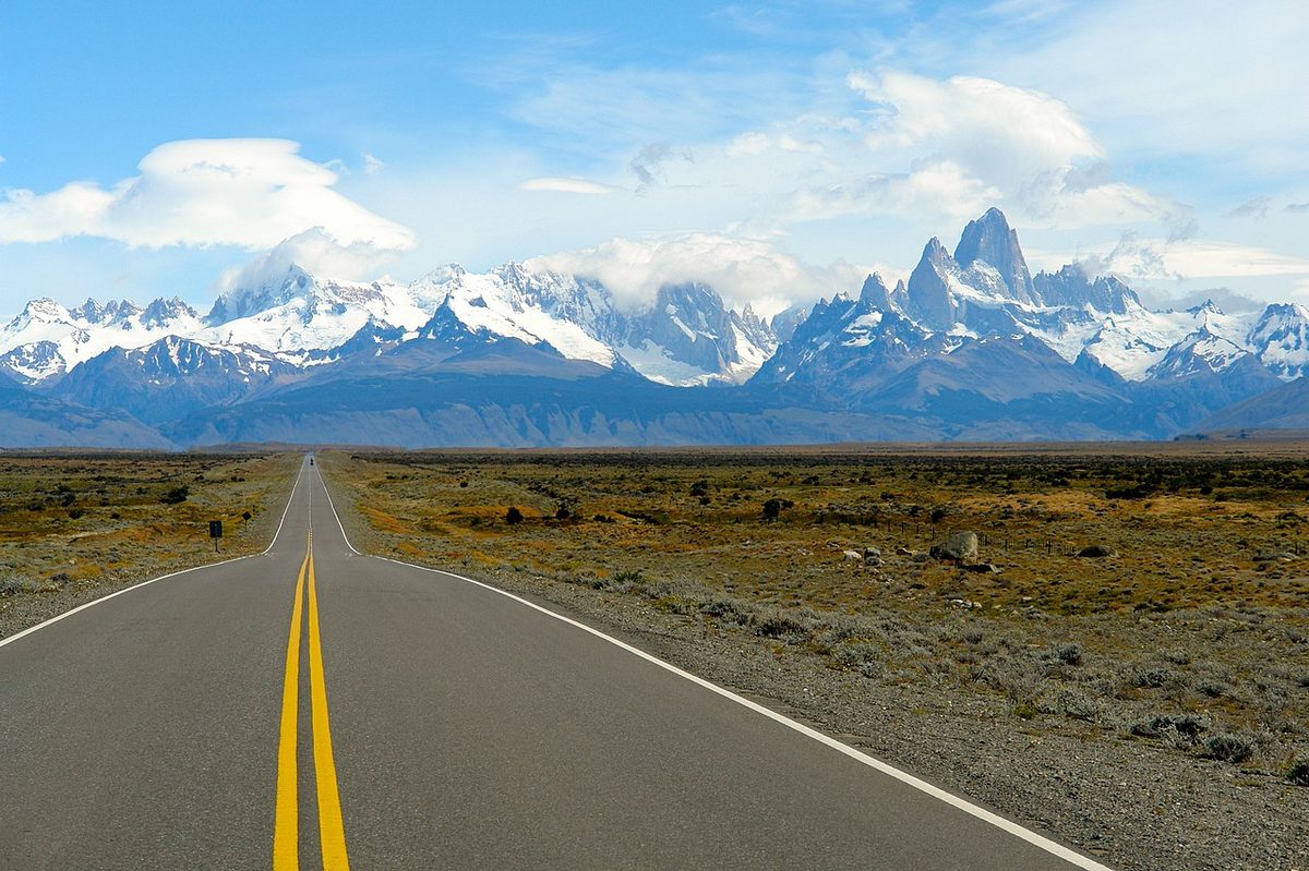
0 — 2 km Fig. 1 · A road leading toward Mount Fitz Roy in El Chalten, Argentina · Photo: https://www.flickr.com/people/43533334@N07/ / CC BY 2.0 via Wikimedia Commons
The first mistake people make with Patagonia transportation is treating it like one destination.
It is not one destination. It is not one airport. It is not one country. It is not one road trip. Patagonia is a huge southern region shared by Argentina and Chile, and the way you get there depends completely on which Patagonia you mean.
If you want Fitz Roy and Perito Moreno Glacier, you are probably looking at flights to El Calafate, then buses or transfers to El Chalten. If you want Torres del Paine, you are usually choosing between Puerto Natales, Punta Arenas, and a cross-border route from El Calafate. If you want Bariloche and the lake district, the southern Patagonia airports are the wrong answer. If you want whales, the gateway is usually Trelew or Puerto Madryn. If you want the Carretera Austral, you are planning a Chilean road trip with ferries, gravel, fuel, and weather buffers. If you want Ushuaia, you should treat it as its own far-south leg, not a casual add-on between two other places.
That is why “how to get to Patagonia” is really two questions:
Which gateway gets you closest to the Patagonia trip you actually want?
How do you move between the places without wasting half the journey on bad connections?
This guide answers both. It covers Patagonia airports, flights, buses, rental cars, ferries, border crossings, route-by-route logistics, sample transport spines, booking order, common mistakes, and the places where I would pay more to save a day instead of trying to prove a point with a cheaper route.
Last fact-check: May 27, 2026. Transport details change often. Treat this as a planning framework, then recheck current flights, bus schedules, border hours, road conditions, ferry operations, and rental car terms before paying.
Quick Answer: Best Way to Get to Patagonia
For most international travelers, the best way to get to Patagonia is to fly first to Buenos Aires for Argentine Patagonia or Santiago for Chilean Patagonia, then take a domestic flight to the regional gateway that matches your route.
Here is the fast version:
Your Patagonia goal
Best practical gateway
How you usually move next
Perito Moreno Glacier
El Calafate airport
Taxi/transfer to town, bus or tour to glacier
El Chalten and Fitz Roy
El Calafate airport
Bus, transfer, or rental car to El Chalten
Torres del Paine
Puerto Natales or Punta Arenas
Bus, rental car, transfer, or tour to Puerto Natales and park
W Trek or O Circuit
Puerto Natales
Trek transport after refugio/campsite bookings
Bariloche and Northern Patagonia
Bariloche airport
Local buses, rental car, tours, or Seven Lakes road trip
Ushuaia and Tierra del Fuego
Ushuaia airport
Taxi/transfer, tour transport, rental car for selected trips
Puerto Madryn and Peninsula Valdes wildlife
Puerto Madryn or Trelew airport
Rental car or wildlife tours
Carretera Austral
Puerto Montt or Balmaceda
Rental car/camper, buses in sections, ferries
Punta Arenas and Isla Magdalena
Punta Arenas airport
Bus to Puerto Natales or boat/tour logistics locally
Swipe to see all columns
Table 1
The best transport mode depends on the route:
Fly for long leaps, especially Buenos Aires to El Calafate, Buenos Aires to Ushuaia, Buenos Aires to Bariloche, Santiago to Punta Arenas, Santiago to Puerto Montt, and Santiago to Balmaceda.
Use buses for classic land connections such as El Calafate to El Chalten, El Calafate to Puerto Natales, Punta Arenas to Puerto Natales, Bariloche to nearby lake towns, and some budget backpacker routes.
Rent a car when flexibility matters more than simplicity: Bariloche and the Seven Lakes, Peninsula Valdes, Torres del Paine day trips, the Carretera Austral, and self-drive road trips.
Avoid a rental car when buses are easy and parking/one-way/cross-border permits add more friction than freedom.
Build buffer days around border crossings, ferries, domestic flights, remote roads, and weather-dependent boats.
If you remember one thing, make it this: choose the route first, then the airport. Patagonia punishes people who book the cheapest flight before they understand the map.
Patagonia gets much easier when you stop thinking in straight lines.
The map makes everything look like a route. Buenos Aires, Bariloche, El Calafate, El Chalten, Puerto Natales, Torres del Paine, Punta Arenas, Ushuaia, Puerto Madryn, and the Carretera Austral all look like they belong to one big southern circuit. In reality, many of the easiest travel connections run north-south through the capital city networks, not neatly sideways across every scenic place.
Visit Argentina describes Argentine Patagonia as an extensive region covering six provinces and stretching roughly 2,500 kilometers. That is only the Argentine side. Chilean Patagonia adds another set of fjords, islands, roads, ferries, airports, and border crossings.
This creates four practical rules.
First, Argentina-side Patagonia is usually organized through Buenos Aires. The big gateways include Bariloche, El Calafate, Ushuaia, Trelew, Puerto Madryn, Neuquen, San Martin de los Andes/Chapelco, Esquel, and Rio Gallegos. You may find some seasonal or interregional routes, but first-time planning should not depend on a perfect direct flight until you have verified it.
Second, Chile-side Patagonia is usually organized through Santiago. The main gateways include Punta Arenas, Puerto Natales, Puerto Montt, and Balmaceda/Coyhaique. Punta Arenas is the workhorse for southern Chilean Patagonia. Puerto Natales is ideal for Torres del Paine when flight schedules line up. Puerto Montt and Balmaceda are the practical doors into the Carretera Austral.
Third, cross-border travel is possible and common, but not frictionless. A bus from El Calafate to Puerto Natales or a rental car between Argentina and Chile sounds simple only until you remember immigration, customs, Chile’s agricultural inspection, border hours, weather, road conditions, and vehicle permits.
Fourth, Patagonia transportation has a season. Summer has the broadest access, more tours, more buses, more ferries, more open lodging, and higher demand. Winter and shoulder seasons can be wonderful, but you must check whether the route you want is actually operating in the way you imagine.
This is why the Patagonia itinerary planner argues for choosing one route spine first. Transport should serve that route. It should not become the route.
Best Airports in Patagonia
There is no best airport for Patagonia. There is only the best airport for your itinerary. Our full Patagonia airports guide breaks down every gateway and which one to fly into.
Argentina Patagonia Airports
Airport
Best for
Practical notes
Bariloche (BRC)
Bariloche, Nahuel Huapi, Villa La Angostura, Seven Lakes, Northern Patagonia
Best first airport for lake district trips and soft-adventure routes
San Martin de los Andes / Chapelco (CPC)
San Martin de los Andes, Lanin, Seven Lakes north end
Useful if your route is focused on Neuquen and the northern lake district
Neuquen (NQN)
Northern Patagonia road trips, business travel, regional routes
More functional than scenic for most first-time leisure routes
Esquel (EQS)
Los Alerces, Trevelin, Welsh Patagonia add-ons
Good for a slower northern/central Argentine Patagonia trip
Trelew (REL)
Puerto Madryn, Peninsula Valdes, Punta Tombo wildlife
Common wildlife gateway, especially when Puerto Madryn flights are limited
Puerto Madryn (PMY)
Puerto Madryn and whales
Convenient when flights line up, but compare with Trelew
El Calafate (FTE)
Perito Moreno Glacier, El Chalten, classic southern Patagonia
The key Argentine gateway for first-time southern Patagonia trips
Ushuaia (USH)
Tierra del Fuego, Beagle Channel, Antarctica departures
Best treated as its own flight leg because it is far south
Rio Gallegos (RGL)
Overland connections, less common southern routes
Usually secondary for most first-time travelers
Swipe to see all columns
Table 2
Visit Argentina’s El Calafate page positions El Calafate as a major gateway for glaciers and nearby parks, with its own airport and recommended stays around 2 to 3 nights. For many first-time travelers, this is the Argentine Patagonia airport that matters most because it unlocks both Perito Moreno Glacier and El Chalten.
For the lake district, Bariloche is the natural first airport. La Ruta Natural’s Seven Lakes guide places the route through Villa La Angostura, San Martin de los Andes, and the Andean Patagonia lake district. That is a completely different Patagonia trip from El Calafate and Torres del Paine. Do not fly to El Calafate for Bariloche. Do not fly to Bariloche for a short El Chalten trip.
For wildlife, Trelew and Puerto Madryn matter more than the famous mountain gateways. If your goal is whales, penguins, sea lions, and Peninsula Valdes, read the Patagonia wildlife and whale watching guide before you assume the classic hiking route is the right route.
Chile Patagonia Airports
Airport
Best for
Practical notes
Puerto Montt (PMC)
Northern Carretera Austral, Chilean lake district, ferry/road routes south
Useful for road trips starting at the top of Route 7
Balmaceda (BBA)
Coyhaique, Cerro Castillo, Puerto Rio Tranquilo, central Aysen
Often the most efficient airport for a shorter Carretera Austral route
Puerto Natales (PNT)
Torres del Paine and W Trek/O Circuit logistics
Excellent when flights operate and schedules fit; more limited than Punta Arenas
Punta Arenas (PUQ)
Puerto Natales, Torres del Paine, Isla Magdalena, southern Chile
The main southern Chilean Patagonia workhorse gateway
Swipe to see all columns
Table 3
Chile Travel’s Puerto Natales page frames Puerto Natales as the gateway to Torres del Paine and notes access by air and land, including connections from Punta Arenas and El Calafate. If I were planning a Torres del Paine trip and Puerto Natales flights lined up with my dates, I would check them seriously. If they were expensive, seasonal, or awkward, I would use Punta Arenas and build in the bus transfer.
For the Carretera Austral, the airport decision is more strategic. Chile Travel describes the Carretera Austral as more than 1,200 kilometers of Route 7 crossing forests, glaciers, rivers, fjords, towns, parks, and barge crossings. Puerto Montt is the full-route or northern-route gateway. Balmaceda is the practical central Aysen gateway if you want Coyhaique, Cerro Castillo, Puerto Rio Tranquilo, the Marble Caves, Patagonia National Park, and a shorter self-drive plan.
Flights to Patagonia
Flights are the cleanest way to cover large distances in Patagonia, but they are not magic.
They save time when you are jumping from a capital to a regional gateway. They can be inefficient when you try to connect two Patagonia regions that are close on a map but not connected by useful direct flights. Sometimes a bus across the steppe is better than an airport day. Sometimes the opposite is true.
When Flying Makes Sense
Flying usually makes sense when:
You are going from Buenos Aires to Patagonia gateways like El Calafate, Bariloche, Ushuaia, Trelew, or Puerto Madryn.
You have limited vacation time and need to avoid multi-day overland journeys.
You are combining northern Patagonia with southern Patagonia.
You are adding Ushuaia to a route.
You are returning to the capital after a one-way Patagonia trip.
You are moving between the wildlife coast and mountain Patagonia.
Flying often matters most when the alternative is not a pleasant scenic ride but a long, tiring transfer with bad timing. There is no award for spending an extra day in transit when that day could have been a weather buffer in El Chalten or a proper night before Torres del Paine.
When Flying Is Not the Best Answer
Flying is not automatically best when:
You are traveling from El Calafate to El Chalten.
You are traveling from El Calafate to Puerto Natales.
You are traveling from Punta Arenas to Puerto Natales.
You are moving around Bariloche, Villa La Angostura, San Martin de los Andes, and nearby lake towns.
You are already on the Carretera Austral and need to move town by town.
You would have to backtrack through Buenos Aires or Santiago for a short regional connection.
The classic example is El Calafate and El Chalten. El Chalten’s official tourism site says El Chalten is reached only by land and is about 215 kilometers from El Calafate, with the trip taking around 3 hours by bus or car. Flying is not the question there. The question is whether to take a bus, transfer, or rental car, and how many weather days to give El Chalten once you arrive.
Buenos Aires Airport Caution
Many Argentina itineraries involve Buenos Aires, but Buenos Aires has more than one airport. International flights often use Ezeiza (EZE), while many domestic flights use Aeroparque (AEP), though this can change by airline and route.
Do not assume your international arrival and domestic Patagonia departure leave from the same airport. If you have to change airports in Buenos Aires, give yourself enough time for immigration, baggage, traffic, check-in, and ordinary travel friction. If the Patagonia leg is important, I prefer a conservative connection or a night in Buenos Aires over a beautiful itinerary that depends on a tight airport transfer.
Open-Jaw Flights Are Often Worth Checking
Patagonia is a good place to use open-jaw logic: fly into one gateway and out of another. For example:
Into El Calafate, out of Punta Arenas or Puerto Natales.
Into Punta Arenas, out of El Calafate.
Into Bariloche, out of El Calafate.
Into Trelew or Puerto Madryn, out of El Calafate.
Into Puerto Montt, out of Balmaceda or Punta Arenas if the road trip is long enough.
This is not always cheaper. It is often better. There is a difference.
Buses in Patagonia
Buses are one of the most useful ways to travel around Patagonia, especially for budget travelers and classic routes. They are also one of the easiest ways to underestimate time. Our guide to buses in Patagonia covers the routes, booking, and when to fly instead.
Patagonia buses are best when they connect nearby gateway towns with established demand. They are less appealing when you use them to stitch together huge regions simply because you want to avoid a flight.
Bus Routes That Often Make Sense
These are the bus-style connections I would check first:
Route
Why it works
El Calafate to El Chalten
Direct, common, and made for hikers
El Calafate to Puerto Natales
Classic Argentina-Chile connection for Torres del Paine routes
Punta Arenas to Puerto Natales
Standard Chilean Patagonia gateway transfer
Puerto Natales to Torres del Paine
Common park access, especially for day hikers and trekkers
Bariloche to Villa La Angostura or San Martin de los Andes
Useful for Northern Patagonia and Seven Lakes planning
Bariloche to El Bolson or Esquel
Useful for slower Argentine Patagonia routes
Ushuaia to Rio Grande or other Tierra del Fuego routes
Regional movement, though long-distance plans need care
Swipe to see all columns
Table 4
Bus-Sur publishes route information for Punta Arenas, Puerto Natales, Torres del Paine, and El Calafate connections, including cross-border services. Use operator pages like that as current schedule checks, not evergreen truth. The route may exist, but frequency, departure times, seasonality, luggage rules, and booking rules can change.
When Buses Start to Hurt
Buses start to hurt when you use them for every long-distance move.
Bariloche to El Calafate, for example, can look like a natural north-south Patagonia route. It is real, but it is long. If you have three or four weeks and like overland travel, it can fit. If you have 10 days, it may eat the trip.
The same goes for trying to use buses to add Ushuaia casually. Ushuaia is reachable by land, but it sits far south on Tierra del Fuego. Visit Argentina’s Ushuaia page notes access by air and by Ruta Nacional 3. For most first-time visitors, especially anyone on a 10 to 14 day trip, Ushuaia is better treated as a flight leg or skipped until a longer itinerary.
Bus Booking Tips
Before booking a bus, check:
Which terminal it leaves from.
Whether it stops at an airport or only in town.
Whether the route crosses a border.
Whether the bus operates every day or only on certain dates.
Whether the schedule changes by season.
How luggage is handled.
Whether food stops are included.
Whether you arrive late enough to need a taxi.
Whether the destination has reception, taxis, or lodging check-in at that hour.
I would rather take a slightly less elegant bus time and sleep properly than arrive late, hungry, and unprepared before a major hike.
Rental Cars in Patagonia
A rental car can be the best decision in Patagonia. It can also be the expensive decision that solves nothing. See our guide to driving in Patagonia guide for exactly when it helps and when it hurts.
The question is not “Do I need a car in Patagonia?” The question is “Does a car improve this specific route?”
When a Rental Car Helps
A car is often useful for:
Bariloche, Circuito Chico, Seven Lakes, Villa La Angostura, and San Martin de los Andes.
Peninsula Valdes and Puerto Madryn wildlife routes.
Torres del Paine day trips, photography stops, and lodge-based travel.
Carretera Austral road trips.
Ruta 40 and border-crossing road trips.
Families or small groups with luggage.
Travelers who value flexible stops over fixed bus schedules.
Northern Patagonia is one of the easiest places to appreciate a car. You can build a lake route, stop at viewpoints, move between towns, and avoid forcing every day through tour pickup times. The northern Patagonia overview goes deeper into that decision.
The Carretera Austral is the other obvious case. You can use some buses, boats, and local transfers, but the route is fundamentally built around movement through remote sections. If you want a serious Route 7 trip, read the Carretera Austral road trip guide before you rent anything. For the wider self-drive layer, including Ruta 40, rental permits, gravel, fuel, and border crossings, use Patagonia Road Trips, Ruta 40 and Border Crossings.
When a Rental Car Does Not Help Much
A car may not help if:
You are only doing El Calafate and El Chalten.
You are doing the W Trek and leaving the car parked.
You are using organized day tours anyway.
You need a one-way drop across countries.
You are nervous on gravel and wind-exposed roads.
You are traveling in winter without snow/ice confidence.
You forgot to arrange a cross-border permit.
The El Calafate to El Chalten bus is straightforward enough that many travelers do not need a car. In Torres del Paine, a car can be excellent for day trips, but useless during a multi-day trek if it just sits in a lot while you hike.
Cross-Border Rental Cars
If you plan to take a rental car between Argentina and Chile, arrange the border permit with the rental company before travel. Do not assume you can decide at the border.
Ask the rental company, in writing:
Can this vehicle cross into the other country?
Which border crossings are allowed?
What documents are required?
How much does the permit cost?
How long does it take to issue?
Is one-way drop-off allowed?
Are gravel roads allowed?
Are ferries allowed?
What happens with insurance across the border?
Are there restrictions for Ruta 40, Carretera Austral, or remote roads?
What spare tire, tools, chains, and emergency equipment are included?
That list is not overkill. It is the difference between a road trip and a desk argument at a border office.
Driving Style and Safety
Patagonia driving can include long distances, wind, gravel, animals, potholes, construction, ferry ramps, dust, snow, ice, and limited services. Fill fuel earlier than you think you need to. Avoid night driving in rural areas. Do not trust map drive times blindly. Carry water, layers, snacks, and a conservative plan.
If your route depends on a remote gravel road, check local conditions before leaving town. If your route depends on a ferry, check the ferry before you book the night’s lodging beyond it.
Ferries and Boats in Patagonia
Patagonia has two very different kinds of boats: transport boats and experience boats.
Transport boats move you somewhere. Experience boats are the activity itself. Confusing those two causes bad planning.
Carretera Austral Ferries
The Carretera Austral is the main ferry-heavy route for independent travelers. Route 7 is not just one continuous easy drive. It includes barge crossings and sections where the schedule matters. Chile Travel’s Carretera Austral page explicitly frames the road through fjords, rivers, towns, parks, and barge crossings.
Some ferry segments are frequent and simple. Others require reservations, seasonal checks, or enough flexibility to absorb weather and operational changes. Transportes del Estuario is one example of an operator source to check for the Caleta La Arena to Puelche crossing, while route-specific Carretera Austral ferry pages and local operators should be checked close to travel.
If you are doing the Carretera Austral, ferries are not a side detail. They are part of the itinerary.
Tierra del Fuego by Land
Getting to Ushuaia by land from mainland Patagonia can involve border logistics and a ferry crossing through the Strait of Magellan area, depending on the route. This is one reason I would not casually add Ushuaia overland to a short itinerary. It is possible. That does not make it efficient.
For most travelers, Ushuaia works best when you fly in, give it real days, and fly out or continue to Antarctica if that is the purpose.
Boat Excursions
Boat trips also matter around:
Beagle Channel from Ushuaia.
Isla Magdalena from Punta Arenas.
Grey Glacier in Torres del Paine.
Lago Argentino from El Calafate.
Whale watching from Puerto Piramides.
Marble Caves from Puerto Rio Tranquilo.
Fjord cruises in Chilean Patagonia.
These are not only transport decisions. They are weather-dependent experiences. Build flexibility when one of them is central to the trip.
Crossing between Argentina and Chile is common in Patagonia. It is also one of the places where casual planning causes trouble. Our Chile Argentina border crossing Patagonia guide walks through each main pass.
The classic first-time route often crosses between El Calafate in Argentina and Puerto Natales in Chile. Road-trippers may cross near Bariloche/Osorno, Futaleufu, Chile Chico/Los Antiguos, Rio Don Guillermo/Cancha Carrera, Dorotea, Integracion Austral, or Tierra del Fuego routes. The exact crossing depends on your itinerary, vehicle, road conditions, and season.
Before any border crossing, check:
Current border status and opening hours.
Passport validity and entry requirements.
Whether you need proof of onward travel or accommodation.
Rental car permit and insurance documents.
Food and agricultural inspection rules.
Weather and road conditions.
Fuel on both sides.
Whether your bus ticket includes all border time or just an optimistic schedule.
Chile’s Pasos Fronterizos site is the official place to start for daily border status and operating information. For entry into Chile, SAG’s entry-control information is important because Chile takes agricultural controls seriously. Do not carry fresh fruit, vegetables, meat, seeds, or other restricted items casually across the border. Declare what must be declared and follow the current rules.
With buses, the border process is usually built into the trip, but it can still take time. With a rental car, you carry more responsibility. With a tight itinerary, either one can break your day.
My rule is simple: do not schedule a major trek start, expensive tour, or same-day flight after an important border crossing unless you have no better choice.
How to Get to Each Major Patagonia Destination
This is the section to use once you know where you are going.
How to Get to El Calafate
El Calafate is the main Argentine gateway for Perito Moreno Glacier and the southern Los Glaciares route.
Most travelers fly from Buenos Aires to El Calafate. From the airport, you continue by taxi, shuttle, private transfer, rental car, or arranged lodging transfer into town. From El Calafate, you can visit Perito Moreno Glacier by tour, bus, rental car, or private transfer.
El Calafate is also the gateway for El Chalten and one of the key Argentina-side gateways for crossing to Puerto Natales and Torres del Paine. For that leg, see our cross-border bus guide bus, car and border guide.
How to Get to El Chalten
El Chalten is reached by land from El Calafate.
The standard route is:
Fly to El Calafate.
Continue by bus, transfer, or rental car to El Chalten.
Stay in El Chalten long enough to absorb mountain weather.
The official El Chalten tourism site says the town is reached only by land and sits about 215 kilometers from El Calafate, roughly 3 hours away by bus or car. Many buses are timed around hiking-season demand, but you still need to check current departures before booking flights.
If Fitz Roy is important, do not make El Chalten a one-night transfer stop. The transport is easy. The weather is not. Use the guide to hiking around Fitz Roy before deciding how many days the route deserves.
How to Get to Torres del Paine and Puerto Natales
Most Torres del Paine trips route through Puerto Natales.
You usually reach Puerto Natales in one of three ways:
Fly to Puerto Natales when flights operate and suit your schedule.
Travel overland from El Calafate by bus, transfer, tour, or rental car with the right permit.
Puerto Natales is where many travelers sleep before the park, rent gear, buy food, confirm trek logistics, and organize buses or tours. Chile Travel’s Puerto Natales page frames it as the gateway to Torres del Paine, which matches how travelers actually use it.
For Torres del Paine day trips, you can use buses, guided tours, private transfers, or a rental car. For the W Trek or O Circuit, transport comes after the route and lodging reservations. Do not book park transport first and hope your refugios fit.
Punta Arenas is the main southern Chilean Patagonia airport gateway and a useful base in its own right.
Use Punta Arenas if:
Puerto Natales flights do not fit your dates.
You are going to Puerto Natales or Torres del Paine by bus.
You want Isla Magdalena or Magellan Strait wildlife.
You are building a southern Chile route.
You need more frequent flight options than Puerto Natales.
The bus onward to Puerto Natales is a normal part of many Torres del Paine trips. I would not treat it as a failure. It is simply the cost of using the larger gateway.
How to Get to Bariloche and Northern Patagonia
For Bariloche, fly to Bariloche.
That sounds too obvious, but it saves a lot of bad route logic. Bariloche is in northern Argentine Patagonia, not near El Calafate, Torres del Paine, or Ushuaia in any practical short-trip sense. It belongs to a lake district route with Nahuel Huapi, Villa La Angostura, San Martin de los Andes, El Bolson, Esquel, Trevelin, and the Seven Lakes corridor.
Once in Bariloche, you can use local buses, taxis, tours, boat trips, or a rental car. A car becomes especially useful if you want Circuito Chico on your own schedule, the Seven Lakes Route, Villa La Angostura, San Martin de los Andes, or a broader Ruta 40 trip.
Read the Bariloche region primer before deciding whether Bariloche is a standalone trip, a northern extension, or a rest-and-food counterweight to southern Patagonia hiking.
Yes, Ushuaia is reachable by road. Visit Argentina’s Ushuaia page notes access by Ruta Nacional 3 as well as by air. But for most first-time Patagonia itineraries, the road journey is too long and logistically heavy unless the overland route is part of the dream.
Ushuaia works best when it has a clear purpose:
Tierra del Fuego National Park.
Beagle Channel trips.
Antarctica departure or return.
Winter travel.
Far-south food and culture.
Penguins and marine wildlife in season.
If you are forcing Ushuaia into a 10-day classic Patagonia trip, pause and read the Ushuaia and Tierra del Fuego guide. It may be worth it. It may also be the thing that steals your weather buffer from El Chalten or Torres del Paine.
How to Get to Puerto Madryn and Peninsula Valdes
For whales and Peninsula Valdes, look at Puerto Madryn and Trelew.
Puerto Madryn is the most convenient city base when flights line up. Trelew is also common and can be practical for Puerto Madryn, Peninsula Valdes, and Punta Tombo. From there, you use a rental car, wildlife tours, or transfers depending on how independent you want the trip to be.
This region is not close to El Chalten or Torres del Paine in a quick-travel sense. It is worth the detour if wildlife matters, especially September to November for broad overlap. It is not worth adding lazily to an already crowded hiking itinerary.
The Carretera Austral is not one destination. It is a road system and a style of trip.
Use Puerto Montt if you want the northern or full Route 7 experience. Use Balmaceda if you want a more efficient central Aysen route around Coyhaique, Cerro Castillo, Puerto Rio Tranquilo, the Marble Caves, and Patagonia National Park.
Then build the trip around road conditions, ferries, fuel, rental terms, and weather. Chile Travel’s Carretera Austral page makes the route sound beautiful, and it is. But the operational reality is what determines whether your trip feels wild or just strained.
If you have 7 to 10 days, do not default to the full route. Choose a section. If you have two to three weeks, the road opens up. The notes on fuel stops and road conditions covers that decision in detail.
Use these as transport spines, not fixed itineraries. Add nights, hikes, tours, and rest days based on your trip style.
7 Days: One Region, One Gateway
Best transport logic:
Fly to El Calafate for El Calafate plus El Chalten.
Fly to Punta Arenas or Puerto Natales for Torres del Paine.
Fly to Bariloche for Northern Patagonia.
Fly to Ushuaia for Tierra del Fuego.
Fly to Trelew or Puerto Madryn for Peninsula Valdes wildlife.
Seven days is not enough time to make transport heroic. Choose one region and make it good.
10 to 14 Days: Classic Southern Patagonia
Best transport spine:
Fly to El Calafate.
Bus or transfer to El Chalten.
Return to El Calafate.
Bus or transfer to Puerto Natales.
Visit Torres del Paine.
Fly out via Puerto Natales or Punta Arenas, or reverse the route.
This is the backbone of many first-time Patagonia trips because the transport is logical by Patagonia standards. It still needs buffers, especially if you are trekking.
Argentina-Only Southern Patagonia
Best transport spine:
Fly Buenos Aires to El Calafate.
Visit Perito Moreno Glacier.
Bus to El Chalten.
Return to El Calafate.
Add Ushuaia by flight if you have enough time.
This avoids cross-border logistics and works well for travelers who want a simpler Argentina-based route.
Chile-Only Torres del Paine Trip
Best transport spine:
Fly Santiago to Puerto Natales or Punta Arenas.
Bus/transfer to Puerto Natales if arriving via Punta Arenas.
Arrange Torres del Paine day trips, W Trek transport, rental car, or guided route.
Return via Puerto Natales or Punta Arenas.
This is clean if Torres del Paine is the priority and you do not need El Chalten on the same trip.
Northern Patagonia Road Trip
Best transport spine:
Fly to Bariloche or another northern gateway.
Rent a car if you want Seven Lakes flexibility.
Build a loop through Villa La Angostura, San Martin de los Andes, El Bolson, Esquel, or Los Alerces depending on time.
Fly out from Bariloche or another practical airport.
This route is much less stressful when you do not pretend it is also a southern Patagonia trip.
Wildlife-First Patagonia
Best transport spine:
Fly to Trelew or Puerto Madryn.
Base in Puerto Madryn or Puerto Piramides.
Use tours or a rental car for Peninsula Valdes, El Doradillo, and Punta Tombo.
Add El Calafate by flight routing only if your trip length supports the transfer.
Wildlife trips are more rewarding when you build them around animal seasons instead of squeezing them between mountain icons.
Carretera Austral Route
Best transport spine:
Fly to Puerto Montt for the northern/full route or Balmaceda for central Aysen.
Rent a car/camper with clear gravel and ferry permissions.
Build the route around ferries and fuel.
Leave real buffers.
Fly out from Balmaceda, Puerto Montt, or another practical endpoint depending on the route.
This is one of Patagonia’s best trips if the road is the point. It is one of the worst if you hate logistics.
Three Weeks or More: Open-Jaw Patagonia
With three weeks or more, transport can become more creative:
Bariloche to El Calafate to Puerto Natales/Punta Arenas.
Puerto Madryn to El Calafate to Torres del Paine.
El Calafate to Torres del Paine to Ushuaia.
Puerto Montt/Balmaceda Carretera Austral plus southern Patagonia.
Even then, choose one main route and one extension. Patagonia gets worse when every place becomes mandatory.
Patagonia Transport Booking Order
Book Patagonia transport in this order:
Choose your season.
Choose your route spine.
Check route-defining scarcity first: W Trek refugios/campsites, Torres del Paine lodging, peak-season rental cars, small-town lodging, ferries, and high-demand tours.
Choose entry and exit airports.
Book major flights.
Book key buses, rental cars, ferries, or transfers.
Book lodging around the transport.
Add buffer days.
Recheck border, road, ferry, and operator status before travel.
The order matters. If you book flights first and later discover that your W Trek nights do not exist, the flight was not a deal. It was a constraint.
For a classic southern route, I would often check W Trek or Torres del Paine lodging availability before locking flights. For the Carretera Austral, I would check rental cars and ferries early. For wildlife, I would check season and local operator availability before choosing exact dates. For El Chalten, I would protect weather days before adding more destinations.
Use Where to Stay in Patagonia before locking lodging, because the best base town is often what makes the transport plan work.
Transport Costs, Time and Buffer Days
Patagonia transport costs change too much by season, exchange rate, fuel price, airline, route, and booking window to give one number that will age well. The pattern matters more.
Flights cost more than buses but can save entire days. Buses are often the best value on classic short regional legs. Rental cars can be excellent for groups, families, photographers, and road trips, but expensive for solo travelers and awkward for one-way or cross-border plans. Private transfers are comfortable and efficient but can be costly. Ferries range from simple crossings to route-defining bookings.
Use this decision test:
If a more expensive transport choice saves a full day on a short trip, price it seriously.
If a cheaper transport choice turns a 10-day trip into 8 usable days, it may not be cheaper.
If a rental car gives you flexibility you will actually use, it may be worth it.
If a rental car sits parked while you trek, it is probably not worth it.
If a route has a border, ferry, or important boat trip, add slack.
For full route-wide budget ranges, use the Patagonia Trip Cost and Budget Guide before choosing between buses, flights, rental cars, and private transfers.
How Many Buffer Days Do You Need?
For short trips, one buffer often means not overscheduling the last day. For serious trekking, road trips, or ferries, you may need more.
Add buffer time around:
El Chalten if Fitz Roy views matter.
Torres del Paine if trekking or crossing borders.
Carretera Austral ferries and gravel.
Domestic flights before international departures.
Whale watching, Marble Caves, glacier boats, and Beagle Channel trips.
Winter travel.
Any route with a tight border crossing.
The best Patagonia itineraries look a little inefficient on paper. That is why they work in real weather.
Getting Around Without a Car
You can visit Patagonia without a car if you choose the right route.
The easiest car-free routes are:
El Calafate and El Chalten.
Puerto Natales and Torres del Paine by bus/tour.
Ushuaia with taxis, tours, and transfers.
Bariloche with local buses and tours if you keep the route simple.
Puerto Madryn with tours if you do not want to self-drive.
Car-free travel becomes harder when you want remote viewpoints, flexible photography stops, early trailhead starts, scattered lodges, road-trip towns, or multiple small places in one day.
For solo travelers and backpackers, buses can be better than cars. For families and photographers, cars can be worth the cost. For couples, it depends on route. For hikers doing point-to-point treks, cars are often less useful than they appear.
Winter and Shoulder Season Transport
Summer is easiest for Patagonia transportation. That does not mean winter is impossible. It means winter asks more questions.
In winter and shoulder seasons, verify:
Are buses running on the route and day you need?
Are park roads open?
Are chains required?
Are rental cars properly equipped?
Are ferries operating on the schedule you found?
Are lodges and restaurants open?
Are border hours reduced?
Are tours operating or only available privately?
Is the trail or road guide-only?
The best time to visit Patagonia guide covers this from a seasonality perspective. For transportation, the key is simple: never copy a January route into July without rebuilding it from current operating information.
Common Patagonia Transport Mistakes
The first mistake is booking international flights before choosing the route. A cheap Santiago flight is not helpful for an Argentina-only itinerary unless the onward logistics still make sense. A cheap Buenos Aires flight is not helpful for a Chile-only Carretera Austral plan unless the connection works.
The second mistake is asking for the best Patagonia airport without naming the destination. El Calafate, Bariloche, Ushuaia, Trelew, Puerto Natales, Punta Arenas, Puerto Montt, and Balmaceda all solve different problems.
The third mistake is adding Bariloche to a short southern Patagonia itinerary because it is also “Patagonia.” Bariloche is wonderful. It is not next to El Chalten.
The fourth mistake is treating Ushuaia as a quick extension. It can be worth the journey, but it needs a reason and real days.
The fifth mistake is renting a car without checking border permits. If you want to cross Argentina and Chile, the rental paperwork matters.
The sixth mistake is ignoring Chile’s agricultural controls. Do not casually carry fresh food across the border. Check SAG rules and declare correctly.
The seventh mistake is trusting map drive times on gravel, in wind, in winter, or on ferry routes.
The eighth mistake is putting a major trek, boat trip, or flight immediately after a border crossing.
The ninth mistake is assuming all buses run daily all year.
The tenth mistake is trying to save money in a way that costs the trip. Patagonia is expensive enough that it is worth being thoughtful. But the cheapest connection is not always the best value.
Suggested Internal Reading Path
If transportation is the thing you are solving now, read in this order:
The best way to get to Patagonia is usually to fly to Buenos Aires for Argentine Patagonia or Santiago for Chilean Patagonia, then take a domestic flight to the right regional gateway. Choose El Calafate for Perito Moreno and El Chalten, Puerto Natales or Punta Arenas for Torres del Paine, Bariloche for Northern Patagonia, Ushuaia for Tierra del Fuego, Trelew or Puerto Madryn for Peninsula Valdes wildlife, and Puerto Montt or Balmaceda for the Carretera Austral.
What airport do you fly into for Patagonia?
There is no single Patagonia airport. Common gateways include Bariloche, El Calafate, Ushuaia, Trelew, Puerto Madryn, Punta Arenas, Puerto Natales, Puerto Montt, and Balmaceda. The right airport depends on which part of Patagonia you are visiting.
Is it better to fly to Buenos Aires or Santiago for Patagonia?
Fly to Buenos Aires if your trip is mostly Argentine Patagonia: Bariloche, El Calafate, El Chalten, Ushuaia, Puerto Madryn, or Peninsula Valdes. Fly to Santiago if your trip is mostly Chilean Patagonia: Torres del Paine, Puerto Natales, Punta Arenas, Puerto Montt, Balmaceda, or the Carretera Austral. For cross-border routes, compare open-jaw options.
Can you get around Patagonia without a car?
Yes, especially on classic routes such as El Calafate to El Chalten, El Calafate to Puerto Natales, Punta Arenas to Puerto Natales, and Puerto Natales to Torres del Paine. You can also use taxis, transfers, and tours in places like Ushuaia, Bariloche, and Puerto Madryn. A car becomes more useful for road trips, flexible photography, scattered trailheads, Peninsula Valdes, Seven Lakes, Torres del Paine day trips, and the Carretera Austral.
Do you need a rental car in Patagonia?
You do not need a rental car for every Patagonia trip. Buses and tours work well on many classic routes. Rent a car if it improves your route: Bariloche and Seven Lakes, Peninsula Valdes, Torres del Paine day trips, Carretera Austral, or self-drive Ruta 40/border trips. Avoid renting if the car will sit parked during a trek or create cross-border paperwork you do not need.
Are buses good in Patagonia?
Buses are good on established routes such as El Calafate to El Chalten, El Calafate to Puerto Natales, Punta Arenas to Puerto Natales, and many Bariloche/lake district routes. They are less ideal for very long region-to-region jumps on a short trip. Check current schedules because frequency can change by season.
How do you get from El Calafate to El Chalten?
Fly to El Calafate, then travel by bus, transfer, or rental car to El Chalten. El Chalten’s official tourism site says the town is reached only by land and is about 215 km from El Calafate, around 3 hours by bus or car.
How do you get from El Calafate to Torres del Paine?
Most travelers go from El Calafate to Puerto Natales by bus, transfer, tour, or rental car with the correct cross-border paperwork. From Puerto Natales, continue to Torres del Paine by bus, tour, rental car, private transfer, or trek-specific transport. Check current border hours and schedules before booking.
How do you get from Punta Arenas to Puerto Natales?
Most travelers take a bus or transfer from Punta Arenas to Puerto Natales. This is a standard Torres del Paine gateway route. It is often the practical choice when Puerto Natales flights are limited, expensive, seasonal, or badly timed.
Can you drive from Argentina to Chile in Patagonia?
Yes, but a rental car needs the correct cross-border permit and insurance from the rental company. You also need to check border status, opening hours, road conditions, and Chile’s SAG declaration/inspection rules. Do not improvise a cross-border rental at the last minute.
Is Patagonia a good road trip destination?
Yes, if you choose the right road trip. Bariloche and the Seven Lakes are good for a shorter, easier road trip. The Carretera Austral is excellent for experienced or patient road-trippers with enough days. Ruta 40 and cross-border routes can be rewarding but need fuel, gravel, wind, insurance, and border planning.
How many days do you lose to transport in Patagonia?
In a well-paced 10 to 14 day southern Patagonia trip, you may lose parts of several days to transfers but still keep the route functional. In a weak route, transport can swallow entire days because of backtracking through capitals, long buses, bad connection times, or avoidable border friction. Build the route around gateways, not just attractions.
Is Ushuaia easy to add to a Patagonia itinerary?
Ushuaia is easy to add only if you have enough days and a clear reason. It is far south and usually works best as a flight leg. Add it for Tierra del Fuego, Beagle Channel, Antarctica, winter travel, food, and far-south atmosphere. Skip it on a short classic route if it steals needed days from El Chalten or Torres del Paine.
Official Sources and Image License Notes
This article uses official tourism, route, transport, border, and agricultural-control sources for planning facts:
Images are sourced from Wikimedia Commons under their respective licenses (CC BY, CC BY-SA, or public domain). Each photo links to its source page and author on Wikimedia Commons. Hero image: CC BY 2.0 via Wikimedia Commons.