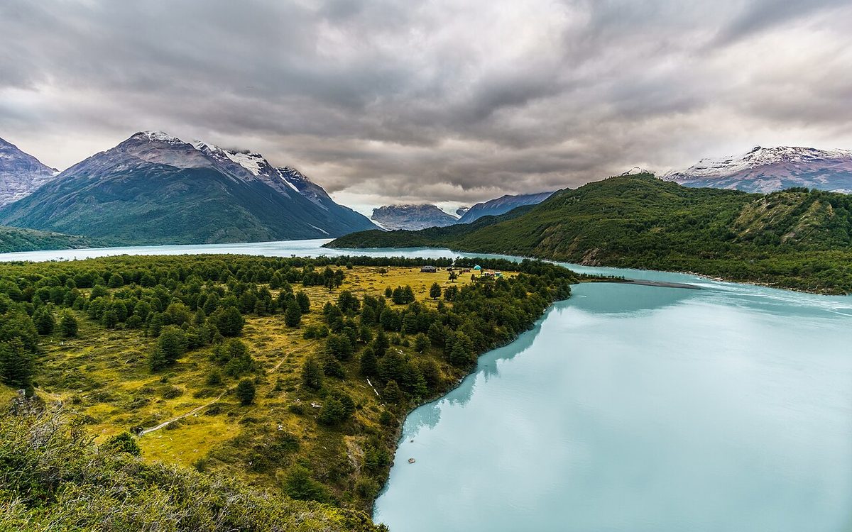
What to wear in Patagonia, month by month and region by region, built from official Chilean and Argentine climate normals, real wind figures and UV data.
By Patagonia Tourism Guide · First published 3 Oct 2026 · Updated 1 Aug 2026
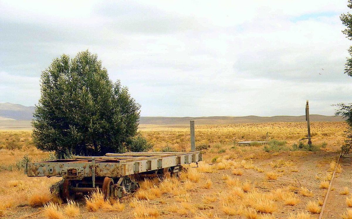
0 — 2 km Fig. 1 · Open Patagonian steppe under a wide sky, the wind-scoured grassland whose gusts decide what to wear in Patagonia far more than air temperature does · Photo: rodoluca / CC BY-SA 3.0 via Wikimedia Commons
A January afternoon on the Nordenskjöld shore in Torres del Paine: 18°C, cloudless, and a gust that stops you mid-stride and drives grit into your teeth. The people struggling out there are almost never the ones who packed too little insulation. They are the ones who packed no windproof.
What to wear in Patagonia comes down to three layers and one non-negotiable: a next-to-skin layer that moves moisture, an adjustable insulating layer, and a shell that is genuinely windproof as well as waterproof. The month on your ticket sets your base-layer weight and how much insulation you carry. The region sets how serious the shell has to be.
Temperatures and rainfall below are 1991–2020 normals from Chile’s Dirección Meteorológica de Chile (DMC) and Argentina’s Servicio Meteorológico Nacional (SMN); wind from DMC’s study of the Austral FIR; UV from DMC and the Universidad de Magallanes. For the kit list itself see our Patagonia packing list — this is its seasonal companion, and both sit under the gear and trail safety rundown.
The rule that matters: block the wind first, insulate second
Most packing lists treat wind as a footnote and winter as the hard season. Both are wrong.
DMC’s study of the Austral FIR records that at Punta Arenas the westerlies dominate in all twelve months, that gusts average 35–65 knots (65–120 km/h) year-round, and that they peak in the afternoon. The seasonal split is the surprise: summer gusts exceed 60 knots (111 km/h), while winter gusts stay below 55 knots (102 km/h). Peak sustained summer wind runs 30–40 knots (56–74 km/h) against roughly 20 knots (37 km/h) in winter. The windy season has intensified within living memory too — mean afternoon wind in November, December and January rose from about 16 knots in 1990–1999 to about 21 knots in 2008–2017.
So the wind peaks in exactly the months most people travel. You cannot out-insulate wind of that order, only block it: a 60 g windproof shell over a light fleece beats a thick down jacket with nothing over it. If you have budget for one good garment, spend it on the shell.
What to wear in Patagonia by month: the hub-by-hub calendar
Find your month, read across the hubs on your itinerary, and note the spread between the warmest and coldest column. That spread is your wardrobe problem in one number.
Average daytime high (°C) — DMC and SMN 1991–2020 normals
Month
Bariloche 41°S
Coyhaique 46°S
El Chaltén 49°S*
El Calafate 50°S
P. Natales 52°S
Ushuaia 55°S
Daylight 52°S, 15th
Jan
23.2
19.5
18.0
19.1
18.8
13.6
16h08
Feb
23.1
20.1
17.0
19.2
18.1
13.6
14h23
Mar
20.1
17.4
14.7
16.6
18.1
12.2
12h32
Apr
15.0
13.6
11.7
12.9
14.3
9.4
10h30
May
10.6
9.4
6.6
8.7
10.9
6.9
8h47
Jun
7.2
6.0
4.4
5.5
6.9
4.5
7h49
Jul
6.7
5.8
4.3
5.2
7.7
4.6
8h14
Aug
8.4
8.3
5.0
6.9
8.9
5.7
9h44
Sep
11.6
11.5
7.9
11.1
12.2
7.6
11h40
Oct
14.7
13.9
11.8
13.5
14.0
10.1
13h39
Nov
17.9
15.9
13.9
15.8
15.6
11.5
15h34
Dec
20.7
18.0
16.2
17.9
17.2
12.5
16h39
Swipe to see all columns
Table 1
Average overnight low (°C) — the figures that decide your evening layer
Hub
Jan
Apr
Jul
Oct
Bariloche
7.0
2.4
−1.6
1.7
Coyhaique
8.9
4.6
−0.4
4.0
El Chaltén*
7.8
2.1
−4.0
2.6
El Calafate
7.2
1.1
−4.4
1.3
Puerto Natales
4.5
−0.3
−4.0
≈0
Ushuaia
5.4
3.0
0.2
2.3
Swipe to see all columns
Table 2
Three caveats matter more than the decimals.
El Chaltén has a station gap. The only observed monthly series I could find for the town runs 1941–1950, and that is what the El Chaltén columns use. It is old, but the alternative is worse: gridded climate sites give the town 2,383–2,869 mm of annual precipitation and a February high of only 9.7–11°C, biased by the Southern Patagonian Ice Field a few kilometres west. Cross-check El Chaltén weather.
Torres del Paine has no published station normal. Puerto Natales is the standard valley proxy, but the park runs colder and windier, especially at Paine Grande, Grey and in the Francés Valley. Reserva Las Torres, the in-park concession, publishes seasonal averages near 18°C in summer, 13°C in spring and autumn, 5°C in winter. Park daylight at 51.0°S is 16h33 on 21 December, 7h55 on 21 June.
Puerto Natales precipitation cannot be reconciled. DMC’s aeronautical study puts the annual mean near 450 mm; popular climate sites list 1,440–1,540 mm. I could not reconcile them, so I am not publishing an annual total for the town. What is internally consistent is the rain-day count: 12 to 16 wet days every month of the year, peaking at 16 in January and December. Rain there is a frequency problem, not a volume problem. The October low reads ≈0 for a related reason — the −1.6°C in secondary compilations breaks monotonicity against September and November and looks like a transcription error.
Month by month: what that means for your bag
December to February — warmest and windiest at once
January highs reach 18.8°C in Puerto Natales and 19.1°C in El Calafate, but only 13.6°C in Ushuaia and a genuinely warm 23.2°C in Bariloche, with lows of +4.5 to +7.2°C. Outside the Lake District this is not hot-weather travel. Wear a light base, a light mid layer and the shell; carry one insulated jacket for evenings and exposed high points rather than for walking; add a hat and thin gloves even in January. Shorts work in Bariloche and on low El Chaltén trails, almost never in Torres del Paine. See Patagonia in January and Patagonia in February.
March to April — the cliff nobody warns you about
March is nearly a summer month: 18.1°C in Puerto Natales, 16.6°C in El Calafate, 20.1°C in Bariloche with only 6.0 rain days. April is a different trip. It is Punta Arenas’ wettest month at 45.1 mm, El Calafate’s lows fall to +1.1°C, Ushuaia picks up 4.3 snow days, and Bariloche’s rainfall roughly doubles to 57.1 mm. Daylight falls from 12h32 in mid-March to 10h30 in mid-April. Add a midweight base layer, real gloves, a warm hat and waterproof footwear, and assume one full wet day a week. Autumn colour in the lenga forests is the payoff. More in Patagonia in March.
May to August — town, day-trip and ski clothing, not trekking clothing
Coastal winter is cold but not brutal: Punta Arenas averages 4.9°C by day and −1.5°C by night in July, Ushuaia 4.6°C and +0.2°C. Inland is harder — El Calafate 5.2°C and −4.4°C, Bariloche down to −1.6°C with 41.7 cm of snowfall in July alone. Daylight shrinks to about 7h34 in mid-June at Punta Arenas, 7h15 at Ushuaia.
What changes the wardrobe, though, is not temperature: the trek most people are packing for does not run in winter. As of July 2026, CONAF’s Torres del Paine winter regime runs 27 April to 30 August 2026, the W circuit is closed outright from 1 June to 31 July 2026, and the “O” circuit is closed until 31 October 2026. So winter here means insulated waterproof boots, waterproof gloves rather than fleece ones, traction devices, and ski-grade insulation in Bariloche. See Torres del Paine in winter, what the off season is really like and what Bariloche is like in the snow.
September to November — the window most people get wrong
Spring reads warmer on paper than it wears. Puerto Natales’ October and November highs are 14.0°C and 15.6°C; El Calafate’s are 13.5°C and 15.8°C, with lows near or just below freezing and still 0.9 and 0.2 snow days a month. Bariloche’s October high is 14.7°C and it is still receiving 5.8 cm of snowfall. Wind is climbing toward its summer peak, and Argentina’s official Perito Moreno page flags strong winds in November and December. Plan on a midweight base layer, real gloves, a warm hat — and using the insulated jacket during the day, not only at night. This is also the ozone-hole window, below. See Patagonia in October.
One sobering data point: on 17 November 2025, five hikers — two Mexicans, two Germans and a British woman — died of hypothermia between Campamento Los Perros and the top of John Garner Pass on the O circuit. Chile’s Servicio Médico Legal found prolonged exposure to extreme cold, with no injuries attributable to serious falls or direct impacts. The forecast was light rain and winds of up to 100 km/h; gusts were reported at 193 km/h, though no official measurement has been published and no agency identified as its source. The average November high in the valley below is 15.6°C. Read Patagonia trekking safety and the O circuit guide if you walk in the shoulder season.
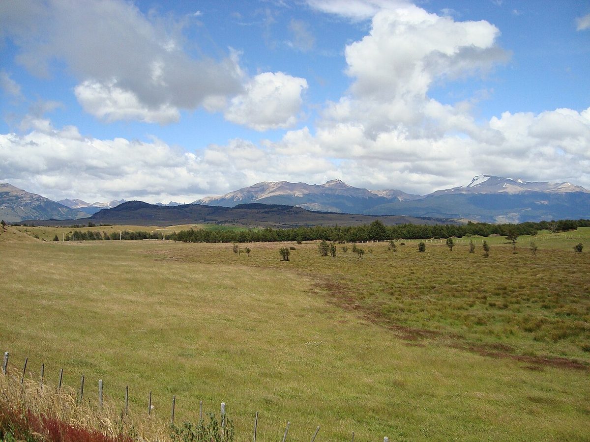
Fig. 2 · Coyhaique in Chilean Aysen, gateway to the Carretera Austral, where 1,023 mm of annual rain makes a taped-seam shell and rain trousers the priorityPhoto: Jason Hollinger / CC BY 2.0 via Wikimedia Commons
What changes by region — more than you think
El Calafate receives 160.8 mm of precipitation a year. Puerto Aisén, in the same Patagonia and on the same road trip, receives 2,255.6 mm — fourteen times more, across four times as many wet days. No single shell recommendation can be right for both. What decides shell class is not annual rainfall but millimetres per wet day: annual total divided by annual precipitation-days.
Hub
mm/year
Wet days
mm per wet day
Shell implication
Ushuaia
457.8
175.4
2.6
Constant drizzle; hood and DWR over hydrostatic head
Río Gallegos
276.6
97.0
2.9
Wind-driven spit, not rain
El Calafate
160.8
42.9
3.7
Arid; a packable shell suffices
Punta Arenas
390.2
86.3
4.5
Wind-driven showers; taped seams
Cochrane
714.5
119
6.0
Real rain; proper membrane
Bariloche
812.5
105
7.7
Real rain, concentrated May–August
Coyhaique
1,023.1
121.2
8.4
Serious shell
Puerto Aisén
2,255.6
178.5
12.6
Storm shell plus rain trousers
Swipe to see all columns
Table 3
Cochrane is DMC 1970–2000; the rest 1991–2020. Puerto Natales is absent for the reason above.
Southern steppe and Torres del Paine. El Calafate records 2,363.8 sunshine hours a year, the sunniest hub here, while summer air stays at 15–19°C — so you sunburn and shiver in the same hour. Wind, not rain, is the controlling variable: a hardshell or stiff softshell that resists 100 km/h without flapping, a hat that stays on, a hood that cinches, a buff for steppe dust. See the full rundown of Torres del Paine, Puerto Natales guide and what to pack for the W Trek.
El Chaltén and Fitz Roy. Roughly five times wetter than El Calafate on the observed series, colder, and directly downwind of the Southern Patagonian Ice Field, so weather arrives with no warning. Waterproof-breathable matters here rather than water-resistant, and trails hold mud most of the season. Bring real insulation for the exposed final climb even in January — the Laguna de los Tres headwall is a different climate from the trailhead. Argentina’s Administración de Parques Nacionales (APN) requires poles and crampons in the north zone from May to September. See the El Chaltén and Fitz Roy guide.
Tierra del Fuego and Ushuaia. Wettest by frequency, least by intensity: 175.4 wet days at 2.6 mm each, plus 59.5 snow days, June to August each averaging 9 to 11. Summer highs never average above 13.6°C, sunshine is the lowest here at roughly 1,404 hours a year, humidity 70–81%. Plan for “cool, grey, damp, breezy” rather than “cold”: a well-hooded shell you wear all day beats a heavy parka you carry. Layer for the boat too — a Beagle Channel deck runs several degrees colder than town. See the Ushuaia and Tierra del Fuego guide.
Lake District: Bariloche and Nahuel Huapi. The only place in Patagonia where summer clothing is genuinely warm-weather clothing: January and February highs of 23.2°C and 23.1°C, a record of 36.4°C, 334.7 sunshine hours in January. Precipitation flips seasons versus the far south — June is the wettest month at 168.3 mm — and the year carries 120.1 cm of snowfall. Summer means shorts, a sun shirt and swimwear; winter means ski-grade insulation, waterproof gloves and traction. Cerro Catedral’s 2026 season runs from Monday 29 June to early October, 1,000 m base to 2,180 m summit. See the guide to Bariloche and the Lake District.
Carretera Austral. A rainfall gradient rather than a climate: 1,023 mm at Coyhaique, 2,256 mm at Puerto Aisén, 715 mm at Cochrane, 887 mm at Villa O’Higgins. Coyhaique’s mean wind is far lower than Magallanes’, so rain-first logic replaces wind-first. And because it is a road trip you are in and out of a vehicle a dozen times a day: favour layers you can pull on in seconds, leave dry shoes in the car, carry a dry bag for ferry decks. Aysén observes daylight saving, so winter local time is UTC−4 — July sunrise near 08:24, sunset near 17:25, which makes a headlamp wardrobe rather than gear. See the Carretera Austral road trip guide.
The wind: what 100 km/h actually does to your clothing
Most pages that mention Patagonian wind reach for wind chill. That is the wrong lever, and the arithmetic shows why — computed with the standard Environment Canada / US National Weather Service index:
Air temp
5 km/h
30 km/h
60 km/h
90 km/h
110 km/h
12°C (Paine summer afternoon)*
12.0
9.2
7.8
7.0
6.6
10°C
9.8
6.6
5.1
4.1
3.6
8°C (El Calafate spring)
7.5
4.0
2.3
1.3
0.7
3°C (Fitz Roy dawn)
1.8
−2.6
−4.6
−5.9
−6.6
−1°C (Paine, winter)
−2.7
−7.8
−10.2
−11.7
−12.5
Swipe to see all columns
Table 4
*The index is formally defined at or below 10°C, so read the 12°C row as indicative.
Notice how it saturates: going from 60 to 110 km/h at 12°C costs barely 1.2°C of apparent temperature. One widely-read Perito Moreno clothing page claims 10°C with a 60 km/h wind “feels like −5°C”. The formula gives about +5°C.
The real damage from a 100 km/h gust is mechanical and hydraulic:
Wind drives rain through fabric. A shell that handles British drizzle wets out in a Patagonian squall. Specify taped seams and a storm flap over the main zip, not just a headline waterproof rating.
Wetted-out insulation stops insulating. The argument for synthetic fill, or hydrophobic-treated down, in the wet regions.
Loose garments flap violently — exhausting, deafening, abrasive on face and neck, destructive to hem seams. Drawcords, adjustable cuffs and a cinchable hood are functional requirements.
Anything unattached leaves. Caps, buffs, map cases. Use a chin cord, or a beanie under your hood.
Balance and footing. Gusts cross the Paine ridgelines and the Laguna de los Tres approach hard enough to knock people over, which argues for poles, a day pack under about 12 kg and stiffer soles.
Grit. Sunglasses are eye protection here, not fashion; glacial dust at 100 km/h abrades.
Treat each wind figure separately. DMC’s measured 111–120 km/h gust range is the defensible one. Reserva Las Torres describes park winds from a 20 km/h breeze to gusts of up to 110 km/h, strongest in summer. At El Calafate airport, fifteen years of METAR reports give a mean near 11 knots (20 km/h) from the west and a maximum gust of 34 knots (63 km/h) — steppe towns are tamer than the park. Ushuaia’s monthly mean sits in the 16.5–25.1 km/h band. One operator page claims gusts “up to 100 mph” (161 km/h); that is an operator claim, not a measurement.
Sun, UV and the ozone hole over southern Patagonia
The lazy version of this section says “extreme UV”. That is not what the measurements show.
In October 2025 the Laboratorio de Investigaciones Atmosféricas at the Universidad de Magallanes measured total column ozone of 210–230 Dobson Units over Punta Arenas around 9 October, with a minimum near 200 DU — below the 220 DU threshold that defines ozone-hole conditions, and the deepest depletion over Magallanes in five years. The hole covered roughly 15 million km², over nearly all of the region. Measured UV index during those episodes: 5 to 7. DMC’s ozone bulletin documents that when the hole sits over southern South America, the UV index at Punta Arenas rises by 1 to 3 units.
Now the honest framing. DMC’s analysis of 30 January 2026 notes a clear latitudinal gradient: UV is highest in northern Chile, and in Punta Arenas the maximum values tend to be more moderate, even though summer days are far longer. Nationwide UV peaks in December and January, with daily maxima between 11:00 and 15:00. Southern Patagonia is not a tropical-UV destination in absolute terms. Three things stack against you anyway.
The spring ozone window, roughly September to November, adds those 1–3 index units on clear days — landing exactly in the shoulder season this guide recommends.
Reflection. The World Health Organization states that fresh snow reflects as much as 80% of UV and “almost doubles a person’s UV exposure”, against under 10% for grass, soil or water. Julbo puts snow reflectance at 80–90% versus about 20% on snow-free ground. Glaciers, snowfields and the Perito Moreno balconies are all high-albedo.
Low sun angle, long exposure. UV arrives from the side and from below — under the chin, the nose, the ears, the lower eyelids, the places nobody applies sunscreen — and mid-December gives Ushuaia 17h20 of daylight. The WHO adds that UV rises about 10% per 1,000 m of altitude and that thin cloud can enhance it by scattering; Chile Montaña cites roughly 90% penetration through cloud.
So: SPF 30–50+, under the chin, on the ears, nose and back of the neck. Argentina’s official Perito Moreno page recommends UV 40 sunscreen alongside a hooded windbreaker, gloves, scarf, jacket, trekking footwear and sunglasses; Chile Montaña recommends SPF 50+ for the face plus lip protection. Both beat the “SPF 15 or higher” still on at least one first-page packing list. For eyes, filter category 3 lenses transmitting 8–18% of visible light suit trail and town; category 4, transmitting only 3–8%, is Julbo’s benchmark for glacier days. Side coverage matters because of ground reflection — the WHO links recurring photokeratitis, snow blindness, in skiers to under-accounting for reflected UV.
One reassuring note that is not a licence to skip sunscreen. NASA and NOAA ranked the 2025 Antarctic ozone hole the fifth smallest since 1992, and the WMO confirmed it closed on 1 December 2025, the earliest since 2019, with full recovery to 1980 levels over Antarctica projected around 2066. It still sat over Magallanes that October.
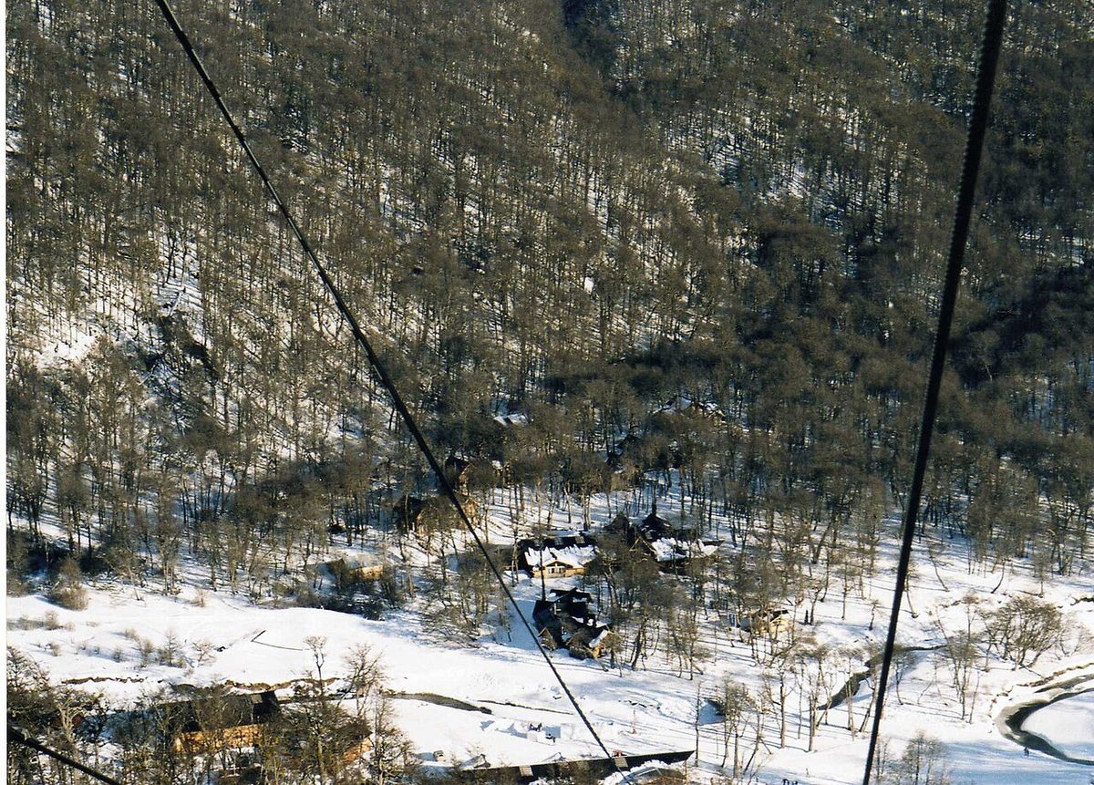
Fig. 4 · Cerro Martial above Ushuaia in Tierra del Fuego, high-albedo snow country where reflected UV can nearly double exposure even on a cool grey dayPhoto: Mel 23 / CC BY-SA 4.0 via Wikimedia Commons
Town clothes, trail clothes, and the 22:00 sunset problem
People pack for the trail and then have nothing to wear at dinner. On the trail, be technical and unglamorous — base, mid, shell, quick-dry trousers, gaiters in shoulder season, over-trousers in El Chaltén, Ushuaia and along the Carretera Austral. In town, relax: Puerto Natales, El Calafate, El Chaltén, Ushuaia, Bariloche and Coyhaique are small, informal, outdoorsy places where hiking clothes are normal at dinner. But bring one non-technical set — dark travel trousers, a merino crew, clean shoes — for the plane, hotel dinners, and the sanity of not being in the same shell for fourteen days. Refugios and restaurants are heated, so a fleece you can shed beats a down jacket you cannot.
Then the daylight arithmetic. In mid-January the sun sets at 22:04 in Punta Arenas, 22:03 in Puerto Natales, 22:02 in Ushuaia, 21:56 in El Calafate and 21:18 in Bariloche. You will be outdoors socially, in daylight, until 22:00 — by which point temperature is falling toward the overnight low (+4.5°C in Puerto Natales, +5.4°C in Ushuaia), the wind is still up, and the sun has stopped warming you. That is the real answer to “do I need a puffy in January”: yes, for 21:30 outside a restaurant rather than for walking. Run it the other way and you get the headlamp rule — by mid-March sunset falls to 20:09–20:15 across the southern hubs, and by mid-July it is 17:50 in Punta Arenas, 17:31 in Ushuaia.
Fabrics, weights and shell specs
The Patagonia packing list has the full inventory; this is only what changes with the month. Published guidance maps merino base layers from 150 gsm (15°C and above) through 170 gsm (10–18°C) and 200 gsm (5–13°C) to 250 gsm (below 5°C):
Season
Merino weight
Notes
Dec–Feb
150–170 gsm
Or synthetic; Chile Montaña suggests 3–4 base layers, light to medium
Oct–Nov, Mar–Apr
170–200 gsm
Add 200 gsm bottoms for El Chaltén and Torres del Paine
May–Sep
200–250 gsm top and bottom
Plus a fleece-lined or insulated trouser layer
Swipe to see all columns
Table 5
Mid layers: grid fleece in summer, 200-weight fleece or a technical softshell in the shoulders, both plus an insulated jacket in winter. Synthetic insulation is the sensible default here rather than down, given Ushuaia’s 175 wet days.
For the shell, look for a waterproof-breathable membrane — Gore-Tex, Gore-Tex Pro, eVent, Futurelight or equivalent — with taped seams, waterproof zips and adjustable hood, hem and cuffs; Chile Montaña’s benchmark is no more than 400 g. Bring rain trousers for El Chaltén, Ushuaia and the Carretera Austral, and never jeans on the trail. Our Patagonia gear rental guide covers what is worth renting locally rather than hauling.
What the parks officially require you to wear or carry
Rules, not suggestions, and several are wardrobe items. All current as of July 2026; confirm the week you travel, because dates move.
Torres del Paine (CONAF). The 2026 winter regime runs 27 April to 30 August 2026, with the summer regime resuming 1 September 2026. Within that window CONAF requires an accredited specialised guide on the W circuit and the Base Torres trail; the June 2026 regulation additionally lists Mirador Ferrier and the Portería Sarmiento–Laguna Amarga trail. The W is closed outright from 1 June to 31 July 2026, so its guide requirement bites only in May and August. The “O” is closed until 31 October 2026. The regulation’s own dates are referencial — CONAF sets operative dates annually by notice, so check conaf.cl before you travel. See Base Torres hike and the four, five and six day route options.
Los Glaciares (APN). Bring a jacket and a waterproof, use ankle-supporting trekking footwear on the glacier walkways, and expect conditions to change from one moment to the next in any season. In the north zone around El Chaltén, from May to September, poles and crampons are mandatory and hikers are told to carry sunglasses and sunscreen. Studded tyres and/or homologated chains are mandatory for winter driving.
Nahuel Huapi. Trekking registration is mandatory and free, and the official kit list includes dry spare clothes in a plastic bag, sunglasses, sunscreen and a hat.
Tierra del Fuego National Park. Online camping registration has been mandatory since 20 November 2023. See Patagonia camping.
Fig. 5 · Lake Nahuel Huapi near Bariloche, the one corner of Patagonia where summer clothing is genuinely warm-weather clothing at 23C daytime highsPhoto: Pepe Robles / Public domain via Wikimedia Commons
Mistakes that ruin Patagonia wardrobes
Cotton, anywhere. It holds water, dries slowly and stops insulating when wet — the standard route to hypothermia at 8°C in a 60 km/h wind. Chile Montaña says it will never bring cotton underwear on an expedition; one El Calafate operator claims 80% of its visitors arrive in jeans.
No genuine windproof. The most consequential error, given DMC’s 111 km/h summer gusts. Fleece alone is worthless in wind.
Three assumptions to unlearn: that one heavy jacket substitutes for a layering system; that winter is the windy season (it is the calmest); and that a cold-looking day is a low-UV day.
Overpacking clothes, underpacking protection. Five shirts and no rain trousers is the classic failure. Unsure which conditions you are dressing for? Our best day hikes in Patagonia and best time to hike Patagonia guides will tell you.
Frequently asked questions
What should I wear in Patagonia in November?
November averages 15.6°C by day in Puerto Natales and 15.8°C in El Calafate, with lows near or just below freezing and wind climbing toward its summer peak. Pack a 170–200 gsm base layer, a fleece, a full hardshell, real gloves and a warm hat, and expect to wear the insulated jacket during the day. November also sits inside the spring ozone window, so bring sunscreen and category 3 sunglasses.
What should I wear in Patagonia in January?
A light base layer, a light fleece, a windproof waterproof shell, plus one insulated jacket you will mostly wear in the evening. January highs reach 18.8°C in Puerto Natales but only 13.6°C in Ushuaia, and lows fall to +4.5 to +7.2°C with sunset around 22:00 — so bring a hat and thin gloves anyway. It is the windiest month, so the shell matters more than the insulation.
Is March a good month, and what changes?
March is close to a summer month — 18.1°C in Puerto Natales, 16.6°C in El Calafate, 20.1°C in Bariloche with only 6.0 rain days — with fewer people and autumn colour. What changes is daylight: 12h32 in mid-March against 16h08 in mid-January. Add a midweight base layer, gloves and a headlamp. April is the real drop-off, not March.
Do I need hiking boots, or will trail runners do?
On dry steppe day walks around El Calafate or the low El Chaltén trails, waterproof trail runners are fine. Boots earn their weight for multi-day treks with a loaded pack, shoulder-season mud and snow, and the metal walkways at Perito Moreno, where APN advises footwear that supports the ankle. Either way, waterproof and broken in.
Do I really need a down jacket in a Patagonian summer?
You need an insulated jacket, and it is for the evenings rather than the walking: southern hubs sit at +4 to +7°C overnight while you are still outdoors in daylight at 22:00. Whether it should be down is the better question — given Ushuaia’s 175 wet days, synthetic or hydrophobic-treated down is safer.
Is one wardrobe enough for both Chilean and Argentine Patagonia?
Mostly yes. Base and mid layers travel unchanged across every hub here. Two things change: the shell class, which steps up from a packable windproof on the El Calafate steppe to a taped-seam storm shell with rain trousers for El Chaltén, Ushuaia or the Carretera Austral; and the footwear, which must be genuinely waterproof once you leave the steppe.
Do I need sunscreen if it feels cold?
Yes, and this is where people get caught. El Calafate records 2,363.8 sunshine hours a year while air temperature stays at 15–19°C. Fresh snow reflects as much as 80% of UV according to the WHO, roughly doubling exposure on glacier days, and the spring ozone hole adds 1 to 3 index units over Punta Arenas. Use SPF 30–50+ and real sunglasses.
The short version
Buy the shell first. Set base-layer weight from the month and shell class from the region. Carry one insulated jacket knowing it is an evening garment in summer and a daytime one in spring.
Daylight and sunset times use the NOAA sunrise/sunset algorithm, 15th of each month and both solstices, 2026, at each hub’s coordinates. Wind chill uses the Environment Canada / NWS index.
Last fact-check: 2026-07-30
Image Credits
Open Patagonian steppe under a wide sky, the wind-scoured grassland whose gusts decide what to wear in Patagonia far more than air temperature does — rodoluca / CC BY-SA 3.0 via Wikimedia Commons
Coyhaique in Chilean Aysen, gateway to the Carretera Austral, where 1,023 mm of annual rain makes a taped-seam shell and rain trousers the priority — Jason Hollinger / CC BY 2.0 via Wikimedia Commons
Cerro Martial above Ushuaia in Tierra del Fuego, high-albedo snow country where reflected UV can nearly double exposure even on a cool grey day — Mel 23 / CC BY-SA 4.0 via Wikimedia Commons