Best Day Hikes in Patagonia by Difficulty and Region
The best day hikes in Patagonia, graded on official park scales, with 2026 fees, mandatory registrations, guide rules and cutoff times that stop you walking.
By Patagonia Tourism Guide · First published 4 Oct 2026 · Updated 1 Aug 2026
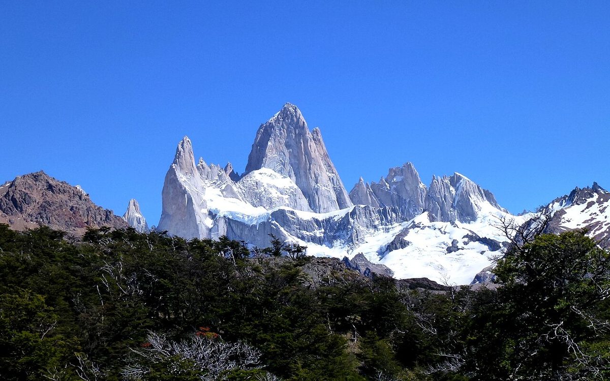
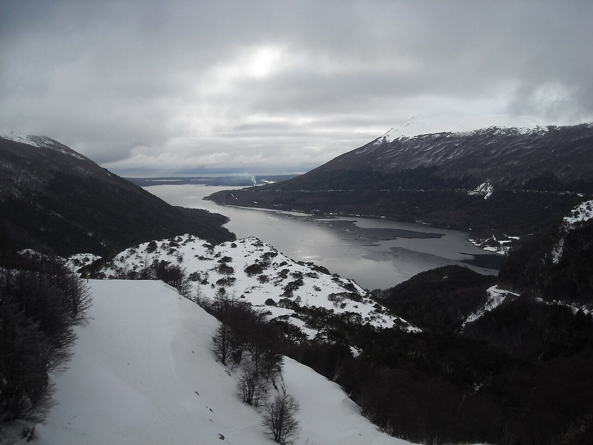
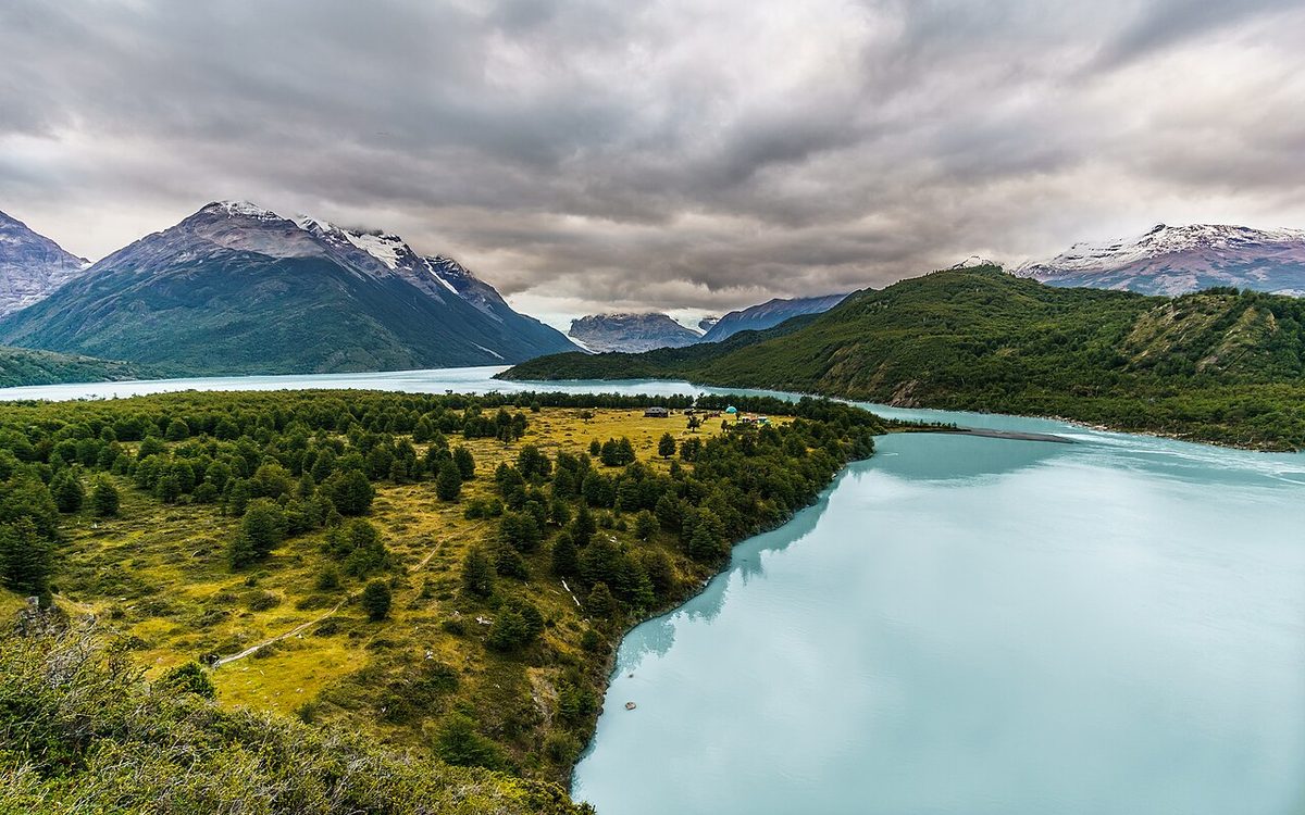
0 — 2 km Fig. 1 · The view from Loma del Pliegue Tumbado near El Chalten, the only day hike in Patagonia that frames Fitz Roy and Cerro Torre together · Photo: Hiroki Ogawa / CC BY 3.0 via Wikimedia Commons
The queue at El Chaltén’s visitor centre in December is not people asking about the weather. It is people discovering, half an hour before they meant to start walking, that the trail they flew 12,000 km for needs a ticket, the ticket is sold online, and cash will not buy it.
The best day hikes in Patagonia cluster in six places, and you will realistically reach two or three in one trip. For the highest payoff per day, walk out of El Chaltén: Laguna de los Tres and Loma del Pliegue Tumbado are hard 19–25 km days, and Laguna Torre is long but nearly flat. For big views on small effort, take Mirador Cuernos in Torres del Paine or Cerro Campanario in Bariloche. Almost every one now carries a fee, a compulsory registration, or an enforced cutoff time.
That last clause is what the ranking lists leave out. Distances you can find anywhere. What is hard to find is which trails charge, which make you sign a register first, which need a guide and when, and which gate you by the clock instead of the climb. Miss the 12:30 cutoff on Cerro Guanaco and your fitness is irrelevant.
Patagonia is not one hiking destination but six clusters separated by 200 to 1,500 km of bus travel. The grades below are not mine: where a park publishes an official scale, I use theirs. Broader context sits in our hiking, camping, gear and safety pillar.
The best day hikes in Patagonia at a glance
Gates: $ paid ticket, REG compulsory registration, GUIDE guide required in some or all seasons, CLOCK enforced entry or return cutoff. n/p = not published.
Hike
Region
Difficulty
Distance RT
Gain
Hours
Gate
Mirador de los Cóndores
El Chaltén
1 Easy
2–5.2 km
90–220 m
1–2
$
Laguna Torre
El Chaltén
2 (media)
18–20 km
~500 m
6–7
$
Loma del Pliegue Tumbado
El Chaltén
3 Hard
19–21 km
~1,100 m
7–9
$
Laguna de los Tres
El Chaltén
3 (media-alta)
20–25 km
~1,000–1,100 m
8–10
$
Salto Grande
Torres del Paine
1 Easy
1.5–2 km
negligible
0.75
$ CLOCK
Mirador Cuernos
Torres del Paine
1 Easy
~5 km
~90 m
1.5–2
$ CLOCK
Mirador Ferrier
Torres del Paine
2–3
4–6.4 km
~600 m
2.5–4
$ GUIDE CLOCK
Mirador Grey
Torres del Paine
2 Moderate
11–13 km
~400 m
4
$ CLOCK
Base Torres
Torres del Paine
3–4
16–20 km
~750–1,000 m
8–10
$ GUIDE CLOCK
Cerro Guanaco
Tierra del Fuego
4 (ALTA)
12 km
n/p
4 up
$ REG CLOCK
Laguna Esmeralda
Ushuaia
2 Moderate
9 km
~220 m
4–5
unclear
Glaciar Martial
Ushuaia
1–3
1.4–7.2 km
100–665 m
0.5–4
$
Cerro Campanario
Bariloche
1 Easy
~2 km
~250 m
1, or 7 min by lift
$
Cerro Llao Llao
Bariloche
1–2 (Baja)
6 km
230 m
2.5
$ CLOCK
Refugio Frey
Bariloche
2–3
20 km
700 m
~8
REG
Ventisquero Colgante
Carretera Austral
2 Moderate
6 km
n/p
2–3
$
Mirador Laguna Cerro Castillo
Carretera Austral
3 Hard
14 km
n/p
8
$ REG GUIDE CLOCK
Cerro Alto El Petiso
Los Alerces
4 (alta)
16 km
n/p
7
$ REG GUIDE
Swipe to see all columns
Table 1
Where a park publishes a figure, that is the figure; otherwise you get the range across sources, or nothing. Gain is unpublished for most trails on both sides of the border.
How to read the difficulty grades
No need to invent a scale: APN grades Tierra del Fuego BAJA / MEDIA / ALTA, Los Glaciares publishes media and media-alta, CONAF uses fácil / medio / difícil, and Bariloche’s sheets grade Baja / Media / Alta and change the grade by season. My tiers map onto those.
Tier
Maps to
Distance RT
Gain
Hours
Character
1 Easy
Baja / fácil
under 6 km
under 200 m
under 2
Path from a road; trainers fine
2 Moderate
Media / medio
6–15 km
200–600 m
2–5
Rough ground; trail shoes
3 Hard
Media-alta
15–22 km
600–1,100 m
6–9
One steep climb, usually last
4 Very hard
Alta / difícil
22 km+ or 1,100 m+
—
9+
Exposure, scree, or a permit gate
Swipe to see all columns
Table 2
Then four modifiers. Wind is a difficulty multiplier, not weather trivia: Llao Llao closes its trails outright on windy days, and Pudeto keeps a wind gauge at the trailhead. A Tier 2 ridge in 90 km/h wind beats a sheltered Tier 3 — see what to wear in Patagonia. Daylight: Torres del Paine gets roughly 17 hours October to April, about 8 May to September. Season: add a tier above treeline May to September, when Los Glaciares tells hikers to carry poles and crampons. Cutoff: several trails gate you by the clock. Refugio Frey is the cleanest seasonal regrade — see best time to hike Patagonia.
What changed in 2026, and why the old lists are wrong
El Chaltén’s trails are no longer free. Paid access to the Zona Norte of Parque Nacional Los Glaciares — the whole Fitz Roy, Laguna Torre and Pliegue Tumbado network — began on 21 October 2024 and was re-implemented from 1 October 2025. Under APN tariffs in force since 1 June 2026 the day rate is ARS 50,000 for non-resident foreigners, sold online only, payable by card only: cash is not accepted. Three of the strongest pages ranking for this query do not mention it at all, and one is an outdoor brand.
Torres del Paine replaced its ticket structure on 1 May 2026. CONAF scrapped the under-three-days / over-three-days split for a daily pass plus a multi-day pass valid for two or more consecutive days, capped at ten. It was first set for 1 January 2026, then postponed on 18 December 2025 for landing in peak season. Any page quoting “CLP 34,000 for under three days” is quoting a dead system — see how to buy park tickets.
Guiding rules moved in both directions. CONAF lifted the temporary guide requirement on the Circuito Macizo Paine — the O — from 1 January 2026, replacing it with an early-warning protocol using pre-defined thresholds for wind, precipitation and temperature, coordinated with SENAPRED and Chile’s meteorological service. Self-guided walking is allowed again, while the winter regime tightened on named routes — see hiking Patagonia without a guide and the O Circuit guide.
El Chaltén: five headline hikes, all on foot from your hostel
The strongest day-hiking town in Patagonia, and it is not close. Every El Chaltén trail above starts in the village or within a few kilometres of it — no car, no shuttle, no boat, no tour. Start with how many days in El Chaltén and the El Chaltén Fitz Roy hiking guide.
The paperwork. Three paid portals cover the network: Los Cóndores, Cerro Torre – Base Fitz Roy, and Río Eléctrico. A second day inside 72 hours is half price. Because the Zona Norte takes cards only, buy before you arrive — the town’s ATMs are unreliable (Patagonia money). You can scan the ticket QR at a trailhead portal, but only if signal and card both cooperate. Registration is separate, and free: at the Centro de Informes Ceferino Fonzo it is obligatory for climbing, for remote-area trekking, and for hiking at all from May to September.
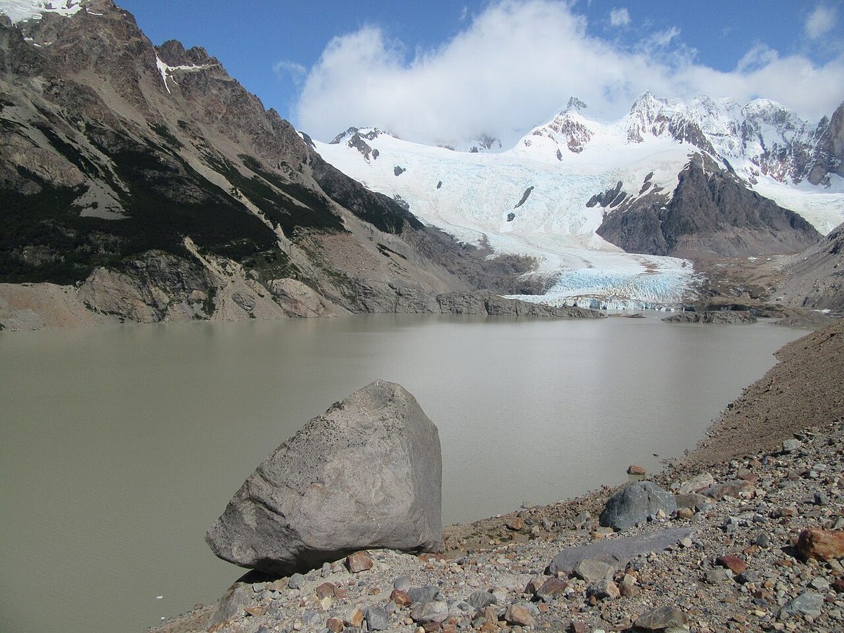
Fig. 2 · Laguna Torre below Cerro Torre near El Chalten, the long but nearly flat media-graded day hike that starts on foot from townPhoto: amanderson2 / CC BY 2.0 via Wikimedia Commons
Mirador de los Cóndores, an hour from the visitor centre, is the acclimatiser and the bad-weather fallback; Chorrillo del Salto is flat and open all year. Both are in El Chaltén short hikes.
Laguna Torre is graded media and nearly level for three-quarters of its length: the best pick for someone with stamina but no mountain experience. The final moraine is the windiest point in the valley — people walk three hours in shelter, crest it, and get knocked sideways. Keep a windproof accessible; see the Laguna Torre hike.
Loma del Pliegue Tumbado is the connoisseur’s day: a roughly 1,500 m summit, no shelter at all in the last two hours, best November to May, and the only trail here that puts Fitz Roy and Cerro Torre in one frame. Sources quote up to 24 km if they measure to the true summit rather than the mirador — see Loma del Pliegue Tumbado.
Laguna de los Tres is graded media-alta; APN states 25 km and eight to nine hours, other measurements 20 to 22. It is Tier 2 walking until the last 1.5 km, which climbs around 400 m of switchbacks and rubble — that section, not the distance, breaks people. Treat it as having three finish lines: Laguna Capri at 4 km and 1:45, Poincenot at 8 km and 3:15, the lake at 10.2 km and 4:30 one way. Turning back at Poincenot is not failure; it is how experienced walkers use this valley. See the Laguna de los Tres hike.
Torres del Paine: the best day hikes, the worst logistics
World-class walks, the most awkward access on this page: almost nothing starts where the bus drops you. Budget for a shuttle and a catamaran, and read how to get to Torres del Paine, the Torres del Paine travel guide and the town you stage Torres del Paine from first. Buy your pass in advance and download the QR PDF in Puerto Natales while you still have signal — there are no ATMs inside the park.
The easy Pudeto cluster gives the highest return on effort if you have one day and only the bus. Salto Grande is a short walk to a waterfall between Lagos Nordenskjöld and Pehoé, and the wind gauge at its trailhead is the most honest signage in Patagonia. Continue to Mirador Cuernos for the Cuernos across the water in under two hours; Mirador Cóndor is short, steep and good at sunset. The Lago Grey shore walk is a flat stroll to grounded icebergs, and it is not Mirador Grey: different hike, different tier, different side of the park. Most ranking pages blur the two — see short walks with big views.
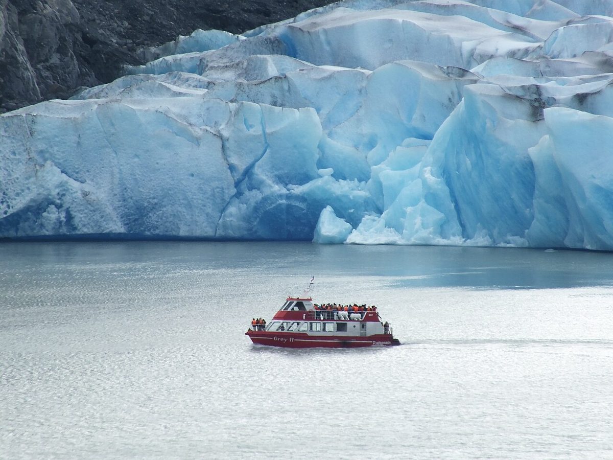
Mirador Ferrier is relentless forest climbing with ladders and steps to a 360-degree panorama, and the best escape-the-crowds option here. Mirador Grey is limited by the boat, not your fitness: the Pudeto–Paine Grande catamaran, historically around USD 30 one way and cash-only, with the last afternoon return the real deadline. More in ranking Torres del Paine’s trails.
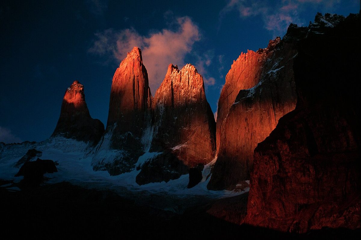
Base Torres numbers vary honestly — 16 to 20 km and 750 to 1,000 m, depending on whether you measure from Laguna Amarga, the Welcome Center or Hotel Las Torres. Rolling ascent to Refugio Chileno, flat forest, then a brutal 45 to 60 minute boulder field. Two hard gates: the return deadline from Campamento Torres is 18:00, and in winter it is guided-only with a 09:00 maximum entry. See the Base Torres hike.
Winter: correcting the claim you will see everywhere
Several well-ranked pages say you need a guide to visit Torres del Paine from May through September. That is wrong in both directions.
The 2026 winter regime runs 27 April to 30 August 2026, with summer resuming 1 September. CONAF brought the start forward from the usual 1 May because of variable conditions, and the June 2026 regulation gives its own window as a referential 1 May to 30 August — which is why you should check CONAF in the week you travel rather than trust any published range, including this one.
Within that window the guide requirement attaches to named routes, not the whole park: the W circuit and the Base Torres trail, with the written regulation additionally listing Mirador Ferrier and Portería Sarmiento – Laguna Amarga. The W is separately closed from 1 June to 31 July 2026, so its guide rule bites only in May and August; entry during the closure needs exceptional authorisation via a CONAF-accredited operator and the Magallanes regional office. The O Circuit is closed until 31 October 2026, and lower-difficulty sectors stay self-guided on the fixed times tabled below. See Torres del Paine in winter and self-guided W Trek.
Ushuaia and Tierra del Fuego: the best official trail data in Patagonia
This is where I can be most precise, because APN publishes a distance, a duration and a grade for every trail. Here it is, verbatim; trails marked Nov–Apr are seasonal.
Trail
Grade
Distance
Duration
Castorera (accessible route)
BAJA
200 m
20 min
Laguna Negra
BAJA
500 m
15 min
Mirador Lapataia
BAJA
980 m
30 min
Cascada Río Pipo (Nov–Apr)
BAJA
900 m one way
15 min one way
La Baliza
BAJA
1,200 m
30 min
Paseo de la Isla
BAJA
1,300 m
30 min
Cruce Ruta 3 – Ensenada (Nov–Apr)
BAJA
1,300 m
40 min
Senda del Turbal
BAJA
1,350 m
40 min
Hito XXIV (Nov–Apr)
MEDIA
3.5 km one way
3 h RT
Pampa Alta (Nov–Apr)
MEDIA
4.7 km
2 h
Senda Costera (Nov–Apr)
MEDIA
8 km
4 h
Cerro Guanaco (max entry 12:30)
ALTA
6 km one way
4 h to summit
Laguna del Caminante (Dec–Mar)
ALTA
24.4 km
9 h
Swipe to see all columns
Table 3
Senda Costera is the best MEDIA-grade day walk here. Cerro Guanaco is the serious one: ALTA, needs mountain experience, prior registration obligatory, 12:30 maximum entry — turn up at 13:00 in perfect weather and you are turned away. Laguna del Caminante also needs registration, camping registration has been mandatory online since 20 November 2023, and vehicles in the public-use areas are capped at a stated 180. See the rundown of trails, train and fees guide.
Two Ushuaia favourites sit outside the park, so APN’s fees and rules do not apply. Laguna Esmeralda is graded media/fácil terrain with media physical effort by Ushuaia’s tourism secretariat, which still recommends an operator; the trailhead is 18 km out on Ruta Nacional 3 with no public bus, and it is notoriously muddy. On fees I have to be honest: I could not establish whether Laguna Esmeralda charges for access. It sits on provincial land near Valle Tierra Mayor and no official page states either a fee or free access — see the Laguna Esmeralda hike.
Glaciar Martial is 7 km from the centre by taxi, with five graded circuits from Bosque (1.4 km, +100 m) to de las Nubes (6.2 km, +520 m); de los Vientos (7.2 km, +665 m) is currently closed. Note a real discrepancy on de las Nubes: the tourism secretariat gives 150 minutes, the provincial trail database four hours and alta. And the bit most pages get wrong — the old chairlift is no longer the access story. More in things to do in Ushuaia and the Ushuaia guide.
Bariloche and the Lake District: register first, then walk
Cheapest access in Patagonia, best city for reaching trailheads by public bus, and home of the rule nobody on page one mentions.
Trekking registration in Parque Nacional Nahuel Huapi is mandatory and free, for tourists as well as residents, before you walk any enabled trail. Register through the park’s form, Bariloche Trekking, Club Andino, refugio websites or a QR code. Its purpose is search and rescue: it captures your declared itinerary so an evacuation can be organised, and unregistered hikers can be fined. The detail with real consequences: high-complexity trails that do not appear in the form are not enabled — that form is the definitive list of legal routes. Separately, Parque Municipal Llao Llao is municipal, not APN, with its own fee.
Cerro Campanario is the best-value viewpoint in Patagonia for near-zero effort: km 17.5 on Avenida Bustillo, on the city bus route, summit 1,050 m, 30 minutes on foot or seven on the chairlift, cafeteria at the top. One caution: the official tourism page states both “35 km from downtown” and “km 17,500 of Bustillo” — the Bustillo marker is the usable one.
Cerro Llao Llao runs 3 km each way to the mirador from Puerto Pañuelo at km 25 on Bustillo, on city bus Línea 20. Officially Baja, “Media depending on fitness,” open all year, summer hours 08:00 to 22:00. And here is the proof that wind belongs in a difficulty framework: these trails close on windy days. Not “are unpleasant” — close.
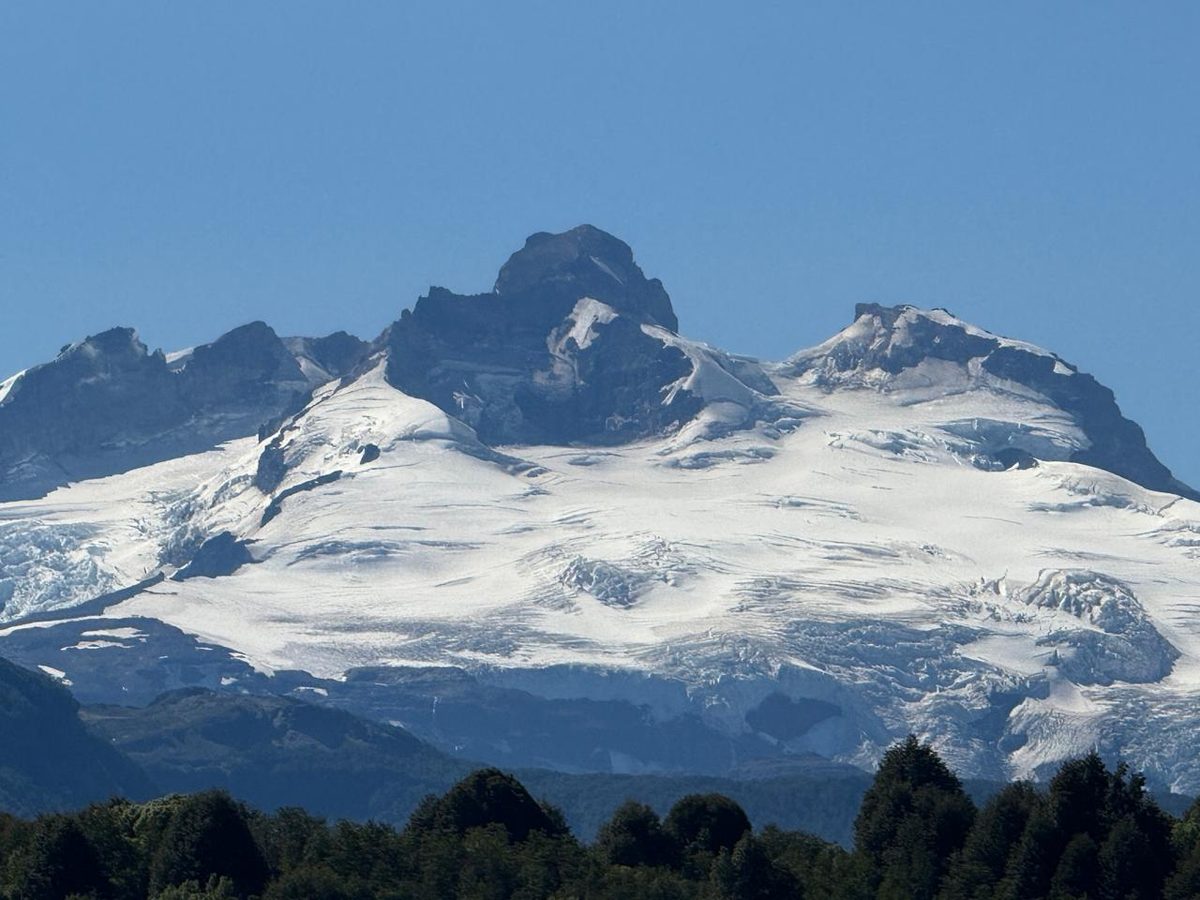
Fig. 4 · Refugio Frey on Laguna Toncek above Bariloche, graded Moderate November to April and High May to October on the official trail sheetPhoto: MR.DORTMUND / CC0 via Wikimedia Commons
Refugio Frey from Villa Catedral is the Lake District classic: 10 km one way, 700 m of gain, to a refugio at 1,700 m on Laguna Toncek, reservation required to sleep or camp. Take city bus Línea 55 with a SUBE card. The grading is worth arguing about — Bariloche’s tourism page calls Frey “low,” while the seasonal trail sheet grades it Moderate November to April and High May to October. Side with the trail sheet: a snow-loaded rock bowl at 1,700 m is not a low-difficulty objective. Cerro Catedral’s summer ridge walks use the lift to turn a Tier 3 into a Tier 2, riding up and walking the filo down to Frey. See Bariloche hiking and the Bariloche and northern Patagonia guide.
The Carretera Austral: showstoppers with the worst paperwork
Sendero Ventisquero Colgante, Parque Nacional Queulat is the best single day hike on the whole Carretera Austral and, refreshingly, only Tier 2, with the hanging glacier visible from a platform after about an hour. The trailhead is 22 km south of Puyuhuapi; buy through the official Chilean parks portal. It is reliably muddy and there are no food services in the sector. See the Queulat hanging glacier guide.
Mirador Laguna Cerro Castillo has a genuinely ambiguous status, so here are both readings. CONAF’s park page lists the trail as closed by resolution and permitted only with a certified guide, with a seasonal closure May to September; the official pass portal sells self-guided day passes with fixed entry windows. The consistent reading is guide-only May to September, self-guided in the open season — but as of 30 July 2026 we are inside the winter window, so guided-only is the rule in force. Email [email protected] before fixing a date.
In the open season passes cost CLP 20,000 plus a 250 service fee for foreigners, CLP 16,650 plus 250 for Chileans, CLP 8,000 plus 250 concession. The windows are hard: Mirador Laguna 08:00 to 12:00, Estero Parada 08:00 to 11:00, latest departure 15:00. Enter by one trail and leave by another and you need a two-day ticket. Registration at park administration is required before any trail, Estero Parada has been closed to self-guided access since 29 May 2026, and CONAF posts a hantavirus warning across all trails here.
Glaciar Exploradores hides a distinction that costs people a day and a chunk of budget. The viewpoint trails in Parque Exploradores are short and self-guided, through forest to views over the glacier and Monte San Valentín, Patagonia’s highest peak. The ice trek onto the glacier is a separate, long, guided-only activity. I could not verify the reserve’s entrance fee, hours, guide policy or the road distance from Puerto Río Tranquilo — the official page omits all four — so contact [email protected]. The Marble Caves are the other reason to stop there.
El Calafate, and the one Los Alerces trail that needs a guide
El Calafate is a base town, not a hiking town. Saying so plainly saves a wasted day. The only real walk in town is Laguna Nimez, a flat loop with separate admission and 80-plus bird species. The Perito Moreno Glacier walkways are roughly 3 km of boardwalks and stairs, 80 km from town — a walk, not a hike. Usefully, the Zona Sur takes cards, cash and online purchase, unlike the Zona Norte. See the El Calafate and Perito Moreno Glacier guide.
Further north, Parque Nacional Los Alerces grades its trails baja to alta and requires registration for Laguna Escondida, Laguna del Toro and Cerro Alto El Petiso. El Petiso is the only Argentine day hike here that requires a guide by rule. Cerro Cocinero and Lago Krügger are currently closed — see the rundown of lakes, trails and gateway towns guide.
Which hikes work without a car
On foot from town: El Chaltén, all five headline hikes; El Calafate, Laguna Nimez only.
City bus: Bariloche — Campanario and Llao Llao on Línea 20, Frey and Catedral on Línea 55 (roughly every 2 h), Lago Gutiérrez on Línea 50. SUBE card required.
Shuttle minibus: Ushuaia — Tierra del Fuego NP, including Senda Costera, Hito XXIV and Cerro Guanaco.
Bus, then more: Torres del Paine — Puerto Natales departures historically around 07:00 and 12:00, roughly CLP 10,000 one way, reaching the park but not most trailheads.
Transfer or boat: Base Torres needs the Laguna Amarga shuttle, Mirador Grey the Pudeto catamaran, and Ferrier and Lago Grey a separate drive-in sector. El Chaltén’s Río Eléctrico taxi is around ARS 40,000, shareable.
Vehicle, taxi or tour: Laguna Esmeralda and Glaciar Martial; Queulat, Cerro Castillo and Exploradores.
El Chaltén is the only place in Patagonia where five headline day hikes start on foot from your hostel. Bariloche is the best bus-hiking city; Torres del Paine is the hardest to do carless — plan with bus routes and journey times and the Patagonia hiking itinerary.
Registration, permits and who needs a guide
Where
What is required
Cost
El Chaltén, Zona Norte
Registration for climbing, remote trekking, and for hiking at all May–Sept; ticket online and card-only
Free; ticket ARS 50,000
Nahuel Huapi
Registration mandatory on every enabled trail; unlisted trails not enabled; fines possible
Free
Tierra del Fuego
Prior registration for the two ALTA trails; camping since 20 Nov 2023
Free; entry separate
Los Alerces
Registration for El Petiso, Escondida and Laguna del Toro; El Petiso also needs a guide
Free
Cerro Castillo
Registration at administration before any trail; fixed entry windows
CLP 20,000 + 250
Torres del Paine
Advance QR ticket; registration at porterías; climbing permit free, foreigners need DIFROL clearance
Per May 2026 structure
Swipe to see all columns
Table 4
Who actually needs a guide, as of 30 July 2026. Base Torres and the W within 27 April to 30 August 2026, plus Mirador Ferrier and Portería Sarmiento – Laguna Amarga in the written regulation. Five Torres del Paine trails need accredited guides year round: Laguna Marco Antonio, Grey to Mirador Zapata, Valle Bader, Campamento Torres to Japonés, Laguna Amarga to Sarmiento. Cerro Alto El Petiso in Los Alerces, and Cerro Castillo under its current resolution. And not the O Circuit any more, since 1 January 2026. Ratios under the June 2026 regulation are one guide per four trekkers, one per ten hikers. Everything else you may legally walk alone — read staying safe on Patagonian trails first, and packing out waste and staying on track for trail manners.
The hard clock: cutoff times and daylight
Gate
Time
Cerro Guanaco, Tierra del Fuego
Max entry 12:30 — later and you are turned away
Base Torres
Return from Campamento Torres by 18:00; segment cutoffs 17:00–18:00
Base Torres, winter 2026
Max entry 09:00, guided only, 27 Apr–30 Aug
Mirador Laguna Cerro Castillo
Entry 08:00–12:00, out by 15:00; Estero Parada entry 08:00–11:00
Two consequences. Any Tier 3 or 4 hike from May to September needs a headlamp as standard — see the gear checklist for Patagonia. And if a bus is getting you to a trailhead with an entry window, work backwards from the cutoff.
Fees at a glance for 2026
Argentine national park entry, effective 1 June 2026, per person per day. Revised often under inflation, so check the official tariff page before you travel.
Park
General
Argentine
Student
Provincial
Los Glaciares Zona Norte (El Chaltén)
ARS 50,000
25,000
15,000
8,000
Tierra del Fuego
ARS 40,000
18,000
12,000
8,000
Nahuel Huapi (Bariloche)
ARS 35,000
15,000
12,000
8,000
Los Alerces
ARS 35,000
15,000
12,000
8,000
Swipe to see all columns
Table 6
A second day inside 72 hours is half price, and exemptions cover retirees with Argentine ID, young children, educational groups, visitors with disabilities and local residents. The Pase Anual at ARS 300,000 covers every Argentine national park for twelve months, paying for itself in three or four full-price park days. I am not converting these into dollars: the peso moves too fast for that to help you.
On the Chilean side, CONAF published no price table with the 1 May 2026 restructure. As of late July 2026 the park’s own site shows around CLP 32,400 daily and CLP 48,500 multi-day for foreign adults, and about CLP 9,400 and CLP 14,200 for Chilean adults. Treat those as indicative and verify on the official portal. Current numbers live in budgeting for park entry.
Frequently asked questions
What is the easiest hike in Patagonia?
Cerro Campanario in Bariloche is hard to beat: 30 minutes on foot or seven on the chairlift from km 17.5 on Avenida Bustillo, for a 1,050 m summit and a cafeteria. In Tierra del Fuego the BAJA trails are easier still — Laguna Negra is 500 m and 15 minutes, and Castorera has an accessible alternative route.
Do I need a permit to hike in Patagonia?
More often than people expect. Paid tickets apply in El Chaltén, Torres del Paine, Queulat and Cerro Castillo. Free but compulsory registration applies to every enabled trail in Nahuel Huapi, the two ALTA trails in Tierra del Fuego, three trails in Los Alerces, and any trail in Cerro Castillo. Registration is not bureaucracy for its own sake — it is what makes a search-and-rescue call possible.
Can I hike Torres del Paine in a day?
Yes, but not the W. Base Torres is the classic single day: 16 to 20 km, eight to ten hours, with an 18:00 return deadline from Campamento Torres and, inside the 2026 winter window of 27 April to 30 August, a guide requirement and 09:00 maximum entry. If that is too much, the Pudeto cluster gives three viewpoints in a relaxed day — multi-day options are in the W Trek and O Circuit guide.
Do I need a guide to hike in Patagonia in winter?
Not park-wide anywhere, which is where most articles go wrong. In Torres del Paine, within 27 April to 30 August 2026, CONAF requires an accredited guide on the W and on Base Torres, and the June 2026 regulation additionally lists Mirador Ferrier and Portería Sarmiento – Laguna Amarga. Lower-difficulty sectors stay self-guided on fixed times, Cerro Castillo is guide-only under its current resolution, and the O Circuit no longer requires a guide at all. CONAF sets operative dates annually by notice, so verify in the week you travel.
Final thoughts
The free-for-all era of Patagonian day hiking is over. The change was not to the trails but to the paperwork: a card-only ticket in El Chaltén, a restructured pass in Torres del Paine, a guide requirement that comes and goes on named routes rather than whole parks, and clocks that will send you home at 12:31.
None of that makes these hikes harder, only less spontaneous. Buy the ticket the night before, sign the register even where you doubt anyone checks, work backwards from the cutoff, and treat wind as a grade rather than a weather report.
Refugio Frey on Laguna Toncek above Bariloche, graded Moderate November to April and High May to October on the official trail sheet — MR.DORTMUND / CC0 via Wikimedia Commons