Best Towns to Base Yourself in Patagonia: Pros and Cons
The best towns in Patagonia to base yourself, compared across Argentina and Chile: day trips, airports, buses, cash, seasons and the 2026/27 changes to know.
By Patagonia Tourism Guide · First published 10 Oct 2026
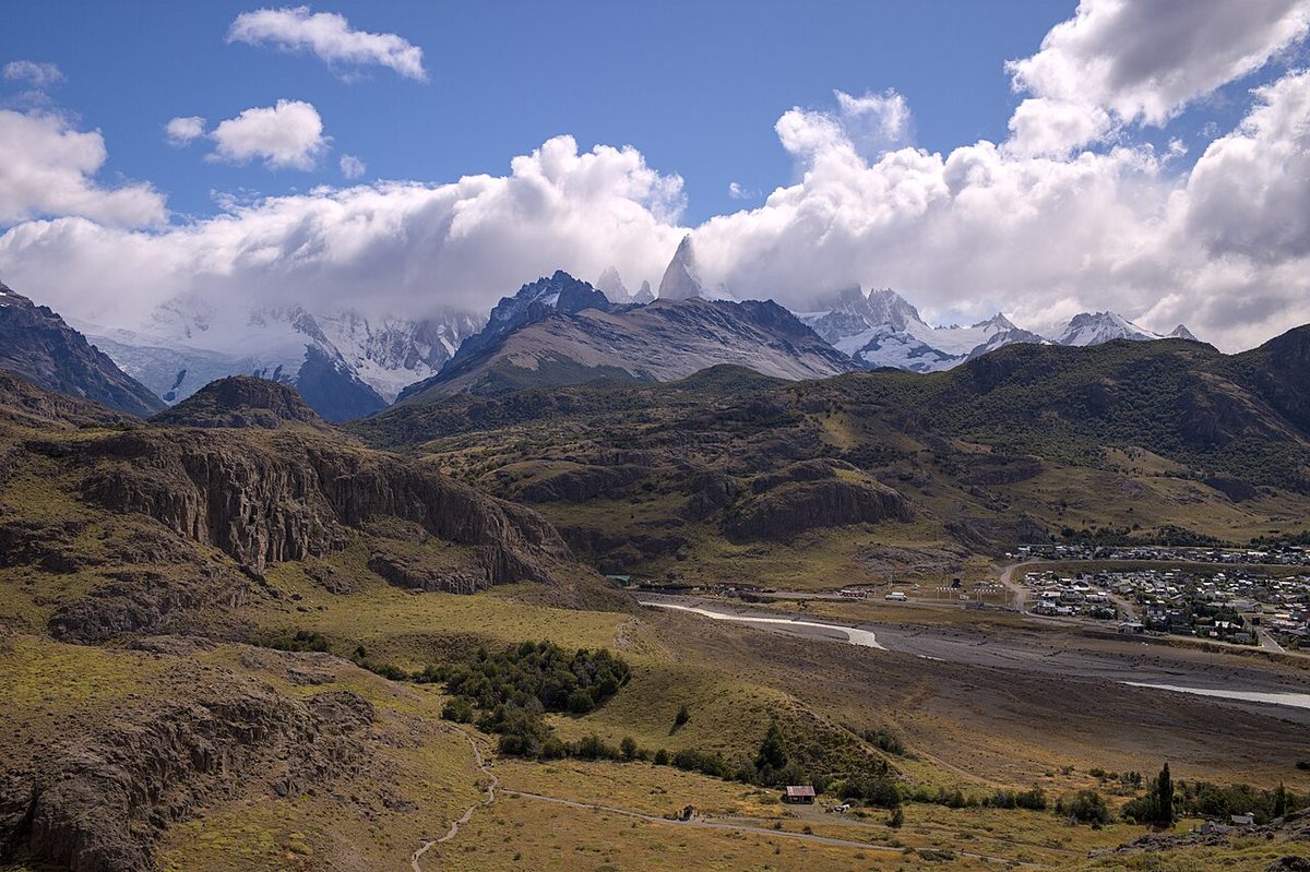
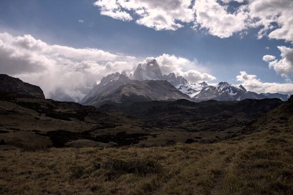
0 — 2 km Fig. 1 · The small town of El Chaltén at the foot of the Fitz Roy massif, the trekking base in Argentine Patagonia where trails start at the edge of town · Photo: Gedankenstuecke / CC BY-SA 4.0 via Wikimedia Commons
The best towns in Patagonia to base yourself are El Chaltén for hiking, Puerto Natales for Torres del Paine, El Calafate for the Perito Moreno Glacier, Bariloche as the all-round northern base, Ushuaia for the far south and Puerto Madryn for whales and penguins. El Bolsón, San Martín de los Andes, Coyhaique and Puerto Varas suit slower trips and road trips. Punta Arenas and Puerto Montt are mostly places to land, sleep one night and move on.
That is the short answer. The longer one depends on a question most planners skip: how many genuinely different days can you get out of one bed? Patagonia’s towns are not neighbourhoods of one city. They sit hundreds of kilometres apart, often with a border, a ferry or a single road between them, so the town you pick decides what you can reach without packing up again.
This page is about which town, and why. For lodging types, booking lead times and budget strategy, the companion guide on where to stay in Patagonia covers all of that. Here, twelve towns across Argentina and Chile get the same five tests, an honest verdict on whether each is a real base or a transit stop, and the 2026/27 changes that alter the answer.
What changed for the 2026/27 season
Five dated changes shift the base-town decision for 2026/27. Plan around them rather than around older advice.
Change
Date
What it means for your base
Puerto Natales airfield (PNT) partly closed for DGAC works
1 January to 31 March 2027; normal operation only 1 to 10 January, otherwise commercial flights mainly at weekends
Sleep in Natales, but plan to fly into Punta Arenas (PUQ), about 3 hours away by paved road
El Chaltén day-visitor fee (Tasa de Uso Urbano)
From 3 March 2026, per Infobae
Visitors who don’t stay overnight pay a town fee; one more reason to sleep there rather than day-trip from El Calafate
Torres del Paine’s O Circuit (Macizo Paine) closed for winter
Initially until 31 October 2026, per CONAF
Early-November O trekkers basing in Natales should check CONAF before committing
Queulat’s Ventisquero Colgante camping zone closed
Since 17 April 2026, until further notice, per CONAF
Coyhaique-based Queulat trips need a bed elsewhere, or a day visit
Major summer fires around the Comarca Andina
January and February 2026, per Argentine press
Check fire risk and trail openings before booking El Bolsón or Epuyén for summer
Swipe to see all columns
Table 1
The airfield closure is the big one. Chile Travel’s notice lists closed blocks in January (for example 11 to 14, 18 to 21 and 25 to 28 January) and every Monday-to-Friday block in February and March 2027. Any airline seat you see for those months needs checking against the schedule on LATAM’s and Sky’s own sites, and against the DGAC.
The El Chaltén fee is small but telling. Infobae reported on 3 March 2026 that the municipality began charging people who visit for the day without staying the night: 3,000 pesos per person at launch, indexed to the price of two litres of YPF super petrol (then 3,018 pesos), collected by QR code at the town accesses. Passengers on regular scheduled buses were exempt because the fee is built into their terminal ticket. The amount moves with fuel prices, so check the current figure and whether it still applies with the Municipalidad de El Chaltén before you go.
On the fires: Argentine press reported a major fire that began on 5 January 2026 at Puerto Patriada, near Lago Epuyén in Chubut, south of El Bolsón, and Infobae’s one-month round-up of 5 February put Chubut’s total burned area at more than 50,000 hectares. El Bolsón and its neighbours remain good bases, but burned slopes are not pristine forest, and summer trail and refugio openings can change at short notice.
How to judge a Patagonia base town: five tests
Every town below is run through the same five tests. Use them for any town not on this list, too.
1. Day-trip radius. What can you reach and return from in a day without moving hotel? Distances matter more than charm. El Chaltén has world-class trails starting at the edge of town; Coyhaique’s headline sight, the Marble Caves, is 240 km away on a road where a gravel-suitable vehicle is recommended. Both are “bases” on paper. Only one of them works as a base for its big sight.
2. Getting in and out. Is there an airport, and does it run all year? Which buses connect, how often, and in which season? Is there a border crossing in the way? A town with a reliable airport makes a good first and last stop even if it is dull.
3. Services and cash. Can you get cash, stock a food bag for a trek, rent gear and get a phone signal? This matters most in small trekking towns, where the machines can run dry in peak season.
4. Season. Some towns are year-round (Bariloche, Ushuaia, El Calafate for the glacier). Others are built around a trekking or wildlife season and quieten sharply outside it.
The rule of thumb that falls out of these tests: two nights is enough for a town you are passing through, three or more for a town whose day-trip radius holds several different days. If you would be spending more time in a bus than out of one, you have picked a transit stop, not a base.
The best towns in Patagonia compared
The table gives the quick read. The town-by-town sections that follow give the detail.
Town
Country
Best for
Base or transit?
Nearest airport
Key day trips
Best season
El Chaltén
Argentina
Fitz Roy and Cerro Torre trekking
Base, not a day trip
None: El Calafate, 215 km
Trails from town; Río Eléctrico portal 16 km
October to April
El Calafate
Argentina
Perito Moreno Glacier, flights
Base for glaciers, transit for hikers
FTE, about 23 km
Perito Moreno 80 km, about 90 min
Year-round
Bariloche
Argentina
Lakes, food, skiing, all-rounder
Base
BRC, linked by city bus line 72
Circuito Chico, Cerro Catedral, Cerro Campanario
Year-round
El Bolsón
Argentina
Slow hiking, crafts, quieter stays
Base
None: Bariloche, 129 km by road
Lago Puelo National Park 16 km
Summer and autumn, check fire risk
San Martín de los Andes
Argentina
Walkable lake town, Seven Lakes
Base
Chapelco
Lago Lácar; Seven Lakes road 107 km to Villa La Angostura
Summer; winter for snow
Puerto Madryn
Argentina
Whales, penguins, sea lions
Base
Trelew (REL), 66 km
Península Valdés from 56 km; Punta Tombo 123 km from Trelew
June to December for whales
Ushuaia
Argentina
Beagle Channel, national park, winter snow
Base
USH, about 5 km
Tierra del Fuego NP; Puerto Almanza 75 km; Cerro Castor 27 km
Summer for hiking, winter for snow
Puerto Natales
Chile
Torres del Paine
Base
PNT (partly closed Jan to Mar 2027); PUQ about 3 h
Torres del Paine, 80 km via Y-290
Spring to autumn
Punta Arenas
Chile
Air gateway, penguins
Transit, unless penguins
PUQ, year-round
Isla Magdalena, 35 km by boat
October to mid-April for penguins
Coyhaique
Chile
Carretera Austral services
Base for the road, not the sights
Balmaceda (BBA)
Queulat 165 km; Río Tranquilo 240 km (not a day trip)
Summer
Puerto Varas
Chile
Lakes, volcanoes, start of road trips
Base
El Tepual (PMC)
Puerto Montt under 30 min; Osorno volcano, Petrohué
Summer
Puerto Montt
Chile
Airport, ferries, Route 7 start
Transit, unless you need the port
El Tepual (PMC)
Hornopirén 110 km
Year-round
Swipe to see all columns
Table 2
Airport-to-town distances for Bariloche, Chapelco, Balmaceda and El Tepual vary between sources; check the airport or your transfer before you plan a tight connection. The Patagonia airports guide covers which airlines use which airport.
Rain shadow: the weather difference between bases
Patagonia’s weather is not one thing. The Andes wring rain out of the westerlies, so towns on the Chilean side and in the northern forests get far more of it than the dry steppe towns to the east. Long-term averages (1991 to 2020 normals from Argentina’s Servicio Meteorológico Nacional and Chile’s Dirección Meteorológica) make the point:
Town
Mean daily high in January
Mean daily high in July
Annual precipitation
Bariloche
23.2 °C
6.7 °C
812.5 mm
El Calafate
19.1 °C
5.2 °C
160.8 mm
Coyhaique
19.5 °C
5.8 °C
1,023.1 mm
Punta Arenas
16.3 °C
4.9 °C
390.2 mm
Ushuaia
13.6 °C
4.6 °C
457.8 mm
Swipe to see all columns
Table 3
El Calafate gets roughly a sixth of Coyhaique’s yearly precipitation, which is part of why it works so well as a glacier-viewing base. Bariloche’s wettest months are May to August. Ushuaia barely reaches 14 °C on an average January day, so even a summer base there needs proper layers. For month-by-month detail, see Patagonia weather by month.
Best towns in Argentine Patagonia
Argentina has seven of the twelve towns here, six of them along the Andes and one on the Atlantic coast. Few of them are a sensible bus ride from each other, which is why most Argentine itineraries are built around flights between two or three bases.
El Chaltén: the trekking base
Verdict: a real base, and the one town where staying beats day-tripping by the widest margin.
What you can reach in a day: almost everything that brings hikers to Argentine Patagonia starts on foot from town. Los Glaciares National Park’s northern sector has three access portals. Portal Los Cóndores sits just before the town and leads to the Los Cóndores and Las Águilas viewpoints, Loma del Pliegue Tumbado and Laguna Toro. Portal Base Fitz Roy leads to Cerro Torre, Laguna de los Tres and Chorrillo del Salto. Portal Río Eléctrico, about 16 km north on Provincial Route 41, opens up Piedra del Fraile, the Piedras Blancas viewpoint and another way to Poincenot and Laguna de los Tres. Town entry is free; the trail ticket is bought on the national parks website, at ARS 50,000 a day for foreign visitors from 1 June 2026, with 50% off a second day used within 72 hours. Because the camps at Poincenot, De Agostini and Laguna Capri are reached on foot from town (ARS 30,000 per person per night, booked through the Asociación Amigos del Parque), El Chaltén is also the base for one-night camp-and-sunrise trips without moving your main luggage.
Getting in and out: there is no airport. You fly to El Calafate, then travel 215 km by road. The town’s tourism site lists Taqsa, Cal Tur and Chaltén Travel among the bus companies at the terminal, and Cal Tur lists a regular El Calafate to El Chaltén bus on its own site. Timetables change by season, so check the operator’s own schedule before you book a flight that lands late. The El Calafate to El Chaltén guide covers the options in more depth.
Services and cash: small and stretched. Cash can run short in peak season, so bring pesos from El Calafate and expect to pay by card for most things. Argentina’s own banking quirks apply: ATM withdrawals on foreign cards come with low limits and possibly hefty charges, per the Canadian government’s travel advice. Food costs more than in El Calafate because almost everything arrives by truck.
When to go: October to April is the trekking season. Outside it, check ahead what is open; the town is much quieter in winter.
Cost feel: lodging is scarce in December to February, and you pay for location more than for luxury.
Pros:
– Trails from the door, so you can wait out bad weather and go when Fitz Roy clears.
– Camp-and-return trips without packing up.
– Regular-bus arrivals avoid the day-visitor fee.
Cons:
– One road in, no airport.
– Limited cash and little to do on a truly wet day.
– Tight inventory in peak season.
El Calafate: a base for glaciers, a transit stop for hikers
Verdict: the right base for the Perito Moreno Glacier and the far-south flight network. The wrong base for Fitz Roy.
What you can reach in a day: the Perito Moreno Glacier is 80 km away via Ruta Provincial 11, about 90 minutes by car, and visitors can go all year. Los Glaciares charges the same ARS 50,000 daily pass for foreign visitors here as at El Chaltén. Glacier boat trips and ice treks fill further days; the how to visit Perito Moreno Glacier guide covers the choices. El Chaltén, at 215 km, is technically reachable for a day, but you would spend most of it on a bus and pay the day-visitor fee if you arrive by tour or car.
Getting in and out: Comandante Armando Tola International Airport (FTE) is about 23 km east of town, according to the airport’s own site, and has no city bus; use a shuttle, taxi, transfer or rental car. See the El Calafate airport guide. El Calafate is also the junction for buses to El Chaltén and to Puerto Natales: Bus-Sur’s El Calafate to Puerto Natales service runs September to April, leaving at 8:00 on Wednesdays, Fridays and Sundays and at 16:30 on Tuesdays, Thursdays and Saturdays. The Puerto Natales to El Calafate guide covers the border crossing.
Services and cash: plenty of hotels, restaurants and supermarkets, so this is where to stock up before El Chaltén. Withdraw pesos here rather than counting on a machine further north, and lean on cards.
When to go: year-round for the glacier, with the peak from December to February. At 160.8 mm a year it is one of the driest bases in Patagonia.
Cost feel: priced for fly-in visitors. Restaurants feel pricier than in the northern towns.
Pros:
– An airport with links to other Patagonian bases.
– Straightforward glacier logistics.
– Bus junction for both El Chaltén and Puerto Natales.
Cons:
– Not a hiking base.
– The town itself is mostly a strip of agencies and restaurants.
– Two nights is plenty unless you add ice treks, lake trips or an estancia.
Verdict: a well-connected northern Patagonia base that works in all four seasons.
What you can reach in a day: more than from anywhere else on this list. The Circuito Chico loop and Cerro Campanario’s chairlift are along Avenida Bustillo, west of the centre. Cerro Catedral is a 40 km round trip from downtown on an asphalt road and is open all year, though in the winter off-season the lifts run only some days of the week. The mountain refugios of Nahuel Huapi National Park make day hikes or overnights; the park requires a free trekking registration before you set out, so register on the park’s own site. Further afield, the Seven Lakes route to San Martín de los Andes is 185 km one way and an authorised-agency tour takes 10 to 11 hours, according to Bariloche’s tourism office. That is a day tour, not a relaxed day trip. El Bolsón, 129 km south on National Route 40, is better as its own base. Where the national park charges entry, the daily pass for foreigners is ARS 35,000 from 1 June 2026.
Getting in and out: Bariloche’s airport is linked to downtown and the bus terminal by municipal bus line 72, which runs daily from early morning to late evening and is paid with a SUBE card, per the city’s official tourism site. Buses cross to Chile over Paso Cardenal Samoré for Osorno, Puerto Montt and Puerto Varas, and the Cruce Andino bus-and-boat crossing runs to Puerto Varas; check the operators for current days, times and prices. The south is a flight away, not a bus ride, so do not plan to hop down to El Calafate overland on a short trip.
Services and cash: a real city, with banks, big supermarkets, gear rental and a deep restaurant scene.
When to go: summer for lakes and hiking, winter for skiing at Catedral, autumn for colour. Most of Bariloche’s 812.5 mm of annual precipitation falls from May to August.
Cost feel: a very wide price spread, from hostels to grand lakeside hotels. Expect domestic-holiday peaks in January and during the July winter holidays.
Pros:
– Lots of genuinely different day options from one bed.
– Easy flights and a city bus from the airport.
– Works without a car.
Cons:
– Spread out, so where you sleep along the lake shore matters.
– Far from the southern icons.
– Holiday crowds in January and July.
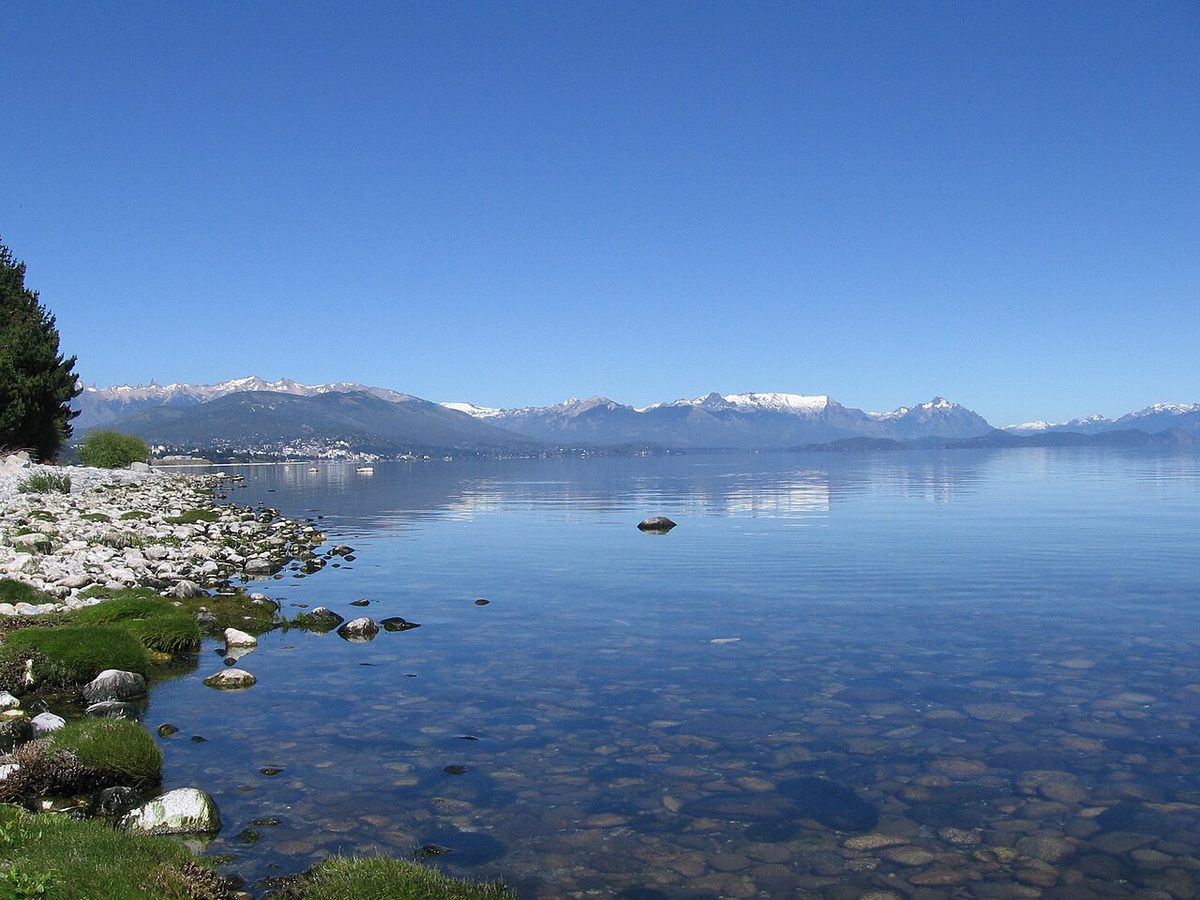
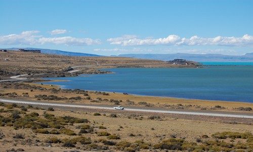
Fig. 3 · Clear water and a stony shore on Lake Nahuel Huapi near Bariloche, with snow on the mountains across the lakePhoto: Public domain via Wikimedia Commons
El Bolsón: the slow base
Verdict: a base for people who want to stay a while, hike from a quieter town and skip the Bariloche crowds.
What you can reach in a day: Lago Puelo National Park is 16 km from town according to Bariloche’s tourism office, with the same ARS 35,000 daily pass for foreigners as Nahuel Huapi. The Mallín Ahogado valley, the Río Azul viewpoint and the carved forest on Cerro Piltriquitrón are all close, and the hills north of town hold a network of mountain refugios reached on foot. The Comarca Andina towns to the south (Lago Puelo, El Hoyo, Epuyén) are short drives, and the Los Alerces National Park guide covers the next big park south.
Getting in and out: there is no airport. Fly to Bariloche, 129 km north on National Route 40, and continue by bus or car; check frequencies at the operators’ desks in Bariloche’s bus terminal. Getting to trailheads without a car takes planning.
Services and cash: a small town with the basics. Stock up before heading to a remote cabin.
When to go: summer and early autumn. Fire risk is now a real variable: after the January 2026 fires to the south, check the provincial fire-service and park notices for trail and refugio status before you book.
Cost feel: generally described as easier on the wallet than Bariloche, though that is a feel rather than a rule.
Pros:
– Calmer and better value for longer stays.
– Hiking and refugios from the door.
– Lago Puelo on the doorstep.
Cons:
– No airport and thin public transport to trailheads.
– Summer fire disruption in recent seasons.
– A detour from the classic north-south route.
Verdict: a base for a quieter, walkable stay at the northern end of the Seven Lakes road.
What you can reach in a day: Lago Lácar’s beach and waterfront are a few blocks from the centre. Lanín National Park charges the same ARS 35,000 daily pass for foreigners as Nahuel Huapi. The Seven Lakes road runs 107 km south to Villa La Angostura through Lanín and Nahuel Huapi national parks, and in winter Cerro Chapelco is the local ski hill.
Getting in and out: Chapelco airport serves the town; check the airlines’ own sites for the season’s routes. By road, Bariloche is 185 km away on the Seven Lakes route. For crossings into Chile, see the Chile-Argentina border crossings guide.
Services and cash: compact, with most things walkable.
When to go: summer for the lake, winter for snow, autumn for colour along the Seven Lakes road.
Cost feel: upmarket for its size, with Argentine domestic-holiday peaks in January and July.
Pros:
– Walkable town on a lovely lake.
– An airport nearby.
– Calmer than Bariloche, with or without skiing.
Cons:
– Fewer day-trip options without a car.
– Far from everything in the south.
– A thinner flight schedule than Bariloche’s.
Puerto Madryn: the wildlife base
Verdict: a base, and a different Patagonia from the Andes towns. Plan it as its own trip with a flight in each direction.
What you can reach in a day: Península Valdés begins 56 km from Madryn via Ruta Provincial 2, per Visit Argentina, and the protected area charges foreign adults ARS 50,000 per day. Whale season runs from June to December, according to the peninsula’s administration. From June to mid-September, beaches near Madryn such as El Doradillo are the place for shore viewing; from mid-September to December, viewing is best from Puerto Pirámides, the boat-trip port, which lists six certified whale-watching operators and a season from mid-June to December. Orcas hunt at Punta Norte from February to May, 80 km from Puerto Pirámides. The Punta Tombo penguin colony is 123 km from Trelew, active from September to April (the 2026 season opened on 14 September), with entry for foreign tourists from ARS 20,000. The peninsula’s distances are long, so a day there is mostly driving.
Getting in and out: Trelew airport is 66 km from Puerto Madryn and is the reliable air gateway; transfers and buses link the two. Overland, Madryn is a very long way from the Andes towns, so fly.
Services and cash: a proper city with supermarkets, banks, dive shops and tour operators. Puerto Pirámides is the small alternative, closer to the boats but with far fewer beds and services.
When to go: June to December for whales, with Visit Argentina naming September to November as the ideal time; February to May for orcas; September to April for penguins.
Cost feel: mid-range by Patagonian standards.
Pros:
– An easy wildlife base.
– Beach-town feel with full services.
– Free shore whale-watching in season.
Cons:
– A separate trip from the Andes, usually a flight each way.
– Long peninsula drives.
– Outside the wildlife windows, the reason to come shrinks.
Verdict: a base with more different days from one bed than almost anywhere else in the south.
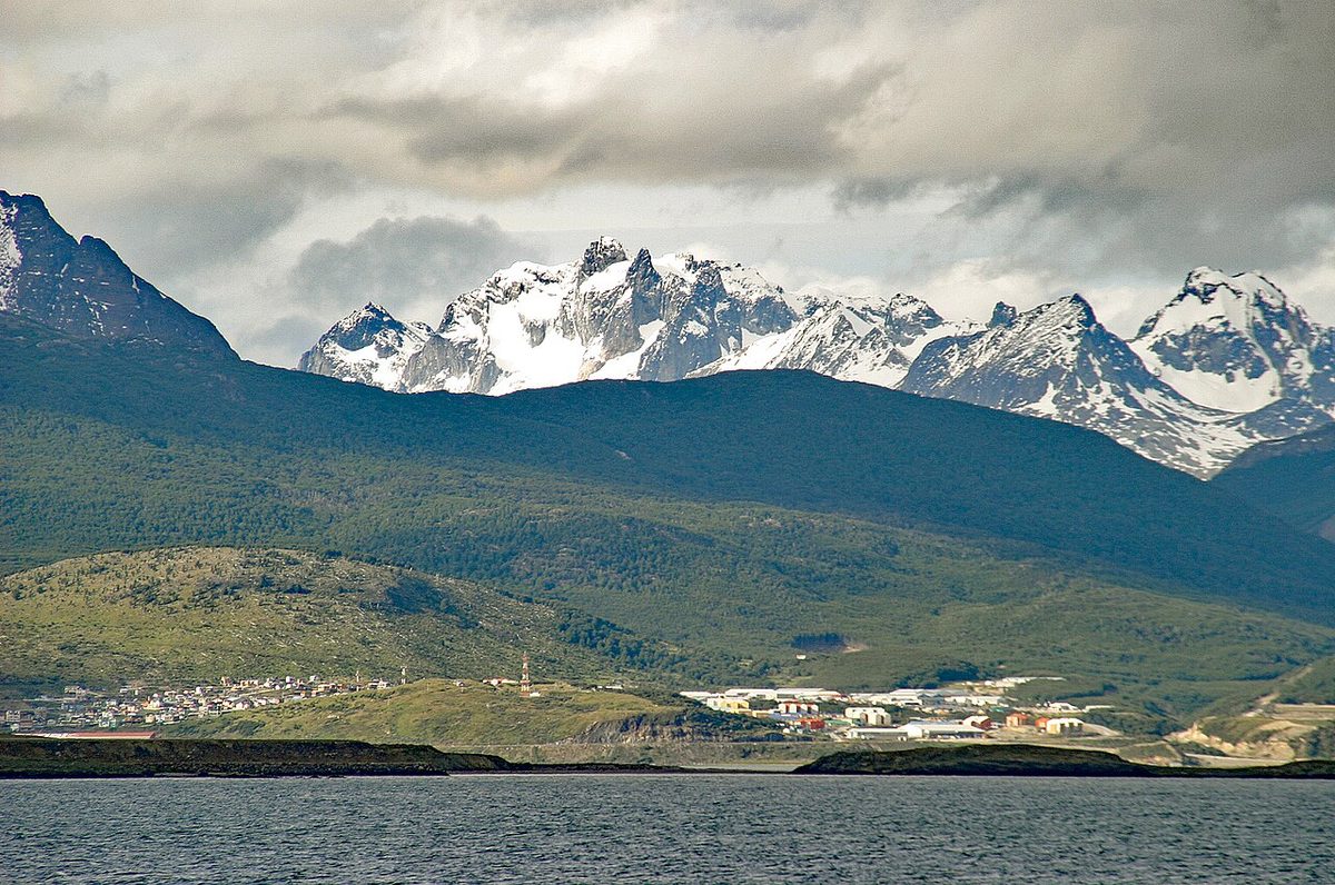
What you can reach in a day: Tierra del Fuego National Park sits just west of town, with a daily pass for foreign adults of ARS 40,000 from 1 June 2026; in this park, the 50% second-day discount applies only to tickets bought online. The Tren del Fin del Mundo runs from 1 September to 30 April at 9:30, 12:00 and 15:00, with Clase Turista at ARS 80,000 for over-13s from October 2026 to March 2027, and park entry is not included. Add the Laguna Esmeralda hike, a Beagle Channel cruise (boats leave the port all year, per Ushuaia’s tourism office), the fishing village of Puerto Almanza 75 km away, and in winter Cerro Castor, 27 km from town.
Getting in and out: the airport is 5 km from the city, according to Ushuaia’s tourism office, which also notes there is no public transport from it; take a taxi, remise or transfer. Overland, the route runs through Chile: National Route 3 to Río Gallegos, the Paso Integración Austral border, the Strait of Magellan ferry between Punta Delgada and Bahía Azul (about 30 minutes, which the tourism office says runs 365 days a year), back into Argentina at San Sebastián, then 293 km to Ushuaia. Bus-Sur connects Ushuaia with Punta Arenas, leaving Ushuaia at 08:00 on Tuesdays, Thursdays and Saturdays and arriving around 18:00. For most trips, flying is the sane option.
Services and cash: a city with full services, banks, supermarkets and outdoor shops.
When to go: two seasons. Summer for hiking, the park and boats; winter for Cerro Castor and snow. Daylight runs from more than 17 hours in summer to just over 7 in winter.
Cost feel: expensive by Argentine standards, partly because of its remoteness and cruise demand.
Pros:
– Many different day options from one bed.
– Year-round appeal.
– Antarctica cruise departures from the port.
Cons:
– Remote from the rest of Patagonia.
– Cool, changeable weather even in summer.
– Busy port on cruise-ship days.
Chile’s bases split into two worlds: the far south around Torres del Paine and the Strait of Magellan, and the north, where Puerto Montt and Puerto Varas open onto the Carretera Austral. Chile’s money logistics are simpler than Argentina’s: the Australian government’s travel advice notes that credit cards are widely accepted and ATMs widely available.
Puerto Natales: the Torres del Paine base
Verdict: the main town base for Torres del Paine, and in early 2027 the base you reach via Punta Arenas.
What you can reach in a day: Torres del Paine is 80 km from Puerto Natales via road Y-290 (Lago Porteño) or 150 km via Ruta 9, according to CONAF. A day in the park from Natales is doable but long: Bus-Sur lists the ride in from 2 hours, and the far stops take longer. CONAF lists regular park buses from Natales at 07:30 and 14:30, while Bus-Sur lists a 12:00 departure, so check your own operator’s timetable. Park passes are sold only online in advance through Pases Parques, and the entrances only validate the QR code. Download every booking and pass before you leave town, because there is no signal across most of the park. The O Circuit is closed initially until 31 October 2026; see Torres del Paine in winter for the cold-season rules.
Getting in and out: the airfield (PNT) is a short drive from town but has scheduled closures from 1 January to 31 March 2027, with normal operation only from 1 to 10 January and mostly weekend flights otherwise. Punta Arenas airport runs normally all year. Bus-Sur’s Punta Arenas to Puerto Natales service takes 3 hours 15 minutes, leaving at 7:00, 8:30, 10:00 and 11:00; the return leaves Natales at 17:00, 19:00 and 21:00. Bus-Sur’s bus to El Calafate leaves at 15:30 and takes about 6 hours. The Navimag ferry connects Natales with Puerto Montt; its Natales office is at Pedro Montt 308, and season dates and fares are on navimag.com. See Punta Arenas to Puerto Natales and how to get to Torres del Paine.
Services and cash: the place to rent gear, buy gas canisters and stock up before the park. ATMs are common in Chile, but in a small town in peak season, don’t leave your cash run until the afternoon before a 7am bus.
When to go: spring to autumn for trekking; winter visits come with guide requirements on some trails.
Cost feel: Chilean prices, with the park’s lodging and transfers the expensive part. Natales itself has everything from hostels to boutique hotels.
Pros:
– The main town base for Torres del Paine.
– Gear, food and park logistics in one place.
– Bus links to both Punta Arenas and El Calafate.
Cons:
– 80 to 150 km from the park, so every day trip is long.
– The airfield is unreliable for January to March 2027.
– Peak-season beds sell out.
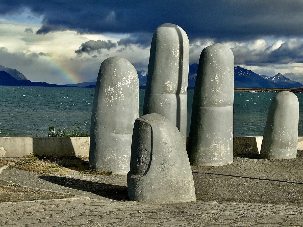
Fig. 5 · La Mano, the concrete hand sculpture on the waterfront of Puerto Natales, with the channel and mountains behindPhoto: Stch2022 / CC0 via Wikimedia Commons
Punta Arenas: the gateway that can be a base
Verdict: usually a one-night transit stop, but a genuine base if penguins and the Strait of Magellan are on your list.
What you can reach in a day: the Monumento Natural Los Pingüinos on Isla Magdalena lies 35 km north-east of the city and is reached only by tour boat from Punta Arenas. CONAF says visits run from October to mid-April, landings happen between 9:00 and 18:00 depending on the penguins’ activity, the maximum stay on the island is one hour, and entry is allowed only with CONAF-certified guides through tour operators. The monument closes for winter, so check CONAF’s page for the reopening date and any avian-influenza measures before booking. Torres del Paine is not a sensible day trip: CONAF puts Punta Arenas 250 km from Natales, before you add the drive into the park.
Getting in and out: Punta Arenas airport (PUQ) operates normally all year, with daily flights from Santiago and other cities. Bus-Sur runs to Puerto Natales and connects with Ushuaia.
Services and cash: the main city of the Magallanes region, with full banking, large supermarkets and hospitals. If something needs sorting, this is the place to do it.
When to go: year-round as a city; October to mid-April for the penguins. The January average high is 16.3 °C.
Cost feel: Chilean city prices, and often better value than Natales for a single night.
Pros:
– A reliable airport, the fallback while PNT is partly shut.
– Full services.
– Penguins and Strait of Magellan history.
Cons:
– 3 hours from Natales and much further from the park.
– Windy and spread out.
– Most travellers need only one night.
Coyhaique: the Carretera Austral service town
Verdict: a base for the road, not for its headline sights. Think of it as the place you start, resupply and finish.
What you can reach in a day: less than people expect. Puerto Río Tranquilo, for the Marble Caves, is 240 km south on Route 7, about five hours, and Chile Travel recommends a gravel-suitable vehicle; you move base, you don’t day-trip. Queulat National Park, for the hanging glacier, is 165 km north, and its Ventisquero Colgante camping zone has been closed since 17 April 2026 until further notice. Parque Nacional Patagonia is about 315 km south. The genuine day trips are the nature reserves and valleys close to town.
Getting in and out: Balmaceda airport (BBA) is Coyhaique’s air gateway; arrange your transfer before landing. Route 7 runs north towards Puerto Montt (with ferries) and south towards Cochrane.
Services and cash: the main full-service town on the central Carretera Austral, with supermarkets, ATMs, gear and the widest choice of beds in Aysén. Treat it as your cash stop and don’t count on finding a machine in the smaller villages further along.
When to go: summer is road-trip season. Coyhaique is wet, with 1,023.1 mm a year on average and the most falling from May to August.
Cost feel: Chilean mid-range.
Pros:
– An airport nearby.
– Full services and resupply.
– The logical first or last night of a central Carretera Austral trip.
Cons:
– Not scenic in itself.
– The big sights are four to six hours away.
– You need a car.
Verdict: a base. Strictly, it sits in Chile’s Lake District, just north of where most definitions of Patagonia begin, but it is where many Chilean Patagonia trips start.
What you can reach in a day: Puerto Montt and its airport are under 30 minutes away, per Chile Travel. Lake Llanquihue’s shore, the Osorno volcano and the Petrohué falls in Vicente Pérez Rosales National Park make classic days out, by car or tour.
Getting in and out: El Tepual airport (PMC), which serves Puerto Montt, is the nearest. The Cruce Andino lake crossing and the Cardenal Samoré buses connect with Bariloche; check the operators for current days and prices. When you cross between Chile and Argentina, check the local time on arrival, because bus timetables are in local time.
Services and cash: a compact centre with guides, gear shops and the usual Chilean card-and-ATM convenience.
When to go: summer is best, though the town works year-round. Expect rain.
Cost feel: pricier than Puerto Montt, as tourist towns are.
Pros:
– The nicest town to sleep in near PMC.
– Lake and volcano day trips.
– Launch point for the Cruce Andino and the Carretera Austral.
Cons:
– Lake District rather than deep Patagonia.
– Rain.
– You need wheels or tours for the park.
Puerto Montt: the logistics hub
Verdict: a transit stop for most people, and a base only if you need the port.
What you can reach in a day: Puerto Varas is under 30 minutes away. Hornopirén is 110 km south, where Somarco’s subsidised “Bimodal Palena” ferry heads to Caleta Gonzalo; CONAF describes a barge leaving Hornopirén daily at 10:30 (subject to change), 3.5 hours to Leptepu, 10 km by road, then a second 40-minute barge from Fiordo Largo. Somarco lists September to April as high season.
Getting in and out: flights land at El Tepual. The Carretera Austral starts here and runs about 1,240 km to Villa O’Higgins, and more than 700 km to Puerto Río Tranquilo. The Navimag ferry sails south to Puerto Natales from Puerto Montt, where its office is at Diego Portales 2000; check navimag.com for the season, departures and fares.
Services and cash: full city services.
When to go: year-round as a port and airport.
Cost feel: cheaper than Puerto Varas for a functional night.
Pros:
– Airport, ferries and car rental in one place.
– The start of Route 7.
Cons:
– A working port city.
– Most travellers prefer to sleep under 30 minutes away in Puerto Varas.
Base or transit stop? The towns people over-book
Four mistakes come up again and again.
El Calafate for hikers. It is 215 km from Fitz Roy. If walking is the point, give El Calafate one or two nights for the glacier and put the rest into El Chaltén. The pillar’s where to stay in Patagonia section on El Calafate versus El Chaltén goes into lodging specifics.
Punta Arenas for Torres del Paine. Natales is 250 km from Punta Arenas before you even reach the park. Use Punta Arenas for the flight and the penguins, then take the bus north the same day if your arrival time allows; Bus-Sur lists departures to Natales from 7:00 to 11:00.
Puerto Montt as a base. Unless you are catching the Navimag, picking up a car at dawn or heading for the Hornopirén ferry, Puerto Varas is the better bed for the same airport.
El Chaltén as a day trip. You spend most of the day on the road, see the mountains only if the weather happens to cooperate in your few hours there, and, if you came by tour or car, pay the day-visitor fee reported in March 2026. Sleep there.
Best base by trip type
Choose the experience before you choose the town. The table below gives one or two towns per trip type, with the reason. For the order to string them together, use the Patagonia itinerary guide.
Trip type
Best base
Why
Serious hiking
El Chaltén, then Puerto Natales
Trails from town; the main town base for Torres del Paine
Glaciers without hiking
El Calafate
Perito Moreno 80 km away, year-round
Whales and penguins
Puerto Madryn
Shore and boat whale-watching, Punta Tombo
No car
Bariloche, El Chaltén, Puerto Natales, Ushuaia
City buses, trails from town or park buses
Winter
Bariloche, Ushuaia
Cerro Catedral and Cerro Castor; El Calafate for the glacier
Road trip
Coyhaique, Puerto Varas
Services and airports at each end of the Carretera Austral’s busiest stretches
Slow travel
El Bolsón, San Martín de los Andes
Quieter towns that reward longer stays
Families
Bariloche, Puerto Varas
Easy day trips, services, short drives
Swipe to see all columns
Table 4
Non-hikers have more choice than they think: see Patagonia without hiking. If you are torn between the two countries, Argentina vs Chile Patagonia frames the trade-offs. Puerto Madryn works without a car too, but only if you join tours for the peninsula; Coyhaique and El Bolsón are hard without wheels.
Cash, ATMs and supermarkets by town
Money logistics differ more between the two countries than between towns.
In Argentina, foreign credit and debit cards are accepted in main cities, you may be asked for photo ID when paying by card, and ATM withdrawals on foreign cards have low limits per withdrawal and per day with possibly substantial charges, according to the Canadian government. In practice that means paying by card for most things and carrying a modest cash reserve for small towns. Bariloche, Ushuaia and Puerto Madryn are cities with full banking. El Calafate is the place to stock up on pesos and groceries before El Chaltén, where cash can run short.
In Chile, cards are widely accepted and ATMs widely available. Punta Arenas, Puerto Montt and Coyhaique have full services; Puerto Natales has what you need but gets busy in peak season. On the Carretera Austral, Coyhaique is the cash and supermarket stop to plan around.
Treating Bariloche and El Calafate as a bus ride apart. They belong to different trips. Fly between them, or pick one.
Trusting Puerto Natales flights in January to March 2027. The airfield runs normally only from 1 to 10 January and then mostly at weekends until 31 March. Book into Punta Arenas and keep the bus as the plan, not the fallback.
Assuming every town has a working ATM. Small Argentine towns in peak season and small villages on the Carretera Austral are the risk. Carry enough for a few days.
Forgetting fire season in the Comarca Andina. After the January 2026 fires, check trail and refugio status for El Bolsón, Lago Puelo and Epuyén before you commit to a summer stay.
Ignoring the season. El Chaltén and Puerto Natales are trekking towns that quieten in winter; Bariloche and Ushuaia come alive with snow. Check the best time to visit Patagonia and Patagonia in winter before you fix dates.
Choosing a town for the hotel, not the radius. A beautiful lodge three hours from what you came to see costs you six hours a day. Decide the base first, then the bed. For how lodging types compare once you know the town, see camping vs hostels vs hotels in Patagonia.
Underestimating transfers. Buses between bases are usually seasonal and sometimes run only on certain days. Check the Patagonia buses guide and the operators’ own timetables, or consider a Patagonia rental car for the road-trip regions.
FAQ
What is the best town to stay in Patagonia?
It depends on the trip. El Chaltén is the best base for hiking, Puerto Natales for Torres del Paine, El Calafate for the Perito Moreno Glacier and Bariloche for an all-round northern stay. Ushuaia suits the far south and Puerto Madryn suits wildlife.
Is it better to stay in El Calafate or El Chaltén?
Both, for different things. El Calafate is the base for the Perito Moreno Glacier, 80 km away, and for flights. El Chaltén is the base for Fitz Roy and Cerro Torre, with trails from town. They are 215 km apart, so don’t day-trip to El Chaltén; Infobae reported that from March 2026 day visitors who don’t stay overnight pay a town fee unless they arrive on a regular bus.
Should I stay in Punta Arenas or Puerto Natales for Torres del Paine?
Puerto Natales. The park is 80 to 150 km from Natales and a further 250 km from Punta Arenas. Stay in Punta Arenas only for the flight or the Isla Magdalena penguins. From 1 January to 31 March 2027, Natales’s own airfield is partly closed, so most travellers will fly into Punta Arenas and take the bus.
Which Patagonia town is best without a car?
Bariloche, El Chaltén, Puerto Natales and Ushuaia work well without a car, thanks to city buses, trails from town or park buses. Puerto Madryn works if you take tours. Coyhaique and El Bolsón are much harder.
Which Patagonia towns have airports?
Bariloche, San Martín de los Andes (Chapelco), El Calafate, Ushuaia, Punta Arenas and Puerto Natales have airports, though Natales’s is partly closed from January to March 2027. Puerto Madryn uses Trelew, 66 km away; Coyhaique uses Balmaceda; Puerto Montt and Puerto Varas share El Tepual. El Chaltén and El Bolsón have none.
Can I get cash in El Chaltén?
Cash can run short in peak season, so bring pesos from El Calafate and plan to pay by card for most things. Argentine ATMs also impose low withdrawal limits and possibly high charges on foreign cards.
What is the best base in Patagonia in winter?
Bariloche, for Cerro Catedral and its city services, and Ushuaia, for Cerro Castor and the Beagle Channel. El Calafate works year-round for the glacier. Torres del Paine and El Chaltén are much quieter, with winter rules in Torres del Paine.
Where should I stay to see whales in Patagonia?
Puerto Madryn, for its services and shore viewing near El Doradillo from June to mid-September, or Puerto Pirámides, where boat trips run from mid-June to December and viewing is best from mid-September.
Final thoughts
The best towns in Patagonia are the ones whose day-trip radius matches what you came for. Sleep in El Chaltén for the trails, Natales for Torres del Paine, El Calafate for the ice, Bariloche or Ushuaia when you want many different days from one bed, and Madryn for wildlife. Treat Punta Arenas and Puerto Montt as doors, not destinations, unless penguins or ferries say otherwise. For 2026/27, build Punta Arenas into any January-to-March 2027 Torres del Paine plan, and check El Chaltén’s fee and the Comarca Andina fire notices before you go.